


Loading the weather...
Population62,253
GeoNames
RegionAndhra Pradesh
Elevation115 m
377 ft
Time zoneAsia/Kolkata
Land area29.9 km²
Nearest airportTirupati Airport (TIR)
35 km
Why visit Nagari
Townapedia lists 1 museum or landmark in and around town.
Weather in Nagari
Forecast from MET Norway (CC BY 4.0). Full forecast
About Nagari
Nagari is a town in Chittoor district of the Indian state of Andhra Pradesh. It is the mandal headquarters of Nagari mandal in Nagari revenue division.
From the Wikipedia article Nagari, Chittoor district (this version), under CC BY-SA 4.0.
Museums and landmarks1

Churches and places of worship2

Healthcare12


Advertisement
Map of Nagari
15 places. The map loads OpenStreetMap tiles when you open it.
Getting there and nearby towns
Tirupati Airport (TIR) is the nearest airport with scheduled flights listed in OpenStreetMap, 35 km away.
- Tirupati 39 km northwest, about 39 min by car
- Tirumala 48 km northwest, about 48 min by car
- Kanchipuram 55 km south, about 55 min by car
- Avadi 61 km east, about 1 h by car
- Vellore 66 km southwest, about 1 h by car
- Ambattur 67 km east, about 1 h by car
- Pallāvaram 73 km southeast, about 1 h 15 min by car
- Tambaram 73 km southeast, about 1 h 15 min by car
- Chennai 79 km east, about 1 h 15 min by car
- Tiruvottiyūr 80 km east, about 1 h 15 min by car
Drive times are estimates from straight-line distance, not routes.
Local news
Headlines from INDB.
Reviews, tips and questions
Loading what members have shared...
Sources and licences
- GeoNames (CC BY 4.0): population, coordinates, regions and time zone
- OpenStreetMap contributors (ODbL 1.0): places, airports, map data
- Wikidata (CC0 1.0): elevation, founding date, time zone, website
- Wikimedia Commons (see each image): photos
- Wikipedia (CC BY-SA 4.0): overview and history text
Photo credits
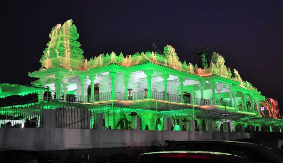
- Sai Baba Mandir Nagari, Balaji Kolukuluri, CC BY-SA 3.0
- Nagari govt Degree college, Vadanagiri bhaskar, CC BY-SA 4.0
- నగరి గవర్నమెంట్ హాస్పిటల్, Vadanagiri bhaskar, CC0
Page built November 3, 2026. Spotted a mistake? Tell us or suggest a place.