


Why visit Chālūs
Townapedia lists 2 museums and landmarks, 7 parks and trails, 39 places to eat, 2 places to stay and 3 attractions in and around town.
Weather in Chālūs
Forecast from MET Norway (CC BY 4.0). Full forecast
About Chālūs
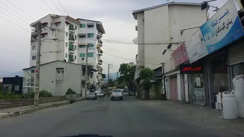
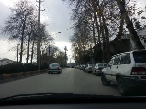
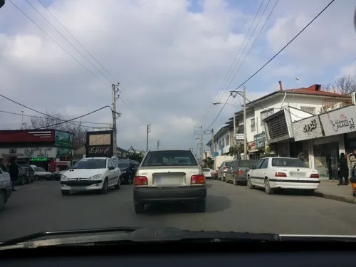
Chalus (Persian: چالوس) is a city in the Central District of Chalus County, Mazandaran province, Iran, serving as capital of both the county and the district.
From the Wikipedia article Chalus, Iran (this version), under CC BY-SA 4.0.
Things to do3


Museums and landmarks2


Parks, trails and playgrounds7


Restaurants and cafes39






27 more on the map.
History
In the past and under Arabic influence, Chalus was called "Salus" or "Shalus". It has a long history of rebellions and clashes with regional rulers or occupying foreign forces. Chalus used to have a large silk factory that was active from 1936 to 1958, and exported fabrics and other silk products to different countries.
Chalus is part of the Kelarestaq area of Ruyan (Tabaristan). Ruyan was an ancient land in the west of Mazandaran province during the Baduspanids era. This land includes Kojur, Kelarestaq and Tonekabon. The city of Kojur was the centre of the land of the Ruyans. Ruyan has always been part of the Tabaristan, nowadays called Mazandaran province. The Ruyan was also called the Rostamdār, Ostandār, and Rostamdele.
From the History section of Chalus, Iran on Wikipedia, under CC BY-SA 4.0.
Where to stay2
Churches and places of worship15
Shopping21
Gas and EV charging3
Schools, colleges and libraries28
Healthcare28
Map of Chālūs
148 places. The map loads OpenStreetMap tiles when you open it.
Getting there and nearby towns
Noshahr Airport (NSH) is the nearest airport with scheduled flights listed in OpenStreetMap, 4 km away.
- Khoshk-e Sarā 4 km southeast, about 4 min by car
- Z̄avāt-e Sharq 5 km southwest, about 5 min by car
- Nowshahr 7 km east, about 7 min by car
- Salmānshahr 21 km west, about 21 min by car
- Kalārdasht 27 km southwest, about 27 min by car
- Tonekābon 52 km west, about 52 min by car
- Nūr 54 km east, about 54 min by car
- Rāmsar 75 km northwest, about 1 h 15 min by car
- Kolāksar 84 km east, about 1 h 30 min by car
- Āmol 86 km east, about 1 h 30 min by car
Drive times are estimates from straight-line distance, not routes.
Local news
Headlines from INDB.
Reviews, tips and questions
Loading what members have shared...
Sources and licences
- GeoNames (CC BY 4.0): population, coordinates, regions and time zone
- Mapillary (see each image): photos
- OpenStreetMap contributors (ODbL 1.0): places, airports, map data
- Wikidata (CC0 1.0): elevation, founding date, time zone, website, landmarks and historic places
- Wikimedia Commons (see each image): photos
- Wikipedia (CC BY-SA 4.0): overview and history text
Photo credits
- Chalus bridge, Asadi, Public domain
- Hotel azadi chalos - panoramio, ali fallahnejad, CC BY-SA 3.0
- Fishmongers in Chalus, Iran - Aug 9, 2007, Beshef, CC BY 2.0
- Chalus, Iran - panoramio, Ali Safdarian, CC BY 3.0
- Chalus city, mazandaran province, Iran 2024,1, Parsa 2au, CC BY-SA 4.0
- Chalus city, mazandaran province, Iran 2024,2, Parsa 2au, CC BY-SA 4.0
- Mazoposhteh, chalus, mazandaran province, Iran 2024, Parsa 2au, CC BY-SA 4.0
- Iran-tehran grand bazar 03, Eliabbasi, CC BY-SA 4.0
- Chaus - panoramio (2), Ali Safdarian, CC BY 3.0
- Chaus under bridge - panoramio, Ali Safdarian, CC BY 3.0
- Chaus - panoramio (1), Ali Safdarian, CC BY 3.0
- Street-level photo, pilsa, CC BY-SA 4.0
- Street-level photo, pilsa, CC BY-SA 4.0
- Street-level photo, pilsa, CC BY-SA 4.0
- Street-level photo, pilsa, CC BY-SA 4.0
- Street-level photo, pilsa, CC BY-SA 4.0
- Street-level photo, pilsa, CC BY-SA 4.0
- Street-level photo, pilsa, CC BY-SA 4.0
- Street-level photo, pilsa, CC BY-SA 4.0
- Street-level photo, pilsa, CC BY-SA 4.0
- Street-level photo, pilsa, CC BY-SA 4.0
- Street-level photo, pilsa, CC BY-SA 4.0
- Street-level photo, pilsa, CC BY-SA 4.0
- Street-level photo, pilsa, CC BY-SA 4.0
- Street-level photo, pilsa, CC BY-SA 4.0
- Street-level photo, pilsa, CC BY-SA 4.0
- Street-level photo, pilsa, CC BY-SA 4.0
- Street-level photo, pilsa, CC BY-SA 4.0
- Street-level photo, pilsa, CC BY-SA 4.0
- Street-level photo, pilsa, CC BY-SA 4.0
- Street-level photo, pilsa, CC BY-SA 4.0
- Street-level photo, pilsa, CC BY-SA 4.0
- Street-level photo, pilsa, CC BY-SA 4.0
- Street-level photo, pilsa, CC BY-SA 4.0
- Street-level photo, pilsa, CC BY-SA 4.0


Page built November 8, 2026. Spotted a mistake? Tell us or suggest a place.