


Why visit Nowshahr
Townapedia lists 1 museum or landmark, 7 parks and trails, 27 places to eat, 2 places to stay and 1 attraction in and around town.
Weather in Nowshahr
Forecast from MET Norway (CC BY 4.0). Full forecast
About Nowshahr
Nowshahr (Persian: نوشهر) is a city in the Central District of Nowshahr County, Mazandaran province, Iran, serving as capital of both the county and the district. It is a port city on the southern coast of the Caspian Sea.
From the Wikipedia article Nowshahr (this version), under CC BY-SA 4.0.
Things to do1

Museums and landmarks1
Parks, trails and playgrounds7



Restaurants and cafes27

کافه رد
Cafe · Coffee Shop, Sandwich
فردوسی شمالی, نوشهر
every day 8 am until 11 pm
نان فانتزی ارس
Bakery · 1.5 km
0 بلوار شهید کریمی, نوشهر
Mo-Su 06:00-22:00

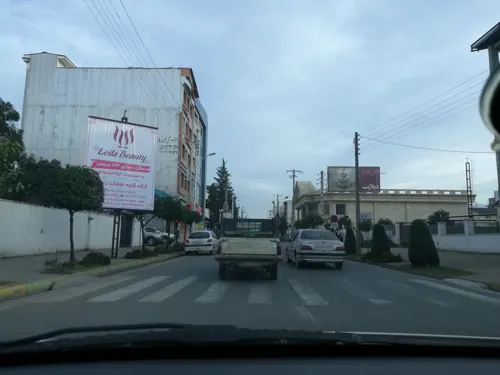
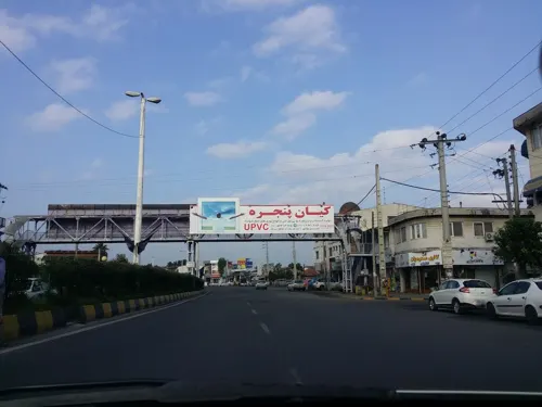


15 more on the map.
History
Ruyan is a region in the west of Mazandaran province. This land includes Kojur, Kalārestāq and Tonekabon. The city of Kojur was the center of the land of the Ruyans. Ruyan has always been part of Tabaristan, nowadays called Mazandaran province. Ruyan was also called Rostamdār, Ostandār and Rostamdele.
The city of Chalus and its associated towns and villages were part of the Nowshahr township prior to 1996, after which they formed the new township of by legislation from the national parliament.
From the History section of Nowshahr on Wikipedia, under CC BY-SA 4.0.
Where to stay2
Churches and places of worship5
Shopping12
لبنیات و پروتِینی دوماس
Grocery · 2.0 km
بزرگراه سپهبد شهید حاج قاسم سلیمانی, نوشهر
Gas and EV charging2
Schools, colleges and libraries11
Healthcare10
Map of Nowshahr
78 places. The map loads OpenStreetMap tiles when you open it.
Getting there and nearby towns
Noshahr Airport (NSH) is the nearest airport with scheduled flights listed in OpenStreetMap, 3 km away.
- Tāzehābād 2 km southwest, about 2 min by car
- Kordī Kolā 2 km southwest, about 2 min by car
- Chālūs 7 km west, about 7 min by car
- Salmānshahr 27 km west, about 27 min by car
- Kalārdasht 33 km southwest, about 33 min by car
- Nūr 47 km east, about 47 min by car
- Tonekābon 59 km west, about 59 min by car
- Kolāksar 78 km east, about 1 h 15 min by car
- Āmol 79 km east, about 1 h 15 min by car
- Rāmsar 81 km west, about 1 h 15 min by car
Drive times are estimates from straight-line distance, not routes.
Local news
Headlines from INDB.
Reviews, tips and questions
Loading what members have shared...
Sources and licences
- GeoNames (CC BY 4.0): population, coordinates, regions and time zone
- Mapillary (see each image): photos
- OpenStreetMap contributors (ODbL 1.0): places, airports, map data
- Wikidata (CC0 1.0): elevation, founding date, time zone, website, landmarks and historic places
- Wikimedia Commons (see each image): photos
- Wikipedia (CC BY-SA 4.0): overview and history text
Photo credits
- Overview of Nowshahr, user:Bhabdi, CC BY 3.0
- Nowshahr, Mazandaran, Iran - panoramio, hassan jafari, CC BY 3.0
- Kolbe kohansal bagh ecology nowshahr by parvan.fateh, Parva.fateh, CC BY-SA 4.0
- Nowshahr, Mazandaran, Iran - panoramio - hassan jafari, hassan jafari, CC BY 3.0
- Namate posht kolbe chobi bagh ecology nowshahr.by parvan.fateh, Parva.fateh, CC BY-SA 4.0
- Berke bagh ecology nowshahr by parvan.fateh, Parva.fateh, CC BY-SA 4.0
- Kaktos bagh ecology nowshahr by parvan.fateh, Parva.fateh, CC BY-SA 4.0
- Noshahr Government - panoramio, Ali Safdarian, CC BY 3.0
- Homafaran sq. - panoramio (1), Ali Safdarian, CC BY 3.0
- Noshahr, mazandaran province, Iran 2024, Parsa 2au, CC BY-SA 4.0
- رستوران ساحلی در نوشهر - panoramio, ak ba, CC BY-SA 3.0
- Platydema triste Laporte de Castelnau & Brullé, 1831 (10036058513), Udo Schmidt from Deutschland, CC BY-SA 2.0
- Endophloeus exsculptus Germar, 1847 (14525915582), Udo Schmidt from Deutschland, CC BY-SA 2.0
- Lover Ants - panoramio, ak ba, CC BY-SA 3.0
- بازار روز نوشهر - panoramio (9), ak ba, CC BY-SA 3.0
- بازار روز نوشهر - panoramio, ak ba, CC BY-SA 3.0
- بازار روز نوشهر - panoramio (5), ak ba, CC BY-SA 3.0
- بازار روز نوشهر - panoramio (7), ak ba, CC BY-SA 3.0
- بازار روز نوشهر - panoramio (1), ak ba, CC BY-SA 3.0
- بازار روز نوشهر - panoramio (8), ak ba, CC BY-SA 3.0
- خیابان مشایخ بخشی Mashayekh bakhshi - panoramio (2), Ali Safdarian, CC BY 3.0
- خیابان مشایخ بخشی Mashayekh bakhshi - panoramio (1), Ali Safdarian, CC BY 3.0
- بن بست سرو Sarv d.e - panoramio, Ali Safdarian, CC BY 3.0
- خیابان مشایخ بخشی Mashayekh bakhshi - panoramio, Ali Safdarian, CC BY 3.0
- کوچه بخشی ۵ Bakhshi 5 Alley - panoramio, Ali Safdarian, CC BY 3.0
- Lastrema verrucicollis (Reitter, 1880) (14718327796), Udo Schmidt from Deutschland, CC BY-SA 2.0
- خیابان مشایخ بخشی Mashayekh bakhshi - panoramio (3), Ali Safdarian, CC BY 3.0
- خیابان مشایخ بخشی Mashayekh bakhshi - panoramio (4), Ali Safdarian, CC BY 3.0
- کمربندی نوشهر - panoramio, ak ba, CC BY-SA 3.0
- خیابان مشایخ بخشی Mashayekh bakhshi - panoramio (5), Ali Safdarian, CC BY 3.0
- Noshahr Shore - panoramio, Ali Safdarian, CC BY 3.0
- Noshahr Shore - panoramio (2), Ali Safdarian, CC BY 3.0
- Noshahr Shore - panoramio (3), Ali Safdarian, CC BY 3.0
- Old wooden hut in the ecology garden, Parva.fateh, CC BY-SA 4.0
- Old wooden hut in the ecology garden by parvan.fateh, Parva.fateh, CC BY-SA 4.0
- شادی بچه گانه - panoramio, ak ba, CC BY-SA 3.0
- Noshahr Shore - panoramio (4), Ali Safdarian, CC BY 3.0
- ماهیگیری در دریا - panoramio, ak ba, CC BY-SA 3.0
- کمربندی چالوس نوشهر - panoramio, ak ba, CC BY-SA 3.0
- Pycnomerus (Dechomus) sulcicollis (Germar, 1824) (15307804469), Udo Schmidt from Deutschland, CC BY-SA 2.0
- Street-level photo, pilsa, CC BY-SA 4.0
- Street-level photo, pilsa, CC BY-SA 4.0
- Street-level photo, pilsa, CC BY-SA 4.0
- Street-level photo, pilsa, CC BY-SA 4.0
- Street-level photo, pilsa, CC BY-SA 4.0
- Street-level photo, pilsa, CC BY-SA 4.0
- Street-level photo, pilsa, CC BY-SA 4.0
- Street-level photo, pilsa, CC BY-SA 4.0
- Street-level photo, pilsa, CC BY-SA 4.0
- Street-level photo, pilsa, CC BY-SA 4.0
- Street-level photo, pilsa, CC BY-SA 4.0
- Street-level photo, pilsa, CC BY-SA 4.0
- Street-level photo, pilsa, CC BY-SA 4.0
- Street-level photo, pilsa, CC BY-SA 4.0
- Street-level photo, pilsa, CC BY-SA 4.0
- Street-level photo, pilsa, CC BY-SA 4.0
- Street-level photo, pilsa, CC BY-SA 4.0
- Street-level photo, pilsa, CC BY-SA 4.0
- Street-level photo, pilsa, CC BY-SA 4.0
- Street-level photo, pilsa, CC BY-SA 4.0
- Street-level photo, pilsa, CC BY-SA 4.0
- Street-level photo, pilsa, CC BY-SA 4.0
- Street-level photo, pilsa, CC BY-SA 4.0
- Street-level photo, pilsa, CC BY-SA 4.0
- Street-level photo, pilsa, CC BY-SA 4.0
- Street-level photo, pilsa, CC BY-SA 4.0
- Street-level photo, pilsa, CC BY-SA 4.0


Page built November 8, 2026. Spotted a mistake? Tell us or suggest a place.