


Ama, Japan
あま市
Ama is a town of 86,126 people in Aichi, Japan, founded in March 22, 2010.
Why visit Ama
Townapedia lists 38 museums and landmarks, 131 parks and trails, 187 places to eat and 2 attractions in and around town.
Highlights include Nagoya Bunri University, Nagoya College of Music, Asahi Site and Kaigarayama Shell Mound.
Weather in Ama
Forecast from MET Norway (CC BY 4.0). Full forecast
About Ama
Ama (あま市, Ama-shi; Japanese pronunciation: [ä́.mä̀, ä̀.mä́(.ɕì)]) is a city located in Aichi Prefecture, Japan. As of 1 October 2019, the city had an estimated population of 87,651 in 36,997 households, and a population density of 3,188 persons per km2. The total area of the city was 27.49 square kilometres (10.61 sq mi). Ama is a member of the World Health Organization’s Alliance for Healthy Cities (AFHC).
From the Wikipedia article Ama, Aichi (this version), under CC BY-SA 4.0.
Things to do2

Nagoya Bunri University
School · 7.3 km
Higher education institution in Aichi Prefecture, Japan

Museums and landmarks38

Asahi Site
Monument and historic site · 6.6 km
Archaeological site in Kiyosu/Nagoya, Aichi, Japan
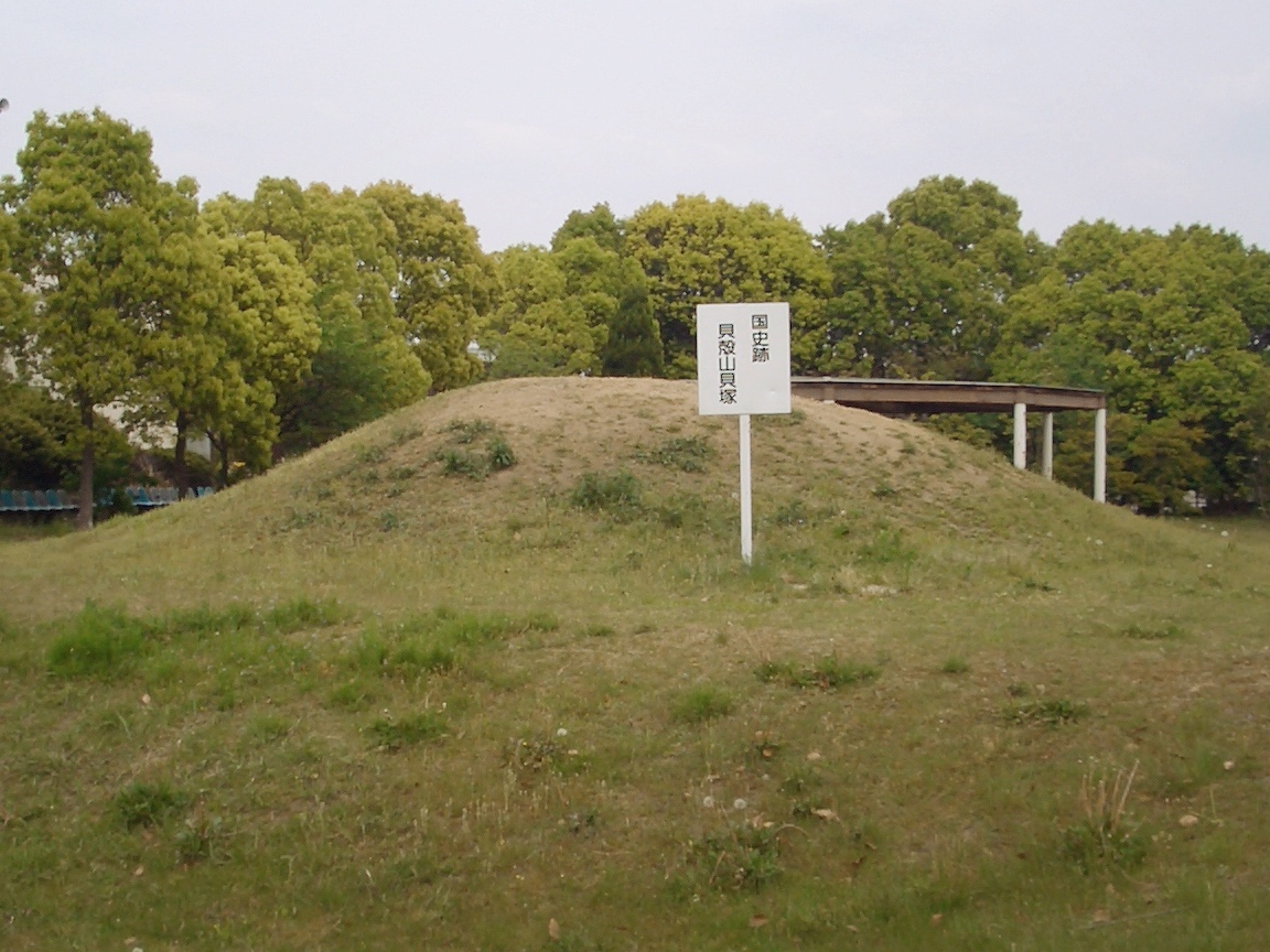
Kaigarayama Shell Mound
Monument and historic site · 6.1 km
Archaeological site in Kiyosu, Aichi, Japan

Noritake Garden
Museum · 7.5 km
Garden in Noritake-shimmachi 3-chōme, Nagoya, Japan

Toyota Commemorative Museum of Industry and Technology
Museum · 6.9 km
Technology museum in Nagoya, Japan




26 more on the map.
Parks, trails and playgrounds131

119 more on the map.
Restaurants and cafes187



Kando no Niku to Kome
Restaurant · Steak House · 4.1 km
Mo-Su11:00-22:00
SATO
Restaurant · Japanese · 3.1 km
Mo-Fr 11:00-01:00, Sa,Su 07:00-01:00
Sagami
Restaurant · Japanese · 3.0 km
Mo-Su 00:00-01:00,11:00-24:00

175 more on the map.
Churches and places of worship79
Shopping34
Gas and EV charging31
Schools, colleges and libraries51
Healthcare19
Map of Ama
250 places. The map loads OpenStreetMap tiles when you open it.
Getting there and nearby towns
Nagoya Airfield (NKM) is the nearest airport with scheduled flights listed in OpenStreetMap, 14 km away.
- Kiyosu 5 km northeast, about 5 min by car
- Kanie 6 km south, about 6 min by car
- Aisai 7 km west, about 7 min by car
- Inazawa 8 km north, about 8 min by car
- Nagoya 10 km east, about 10 min by car
- Kitanagoya 10 km northeast, about 10 min by car
- Ichinomiya 13 km north, about 13 min by car
- Iwakura 13 km northeast, about 13 min by car
- Komaki 15 km northeast, about 15 min by car
- Kōnan 18 km north, about 18 min by car
Drive times are estimates from straight-line distance, not routes.
Local news
Headlines from INDB.
Reviews, tips and questions
Loading what members have shared...
Sources and licences
- GeoNames (CC BY 4.0): population, coordinates, regions and time zone
- OpenStreetMap contributors (ODbL 1.0): places, airports, map data
- Wikidata (CC0 1.0): elevation, founding date, time zone, website, landmarks and historic places
- Wikimedia Commons (see each image): photos
- Wikipedia (CC BY-SA 4.0): overview and history text
Photo credits
- Jimokuji, Alpsdake, CC BY-SA 4.0
- Ama East Fire Station 20160803, 円周率3パーセント, CC BY-SA 4.0
- Aichi Ama c20250819 1641a, 円周率3パーセント, CC BY-SA 4.0
- Aichi Ama c20250819 1641b, 円周率3パーセント, CC BY-SA 4.0
- Aichi Ama c20250819 1638, 円周率3パーセント, CC BY-SA 4.0
- Aichi Ama c20250819 1637c, 円周率3パーセント, CC BY-SA 4.0
- Aichi Ama c20250819 1638a, 円周率3パーセント, CC BY-SA 4.0
- Aichi Ama c20250819 1637b, 円周率3パーセント, CC BY-SA 4.0
- Aichi Ama c20250819 1637a, 円周率3パーセント, CC BY-SA 4.0
- Aichi Ama s20260610 172513, 円周率3パーセント, CC BY-SA 4.0
- Aichi Ama s20260610 172723, 円周率3パーセント, CC BY-SA 4.0
- Aichi Ama c20250819 1636, 円周率3パーセント, CC BY-SA 4.0
- Ama 20190922-04, 円周率3パーセント, CC BY-SA 4.0
- Ama 20190922-02, 円周率3パーセント, CC BY-SA 4.0
- Ama 20190922-03, 円周率3パーセント, CC BY-SA 4.0
- Nagoya Bunri University ac (1), Asturio Cantabrio, CC BY-SA 4.0
- Nagoya College of Music Building C 20151024, 円周率3パーセント, CC BY-SA 4.0
- Asahi museum2, Bariston, CC BY-SA 4.0
- Kaigarayama shell midden, MChew, CC BY-SA 4.0
- Noritake Garden02, Nishi Ward Nagoya 2014, Tomio344456, CC BY-SA 4.0
- Toyota tecno museum, Bariston, CC BY-SA 4.0
- Daido University Do Plaza ac (2), Asturio Cantabrio, CC BY-SA 4.0
- Myogenin, アラツク, CC BY-SA 4.0
- Miwa Historical Museum-01, KAMUI, CC BY-SA 3.0
- Kayazujinja1, Bariston, CC BY-SA 4.0
- Kikusenin, Bariston, CC BY-SA 4.0
- Shichishosha1, Bariston, CC BY-SA 4.0
- Shippo Art Village-20150201, KAMUI, CC BY-SA 4.0
- Ryouunji, Bariston, CC BY-SA 3.0
- Bait-ul-Ahad The Japan Mosque, Abasaa, Public domain
- Sennonji 20210921-28, 円周率3パーセント, CC BY-SA 4.0
- Nagoya City Tomida JHS 20150920, 円周率3パーセント, CC BY-SA 4.0
- Sunari Shrine in Kanie ac (1), Asturio Cantabrio, CC BY-SA 4.0
- Kousen-ji temple, Ama, 運動会プロテインパワー, CC BY-SA 4.0
- Kobai-en 20211006-06, 円周率3パーセント, CC BY-SA 4.0
- K nakamura, Grape oscillo, CC BY-SA 3.0
- ヨシヅヤ事務センター, TakumaMuraoka, CC BY-SA 4.0
- Ryounji1, Bariston, CC BY-SA 4.0
- Shichisho-sha Shrine Haiden, Kamikoji Iwatsuka-cho Nakamura Ward Nagoya City 2023, Tomio344456, CC BY-SA 4.0
- Ama City Jimokuji-Minami Elementary School 20190314, Редактор Канзаки, CC BY-SA 4.0
- Nagoya City Hatori Junior High School 20150919-02, 円周率3パーセント, CC BY-SA 4.0
- Nagoya City Hosei Junior High School 20160724, 円周率3パーセント, CC BY-SA 4.0


Page built November 4, 2026. Spotted a mistake? Tell us or suggest a place.