


Kitanagoya, Japan
北名古屋市
Kitanagoya is a town of 86,385 people in Aichi, Japan, founded in March 20, 2006.
Why visit Kitanagoya
Townapedia lists 22 museums and landmarks, 182 parks and trails, 167 places to eat, 2 places to stay and 4 attractions in and around town.
Highlights include Aichi Prefectural College of Nursing & Health, Nagoya Noh Theater, Asahi Site and Kaigarayama Shell Mound.
Weather in Kitanagoya
Forecast from MET Norway (CC BY 4.0). Full forecast
About Kitanagoya
Kitanagoya (北名古屋市, Kitanagoya-shi) is a city in Aichi Prefecture, Japan. As of 1 October 2019, the city had an estimated population of 86,068 in 36,904 households, and a population density of 4,685 inhabitants per square kilometre (12,130/sq mi). The total area of the city is 18.37 square kilometres (7.09 sq mi). Kitanagoya is a member of the World Health Organization’s Alliance for Healthy Cities (AFHC).
From the Wikipedia article Kitanagoya (this version), under CC BY-SA 4.0.
Things to do4

Aichi Prefectural College of Nursing & Health
School · 6.1 km
Public university in Nagoya, Aichi, Japan

Nagoya Noh Theater
Cinema and theater · 6.7 km
Noh theatre in Nagoya, Aichi, Japan

Nagoya University of Arts
School · 1.0 km
Higher education institution in Aichi Prefecture, Japan

Museums and landmarks22

Asahi Site
Monument and historic site · 3.5 km
Archaeological site in Kiyosu/Nagoya, Aichi, Japan
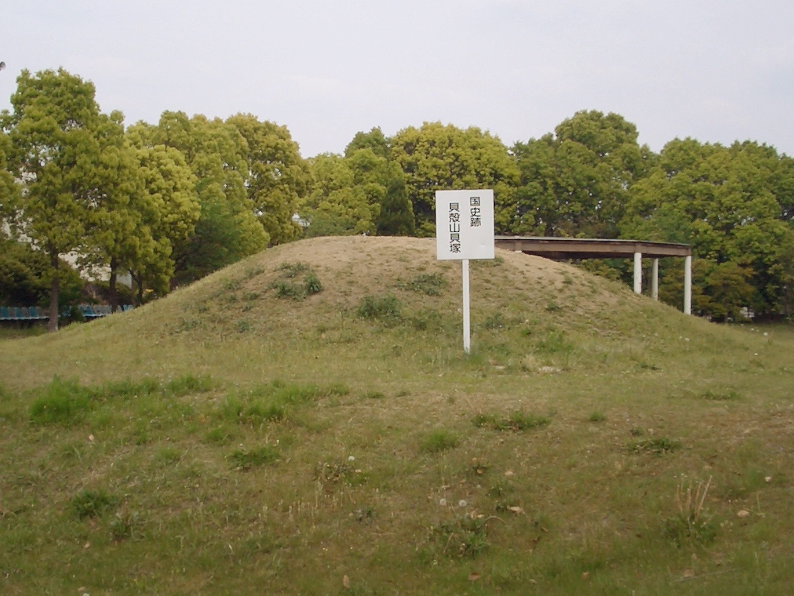
Kaigarayama Shell Mound
Monument and historic site · 4.0 km
Archaeological site in Kiyosu, Aichi, Japan


Menard Art Museum
Museum · 6.0 km
Art museum in Komaki City, Aichi, Japan

Toyota Commemorative Museum of Industry and Technology
Museum · 7.1 km
Technology museum in Nagoya, Japan


殉職記念碑
Monument and historic site · 2.5 km
自由民権運動末期の過激な事件であったが,その過程で亡くなった2人の巡査の殉難記念碑が平田橋近くに建てられている。
10 more on the map.
Parks, trails and playgrounds182






170 more on the map.
Restaurants and cafes167



155 more on the map.
Where to stay2
Churches and places of worship70
Shopping30
Gas and EV charging21
Schools, colleges and libraries51
Healthcare28
Map of Kitanagoya
250 places. The map loads OpenStreetMap tiles when you open it.
Getting there and nearby towns
Nagoya Airfield (NKM) is the nearest airport with scheduled flights listed in OpenStreetMap, 4 km away.
- Iwakura 4 km north, about 4 min by car
- Komaki 5 km northeast, about 5 min by car
- Kiyosu 5 km southwest, about 5 min by car
- Nagoya 8 km south, about 8 min by car
- Inazawa 9 km west, about 9 min by car
- Ichinomiya 9 km northwest, about 9 min by car
- Kōnan 9 km north, about 9 min by car
- Owariasahi 14 km east, about 14 min by car
- Kanie 15 km southwest, about 15 min by car
- Kakamigahara 19 km north, about 19 min by car
Drive times are estimates from straight-line distance, not routes.
Local news
Headlines from INDB.
Reviews, tips and questions
Loading what members have shared...
Sources and licences
- GeoNames (CC BY 4.0): population, coordinates, regions and time zone
- OpenStreetMap contributors (ODbL 1.0): places, airports, map data
- Wikidata (CC0 1.0): elevation, founding date, time zone, website, landmarks and historic places
- Wikimedia Commons (see each image): photos
- Wikipedia (CC BY-SA 4.0): overview and history text
Photo credits
- Kitanagoya City Hall West branch ac, Asturio Cantabrio, CC BY-SA 4.0
- Kitanagoya 20201111-25, 円周率3パーセント, CC BY-SA 4.0
- Aichi Kitanagoya c20240926 1339, 円周率3パーセント, CC BY-SA 4.0
- Kitanagoya 20201111-26, 円周率3パーセント, CC BY-SA 4.0
- Kitanagoya 20201111-24, 円周率3パーセント, CC BY-SA 4.0
- Kitanagoya 20201111-27, 円周率3パーセント, CC BY-SA 4.0
- Kitanagoya 20201111-20, 円周率3パーセント, CC BY-SA 4.0
- Kitanagoya 20201111-19, 円周率3パーセント, CC BY-SA 4.0
- Kitanagoya 20201111-23, 円周率3パーセント, CC BY-SA 4.0
- Kitanagoya 20201111-21, 円周率3パーセント, CC BY-SA 4.0
- Kitanagoya 20201111-22, 円周率3パーセント, CC BY-SA 4.0
- Aichi Kitanagoya s20240926 142956, 円周率3パーセント, CC BY-SA 4.0
- Aichi Kitanagoya s20240926 142952, 円周率3パーセント, CC BY-SA 4.0
- Aichi Kitanagoya s20251031 194750, 円周率3パーセント, CC BY-SA 4.0
- Aichi Kitanagoya s20251031 195734, 円周率3パーセント, CC BY-SA 4.0
- Aichi Kitanagoya s20251031 195751, 円周率3パーセント, CC BY-SA 4.0
- Aichi Kitanagoya s20240926 142251, 円周率3パーセント, CC BY-SA 4.0
- Aichi Kitanagoya s20251031 193932, 円周率3パーセント, CC BY-SA 4.0
- Aichi Kitanagoya s20251031 193935, 円周率3パーセント, CC BY-SA 4.0
- Aichi Kitanagoya s20251031 194623, 円周率3パーセント, CC BY-SA 4.0
- Aichi Kitanagoya s20251031 194631, 円周率3パーセント, CC BY-SA 4.0
- KitanagoyaCity from PareMarche01, Nryate, CC BY-SA 4.0
- Aichi Kitanagoya s20240926 142135, 円周率3パーセント, CC BY-SA 4.0
- KitanagoyaCity from PareMarche03, Nryate, CC BY-SA 4.0
- KitanagoyaCity from PareMarche02, Nryate, CC BY-SA 4.0
- Aichi Kitanagoya s20251031 195711, 円周率3パーセント, CC BY-SA 4.0
- Aichi Kitanagoya s20251031 194539, 円周率3パーセント, CC BY-SA 4.0
- Aichi Kitanagoya s20251031 193019, 円周率3パーセント, CC BY-SA 4.0
- Aichi Kitanagoya s20251031 194530, 円周率3パーセント, CC BY-SA 4.0
- Nagoya Noh Theater (1), Gryffindor, CC BY-SA 3.0
- Asahi museum2, Bariston, CC BY-SA 4.0
- Kaigarayama shell midden, MChew, CC BY-SA 4.0
- Toyota tecno museum, Bariston, CC BY-SA 4.0
- Meijo Park, Alpsdake, CC BY-SA 3.0
- Shonai-ryokuchi04, KAMUI, CC BY-SA 3.0
- Mozo AEON Wonder City Shopping Center 02, Gnsin, CC BY-SA 3.0
- K kita, Grape oscillo, CC BY-SA 3.0
- Heiden-ji Kitanagoya 2025-09 ac (1), Asturio Cantabrio, CC BY-SA 4.0
- Aichi Prefecture Nagoya Special Support School 20150620, 円周率3パーセント, CC BY-SA 4.0
- Hoshi-Jinja, KAMUI, CC BY-SA 3.0
- Kitanagoya City East Library, Gosei78 ( talk ), CC BY-SA 3.0
- 260125 Kiyosu City Haruhi Art Museum Kiyosu Aichipref Japan01s3, 663highland, CC BY-SA 4.0
- Jaike Shrine, 立花左近, CC BY-SA 3.0
- Toyoyama Town Shimizu Elementary School 20160117-02, 円周率3パーセント, CC BY-SA 4.0
- Toyoyama Town Toyoyama Junior High School 20160831, 円周率3パーセント, CC BY-SA 4.0
- Kenrin-ji temple, Komaki, 運動会プロテインパワー, CC BY-SA 4.0
- APITA Iwakura, Abasaa, Public domain
- Chozen-ji Temple Hondou, Kamiotai Nishi Ward Nagoya 2021, Tomio344456, CC BY-SA 4.0
- Shorin-ji hondo ac (1), Asturio Cantabrio, CC BY-SA 4.0
- Nagoya university of arts east, Gosei78 ( talk ), CC BY-SA 3.0
- Nagoya City Yamada Junior High School 20150620, 円周率3パーセント, CC BY-SA 4.0
- Nagoya City Yamada High School 20150620-01, 円周率3パーセント, CC BY-SA 4.0
- Shinmei-koen Park 20131122, 円周率3パーセント, CC BY-SA 4.0
- Toyoyama Town Toyoyama Elementary School 20160130, 円周率3パーセント, CC BY-SA 4.0
- Iwakura city historic park-01, KAMUI, CC BY-SA 3.0
- Araizeki-Ryokuchi01, KAMUI, CC BY-SA 3.0
- Nagoya City Kusunoki Nishi Elementary School 20150412, 円周率3パーセント, CC BY-SA 4.0
- Nagoya city Hirata JHS 20130827, 円周率3パーセント, CC BY-SA 3.0
- Nagoya City Onogi Elementary School 20180722, 円周率3パーセント, CC BY-SA 4.0
- Nagoya 20210130-027, 円周率3パーセント, CC BY-SA 4.0
- Nagoya City Yamada Elementary School 20150620, 円周率3パーセント, CC BY-SA 4.0
- Nakaotai Park 20200803-06, 円周率3パーセント, CC BY-SA 4.0


Page built November 4, 2026. Spotted a mistake? Tell us or suggest a place.