


Ashiya, Japan
芦屋市
Ashiya is a town of 93,922 people in Hyōgo, Japan, founded in April 1, 1889.
Why visit Ashiya
Townapedia lists 39 museums and landmarks, 64 parks and trails, 323 places to eat, 2 places to stay and 15 attractions in and around town.
Highlights include Ashiya University, Higashi Kobe Bridge, Yodokō Guest House and Egenoyama Site.
Weather in Ashiya
Forecast from MET Norway (CC BY 4.0). Full forecast
About Ashiya
Ashiya (芦屋市, Ashiya-shi; Japanese pronunciation: [ä̀.ɕí.jä́(.ɕì)]) is a city in Hyōgo Prefecture, Japan. As of 1 June 2024, the city had an estimated population of 92,976 in 43,229 households and a population density of 5,000 persons per km2. The total area of the city is 53.44 square kilometres (20.63 sq mi). It has a reputation as a high-end residential area and is the municipality with the highest average income in Japan, outside the richest wards of Tokyo.
From the Wikipedia article Ashiya, Hyōgo (this version), under CC BY-SA 4.0.
Things to do15

Ashiya University
School · 2.8 km
Higher education institution in Hyōgo Prefecture, Japan


Hyogo Medical University
School · 7.1 km
Higher education institution in Hyōgo Prefecture, Japan

Hyogo Performing Arts Center
Cinema and theater · 5.2 km
Building in Nishinomiya, Hyogo Prefecture, Japan
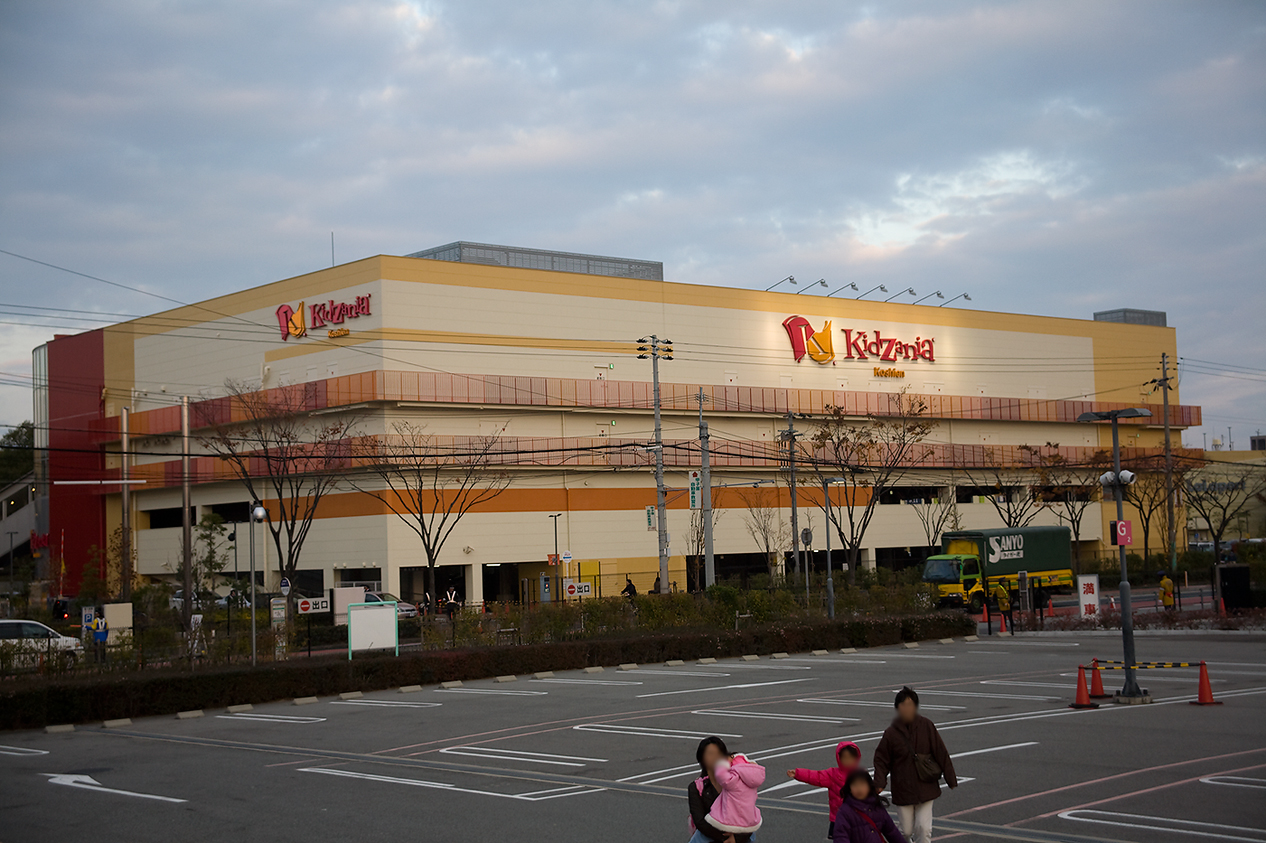
KidZania Koshien
Monument and historic site · 5.7 km
Family edutainment center amusement park

Kobe College
School · 5.8 km
Higher education institution in Hyōgo Prefecture, Japan
Kobe International University
School · 6.0 km
Higher education institution in Hyōgo Prefecture, Japan

Kobe Pharmaceutical University
School · 1.8 km
Higher education institution in Hyōgo Prefecture, Japan


Kobe University
School · 6.2 km
Higher education institution in Hyōgo Prefecture, Japan

Konan University
School · 3.1 km
Higher education institution in Hyōgo Prefecture, Japan

Konan Women's University
School · 1.6 km
Private women's college in Higashinada-ku, Kobe, Hyōgo, Japan
3 more on the map.
Museums and landmarks39

Yodokō Guest House
Monument and historic site · 1.3 km
旧山邑家住宅。フランク・ロイド・ライト設計

Egenoyama Site
Monument and historic site · 1.8 km
Yayoi period settlement trace in Ashiya, Hyōgo, Japan


Kobe City Koiso Memorial Museum of Art
Museum · 5.1 km
Museum in Japan

Kosetsu Museum of Art
Museum · 4.3 km
Museum for Japanese, Chinese and Korean art in Kobe

Kurokawa Institute of Ancient Cultures
Museum · 3.9 km
Museum in Japan


27 more on the map.
Parks, trails and playgrounds64




52 more on the map.
Restaurants and cafes323


311 more on the map.
History
The area of Ashiya was part of ancient Settsu Province and was mostly tenryō territory under direct control the Tokugawa shogunate during the Edo Period. Ashiya was established in 1871 as a township in Hyōgo Prefecture and was designated part of Seido village (精道村) on 1 April 1889, with the creation of the modern municipalities system. In the early 1900s, it was designated as an urban planning area and became one of the centers of the Hanshinkan Modernism movement in terms of architecture and culture. This led to the building of large single-family homes with tennis courts, swimming pools, and tea houses, etc. along the hills overlooking Osaka Bay. Seido was promoted to city status on 10 November 1940, changing its name to "Ashiya".
From the History section of Ashiya, Hyōgo on Wikipedia, under CC BY-SA 4.0.
Where to stay2
Churches and places of worship24
Shopping44
Gas and EV charging10
Schools, colleges and libraries16
Healthcare61
Map of Ashiya
250 places. The map loads OpenStreetMap tiles when you open it.
Getting there and nearby towns
Kobe Airport (UKB) is the nearest airport with scheduled flights listed in OpenStreetMap, 13 km away.
- Takarazuka 9 km northeast, about 9 min by car
- Amagasaki 10 km east, about 10 min by car
- Kobe 12 km west, about 12 min by car
- Itami 11 km northeast, about 11 min by car
- Kawanishi 14 km northeast, about 14 min by car
- Osaka 19 km east, about 19 min by car
- Sandachō 19 km north, about 19 min by car
- Minoh 19 km northeast, about 19 min by car
- Moriguchi 24 km east, about 24 min by car
- Kadoma 25 km east, about 25 min by car
Drive times are estimates from straight-line distance, not routes.
Local news
Headlines from INDB.
Reviews, tips and questions
Loading what members have shared...
Sources and licences
- GeoNames (CC BY 4.0): population, coordinates, regions and time zone
- OpenStreetMap contributors (ODbL 1.0): places, airports, map data
- Wikidata (CC0 1.0): elevation, founding date, time zone, website, landmarks and historic places
- Wikimedia Commons (see each image): photos
- Wikipedia (CC BY-SA 4.0): overview and history text
Photo credits
- Hanshin Ashiya Station - panoramio (1), DVMG, CC BY 3.0
- Hanshin Ashiya Station - panoramio (4), DVMG, CC BY 3.0
- Hanshin Ashiya Station - panoramio (5), DVMG, CC BY 3.0
- Hanshin Ashiya Station - panoramio (8), DVMG, CC BY 3.0
- Hanshin Ashiya Station - panoramio (12), DVMG, CC BY 3.0
- Hanshin Ashiya Station - panoramio (2), DVMG, CC BY 3.0
- Hanshin Ashiya Station - panoramio, DVMG, CC BY 3.0
- Hanshin Ashiya Station - panoramio (9), DVMG, CC BY 3.0
- Hanshin Ashiya Station - panoramio (3), DVMG, CC BY 3.0
- Hanshin Ashiya Station - panoramio (7), DVMG, CC BY 3.0
- Ashiya River:芦屋川 - panoramio - studio IRONY (2), studio IRONY, CC BY 3.0
- Ashiya, Hanshin Main Line - panoramio, DVMG, CC BY 3.0
- Hanshin Ashiya Station - panoramio (6), DVMG, CC BY 3.0
- Hanshin Ashiya Station platform - panoramio (3), DVMG, CC BY 3.0
- Hanshin Ashiya Station platform - panoramio (4), DVMG, CC BY 3.0
- Ashiya River:芦屋川 - panoramio - studio IRONY (1), studio IRONY, CC BY 3.0
- Hanshin Ashiya Station platform - panoramio (5), DVMG, CC BY 3.0
- Hanshin Ashiya Station - panoramio (11), DVMG, CC BY 3.0
- Hanshin Ashiya Station platform - panoramio (2), DVMG, CC BY 3.0
- Hanshin Ashiya Station - panoramio (13), DVMG, CC BY 3.0
- Hanshin Ashiya Station - panoramio (10), DVMG, CC BY 3.0
- Hanshin Ashiya Station platform - panoramio (1), DVMG, CC BY 3.0
- Hanshin Expressway, Studio IRONY, CC BY 3.0
- Hyogo Performing Arts Center night, User:Poprishchin, Public domain
- Vories kc 02, Miya, CC BY-SA 3.0
- KobeShoinFar, Lowell Silverman, CC BY-SA 2.5
- Kobe University Rokkodai Main Building, 0-0t, CC BY-SA 3.0
- Konan University3, The original uploader was 常時 舞蹴 at Japanese Wikipedia ., CC BY-SA 3.0
- Egenoyamaiseki1, KENPEI, CC BY-SA 3.0
- Hakutsuru museum01 1024, Original uploader was 663highland at ja.wikipedia, CC BY-SA 3.0
- Kobe city koiso memorial museum of art02s3200, 663highland, CC BY 2.5
- Kosetsu Museum:香雪美術館 - panoramio, studio IRONY, CC BY 3.0
- Ashiya Tanizaki Junichiro Memorial Museum01s3200, 663highland, CC BY 2.5
- Yamamura house07n4272, 663highland, CC BY 2.5
- Tekisui museum01s3200, 663highland, CC BY 2.5
- Ashiya Shiomi elementary school, 岩佐 栄三, CC0
- Ashiya City Museum of Art & History01s3200, 663highland, CC BY 2.5
- Ashiya-City-Library01s3872, 663highland, CC BY 2.5
- Motoyama daisan elementary school, Hyogo, Japan, Show_ryu, CC BY-SA 3.0
- 三条八幡神社, ながながながな, CC BY-SA 4.0
- Aboshinnozuka Kofun, haisho, Saigen Jiro, CC0
- Ashiya University Hyogo Japan 2008, Ofg, CC BY-SA 3.0
- Kobe-Pharmaceutical-Univ-2013042802, Hasec, CC0
- Konan-Women's-Univ-2014081101, Hasec, CC0
- Kizzania, wiki0001, CC BY 3.0
- Hyogo pref Ashiya highschool, Bakkai, CC BY 3.0
- Ashiya International Secondary School, 岩佐 栄三, CC0
- Ashiya Yamate elementary school, 岩佐 栄三, CC0
- Higashinada elem-sch, 岩佐 栄三, CC BY-SA 4.0
- Ashiya Miyagawa elementary school, 岩佐 栄三, CC0
- Ashiya Seido Elementary School, 岩佐 栄三, CC0
- 芦屋公園, Yaritsusozai, CC BY-SA 4.0
- 金津山古墳, 壱与, CC BY-SA 4.0


Page built November 4, 2026. Spotted a mistake? Tell us or suggest a place.