


Chatan, Japan
北谷町
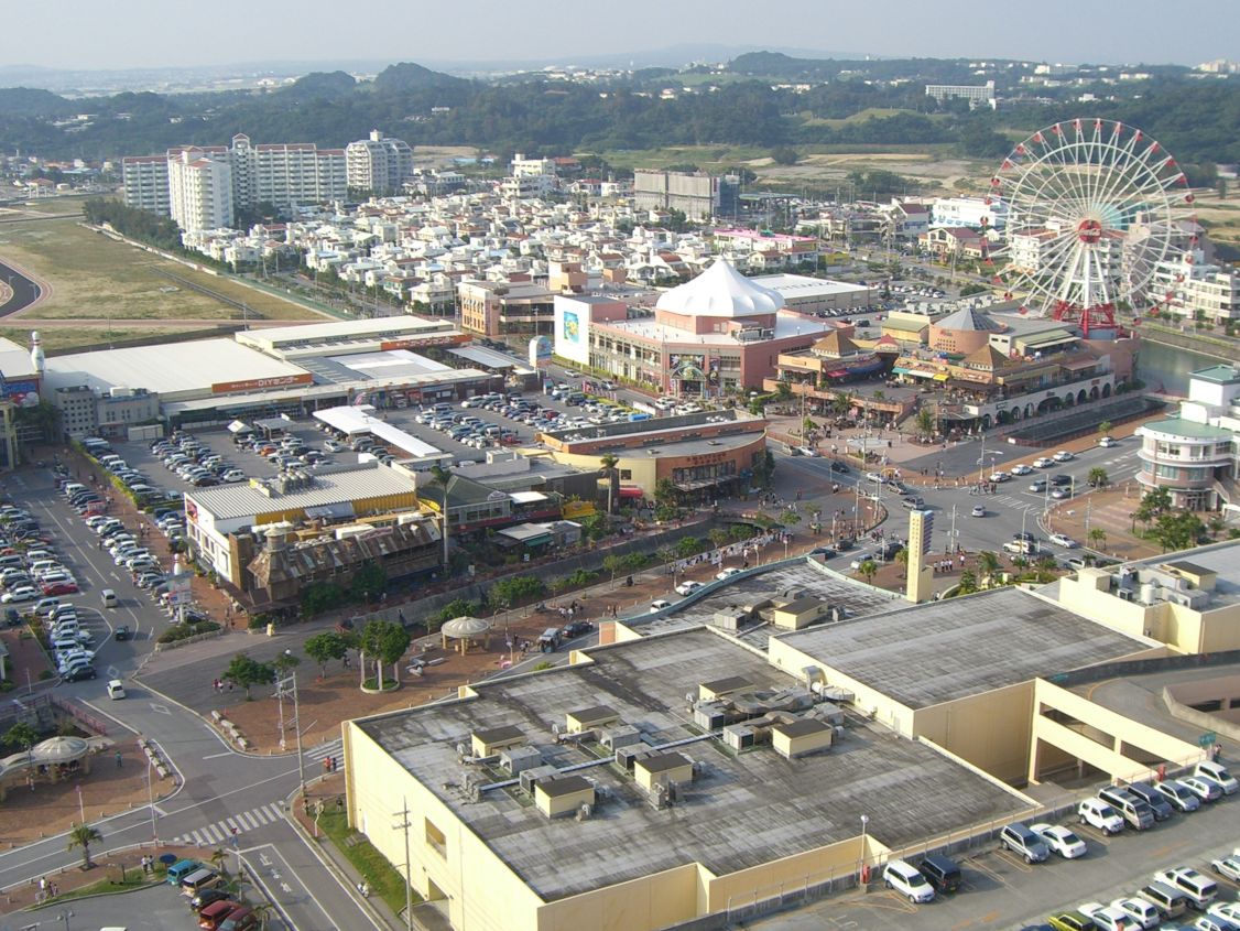
Chatan is a town of 28,201 people in Okinawa, Japan, founded in April 1, 1980.
Why visit Chatan
Townapedia lists 26 museums and landmarks, 53 parks and trails, 288 places to eat, 29 places to stay and 7 attractions in and around town.
Highlights include Okinawa International University, University of the Ryukyus, Chatan Museum and Sakima Art Museum.
Weather in Chatan
Forecast from MET Norway (CC BY 4.0). Full forecast
About Chatan
Chatan (北谷町, Chatan-chō; Okinawan: Chatan, Northern Ryukyuan: きたたん Kitatan) is a town located in Nakagami District, Okinawa Prefecture, Japan. As of October 2016 the town had an estimated population of 28,578 and the density of 2,100 per km2. The total area of Chatan is 13.62 square kilometres (5.26 mi2). 53.5% of the land area of the town is covered by United States military bases.
From the Wikipedia article Chatan, Okinawa (this version), under CC BY-SA 4.0.
Travel tips from other travellers: Chatan on Wikivoyage (CC BY-SA 4.0).
Things to do7

Okinawa International University
School · 5.5 km
Higher education institution in Okinawa Prefecture, Japan

University of the Ryukyus
School · 6.5 km
Higher education institution in Okinawa Prefecture, Japan


Museums and landmarks26



Ireibaru Site
Monument and historic site · 2.0 km
Archaeological site in Japan

Ogidō Shell Mound
Monument and historic site · 3.4 km
Shell midden in Okinawa, Japan

Ōyama Shell Mound
Monument and historic site · 4.7 km
Early Kaizuka Period shellmound in Ginowan, Okinawa

Ryukyu University Museum (Fūjukan)
Museum · 6.6 km
Museum in Nishihara, Okinawa, Japan

Memorial of Completion of Awase Land Readjustment
Monument and historic site · 2.6 km
14 more on the map.
Parks, trails and playgrounds53





41 more on the map.
Restaurants and cafes288



105 DELI&肉酒場
Restaurant · Steak · 2.6 km
1, 宜野湾市
Mo-Sa 11:00-15:00, 18:00-24:00; Su 11:00-15:00, 18:00-23:00

276 more on the map.
Where to stay29
Churches and places of worship24
Church of Jesus Christ of Latter-Day Saints
Church · Mormon · 2.7 km
2-31-1 Nodake, 宜野湾市
Shopping64
Gas and EV charging21
Schools, colleges and libraries35
Kitanakagusuku Village Kitanakagusuku Junior High School
School · 2.8 km
306 字喜舎場306
Healthcare31
Map of Chatan
250 places. The map loads OpenStreetMap tiles when you open it.
Getting there and nearby towns
Kadena Air Base (DNA) is the nearest airport with scheduled flights listed in OpenStreetMap, 4 km away.
- Chuzan Hospital map
- Ginowan 5 km south, about 5 min by car
- Urasoe 7 km southwest, about 7 min by car
- Kadena 6 km north, about 6 min by car
- Nishihara 7 km southwest, about 7 min by car
- Uruma 12 km northeast, about 12 min by car
- Gushikawa 11 km northeast, about 11 min by car
- Yonabaru 12 km south, about 12 min by car
- Kanegusuku 13 km south, about 13 min by car
- Ishikawa 14 km north, about 14 min by car
- Naha 14 km southwest, about 14 min by car
Drive times are estimates from straight-line distance, not routes.
Local news
Headlines from INDB.
Reviews, tips and questions
Loading what members have shared...
Sources and licences
- GeoNames (CC BY 4.0): population, coordinates, regions and time zone
- OpenStreetMap contributors (ODbL 1.0): places, airports, map data
- Wikidata (CC0 1.0): elevation, founding date, time zone, website, landmarks and historic places
- Wikimedia Commons (see each image): photos
- Wikipedia (CC BY-SA 4.0): overview and history text
Photo credits
- Chatan Gusuku, Bérangère444, CC BY 4.0
- Chatan Gusuku Hill Complex, Bérangère444, CC BY 4.0
- Chatan Gusuku 02, Bérangère444, CC BY 4.0
- Chatan Gusuku 01, Bérangère444, CC BY 4.0
- Chibugaa Spring in Chatan, Okinawa, Bérangère444, CC BY 4.0
- JP 日本 Japan 沖繩 OKINAWA Naha shuttle bus view from Chatan city to 那霸機場 Naha Airport via 國道58號 National Route morning 1128am January 2025 R12S 123, Naha Mama Pavilionz, CC0
- JP 日本 Japan 沖繩 OKINAWA Naha shuttle bus view from Chatan city to 那霸機場 Naha Airport via 國道58號 National Route morning 1128am January 2025 R12S 124, Naha Mama Pavilionz, CC0
- JP 日本 Japan 沖繩 OKINAWA Naha shuttle bus view from Chatan city to 那霸機場 Naha Airport via 國道58號 National Route morning 1128am January 2025 R12S 121, Naha Mama Pavilionz, CC0
- JP 日本 Japan 沖繩 OKINAWA Naha shuttle bus view from Chatan city to 那霸機場 Naha Airport via 國道58號 National Route morning 1128am January 2025 R12S 116, Naha Mama Pavilionz, CC0
- JP 日本 Japan 沖繩 OKINAWA Naha shuttle bus view from Chatan city to 那霸機場 Naha Airport via 國道58號 National Route morning 1128am January 2025 R12S 122, Naha Mama Pavilionz, CC0
- JP 日本 Japan 沖繩 OKINAWA Naha shuttle bus view from Chatan city to 那霸機場 Naha Airport via 國道58號 National Route morning 1128am January 2025 R12S 117, Naha Mama Pavilionz, CC0
- JP 日本 Japan 沖繩 OKINAWA Naha shuttle bus view from Chatan city to 那霸機場 Naha Airport via 國道58號 National Route morning 1128am January 2025 R12S 118, Naha Mama Pavilionz, CC0
- JP 日本 Japan 沖繩 OKINAWA Naha shuttle bus view from Chatan city to 那霸機場 Naha Airport via 國道58號 National Route morning 1128am January 2025 R12S 120, Naha Mama Pavilionz, CC0
- JP 日本 Japan 沖繩 OKINAWA Naha shuttle bus view from Chatan city to 那霸機場 Naha Airport via 國道58號 National Route morning 1128am January 2025 R12S 119, Naha Mama Pavilionz, CC0
- JP 日本 Japan 沖繩 OKINAWA Naha shuttle bus view from Chatan city to 那霸機場 Naha Airport via 國道58號 National Route morning 1134am January 2025 R12S 200, Naha Mama Pavilionz, CC0
- JP 日本 Japan 沖繩 OKINAWA Naha shuttle bus view from Chatan city to 那霸機場 Naha Airport via 國道58號 National Route morning 1134am January 2025 R12S 202, Naha Mama Pavilionz, CC0
- JP 日本 Japan 沖繩 OKINAWA Naha shuttle bus view from Chatan city to 那霸機場 Naha Airport via 國道58號 National Route morning 1134am January 2025 R12S 201, Naha Mama Pavilionz, CC0
- Ryuukyuudaigaku, Hykw-a4 at ja.Wikipedia, CC BY-SA 3.0
- Chatan Museum 02, Bérangère444, CC BY 4.0
- Sakima Art Museum03n3000, 663highland, CC BY 2.5
- Ōyama Shellmound (entrance stele), Bérangère444, CC BY-SA 4.0
- 琉球大学博物館(風樹館), Kiken68, CC0
- Okinawa Temple Front, Epachamo, CC BY-SA 4.0
- Mihama AV D Japan, Amoriver Information, CC BY-SA 3.0
- AEON Chatan Shopping Center 1, Abasaa, Public domain
- San-A Hamby Town, Abasaa, Public domain
- Plaza House Shopping Center, Abasaa, Public domain
- Chatan Park Baseball Stadium, Abasaa, Public domain
- Futemma-gū haiden, nnh, Public domain
- Okinawa City Stadium, Kk123456123456, CC BY-SA 4.0
- Futenma High School, Abasaa, Public domain
- Ryukyu-univ hospital, Kugel~commonswiki, Public domain
- AEON Mall Okinawa Rycom 01, Kugel~commonswiki, CC BY-SA 4.0
- Okinawa arena 1, Kk123456123456, CC BY-SA 4.0
- Starbucks Headquarters Seattle, Original uploader was Wesley H. Brewton, Jr. at en.wikipedia, Public domain
- Okinawa City Baseball Stadium 202305, 運動会プロテインパワー, CC BY-SA 4.0
- Chatan town Chatan elem-sch, Bakkai, CC BY 3.0
- Chatan town Chatan-daini elem-sch, Bakkai, CC BY-SA 3.0
- Chatan town Kuwae jhs, Bakkai, CC BY-SA 3.0
- 新 琉球大学病院, 琉球大学病院, CC0
- Hini Gusuku 2, Bérangère444, CC BY-SA 4.0
- Baseball field of Chatan Park 20150317, そらみみ, CC BY-SA 4.0


Page built November 5, 2026. Spotted a mistake? Tell us or suggest a place.