
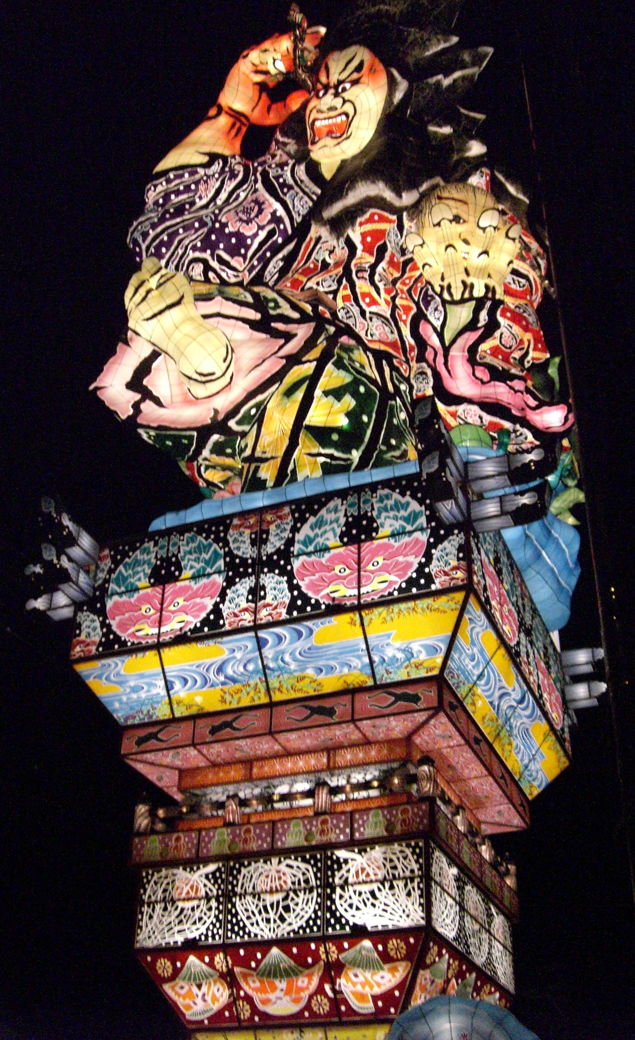


Goshogawara, Japan
五所川原市
Goshogawara is a town of 53,576 people in Aomori, Japan, founded in March 28, 2005.
Why visit Goshogawara
Townapedia lists 53 museums and landmarks, 56 parks and trails, 137 places to eat, 14 places to stay and 21 attractions in and around town.
Highlights include Mt. Bonju, 馬ノ神山, Kamegaoka Stone Age Site and Ōmori Katsuyama Site.
Weather in Goshogawara
Forecast from MET Norway (CC BY 4.0). Full forecast
About Goshogawara
Goshogawara (五所川原市, Goshogawara-shi) is a city located in Aomori Prefecture, Japan. As of 31 January 2023, the city had an estimated population of 51,578 in 25,615 households, and a population density of 130 persons per km2. The total area of the city is 404.18 square kilometres (156.05 sq mi).
From the Wikipedia article Goshogawara (this version), under CC BY-SA 4.0.
Travel tips from other travellers: Goshogawara on Wikivoyage (CC BY-SA 4.0).
Things to do21





9 more on the map.
Museums and landmarks53

Kamegaoka Stone Age Site
Monument and historic site · 12.4 km
Settlement site of Jomon period Japan

Ōmori Katsuyama Site
Monument and historic site · 13.7 km
Stone circle, settlement in Aomori, Japan

Tagoyano Shell Mound
Monument and historic site · 12.7 km
Archaeological site in Tsugaru, Tohoku, Japan



Goshogawara Sue Pottery Kiln Site
Monument and historic site · 10.2 km
Archaeological site in Japan


Takayashikidate Site
Monument and historic site · 14.2 km
Archeological site in Aomori, Tohuku, Japan
41 more on the map.
Parks, trails and playgrounds56


44 more on the map.
Restaurants and cafes137


ふくら
Restaurant · Japanese, 天ぷら · 0.8 km
1, 五所川原市
Mo,We-Su 18:00-24:00
125 more on the map.
History
The area of Goshogawara was part of the holdings of the Tsugaru clan of Hirosaki Domain in the Edo period. With the post-Meiji restoration establishment of the modern municipalities system on April 1, 1889, the area became part of Kitatsugaru District, Aomori, and was divided into the villages of Goshogawara, Sakae, Miyoshi, Nakagawa, Nagahashi, Nanawa, Matsushima and Itayanagi on April 1, 1889. On July 1, 1898, Goshogawara was elevated to town status. On October 1, 1954. Goshogawara absorbed the villages of Sakae, Nakagawa, Nagahashi, Matsushima and Iizume to create the city of Goshogawara. On April 1, 1958, Goshogawara absorbed a portion of the town of Kizukuri.
On March 28, 2005, the town of Kanagi, and the village of Shiura were merged into Goshogawara.
In March 2024, the city announced the creation of its own "Citizen's Honor Award", with the intention of making sumo wrestler Takerufuji the first recipient of the prize following his historical championship win.
From the History section of Goshogawara on Wikipedia, under CC BY-SA 4.0.
Where to stay14
Churches and places of worship48
Shopping50
Gas and EV charging23
Schools, colleges and libraries42
Healthcare59
Map of Goshogawara
250 places. The map loads OpenStreetMap tiles when you open it.
Getting there and nearby towns
Aomori Airport (AOJ) is the nearest airport with scheduled flights listed in OpenStreetMap, 22 km away.
- Itayanagi 12 km south, about 12 min by car
- Namioka 16 km southeast, about 16 min by car
- Kuroishi 21 km southeast, about 21 min by car
- Hirosaki 24 km south, about 24 min by car
- Aomori 25 km east, about 25 min by car
- Hiranai 45 km east, about 45 min by car
- Ōdate 60 km south, about 1 h by car
- Shichinohe 61 km east, about 1 h by car
- Takanosu 65 km south, about 1 h by car
- Noshiro 75 km southwest, about 1 h 15 min by car
Drive times are estimates from straight-line distance, not routes.
Local news
Headlines from INDB.
Reviews, tips and questions
Loading what members have shared...
Sources and licences
- GeoNames (CC BY 4.0): population, coordinates, regions and time zone
- OpenStreetMap contributors (ODbL 1.0): places, airports, map data
- Wikidata (CC0 1.0): elevation, founding date, time zone, website, landmarks and historic places
- Wikimedia Commons (see each image): photos
- Wikipedia (CC BY-SA 4.0): overview and history text
Photo credits
- Tachineputa~2007 "Mebukiurasaburu", 撮影者に準ずる, CC BY-SA 3.0
- Minami Elementary School Goshogawara 200921, Yauchi, CC BY-SA 4.0
- Goshogawara City Government Office 20191124, 掬茶, CC BY-SA 4.0
- Aomori Bank Goshogawara branch, 掬茶, CC BY-SA 4.0
- 140914 Tsugaru Goshogawara Station Goshogawara Aomori pref Japan10bs5, 663highland, CC BY 2.5
- 140914 Tsugaru Goshogawara Station Goshogawara Aomori pref Japan06n, 663highland, CC BY 2.5
- 140914 Goshogawara Station Goshogawara Aomori pref Japan07n, 663highland, CC BY 2.5
- 140914 Tsugaru Goshogawara Station Goshogawara Aomori pref Japan04s3, 663highland, CC BY 2.5
- 140914 Tsugaru Goshogawara Station Goshogawara Aomori pref Japan02n, 663highland, CC BY 2.5
- 140914 Goshogawara Station Goshogawara Aomori pref Japan06n, 663highland, CC BY 2.5
- 140914 Tsugaru Goshogawara Station Goshogawara Aomori pref Japan11n, 663highland, CC BY 2.5
- 140914 Tsugaru Goshogawara Station Goshogawara Aomori pref Japan07n, 663highland, CC BY 2.5
- 140914 Goshogawara Station Goshogawara Aomori pref Japan01n, 663highland, CC BY 2.5
- 140914 Goshogawara Station Goshogawara Aomori pref Japan05n, 663highland, CC BY 2.5
- 140914 Goshogawara Station Goshogawara Aomori pref Japan08s3, 663highland, CC BY 2.5
- 140914 Tsugaru Goshogawara Station Goshogawara Aomori pref Japan01n, 663highland, CC BY 2.5
- 140914 Goshogawara Station Goshogawara Aomori pref Japan10n, 663highland, CC BY 2.5
- 140914 Goshogawara Station Goshogawara Aomori pref Japan02s3, 663highland, CC BY 2.5
- 140914 Goshogawara Station Goshogawara Aomori pref Japan03s3, 663highland, CC BY 2.5
- 140914 Goshogawara Station Goshogawara Aomori pref Japan09s3, 663highland, CC BY 2.5
- 140914 Tsugaru Goshogawara Station Goshogawara Aomori pref Japan05n, 663highland, CC BY 2.5
- 140914 Goshogawara Station Goshogawara Aomori pref Japan04s3, 663highland, CC BY 2.5
- 140914 Tsugaru Goshogawara Station Goshogawara Aomori pref Japan03s3, 663highland, CC BY 2.5
- 140914 Tsugaru Goshogawara Station Goshogawara Aomori pref Japan09s3, 663highland, CC BY 2.5
- Kamegaoka2, MChew, CC BY-SA 4.0
- Omori-Katsuyama Stone Circle, MChew, CC BY-SA 4.0
- Tagoyano Shell Mound 02, Indiana jo, CC BY-SA 4.0
- Shayōkan the birthhouse of Osamu Dazai, 掬茶, CC BY-SA 4.0
- Mount Bonju from National Route 7, Mccunicano, CC BY-SA 4.0
- Aomori Prefectural Goshogawara High School 1, Ebiebi2, CC BY-SA 3.0
- Mt Manogamiyama Aomori PB110845, あおもりくま, CC BY-SA 3.0
- Aomori Prefectural Tsuruta High School, 掬茶, CC BY-SA 4.0
- Goshogawara City Library ac, Asturio Cantabrio, CC BY-SA 4.0
- Takayashikidate, MChew, CC BY-SA 4.0
- Tachineputa Hall, 掬茶, CC BY-SA 3.0
- 立佞武多 - panoramio (1), 田附宏秀, CC BY 3.0
- 立佞武多 - panoramio, 田附宏秀, CC BY 3.0
- Tachineputa Float, Occidentale, CC BY 4.0
- 五所川原駅 - panoramio, くろふね, CC BY 3.0
- 五所川原駅 - panoramio (3), くろふね, CC BY 3.0


Page built November 4, 2026. Spotted a mistake? Tell us or suggest a place.