


Imizu, Japan
射水市
Imizu is a town of 90,742 people in Toyama, Japan, founded in November 1, 2005.
Why visit Imizu
Townapedia lists 34 museums and landmarks, 51 parks and trails, 91 places to eat, 4 places to stay and 10 attractions in and around town.
Highlights include Toyama Prefectural University, Toyama College of Business and Information Technology, Kitadai Site and Kosugimaruyama Site.
Weather in Imizu
Forecast from MET Norway (CC BY 4.0). Full forecast
About Imizu
Imizu (射水市, Imizu-shi; Japanese pronunciation: [í.mʲì.(d͡)zɨ̀, ì.mʲí.(d͡)zɨ́.ɕì]) is a city located in Toyama Prefecture, Japan. As of 28 February 2018, the city had an estimated population of 93,447 in 37,734 households and a population density of 850 persons per km2. Its total area was 109.43 square kilometres (42.25 sq mi).
From the Wikipedia article Imizu (this version), under CC BY-SA 4.0.
Things to do10

Toyama Prefectural University
School · 7.2 km
Higher education institution in Toyama Prefecture, Japan

Toyama College of Business and Information Technology
School · 5.4 km
Technical college in Toyama, Japan



Museums and landmarks34
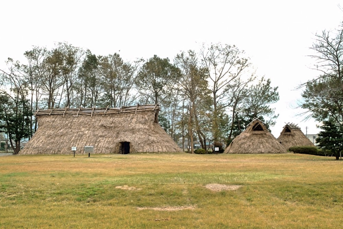
Kitadai Site
Monument and historic site · 7.8 km
Archaeological site in Toyama, Toyama, Japan
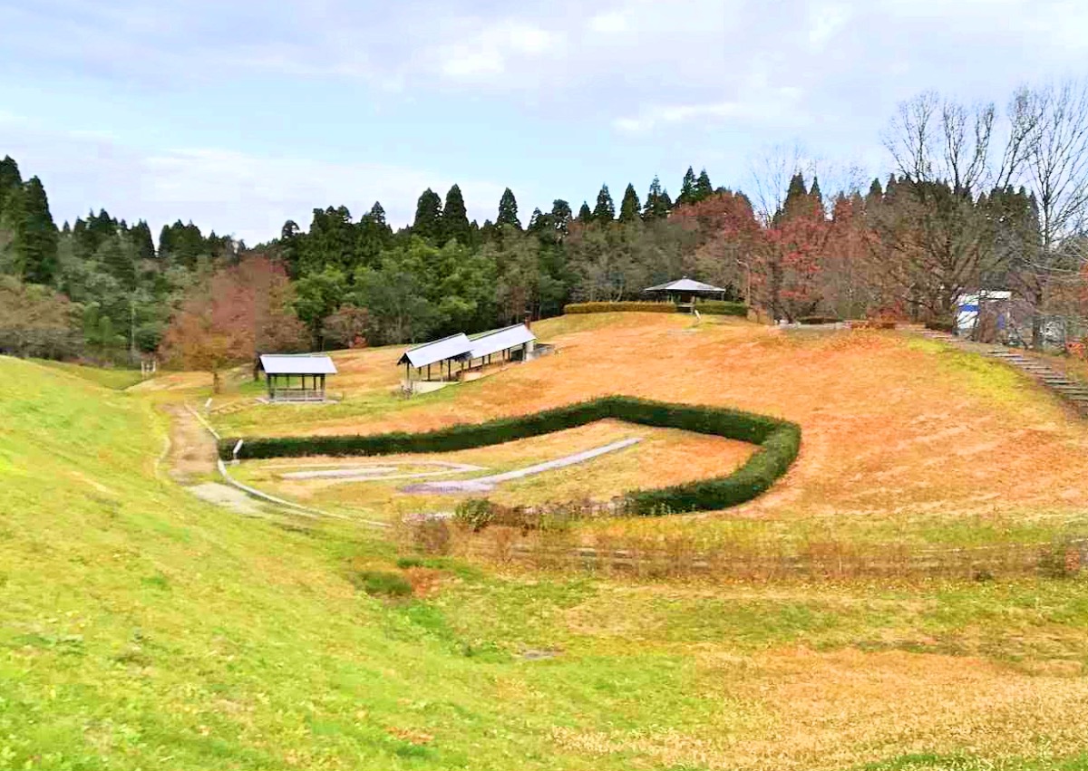
Kosugimaruyama Site
Monument and historic site · 9.6 km
Archaeological site in Japan

Kushidashin Site
Monument and historic site · 11.6 km
Archaeological site in Imizu, Toyama, Japan

Takaoka Manyō Historical Museum
Museum · 7.7 km
Museum in Takaoka, Toyama, Japan

The Suiboku Museum, Toyama
Museum · 10.0 km
Art museum in Toyama, Toyama, Japan

Toyama Prefectural Museum of Art and Design
Museum · 9.9 km
Art museum in Toyama, Toyama, Japan


22 more on the map.
Parks, trails and playgrounds51

39 more on the map.
Restaurants and cafes91

Ramen Ajiraku
Restaurant · Ramen · 6.7 km
三ケ2452-2
Th-Tu 11:30-15:00, 18:00-23:30
ZAIQA CURRY HOUSE
Restaurant · Indian · 4.3 km
中曽根260-3 姫野能町線
Mo-Su 11:00-15:00, 17:00-22:00
カシミール
Restaurant · Indian · 4.9 km
沖塚原752-1
Mo-Su 09:00-15:00, 17:00-21:30
ホット・スプーン (HOT SPOON)
Restaurant · Indian · 5.9 km
戸破3662
Mo-Su 11:00-15:00, 17:00-22:00

ビストロサザン
Restaurant · Coffee Shop, Curry, Pasta · 1.0 km
11:00-22:00;Tu off
台湾料理 来来来
Restaurant · Chinese · 5.3 km
Mo-Fr 11:00-14:30,17:00-24:00;Sa-Su,PH 11:00-24:00
79 more on the map.
History
The area of present-day Imizu was part of ancient Etchū Province, and was governed during the Edo period as part of Kaga Domain.
The modern city of Imizu was established on November 1, 2005, from the merger of the city of Shinminato, the towns of Daimon, Kosugi and Ōshima, and the village of Shimo (all from Imizu District). Imizu District was dissolved as a result of this merger.
From the History section of Imizu on Wikipedia, under CC BY-SA 4.0.
Where to stay4
Churches and places of worship56
Shopping28
Gas and EV charging13
Schools, colleges and libraries72
Healthcare22
Map of Imizu
250 places. The map loads OpenStreetMap tiles when you open it.
Getting there and nearby towns
Toyama Airport (TOY) is the nearest airport with scheduled flights listed in OpenStreetMap, 14 km away.
- Toyama 11 km southeast, about 11 min by car
- Himimachi 16 km northwest, about 16 min by car
- Kamiichi 23 km east, about 23 min by car
- Uozu 25 km east, about 25 min by car
- Oyabe 27 km southwest, about 27 min by car
- Nanto-shi 29 km southwest, about 29 min by car
- Kurobe-shi 32 km northeast, about 32 min by car
- Fukumitsu 33 km southwest, about 33 min by car
- Nanao 34 km northwest, about 34 min by car
- Hakui 33 km northwest, about 33 min by car
Drive times are estimates from straight-line distance, not routes.
Local news
Headlines from INDB.
Reviews, tips and questions
Loading what members have shared...
Sources and licences
- GeoNames (CC BY 4.0): population, coordinates, regions and time zone
- OpenStreetMap contributors (ODbL 1.0): places, airports, map data
- Wikidata (CC0 1.0): elevation, founding date, time zone, website, landmarks and historic places
- Wikimedia Commons (see each image): photos
- Wikipedia (CC BY-SA 4.0): overview and history text
Photo credits
- Imizu City Hall 2016, TTTNIS, CC0
- Japan, 〒933-0221 Toyama-ken, Imizu-shi, Horiokashinmyōjin, 県道350号線 - panoramio, kiwa dokokano, CC BY-SA 3.0
- Japan, 〒933-0221 Toyama-ken, Imizu-shi, Horiokashinmyōjin, 県道350号線 - panoramio (1), kiwa dokokano, CC BY-SA 3.0
- Japan, 〒933-0221 Toyama-ken, Imizu-shi, Horiokashinmyōjin, 県道350号線 - panoramio (3), kiwa dokokano, CC BY-SA 3.0
- Japan, 〒933-0221 Toyama-ken, Imizu-shi, Horiokashinmyōjin, 県道350号線 - panoramio (2), kiwa dokokano, CC BY-SA 3.0
- Horiokashinmyojin, Imizu, Toyama Prefecture 933-0221, Japan - panoramio, ESU, CC BY 3.0
- Japan, 〒934-0021 Toyama-ken, Imizu-shi, Horiokashinmyōjin, 県道350号線 - panoramio, kiwa dokokano, CC BY-SA 3.0
- Horiokashinmyojin, Imizu, Toyama Prefecture 933-0221, Japan - panoramio (1), kiwa dokokano, CC BY-SA 3.0
- Horiokashinmyojin, Imizu, Toyama Prefecture 933-0221, Japan - panoramio (2), kiwa dokokano, CC BY-SA 3.0
- 109-24 Horiokashinmyōjin, Imizu-shi, Toyama-ken 933-0221, Japan - panoramio, kiwa dokokano, CC BY-SA 3.0
- Koshinokatamachi, Imizu, Toyama Prefecture 934-0024, Japan - panoramio, ESU, CC BY 3.0
- 2 Kaiōmachi, Imizu-shi, Toyama-ken 934-0023, Japan - panoramio, kiwa dokokano, CC BY-SA 3.0
- Toyama Prefectural University, RESPITE, Public domain
- Kitadai Site, MChew, CC BY-SA 4.0
- Kosugimaruyama Site, MChew, CC BY-SA 4.0
- Kushidashin Kofun, MChew, CC BY-SA 4.0
- 富山水墨美術館, くろふね, CC BY 3.0
- Kaiwo Maru II in yokohama japan, baku13, CC BY-SA 3.0
- Takaoka Fushiki jinja ac, Asturio Cantabrio, CC BY-SA 4.0
- Shoko Temple 2010, Miyuki Meinaka, Public domain
- Kureha-Anekurahime-jinja haiden, nnh, Public domain
- Toyama Prefectural Library, Hirorinmasa, CC BY-SA 3.0
- 大島絵本館, Ttaakkaco, CC BY-SA 4.0
- Keta Shrine, nnh, Public domain
- GOHYAKURAKAN CHOUKEIJI, Jinzuu, CC BY-SA 3.0
- 下村加茂神社, Ttaakkaco, CC BY-SA 4.0
- 射水市民病院, Ttaakkaco, CC BY-SA 4.0
- Thatched Roof Folk Art Museum, tsuda, CC BY-SA 2.0
- 射水市新湊博物館, Ttaakkaco, CC0
- Toyama glass studio001, えむかとー, CC BY-SA 4.0
- Toyama Prefectural Center for Archaeological Operations, Beryllium Transistor, CC0
- Hondo, Renno-ji 20190818141015, shiro524, CC BY-SA 3.0
- Ettyuu-gokoku-hachimangu(Toyama-shi), Makoto01ta, CC BY-SA 4.0
- 越中国庁址碑, 小池 隆, CC BY 3.0
- Chokei-ji, Toyama, Beryllium Transistor, CC0
- Toyama Municipal Family Park Zoo, TTTNIS, CC0
- Toyama University of International Studies, SONIC BLOOMING, CC BY-SA 4.0
- Keta-jinja (Takaoka), shaden, Saigen Jiro, CC0
- 姉倉比売神社 富山市呉羽町 Anekura-hime-jinja 2014.8.25 - panoramio (1), Nankou Oronain (as36…, CC BY-SA 3.0
- Kosugi-high-school toyama-pref 2018, XF10, CC BY-SA 4.0
- Kosugi-minami-junior-high-school imizu-city 2018, XF10, CC BY-SA 4.0
- Kureha-high-school toyama-pref 2018, XF10, CC BY-SA 4.0
- AL.PLAZA Kosugi, Suikotei, CC BY 4.0
- Kureha-junior-high-school sumo toyama-city 2018, XF10, CC BY-SA 4.0
- Furusawa-elem-school toyama-city 2018, XF10, CC BY-SA 4.0
- Nagaoka-elem-school toyama-city 2018, XF10, CC BY-SA 4.0
- Kureha-elem-school toyama-city 2018, XF10, CC BY-SA 4.0
- Kusajima-elem-school toyama-city 2018, XF10, CC BY-SA 4.0
- Hachiman-elem-school toyama-city 2018, XF10, CC BY-SA 4.0
- Tanino Gozan Hospital, Beryllium Transistor, CC0


Page built November 5, 2026. Spotted a mistake? Tell us or suggest a place.