
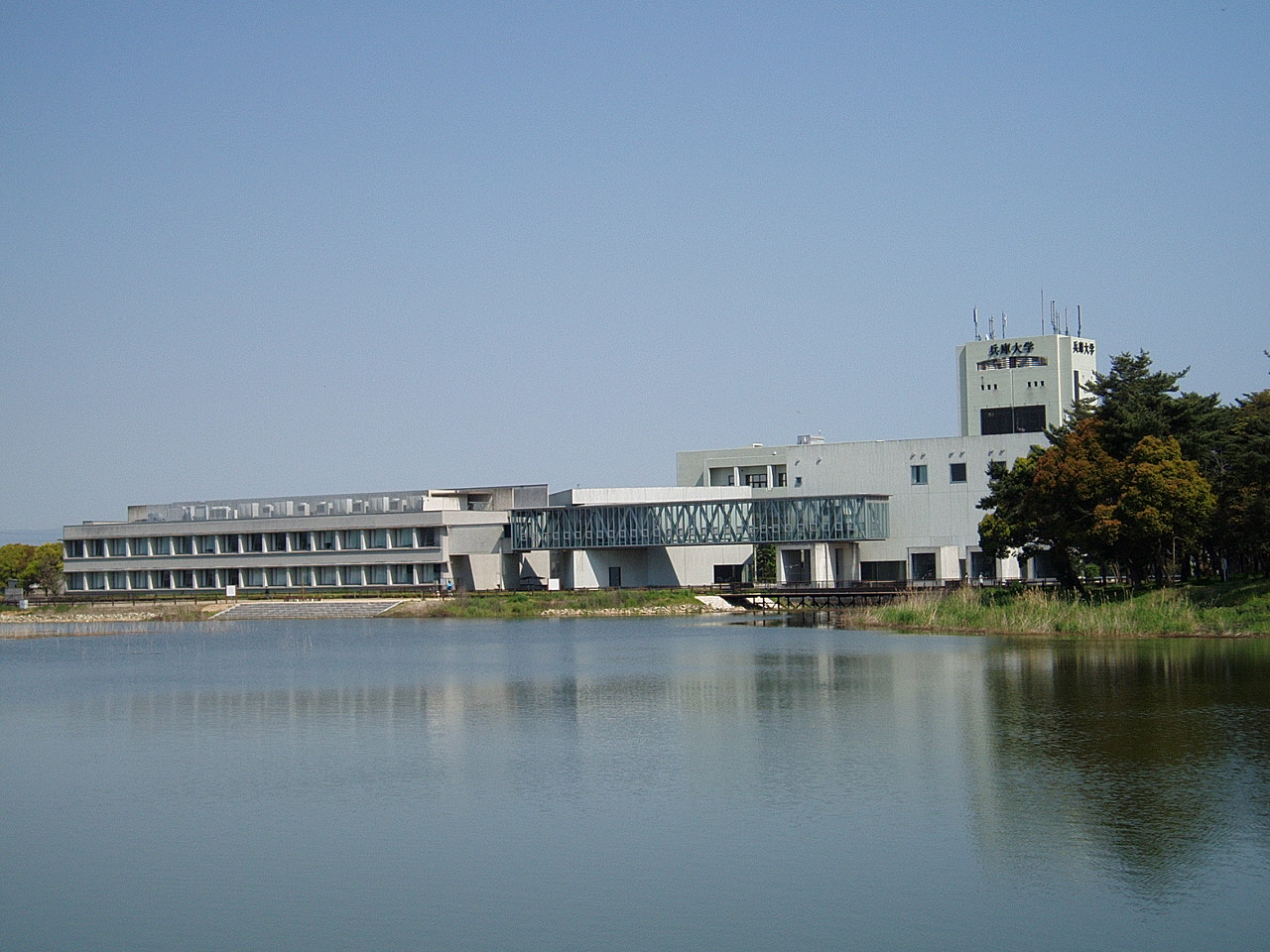


Inami, Japan
稲美町
Inami is a town of 30,268 people in Hyōgo, Japan, founded in March 31, 1955.
Why visit Inami
Townapedia lists 21 museums and landmarks, 143 parks and trails, 278 places to eat, 5 places to stay and 2 attractions in and around town.
Highlights include Hyogo University, Banshū Winery, Harima Historical Museum and Onaka Ruins.
Weather in Inami
Forecast from MET Norway (CC BY 4.0). Full forecast
About Inami
Inami (稲美町, Inami-chō) is a town located in Kako District, Hyōgo Prefecture, Japan. As of 1 May 2022, the town had an estimated population of 30,622 in 12843 households and a population density of 880 persons per km2. The total area of the town is 34.92 square kilometres (13.48 sq mi).
From the Wikipedia article Inami, Hyōgo (this version), under CC BY-SA 4.0.
Things to do2
Hyogo University
School · 2.9 km
Higher education institution in Hyōgo Prefecture, Japan

Museums and landmarks21


Harima Historical Museum
Museum · 4.1 km
Museum in Harima, Hyōgo, Japan

Hyogo Prefectural Museum of Archaeology
Museum · 4.1 km
Building in Hyōgo Prefecture, Japan





9 more on the map.
Parks, trails and playgrounds143
Onaka Ruins
Park · 4.0 km
Yayoi period settlement trace in Harima, Japan




131 more on the map.
Restaurants and cafes278

北京料理 夜来香
Restaurant · Chinese · 3.7 km
テイクアウト対応:スープ類以外のメニュー全般
1022-5, 加古川市
PH,Tu-Su 11:30-14:00,17:00-21:00
屋台豚骨ラーメン 弦流 東加古川店
Restaurant · Ramen · 4.0 km
5, 加古川市
Mo 00:00-03:00; Tu 17:00-24:00; We-Su 00:00-03:00,17:00-24:00
麺工房おおにし
Restaurant · Soba, Ramen, Noodle, Japanese · 4.3 km
130 野口町水足, 加古川市
Mo-Fr 11:00-13:30; Sa 11:00-14:00; Su off


いな美の里 カフェ&レストラン
Cafe · Coffee Shop, Sandwich, Salad, Cake, Pancake · 1.5 km
テイクアウト対応:ハンバーグ、かつめし弁当など 配達は5点以上ご注文の方のみ。
Mo-Tu,Th-Fr 08:00-20:30; We off; Sa-Su,PH 07:00-20:30
266 more on the map.
History
The area of the modern town of Inami was within ancient Harima Province, and as a place name is mentioned in the Nara period Man'yōshū. In the Edo Period, the area was part of the holdings of Himeji Domain. Following the Meiji restoration, the villages of Kakoshin, Mori and Tenman and Hase were created within Kako District, Hyōgo with the creation of the modern municipalities system on April 1, 1889. The three villages merged on March 31, 1955, to form the town of Inami.
From the History section of Inami, Hyōgo on Wikipedia, under CC BY-SA 4.0.
Where to stay5
Churches and places of worship34
Shopping24
Gas and EV charging7
Schools, colleges and libraries26
Healthcare47
Map of Inami
250 places. The map loads OpenStreetMap tiles when you open it.
Getting there and nearby towns
Kobe Airport (UKB) is the nearest airport with scheduled flights listed in OpenStreetMap, 31 km away.
- Kakogawachō-honmachi 8 km west, about 8 min by car
- Miki 9 km northeast, about 9 min by car
- Takasago 11 km west, about 11 min by car
- Ono 11 km north, about 11 min by car
- Akashi 13 km southeast, about 13 min by car
- Yashiro 19 km north, about 19 min by car
- Himeji 21 km west, about 21 min by car
- Kobe 25 km east, about 25 min by car
- Nishiwaki 27 km north, about 27 min by car
- Awaji 30 km south, about 30 min by car
Drive times are estimates from straight-line distance, not routes.
Local news
Headlines from INDB.
Reviews, tips and questions
Loading what members have shared...
Sources and licences
- GeoNames (CC BY 4.0): population, coordinates, regions and time zone
- OpenStreetMap contributors (ODbL 1.0): places, airports, map data
- Wikidata (CC0 1.0): elevation, founding date, time zone, website, landmarks and historic places
- Wikimedia Commons (see each image): photos
- Wikipedia (CC BY-SA 4.0): overview and history text
Photo credits
- Hyogo-Univ-and-Terada-Pond01, Hasec, Public domain
- Harima Museum, Bittercup, CC BY-SA 4.0
- 131123 Hyogo Prefectural Museum of Archaeology Japan01bs3, 663highland, CC BY 2.5
- Hyogo Prefectural Kakogawa Medical Center, KishujiRapid, CC BY-SA 3.0
- Kakogawa Yamate Jr.Highschool, Bio06940, CC BY-SA 3.0
- Hiraoka J school, Bio06940, CC BY-SA 3.0
- Noguchikita E school, Bio06940, CC BY-SA 3.0
- Sousayakujin-hachiman-jinja Kakogawa Hogo pref08s3, 663highland, CC BY 2.5
- Harima Town Hasuike elementary school, KishujiRapid, CC BY-SA 3.0
- Kako elementary school, Mti, CC BY-SA 3.0
- Inami Town Temma-Minami elementary school, KishujiRapid, CC BY-SA 3.0
- Inami jinior high school No,1, Mti, CC BY-SA 3.0
- 131123 Nozoe-kita Park Harima Hyogo pref Japan01s3, 663highland, CC BY 2.5
- Befu Railway DC302 at Harimacho Museum, Saigen Jiro, CC0
- 別府鉄道ハフ5, TRJN, CC BY-SA 3.0
- 大中遺跡復元住居, Akas1950, CC BY-SA 4.0
- Hyogo Prefectural Museum of Archaeology01s3200, 663highland, CC BY 2.5
- Higahari, Gezi094, CC BY-SA 3.0
- Tenma-ohike6226093, 溜池五郎, CC BY-SA 3.0
- Inami Town Inami Kita junior high school, KishujiRapid, CC BY-SA 4.0
- Inami Town Inami junior high school, KishujiRapid, CC BY-SA 4.0
- Hyogo-Pref-Agricultural-HighSchool02, Hasec, CC0
- Inami Town Kako elementary school, KishujiRapid, CC BY-SA 4.0
- Inami Town Temma Minami elementary school, KishujiRapid, CC BY-SA 3.0
- Hyogo Prefectural Kakogawa Medical Center 20220629, KishujiRapid, CC BY-SA 4.0
- Hiraoka Elementary school, Bio06940, CC BY-SA 4.0
- Kakogawa City Hiraoka Kita elementary school, KishujiRapid, CC BY-SA 4.0
- Atagozuka Kofun (Harima), funkyu, Saigen Jiro, CC0
- 加古郡稲美町下沢児童公園うんてい, Harimawood, CC BY-SA 4.0
- 加古郡稲美町下沢児童公園ロープジャングルジム3, Harimawood, CC BY-SA 4.0
- 五軒屋交差点 Gokenya - panoramio, iloverjoa, CC BY 3.0
- 加古郡稲美町下沢児童公園ロープジャングルジム1, Harimawood, CC BY-SA 4.0
- 加古郡稲美町下沢児童公園ロープジャングルジム2, Harimawood, CC BY-SA 4.0
- 加古郡稲美町下沢児童公園東屋, Harimawood, CC BY-SA 4.0
- フォルテ(たばこ)全種類, むすか, CC BY-SA 4.0
- フォルテ(たばこ) 中身, むすか, CC BY-SA 4.0
- 兵庫大学事務棟, AKIAKI21, CC0
- 兵庫大学キャンパス広場, AKIAKI21, CC0
- 兵庫大学14号館, AKIAKI21, CC0
- 快晴の日の14号館 線対象に映る水面, AKIAKI21, CC0


Page built November 5, 2026. Spotted a mistake? Tell us or suggest a place.