
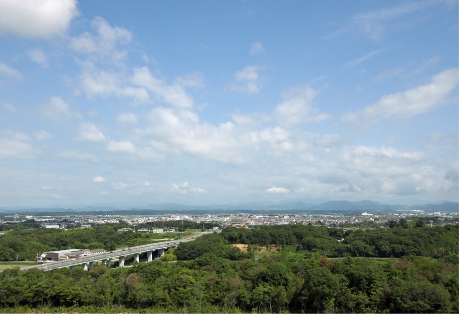


Ono, Japan
小野市
Ono is a town of 47,609 people in Hyōgo, Japan, founded in December 1, 1954.
Why visit Ono
Townapedia lists 88 museums and landmarks, 60 parks and trails, 159 places to eat, 8 places to stay and 10 attractions in and around town.
Highlights include Hyogo University of Teacher Education, Kōdo temple ruins, Ono City Museum and ひまわりの丘公園.
Weather in Ono
Forecast from MET Norway (CC BY 4.0). Full forecast
About Ono
Ono (小野市, Ono-shi; Japanese pronunciation: [ò̞.nó̞(.ɕì)]) is a city located in Hyōgo Prefecture, Japan. As of 30 April 2022, the city had an estimated population of 47,609 in 20483 households and a population density of 510 persons per km². The total area of the city is 92.94 square kilometres (35.88 sq mi).
From the Wikipedia article Ono, Hyōgo (this version), under CC BY-SA 4.0.
Things to do10

Hyogo University of Teacher Education
School · 10.2 km
Higher education institution in Hyōgo Prefecture, Japan

Museums and landmarks88

Kōdo temple ruins
Monument and historic site · 1.9 km
Archaeological site in Hyogo prefecture, Japan


Site of Kawanishi Aircraft Uzurano Assembly Plant fire prevention water reservoir
Monument and historic site · 7.8 km
Ruins of Himeji Naval Air Group Command Post bunker
Monument and historic site · 7.4 km
Ruins of the Uzurano Airfield anti-aircraft machine gun emplacement
Monument and historic site · 7.8 km
2022年5月現在、映画『男たちの大和』の撮影で使用された九六式二十五粍三連装機銃の実物大モデルは、ここに設置されているが、通常時はブルーシートで覆われている。
76 more on the map.
Parks, trails and playgrounds60





48 more on the map.
Restaurants and cafes159



COME’S Restrant & Cafe
Restaurant · Coffee Shop, Sandwich, Cake, Pizza, Ice Cream · 5.4 km
We-Mo 11:00-17:00
147 more on the map.
History
The area of the modern city of Ono was within ancient Harima Province. The village of Ono was established within Katō District with the creation of the modern municipalities system on April 1, 1889. Ono was elevated to town status on May 1, 1915. On December 1, 1954 Ono merged with the neighboring villages of Kawai, Kishi, Ichiba, Obe, and Shimo-Hojo to form the city of Ono.
From the History section of Ono, Hyōgo on Wikipedia, under CC BY-SA 4.0.
Where to stay8
Churches and places of worship51
Shopping38
Gas and EV charging15
Schools, colleges and libraries33
Healthcare57
Map of Ono
250 places. The map loads OpenStreetMap tiles when you open it.
Getting there and nearby towns
Kobe Airport (UKB) is the nearest airport with scheduled flights listed in OpenStreetMap, 36 km away.
- Yashiro 8 km north, about 8 min by car
- Kakogawachō-honmachi 13 km southwest, about 13 min by car
- Himeji 22 km west, about 22 min by car
- Akashi 23 km south, about 23 min by car
- Sandachō 27 km east, about 27 min by car
- Kobe 29 km southeast, about 29 min by car
- Sasayama 35 km northeast, about 35 min by car
- Takarazuka 39 km east, about 39 min by car
- Itami 43 km east, about 43 min by car
- Amagasaki 47 km east, about 47 min by car
Drive times are estimates from straight-line distance, not routes.
Local news
Headlines from INDB.
Reviews, tips and questions
Loading what members have shared...
Sources and licences
- GeoNames (CC BY 4.0): population, coordinates, regions and time zone
- OpenStreetMap contributors (ODbL 1.0): places, airports, map data
- Wikidata (CC0 1.0): elevation, founding date, time zone, website, landmarks and historic places
- Wikimedia Commons (see each image): photos
- Wikipedia (CC BY-SA 4.0): overview and history text
Photo credits
- View Ono, Rocky2takeuchi, CC BY-SA 4.0
- Ono Shopping Street 20240503 02, Suikotei, CC BY 4.0
- Hyogoken Shinkumi Bank Ono Branch, Suikotei, CC BY 4.0
- Ono City Tradition Industrial Hall01n4272, 663highland, CC BY 2.5
- Himeji Shinkin Bank Ono Branch 2024, Suikotei, CC BY 4.0
- Nakahyogo Shinkin Bank Ono Branch, Suikotei, CC BY 4.0
- Ono Station Platform 20240503, Suikotei, CC BY 4.0
- Shintetsu 2000 series 2004 at Ono Station, Suikotei, CC BY 4.0
- Ono Shopping Street 20240503 01, Suikotei, CC BY 4.0
- Ono City Library, Suikotei, CC BY 4.0
- Ono-onohigasi-ES, 武士の酒宴, CC0
- Ono-ichiba-ES, 武士の酒宴, CC0
- 2021-08-07 Ono-himawarino-oka-park (小野市立ひまわりの丘公園) DJI 0218, 松岡明芳, CC BY-SA 4.0
- Kiyotanicho, Ono, Hyogo Prefecture 675-1317, Japan - panoramio, H Okano, CC BY 3.0
- 2021-08-07 Ono-himawarino-oka-park (小野市立ひまわりの丘公園) DJI 0220, 松岡明芳, CC BY-SA 4.0
- Jyodoji-ono001, 日: Jnn, CC BY 2.1 jp
- Furukawatown Onocity Hyogopref Hyogoprefectutral road 18 Kakogawa Ono line No,3, Mti, CC BY-SA 3.0
- Gonosetown Nishiwakicity Hyogopref Route 427 No,1, Mti, CC BY-SA 3.0
- Jodoji Ono Hyogo01n3200, 663highland, CC BY 2.5
- Omiya-hachimangu Miki Hyogo16n4272, 663highland, CC BY 2.5
- Miki elementary school, mti, CC0
- Sanjyu Elementary School, mti, Public domain
- Miki City Central Library ac, Asturio Cantabrio, CC BY-SA 4.0
- Horimitsu museum01n3200, 663highland, CC BY 2.5
- Miki City Hardware Museum02s3872, 663highland, CC BY 2.5
- Saho-Jinja Kato-Hyogo 佐保神社社殿(兵庫県加東市社)例祭 DSCF0357, 松岡明芳, CC BY-SA 3.0
- Kasai City Kasai Junior High School, KishujiRapid, CC BY-SA 4.0
- Omura hospital in Mikicity Hyogopref, mti, CC0
- Sousayakujin-hachiman-jinja Kakogawa Hogo pref08s3, 663highland, CC BY 2.5
- Ono golf club01s2400, 663highland, CC BY 2.5
- City Museum Ono Hyogo01s5s3200, 663highland, CC BY 2.5
- Kitaharima Medical Center 20160402, KishujiRapid, CC BY-SA 4.0
- Sumiyoshi-jinjya mon, コヲダ, CC BY-SA 4.0
- Heiso elementary school, Mti, CC BY-SA 3.0
- Shuhen-ji (Kasai) - Gate, 運動会プロテインパワー, CC BY-SA 4.0
- Hyogo-u, Hyogo University of Teacher Education, CC BY-SA 3.0
- 2017-07-15 Ono-himawarino-oka-park (小野市立ひまわりの丘公園) ☆彡6, 松岡明芳, CC BY-SA 4.0
- Miki Junior High School, mti, CC0
- Ryoso junior high school, Mti, CC BY-SA 3.0
- Shimotojo elementery school, Mti, CC BY-SA 3.0
- Miki railway memorial park 01, Mti, CC BY-SA 3.0
- Kakogawa City Kakogawa Support School, KishujiRapid, CC BY-SA 4.0
- Kakogawa Yahata elementary school, Bio06940, CC BY-SA 3.0
- Kamiso E school, Bio06940, CC BY-SA 3.0


Page built November 4, 2026. Spotted a mistake? Tell us or suggest a place.