


Miki, Japan
三木市
Miki is a town of 75,450 people in Hyōgo, Japan, founded in June 1, 1954.
Why visit Miki
Townapedia lists 39 museums and landmarks, 103 parks and trails, 214 places to eat, 9 places to stay and 9 attractions in and around town.
Highlights include Hyogo University, Hyogo University of Teacher Education, Banshū Winery and Harima Historical Museum.
Weather in Miki
Forecast from MET Norway (CC BY 4.0). Full forecast
About Miki
Miki (三木市, Miki-shi) is a city in Hyōgo Prefecture, Japan. As of 30 September 2022, the city had an estimated population of 75,009 and a population density of 420 persons per km2. The total area of the city is 176.51 square kilometres (68.15 sq mi).
From the Wikipedia article Miki, Hyōgo (this version), under CC BY-SA 4.0.
Things to do9
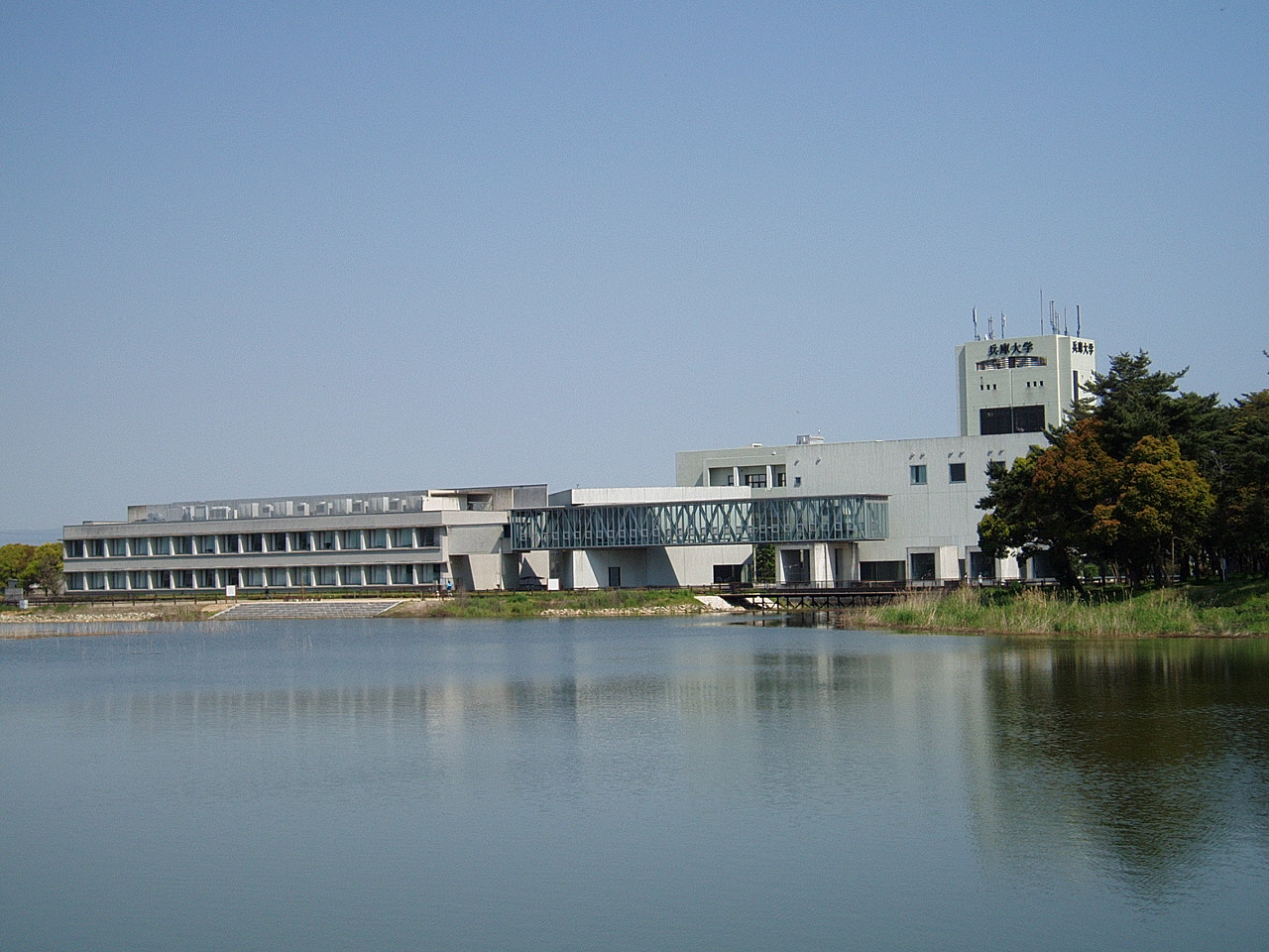
Hyogo University
School · 11.0 km
Higher education institution in Hyōgo Prefecture, Japan

Hyogo University of Teacher Education
School · 12.8 km
Higher education institution in Hyōgo Prefecture, Japan
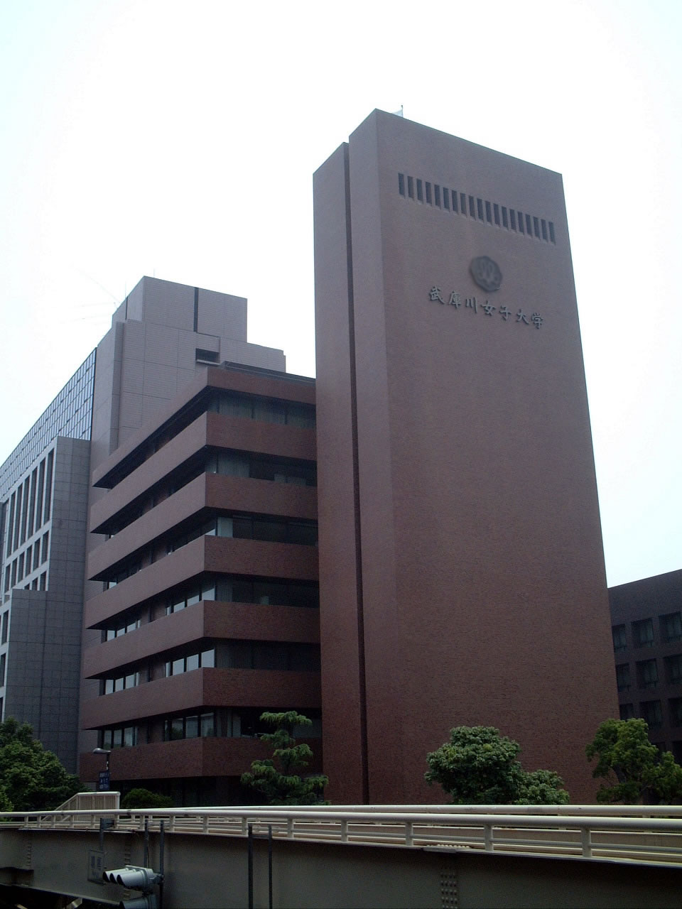
Mukogawa Women's University
School · 10.7 km
Japanese private women's university



Museums and landmarks39


Harima Historical Museum
Museum · 12.7 km
Museum in Harima, Hyōgo, Japan

Hyogo Prefectural Museum of Archaeology
Museum · 12.7 km
Building in Hyōgo Prefecture, Japan

Kōdo temple ruins
Monument and historic site · 8.4 km
Archaeological site in Hyogo prefecture, Japan


27 more on the map.
Parks, trails and playgrounds103


Onaka Ruins
Park · 12.6 km
Yayoi period settlement trace in Harima, Japan




91 more on the map.
Restaurants and cafes214

202 more on the map.
History
The area of the modern city of Mino was within ancient Harima Province, and developed as a castle town at the foot of Miki Castle during the Muromachi period. During the Sengoku period, the castle was destroyed in the Siege of Miki. In the Edo Period, the area was controlled by Himeji Domain. The town of Miki was established within Mino District, Hyōgo with the creation of the modern municipalities system on April 1, 1889. It was raised to city status on June 1, 1954. On October 24, 2005, the town of Yokawa (from Mino District) was merged into Miki.
From the History section of Miki, Hyōgo on Wikipedia, under CC BY-SA 4.0.
Where to stay9
Churches and places of worship49
Shopping37
Gas and EV charging10
Schools, colleges and libraries41
Healthcare67
Map of Miki
250 places. The map loads OpenStreetMap tiles when you open it.
Getting there and nearby towns
Kobe Airport (UKB) is the nearest airport with scheduled flights listed in OpenStreetMap, 29 km away.
- Ono 7 km northwest, about 7 min by car
- Yashiro 13 km north, about 13 min by car
- Kakogawachō-honmachi 14 km west, about 14 min by car
- Akashi 16 km south, about 16 min by car
- Nishiwaki 20 km north, about 20 min by car
- Kobe 22 km southeast, about 22 min by car
- Sandachō 24 km northeast, about 24 min by car
- Himeji 26 km west, about 26 min by car
- Takarazuka 34 km east, about 34 min by car
- Itami 38 km east, about 38 min by car
Drive times are estimates from straight-line distance, not routes.
Local news
Headlines from INDB.
Reviews, tips and questions
Loading what members have shared...
Sources and licences
- GeoNames (CC BY 4.0): population, coordinates, regions and time zone
- OpenStreetMap contributors (ODbL 1.0): places, airports, map data
- Wikidata (CC0 1.0): elevation, founding date, time zone, website, landmarks and historic places
- Wikimedia Commons (see each image): photos
- Wikipedia (CC BY-SA 4.0): overview and history text
Photo credits
- Ōmiya Hachiman Shrine Mikoshi, Miyamalu, CC BY 2.5
- Shintetsu 2000 series 2001 at Miki Station, Suikotei, CC BY 4.0
- Shintetsu 1300 series 1353 at Miki Station, Suikotei, CC BY 4.0
- 2 Chome Suehiro, Miki-shi, Hyōgo-ken 673-0403, Japan - panoramio, 百合の國, CC BY 3.0
- JA Minori Miki branch 20240503, Suikotei, CC BY 4.0
- Sumitomo Mitsui Banking Corporation Miki & Midorigaoka Branch, Suikotei, CC BY 4.0
- Banshu Shinkin Bank Miki Branch, Suikotei, CC BY 4.0
- 121007 Miki Autumn Harvest Festival Miki Hyogo pref Japan01s3, 663highland, CC BY 2.5
- Miki Police station Honmachi Koban, Suikotei, CC BY 4.0
- 121007 Miki Autumn Harvest Festival Miki Hyogo pref Japan03s5, 663highland, CC BY 2.5
- 121007 Miki Autumn Harvest Festival Miki Hyogo pref Japan02s5, 663highland, CC BY 2.5
- 3 Chome Honmachi, Miki-shi, Hyōgo-ken 673-0431, Japan - panoramio, shikabane taro, CC BY 3.0
- 121007 Miki Autumn Harvest Festival Miki Hyogo pref Japan04s5, 663highland, CC BY 2.5
- 121007 Miki Autumn Harvest Festival Miki Hyogo pref Japan05s5, 663highland, CC BY 2.5
- 121007 Miki Autumn Harvest Festival Miki Hyogo pref Japan06s5, 663highland, CC BY 2.5
- 2021-09-27 Ōmiya Hachiman Shrine (Miki),大宮八幡宮空撮、兵庫県三木市 DJI 0705, 松岡明芳, CC BY-SA 4.0
- Hyogoken Shinkumi Bank Miki Branch, Suikotei, CC BY 4.0
- MIKI City Hirayama 福の太 2017-02-02, S OKA This photo was taken with iPhone 6, CC BY-SA 4.0
- MIKI City Shibamachi Kominkan 20170201, S OKA This photo was taken with iPhone 6, CC BY-SA 4.0
- Miki Shibamachi 20170201001, 岡本修平 (Shuhei Okamoto) This photo was taken with iPhone 6, Public domain
- MIKI City Shibamchi 2017-02-01 09.30.27, S OKA This photo was taken with iPhone 6, CC BY-SA 4.0
- 2 Chome Fukui, Miki-shi, Hyōgo-ken 673-0433, Japan - panoramio (1), 百合の國, CC BY 3.0
- 2 Chome Fukui, Miki-shi, Hyōgo-ken 673-0433, Japan - panoramio (2), 百合の國, CC BY 3.0
- Miki Railway 180-101, まも(Mamo), Public domain
- Himeji Shinkin Bank Miki Branch, Suikotei, CC BY 4.0
- 2 Chome Fukui, Miki-shi, Hyōgo-ken 673-0433, Japan - panoramio, マコ1号, CC BY-SA 3.0
- 2 Chome Fukui, Miki-shi, Hyōgo-ken 673-0433, Japan - panoramio (5), 百合の國, CC BY 3.0
- 2 Chome Fukui, Miki-shi, Hyōgo-ken 673-0433, Japan - panoramio (3), 百合の國, CC BY 3.0
- 2 Chome Fukui, Miki-shi, Hyōgo-ken 673-0433, Japan - panoramio (4), 百合の國, CC BY 3.0
- 3 Chome Fukui, Miki-shi, Hyōgo-ken 673-0433, Japan - panoramio, 百合の國, CC BY 3.0
- Nakahyogo Shinkin Bank Miki Branch, Suikotei, CC BY 4.0
- Hyogo-Univ-and-Terada-Pond01, Hasec, Public domain
- Mukogawa Womens University, Suguri F, CC BY-SA 3.0
- Harima Museum, Bittercup, CC BY-SA 4.0
- 131123 Hyogo Prefectural Museum of Archaeology Japan01bs3, 663highland, CC BY 2.5
- Omiya-hachimangu Miki Hyogo16n4272, 663highland, CC BY 2.5
- Mikiyama Comprehensive park in 2011-2-17 No,4, Mti, CC BY-SA 3.0
- Miki Sanyo hospital, Mti, CC BY-SA 3.0
- Miki elementary school, mti, CC0
- Sanjyu Elementary School, mti, Public domain
- Miki City Central Library ac, Asturio Cantabrio, CC BY-SA 4.0
- Horimitsu museum01n3200, 663highland, CC BY 2.5
- Hirono elementary school, mti, CC0
- Miki City Hardware Museum02s3872, 663highland, CC BY 2.5
- Gayain01, Jnn 。, CC BY-SA 3.0
- Omura hospital in Mikicity Hyogopref, mti, CC0
- Sousayakujin-hachiman-jinja Kakogawa Hogo pref08s3, 663highland, CC BY 2.5
- City Museum Ono Hyogo01s5s3200, 663highland, CC BY 2.5
- Hirono golf club, Mti, CC BY-SA 3.0
- Hattori hospital in Mikicity Hyogopref, mti, CC0
- Inami town Mori elem-sch, Bakkai, CC BY 3.0
- Kitaharima Medical Center 20160402, KishujiRapid, CC BY-SA 4.0
- Sumiyoshi-jinjya mon, コヲダ, CC BY-SA 4.0
- Mekkosan, 藤谷良秀, CC BY-SA 3.0
- Hyogo-u, Hyogo University of Teacher Education, CC BY-SA 3.0
- 大中遺跡復元住居, Akas1950, CC BY-SA 4.0
- Kansai University of International Studies Amagasaki campus, Own work, CC BY-SA 3.0
- Mikiyama shinrin koen, Miyamalu, CC BY 2.5
- Nojigiku supecial support school in 2013, Mti, CC BY-SA 3.0
- Mikihigashi High School, mti, CC0
- Miki special support school, mti, CC0
- Miki Junior High School, mti, CC0
- Okkosan, 藤谷良秀, CC BY-SA 3.0
- Miki railway memorial park 01, Mti, CC BY-SA 3.0
- Miki disaster-prevention park square game, Mti, CC BY-SA 3.0
- Kakogawa City Kakogawa Support School, KishujiRapid, CC BY-SA 4.0
- Kakogawa Yahata elementary school, Bio06940, CC BY-SA 3.0


Page built November 4, 2026. Spotted a mistake? Tell us or suggest a place.