
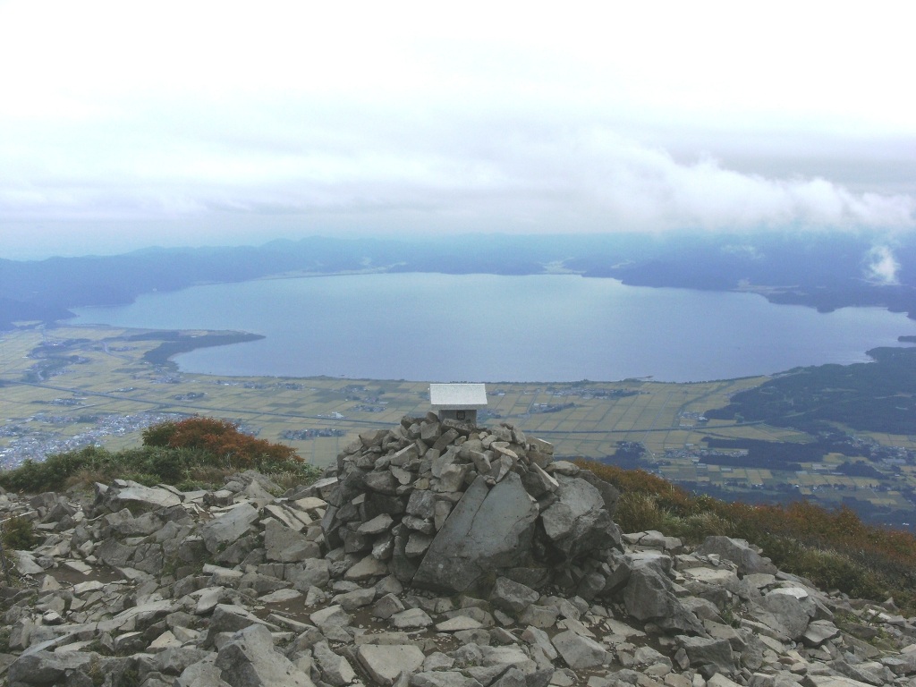


Inawashiro, Japan
猪苗代町
Inawashiro is a town of 13,810 people in Fukushima, Japan, founded in April 1, 1889.
Why visit Inawashiro
Townapedia lists 53 museums and landmarks, 38 parks and trails, 67 places to eat, 60 places to stay and 68 attractions in and around town.
Highlights include Tenjin Beach, University of Aizu, Morohashi Museum of Modern Art and Tenkyōkaku.
Weather in Inawashiro
Forecast from MET Norway (CC BY 4.0). Full forecast
About Inawashiro
Inawashiro (猪苗代町, Inawashiro-machi) is a town located in Fukushima Prefecture, Japan. As of 1 March 2020, the town had an estimated population of 13,810 in 5309 households, and a population density of 35 persons per km2. The total area of the town was 394.85 square kilometres (152.45 sq mi). It is noted as the birthplace of the famous doctor Hideyo Noguchi, who contributed to knowledge in the fight against syphilis and yellow fever.
From the Wikipedia article Inawashiro (this version), under CC BY-SA 4.0.
Travel tips from other travellers: Inawashiro on Wikivoyage (CC BY-SA 4.0).
Things to do68

Tenjin Beach
Beach · 5.4 km
Recreational beach on Lake Inawashiro in Fukushima Prefecture, Japan

University of Aizu
School · 16.4 km
Higher education institution in Fukushima Prefecture, Japan






56 more on the map.
Museums and landmarks53


Tenkyōkaku
Museum · 8.1 km
Building in Inawashiro, Fukushima Prefecture, Japan



旧中山宿駅跡
Monument and historic site · 12.7 km
1997-03-21まで使用されていた(旧)中山宿駅の跡地。 ホーム跡が見学可能。

41 more on the map.
Parks, trails and playgrounds38


Hoshino Resorts Nekoma Mountain
Sports field and stadium · 8.2 km
Open in Google Maps · Wikipedia · +81-242-74-5000;+81-241-32-3001


Bandai-Atami Sports Park Koriyama Skating Rink
Park · 16.8 km
Japanese skating rink

26 more on the map.
Restaurants and cafes67


55 more on the map.
History
The area of present-day Inawashiro was part of ancient Mutsu Province and the location of Inawashiro Castle since the Kamakura period. It was the site of the Battle of Suriagehara during the Sengoku period. The area formed part of the holdings of Aizu Domain during the Edo period. During the Boshin War, the Battle of Bonari Pass took place near Inawashiro. After the Meiji Restoration, the area was organized as part of Yama District, Fukushima Prefecture. The town of Inawashiro was founded with the establishment of the modern municipalities system on April 1, 1898. The town borders expanded considerably in 1955 through a merger with the villages of Iwase, Iwaho, Azauma, Nagase, Tsukinowa, Chisato, and Okinajima.
From the History section of Inawashiro on Wikipedia, under CC BY-SA 4.0.
Where to stay60
Churches and places of worship16
Shopping11
Gas and EV charging8
Schools, colleges and libraries10
Healthcare11
Map of Inawashiro
250 places. The map loads OpenStreetMap tiles when you open it.
Getting there and nearby towns
Fukushima Airport (FKS) is the nearest airport with scheduled flights listed in OpenStreetMap, 47 km away.
- Aizu-Wakamatsu 17 km southwest, about 17 min by car
- Kitakata 24 km northwest, about 24 min by car
- Motomiya 26 km east, about 26 min by car
- Kōriyama 30 km southeast, about 30 min by car
- Miharu 36 km southeast, about 36 min by car
- Fukushima 37 km northeast, about 37 min by car
- Sukagawa 39 km southeast, about 39 min by car
- Yabuki 44 km southeast, about 44 min by car
- Koori 46 km northeast, about 46 min by car
- Yanagawamachi-saiwaichō 53 km northeast, about 53 min by car
Drive times are estimates from straight-line distance, not routes.
Local news
Headlines from INDB.
Reviews, tips and questions
Loading what members have shared...
Sources and licences
- GeoNames (CC BY 4.0): population, coordinates, regions and time zone
- OpenStreetMap contributors (ODbL 1.0): places, airports, map data
- Wikidata (CC0 1.0): elevation, founding date, time zone, website, landmarks and historic places
- Wikimedia Commons (see each image): photos
- Wikipedia (CC BY-SA 4.0): overview and history text
Photo credits
- Lake Inawashiro view from Mt.Bandai, Stingfield, CC BY-SA 3.0
- Inawashiro mountains (37856374041), Raita Futo from Tokyo, Japan, CC BY 2.0
- Inawashiro rice fields and Bandaisan 2016 (37824690472), Raita Futo from Tokyo, Japan, CC BY 2.0
- Inawashiro rice fields (37824693572), Raita Futo from Tokyo, Japan, CC BY 2.0
- Mine, Inawashiro, Yama District, Fukushima Prefecture 969-3102, Japan - panoramio, Fumihiko Ueno, CC BY 3.0
- Mineyama, Inawashiro, Yama District, Fukushima Prefecture 969-3102, Japan - panoramio, taro gen, CC BY 3.0
- Inawashiro Cultural Center01, Proshikok, CC BY-SA 4.0
- Chiyoda, Inawashiro, Yama District, Fukushima Prefecture 969-3133, Japan - panoramio, Fumihiko Ueno, CC BY 3.0
- JR Inawashiro sta 001, 東京特許許可局, CC BY-SA 4.0
- JR Inawashiro sta 002, 東京特許許可局, CC BY-SA 4.0
- Tenjinhama in winter, BrianAdler, Public domain
- University of Aizu in bloom, Terakin, CC BY-SA 3.0
- 磐梯熱海スポーツパーク 野球場, Sugikats, CC BY-SA 4.0
- Morohashi Museum of Modern Art, Qwert1234, Public domain
- Tenkyokaku, DCyokohama at Japanese Wikipedia, CC BY 3.0
- Nekoma volcano 2015-04-25 - panoramio, くろふね, CC BY 3.0
- Hanitsu Jinja, sisisai, CC BY-SA 3.0
- Kobirakata Shrine Front, BrianAdler, Public domain
- Onogawa-Fudotaki Falls, Qwert1234, CC BY-SA 3.0
- 裏磐梯猫魔スキー場, Najirane-n, CC BY-SA 4.0
- Hideyo Noguchi Memorial Hall, Altomarina, CC BY-SA 3.0
- Inawashiromachi, ToshiJapon, CC BY-SA 4.0
- Mt. Bandai eruption memorial museum, 掬茶, CC BY-SA 4.0
- Mt. Nekomadake, Qwert1234, CC BY-SA 3.0
- Choshi-ga-taki, S Shinohal, CC BY-SA 3.0
- Mt.Higashiazuma-yama4, Qwert1234, Public domain
- Bansaisan and rice fields (37146089964), Raita Futo from Tokyo, Japan, CC BY 2.0
- Beer mug - Fukushima area - Dec 3 2017, nesnad, CC BY 3.0
- 天司のケヤキ - panoramio, Duff Figgy, CC BY-SA 3.0
- 猪苗代町立猪苗代小学校 - panoramio, Duff Figgy, CC BY-SA 3.0
- 猪苗代スキー場全景, Go.n2020, CC BY-SA 4.0
- 見祢の大石 - panoramio, Duff Figgy, CC BY-SA 3.0
- 亀ヶ城から川桁山2012-04-30 - panoramio, hundumari, CC BY 3.0
- 土津(はにつ)神社/猪苗代町 - panoramio, shikabane taro, CC BY 3.0
- 土津神社 - panoramio, shikabane taro, CC BY 3.0
- 土津霊神之碑(山崎闇斎撰文、保科正之紀功碑)/土津(はにつ)神社 - panoramio, shikabane taro, CC BY 3.0
- 保科正之廟所 - panoramio, shikabane taro, CC BY 3.0
- 沼尻軽便鉄道会津下館駅跡 - panoramio, Yobito KAYANUMA, CC BY-SA 3.0
- 県道323号線 - panoramio - Yobito KAYANUMA, Yobito KAYANUMA, CC BY-SA 3.0
- 川桁山 - panoramio, Duff Figgy, CC BY-SA 3.0


Page built November 4, 2026. Spotted a mistake? Tell us or suggest a place.