



Itoshima, Japan
糸島市
Itoshima is a town of 98,877 people in Fukuoka, Japan, founded in January 1, 2010.
Why visit Itoshima
Townapedia lists 45 museums and landmarks, 105 parks and trails, 151 places to eat, 22 places to stay and 30 attractions in and around town.
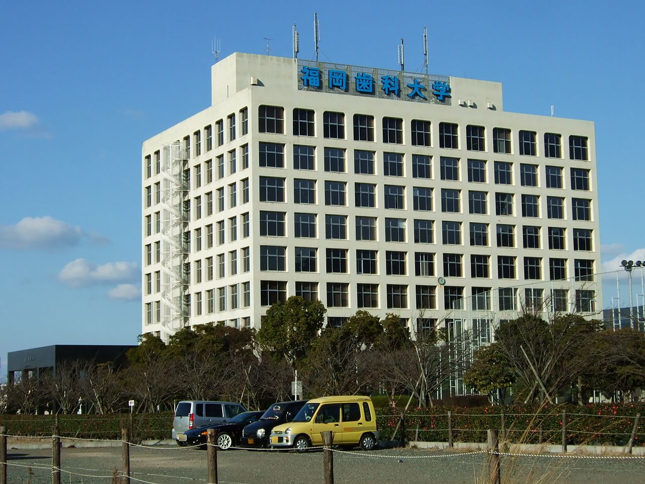
Highlights include Fukuoka Dental College, Kyushu University, House of Yoshinomura's family and Hirabaru Site.
Weather in Itoshima
Forecast from MET Norway (CC BY 4.0). Full forecast
About Itoshima
Itoshima (糸島市, Itoshima-shi; Japanese pronunciation: [ì.tó̞.ɕí.mä́(.ɕì)]) is a city located in western Fukuoka Prefecture, Japan. As of 31 March 2024, the city had an estimated population of 103,655 in 46,192 households, and a population density of 480 persons per km². The total area of the city is 215.69 km2 (83.28 sq mi).
From the Wikipedia article Itoshima (this version), under CC BY-SA 4.0.
Things to do30
Fukuoka Dental College
School · 13.7 km
Higher education institution in Fukuoka Prefecture, Japan

Kyushu University
School · 6.7 km
Higher education institution in Fukuoka, Japan




18 more on the map.
Museums and landmarks45

House of Yoshinomura's family
Monument and historic site · 9.4 km
House of Yoshimura's family; a well preserved traditional Japanese house.

Hirabaru Site
Monument and historic site · 4.1 km
Archaeological site in Itoshima, Fukuoka, Japan

Imayama Site
Monument and historic site · 9.0 km
Archaeological site in Japan

Itokoku History Museum
Museum · 6.3 km
Municipal museum in Itoshima, Japan

Mikumo–Iwara Site
Monument and historic site · 5.7 km
Archaeological site in Itoshima, Fukuoka, Japan

Nokata Site
Monument and historic site · 11.4 km
Archaeological site in Nishi-ku, Fukuoka, Japan
Shinmachi Dolmen Cluster
Monument and historic site · 5.6 km
Archaeological site in Japan


33 more on the map.
Parks, trails and playgrounds105



93 more on the map.
Restaurants and cafes151

Robatajidori Yamaarashi
Restaurant · Robatayaki, Japanese · 8.9 km
1, 糸島市
Mo-Fr 11:00-15:00; Sa,Su,PH 11:00-17:00

Asahi Sushi
Restaurant · Sushi · 8.6 km
Mo,We-Su,PH 11:30-20:00,Mo,We-Su,PH 20:00-22:00 "reservation only"; Tu off


Bikkuri Donkey
Restaurant · Burger · 7.6 km
10, 福岡市西区北原
Mo-Su 08:00-00:00
Bistro Bianca
Restaurant · Italian · 2.7 km
515-10, Kyushuu
Sa-Su 11:00-22:00
福泉餃子
Restaurant · Chinese · 7.5 km
33, 福岡市西区周船寺
Tu-Su 11:00-14:30,17:00-23:00
139 more on the map.
History
In Itoshima, many Jomon period sites have been discovered, and Jomon people remains have been found at the Shimmachi stone burial mound group (新町支石墓群).
During the Yayoi period, it is believed that a country called Itokoku (伊都国) existed, which controlled the entire Itoshima Peninsula. Itokoku shared a border with Nakoku (奴国), a country that ruled over the entire Fukuoka Plain, including present-day Fukuoka City. In ancient Japanese history, the northern Kyushu region, including present-day Fukuoka Prefecture, was an important area, and many of the latest technologies and innovations in Japan originated in this region.
The Fukuoka region, including Itoshima, which is a peninsula jutting out into the Tsushima Current that branches off from the Kuroshio Current along the Ryukyu Islands, is believed to have had especially active exchanges with the Okinawa (Ryukyu) region since ancient times. In fact, obsidian produced in Saga Prefecture in southwestern Fukuoka has been excavated from archaeological sites on the Okinawa island. There is also believed to have been strong cultural exchange; for example, Okinawa’s maritime faith of Nirai Kanai (ニライカナイ) and the Wadatsumi (ワダツミ) and Munakata beliefs (宗像三神) that symbolize the Fukuoka and Itoshima areas are considered to have a common origin.
From the History section of Itoshima on Wikipedia, under CC BY-SA 4.0.
Where to stay22
Churches and places of worship50
Shopping32
Gas and EV charging8
Schools, colleges and libraries61
Healthcare38
Map of Itoshima
250 places. The map loads OpenStreetMap tiles when you open it.
Getting there and nearby towns
Fukuoka Airport (FUK) is the nearest airport with scheduled flights listed in OpenStreetMap, 25 km away.
- Maebaru-chūō 2 km northeast, about 2 min by car
- Fukuoka 22 km east, about 22 min by car
- Karatsu 23 km southwest, about 23 min by car
- Kasuga 26 km east, about 26 min by car
- Ōnojō 27 km east, about 27 min by car
- Chikushino-shi 31 km east, about 31 min by car
- Shingū 30 km northeast, about 30 min by car
- Umi 30 km east, about 30 min by car
- Dazaifu 32 km east, about 32 min by car
- Koga 34 km northeast, about 34 min by car
Drive times are estimates from straight-line distance, not routes.
Local news
Headlines from INDB.
Reviews, tips and questions
Loading what members have shared...
Sources and licences
- GeoNames (CC BY 4.0): population, coordinates, regions and time zone
- OpenStreetMap contributors (ODbL 1.0): places, airports, map data
- Wikidata (CC0 1.0): elevation, founding date, time zone, website, landmarks and historic places
- Wikimedia Commons (see each image): photos
- Wikipedia (CC BY-SA 4.0): overview and history text
Photo credits
- Sakurai Futamigaura, STA3816, CC BY-SA 3.0
- Kafuri Branch of Japan Agricultural Coorperatives Itoshima, そらみみ, CC BY-SA 4.0
- Manhole cover of Maebaru, Itoshima, Fukuoka 2, そらみみ, CC BY-SA 4.0
- Itoshima, Fukuoka (31153034130), Thomas Woodtli from Zürich, Switzerland, CC BY-SA 2.0
- Fukuoka Dental College01, Muyo, CC BY-SA 3.0
- Kyushu University Ito Campus Center Zone and East Zone 20180808, 新幹線, CC BY-SA 4.0
- Hirabaru Site, tomb-1, Saigen Jiro, CC0
- Mikumo-Minamishouji Site, zenkei, Saigen Jiro, CC0
- Ito-koku-History-Museum, Heartoftheworld, CC BY-SA 3.0
- AEON MALL FUKUOKA ITO, わたらせみずほ, CC BY-SA 3.0
- Mt. Kayasan, Hetare-man, CC BY-SA 3.0
- Mount Hagane from Fuji, Saga, Pekachu, CC BY-SA 4.0
- Mount Raizan from platform of Susenji Station, そらみみ (Soramimi), CC BY-SA 4.0
- Fukuoka Iimori Shrine01, Muyo, CC BY-SA 3.0
- Sakurai Shrine Romon Main gate 001, Naokijp, CC BY-SA 4.0
- 前原白糸の滝 - panoramio, sk01, CC BY-SA 3.0
- Ito Art Museum, Suikotei, CC BY-SA 4.0
- Yoshimura Family Residence, Saga, STA3816, CC BY-SA 4.0
- Nokata Ruins01, Muyo, CC BY-SA 4.0
- Mount Rai, enkei-1, Saigen Jiro, CC0
- 今宿小, 奈良泉, CC BY-SA 4.0
- Itoshima Maebarunishi Junior High School, hyolee2, CC BY-SA 4.0
- Itoshima City Maebaru Minami Elementary school, Suikotei, CC BY-SA 4.0
- 元岡小 (1), 奈良泉, CC BY-SA 4.0
- 今津小, 奈良泉, CC BY-SA 4.0
- Motooka Junior High School Main Gate, わたらせみずほ, CC BY-SA 4.0
- Main gate of Sakurai Shrine, Takometer33, CC BY-SA 4.0
- Ikisan Choshizuka Kofun, zenkei, Saigen Jiro, CC0
- -i---i- (31408692961), Thomas Woodtli from Zürich, Switzerland, CC BY-SA 2.0
- 가후리역 전경1, Twotwo2019, CC BY 4.0
- 가후리역 전경2, Twotwo2019, CC BY 4.0
- Platform of Kafuri Station 3, そらみみ, CC BY-SA 4.0
- Platform of Kafuri Station 2, そらみみ, CC BY-SA 4.0
- Kafuri Station 20170419, そらみみ, CC BY-SA 4.0
- Kafuri Station 20170419-2, そらみみ, CC BY-SA 4.0
- Platform of Kafuri Station, そらみみ, CC BY-SA 4.0
- Platform of Misakigaoka Station 3, そらみみ, CC BY-SA 4.0
- Platform of Misakigaoka Station 2, そらみみ, CC BY-SA 4.0
- Platform of Misakigaoka Station 4, そらみみ, CC BY-SA 4.0
- Misakigaoka Station 20180214-3, そらみみ, CC BY-SA 4.0


Page built November 5, 2026. Spotted a mistake? Tell us or suggest a place.