


Machida, Japan
町田市
Machida is a town of 431,079 people in Tokyo, Japan, founded in February 1, 1958.
Why visit Machida
Townapedia lists 28 museums and landmarks, 72 parks and trails, 267 places to eat, 9 places to stay and 20 attractions in and around town.
Highlights include Azabu University, Den-en Chofu University, Machida City Museum of Graphic Arts and Katsusaka Site.
Weather in Machida
Forecast from MET Norway (CC BY 4.0). Full forecast
About Machida
Machida (町田市, Machida-shi) is a city located in the western portion of the Tokyo Metropolis, Japan. As of 1 April 2021, the city had an estimated population of 428,851, and a population density of 6,000 persons per km2. The total area of the city was 71.80 square kilometres (27.72 sq mi).
From the Wikipedia article Machida, Tokyo (this version), under CC BY-SA 4.0.
Travel tips from other travellers: Machida on Wikivoyage (CC BY-SA 4.0).
Things to do20

Azabu University
School · 6.8 km
Higher education institution in Kanagawa Prefecture, Japan

Den-en Chofu University
School · 9.0 km
Higher education institution in Kanagawa Prefecture, Japan

Japan Institute of the Moving Image
School · 8.0 km
Japanese film school and university

Joshibi University of Art and Design
School · 5.8 km
Higher education institution in Kanagawa Prefecture, Japan
Keisen University
School · 7.7 km
Private women's college in Tokyo, Japan

Kodomonokuni Theme Park
Monument and historic site · 4.4 km
Amusement park in Yokohama, Japan


Sagami Women's University
School · 2.1 km
Private college in Sagamihara, Japan


Showa Pharmaceutical University
School · 2.3 km
Japanese private university


8 more on the map.
Museums and landmarks28

Machida City Museum of Graphic Arts
Museum · 0.6 km
Graphic arts museum in Tokyo, Japan
1, 町田市
Tu-Fr 10:00-17:00; Sa,Su 10:00-17:30

Katsusaka Site
Monument and historic site · 6.7 km
Archaeological site of the Jomon period in Sagamihara City, Kanagawa Prefecture.
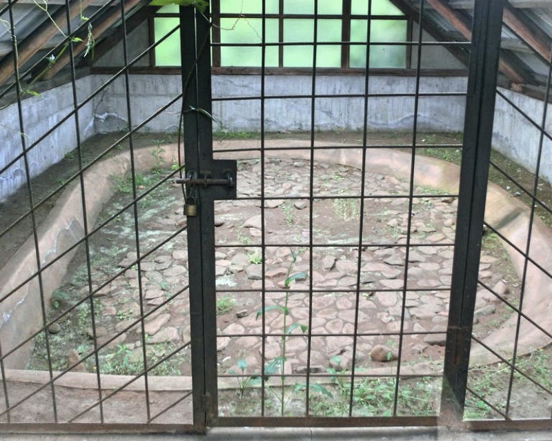
Kogasaka Stone Age Site
Monument and historic site · 0.8 km
Archaeological site in Japan



Tanamukaihara Site
Monument and historic site · 8.7 km
Ruins in Sagamihara, Japan
16 more on the map.
Parks, trails and playgrounds72




60 more on the map.
Restaurants and cafes267





Spain grill bar TOROS
Bar and pub · Tapas, Spanish, Grill
東京都道51号町田厚木線
Mo-Fr 17:00-24:00; Sa 16:00-24:00
アレグロ コン ブリオ
Restaurant · Italian
12, 町田市
Mo-Fr 18:00-01:00, Sa 12:00-13:30, 18:00-01:00, Su,PH 12:00-13:30,...
255 more on the map.
History
The area of present-day Machida was part of ancient Musashi Province. In the post-Meiji Restoration cadastral reform of July 22, 1878, the area became part of Minamitama District in Kanagawa Prefecture. The village of Machida was created on April 1, 1889, with the establishment of modern municipalities system. Minamitama District was transferred to the administrative control of Tokyo Metropolis on April 1, 1893. Tama was elevated to town status on April 1, 1913. The town was bombed by American forces on May 24, 1945, during World War II.
Machida expanded through annexation of the neighboring village of Minami on April 1, 1954, followed by the villages of Tsurukawa, Tadao and Sakai on February 1, 1958, to become the city of Machida. A USMC RF-8A crashed in a residential area Machida on April 1, 1964, killing four people. From 1973, the Tama New Town development resulted in a rapid increase in population, turning the city into a bedroom community for Tokyo and Yokohama.
From the History section of Machida, Tokyo on Wikipedia, under CC BY-SA 4.0.
Where to stay9
Churches and places of worship40
Shopping50
Gas and EV charging3
Schools, colleges and libraries41
Healthcare53
Map of Machida
250 places. The map loads OpenStreetMap tiles when you open it.
Getting there and nearby towns
United States Naval Air Facility Atsugi (NJA) is the nearest airport with scheduled flights listed in OpenStreetMap, 10 km away.
- Yamato 8 km south, about 8 min by car
- Zama 8 km southwest, about 8 min by car
- Atsugi 13 km southwest, about 13 min by car
- Aihara 14 km northwest, about 14 min by car
- Ebina 18 km south, about 18 min by car
- Sagamihara 19 km west, about 19 min by car
- Yokohama 22 km southeast, about 22 min by car
- Fujisawa 21 km south, about 21 min by car
- Isehara 20 km southwest, about 20 min by car
- Musashino 21 km northeast, about 21 min by car
Drive times are estimates from straight-line distance, not routes.
Local news
Headlines from INDB.
Reviews, tips and questions
Loading what members have shared...
Sources and licences
- GeoNames (CC BY 4.0): population, coordinates, regions and time zone
- OpenStreetMap contributors (ODbL 1.0): places, airports, map data
- Wikidata (CC0 1.0): elevation, founding date, time zone, website, landmarks and historic places
- Wikimedia Commons (see each image): photos
- Wikipedia (CC BY-SA 4.0): overview and history text
Photo credits
- MachidaHills, JN's JL at English Wikipedia, CC BY-SA 3.0
- 3 Chome Haramachida, Machida-shi, Tōkyō-to 194-0013, Japan - panoramio (1), 運転太郎, CC BY 3.0
- 2 Chome Haramachida, Machida-shi, Tōkyō-to 194-0013, Japan - panoramio, 運転太郎, CC BY 3.0
- Building of HOTEL THE ELLCY MACHIDA and Machida City Central Library, Kkairri, CC BY-SA 3.0
- Machida City Central Library Ent, Kkairri, CC BY-SA 3.0
- 3 Chome Haramachida, Machida-shi, Tōkyō-to 194-0013, Japan - panoramio (2), 運転太郎, CC BY 3.0
- 3 Chome Haramachida, Machida-shi, Tōkyō-to 194-0013, Japan - panoramio, 運転太郎, CC BY 3.0
- Azabu University, Abasaa, Public domain
- Den-en Chofu University, Abasaa, Public domain
- Japan Institute of the Moving Image, Shin-Yurigaoka Campus, Nyao148, CC BY-SA 4.0
- Colorful boats kodomonokuni, k yamada from Yokohama, Japan, CC BY-SA 2.0
- 崇貞館入口付近, faso, CC BY-SA 3.0
- Showa University of Music, Unknown author, CC BY-SA 3.0
- Showa Pharmaceutical University, machiro, CC BY-SA 3.0
- Tama University in April 2009, Nikm, Public domain
- Tamagawauniv, Original uploader was Hykw-a4 at ja.wikipedia, CC BY-SA 3.0
- Reconstructed Buildings at Katsusaka Site Park - panoramio, 小林俊通, CC BY-SA 3.0
- Kogasaka Stone Age Site, MChew, CC BY-SA 4.0
- Izuminomori Park 01, 椎林 隆夫, CC BY-SA 3.0
- Zoorasia100403, Space Key, CC BY 3.0
- 町田市勝楽寺全体, machiro, CC BY-SA 3.0
- Building of Machida Citizens Literature Museum KOTOBA LAND, Kkairri, CC BY-SA 3.0
- SerigayaPark, machiro, CC BY-SA 3.0
- Machida-Tenmangu-Shrine, machiro, CC BY-SA 3.0
- Seiryu-ji Temple in Sagamihara city, ブルーノ・プラス, CC BY 4.0
- Shoun-ji Temple in Machida city, ブルーノ・プラス, CC BY 4.0
- Sagajo, Wikikanamori at Japanese Wikipedia, CC BY-SA 3.0
- Snoopy Museum Tokyo, そらたこ, CC BY-SA 4.0
- Itoen Kagurazaka building, Mochizuki1018, CC BY 4.0
- MachidaTokyuTwins, machiro, CC BY-SA 3.0
- Odakyu-Hotel-Century Sagami-Ono, Machiro, CC BY-SA 3.0
- Machida-Tenmangu Shrine in Machida city, ブルーノ・プラス, CC BY 4.0
- カフェ^バー アイビー - panoramio, 運転太郎, CC BY 3.0
- スギ薬局 原町田店 - panoramio, 運転太郎, CC BY 3.0
- ファミリーマート サンズ原町田三丁目店 - panoramio, 運転太郎, CC BY 3.0
- 工事中 - panoramio (43), 運転太郎, CC BY 3.0
- マンホール - panoramio (69), 運転太郎, CC BY 3.0
- Dining Bar KAGAMI - panoramio, 運転太郎, CC BY 3.0
- (有)住創 - panoramio, 運転太郎, CC BY 3.0
- 清水屋製パン(有) - panoramio, 運転太郎, CC BY 3.0


Page built November 4, 2026. Spotted a mistake? Tell us or suggest a place.