


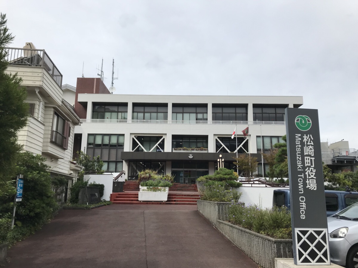

Matsuzaki, Japan
松崎町
Matsuzaki is a town of 6,563 people in Shizuoka, Japan, founded in April 1, 1889.
Why visit Matsuzaki
Townapedia lists 23 museums and landmarks, 10 parks and trails, 15 places to eat, 52 places to stay and 20 attractions in and around town.
Highlights include Izu-no-Chouhachi Museum, Joukan-ji Chouhachi Memorial Hall and Dogashima Park.
Weather in Matsuzaki
Forecast from MET Norway (CC BY 4.0). Full forecast
About Matsuzaki
Matsuzaki (松崎町, Matsuzaki-chō) is a town located in on the southwest coast of Izu Peninsula in Kamo District, Shizuoka Prefecture, Japan. As of 31 July 2019, the town had an estimated population of 6,563 in 2969 households, and a population density of 77 persons per km². The total area of the town is 85.23 square kilometres (32.91 sq mi). Sakuramochi is a noted local specialty.
From the Wikipedia article Matsuzaki, Shizuoka (this version), under CC BY-SA 4.0.
Things to do20

8 more on the map.
Museums and landmarks23



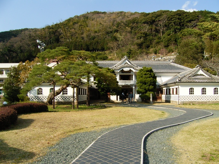
Former School Building Of Iwashina School
Monument and historic site · 2.1 km



11 more on the map.
Parks, trails and playgrounds10


Restaurants and cafes15



3 more on the map.
History
During the Edo period, all of Izu Province was tenryō territory under direct control of the Tokugawa shogunate, and the area now comprising Matsuzaki Town consisted of 21 villages. With the establishment of the modern municipalities system of the early Meiji period in 1889, the area was divided into 11 villages within Kamo District, and 10 villages within Naka District. After the abolishment of Naka District, all 21 villages were reunited under Kamo District. Matsuzaki Village was elevated to town status in 1901. The town annexed neighboring Nakagawa Village in 1955 and Iwashina Village in 1956.
Around March 31, 2010, the city of Shimoda and three municipalities in Kamo District (Kawazu, Matsuzaki, and Minamiizu) were scheduled to merge. However, the merger backed out.
From the History section of Matsuzaki, Shizuoka on Wikipedia, under CC BY-SA 4.0.
Where to stay52
Churches and places of worship27
Shopping6
Gas and EV charging5
Schools, colleges and libraries10
Healthcare2
Map of Matsuzaki
170 places. The map loads OpenStreetMap tiles when you open it.
Getting there and nearby towns
Oshima Airport (OIM) is the nearest airport with scheduled flights listed in OpenStreetMap, 53 km away.
- Shimoda 18 km southeast, about 18 min by car
- Inatori 24 km east, about 24 min by car
- Shuzenji 28 km northeast, about 28 min by car
- Izu 29 km northeast, about 29 min by car
- Izunokuni 36 km northeast, about 36 min by car
- Itō 37 km northeast, about 37 min by car
- Numazu 39 km north, about 39 min by car
- Mishima 42 km north, about 42 min by car
- Yaizu 44 km west, about 44 min by car
- Fuji 47 km north, about 47 min by car
Drive times are estimates from straight-line distance, not routes.
Local news
Headlines from INDB.
Reviews, tips and questions
Loading what members have shared...
Sources and licences
- GeoNames (CC BY 4.0): population, coordinates, regions and time zone
- OpenStreetMap contributors (ODbL 1.0): places, airports, map data
- Wikidata (CC0 1.0): elevation, founding date, time zone, website
- Wikimedia Commons (see each image): photos
- Wikipedia (CC BY-SA 4.0): overview and history text
Photo credits
- Matsuzaki Town - panoramio - ion66, ion66, CC BY 3.0
- Chohachi Matsuzaki Shizuoka Japan, ahomin, CC BY-SA 3.0
- Matsuzaki Kaigan -01, Aimaimyi, CC BY-SA 3.0
- Matsuzaki, Kamo District, Shizuoka Prefecture 410-3611, Japan - panoramio, ion66, CC BY 3.0
- Matsuzaki town hall, Yaritsusozai, CC BY-SA 4.0
- Nakase-Ashiyu Matsuzaki Shizuoka Japan, ahomin, CC BY-SA 3.0
- Izu-Buntei Matsuzaki Shizuoka Japan, ahomin, CC BY-SA 3.0
- TokaiBusTerm Matsuzaki Shizuoka Japan, ahomin, CC BY-SA 3.0
- Miyauchi, Matsuzaki, Kamo District, Shizuoka Prefecture 410-3612, Japan - panoramio, ion66, CC BY 3.0
- Shikura, Matsuzaki, Kamo District, Shizuoka Prefecture 410-3623, Japan - panoramio, ion66, CC BY 3.0
- Nango, Matsuzaki, Kamo District, Shizuoka Prefecture 410-3622, Japan - panoramio, ion66, CC BY 3.0
- Naka, Matsuzaki, Kamo District, Shizuoka Prefecture 410-3626, Japan - panoramio, ion66, CC BY 3.0
- Izu-no-chohachi Museum 01, Motokoka, CC BY-SA 4.0
- Iwashinagakko, しんかわな, CC BY-SA 3.0
- Tensodo 2008-09-15, fujitariuji, CC BY 2.0
- Matsuzaki Elementary School, Asasa198, CC BY-SA 4.0
- Dogashima 20121019, Batholith (Wikimedia Commons) Batholith (Wikipedia), Public domain
- Sunset - panoramio - ion66, ion66, CC BY 3.0
- Sunset - panoramio - ion66 (1), ion66, CC BY 3.0
- Izu - panoramio - ion66 (17), ion66, CC BY 3.0
- Sunset@westcoast - panoramio, ion66, CC BY 3.0
- Tokiwaohashi -01, Aimaimyi, CC BY-SA 3.0
- Izu - panoramio, ion66, CC BY 3.0
- Izu - panoramio - ion66 (10), ion66, CC BY 3.0
- Namakokabe -01, Aimaimyi, CC BY-SA 3.0
- Izu - panoramio - ion66 (15), ion66, CC BY 3.0
- Izu - panoramio - ion66 (11), ion66, CC BY 3.0
- なまこ壁 - panoramio (1), ion66, CC BY 3.0
- なまこ壁 - panoramio, ion66, CC BY 3.0
- Ushibarayama Chomin no Mori Park, june 2012 (14655465877), Izu navi from Kyoto, Japan, CC BY 2.0
- Ushibarayama Chomin no Mori Park, june 2012 (14655375029), Izu navi from Kyoto, Japan, CC BY 2.0
- 牛原山町民の森|Ushibarayama Chomin no Mori Park, june 2012 (14655465627), Izu navi from Kyoto, Japan, CC BY 2.0
- Izu - panoramio - ion66 (6), ion66, CC BY 3.0
- Izu - panoramio - ion66 (5), ion66, CC BY 3.0
- Tori-115 - panoramio, ion66, CC BY 3.0
- Izu - panoramio - ion66 (3), ion66, CC BY 3.0
- Post-123 - panoramio, ion66, CC BY 3.0
- Izu Cote d Azur, PHGCOM, CC BY-SA 3.0
- Plaster relief KOTE-E 2010, TANAKA Juuyoh (田中十洋), CC BY 2.0
- Japanese traditional furniture, TANAKA Juuyoh (田中十洋), CC BY 2.0


Page built November 5, 2026. Spotted a mistake? Tell us or suggest a place.