


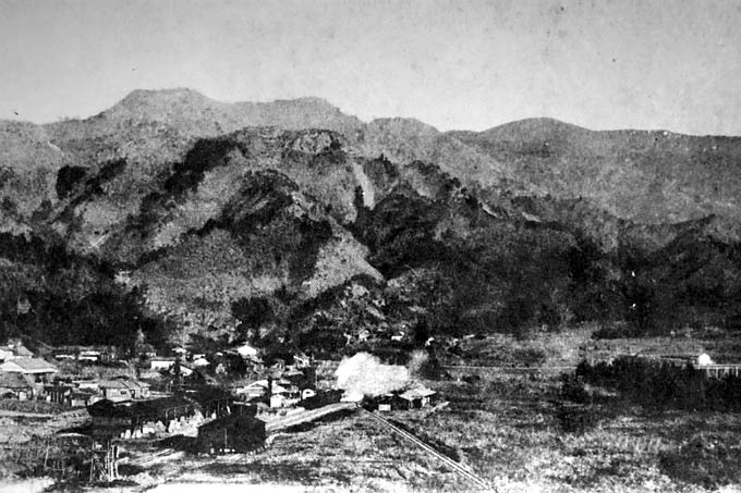


Minano, Japan
皆野町
Minano is a town of 9,497 people in Saitama, Japan, founded in March 1, 1955.
Why visit Minano
Townapedia lists 15 museums and landmarks, 12 parks and trails, 50 places to eat, 10 places to stay and 60 attractions in and around town.
Highlights include Mt. Hodo, 大霧山, Saitama Museum of Natural History and Wadō Site.
Weather in Minano
Forecast from MET Norway (CC BY 4.0). Full forecast
About Minano
Minano (皆野町, Minano-machi) is a town located in Saitama Prefecture, Japan. As of 1 January 2021, the town had an estimated population of 9,497 in 3994 households and a population density of 150 persons per km2. The total area of the town is 63.74 square kilometres (24.61 sq mi).
From the Wikipedia article Minano, Saitama (this version), under CC BY-SA 4.0.
Things to do60



48 more on the map.
Museums and landmarks15
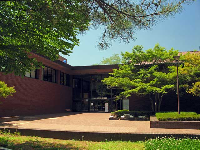

Wadō Site
Monument and historic site · 2.9 km
Mining site, archaeological site in Saitama, Japan


3 more on the map.
Parks, trails and playgrounds12




Restaurants and cafes50

BOOK CAFE GALLERY PNB-1253
Cafe · Cake, Coffee Shop · 1.3 km
1, 皆野町
Th-Tu 11:00-19:00

台湾料理 香林坊長瀞店
Restaurant · Chicken, Chinese, Friture, Noodles · 4.1 km
We-Mo 11:00-14:30,17:00-23:00
38 more on the map.
History
The village of Minano was created within Chichibu District, Saitama with the establishment of the modern municipalities system on April 1, 1889. It was elevated to town status on November 10, 1928. On September 8, 1943 Minano was merged with the neighboring villages of Kunikami, Kanazawa, Hinozawa, Misawa and Ota to form the new town of Mino. However, the town was dissolved on December 1, 1946 back into its original components.
On March 1, 1955, Minano again annexed the neighboring villages of Kunikami, Kanazawa, and Hinozawa followed by the village of Misawa on March 31, 1957.
From the History section of Minano, Saitama on Wikipedia, under CC BY-SA 4.0.
Where to stay10
Churches and places of worship26
Shopping9
Gas and EV charging7
Schools, colleges and libraries20
Healthcare9
Map of Minano
218 places. The map loads OpenStreetMap tiles when you open it.
Getting there and nearby towns
Yokota Air Base (OKO) is the nearest airport with scheduled flights listed in OpenStreetMap, 42 km away.
- Chichibu 9 km south, about 9 min by car
- Yorii 10 km northeast, about 10 min by car
- Ogano 10 km southwest, about 10 min by car
- Ogawamachi 15 km east, about 15 min by car
- Fujioka 19 km north, about 19 min by car
- Ranzan 19 km east, about 19 min by car
- Ogose 21 km southeast, about 21 min by car
- Yoshii 22 km northwest, about 22 min by car
- Hatoyama 23 km southeast, about 23 min by car
- Kumagaya 27 km east, about 27 min by car
Drive times are estimates from straight-line distance, not routes.
Local news
Headlines from INDB.
Reviews, tips and questions
Loading what members have shared...
Sources and licences
- GeoNames (CC BY 4.0): population, coordinates, regions and time zone
- OpenStreetMap contributors (ODbL 1.0): places, airports, map data
- Wikidata (CC0 1.0): elevation, founding date, time zone, website, landmarks and historic places
- Wikimedia Commons (see each image): photos
- Wikipedia (CC BY-SA 4.0): overview and history text
Photo credits
- Minano town-office, nattou, Public domain
- Minano Station Entrance 20110913, 京浜にけ at Japanese Wikipedia (Keihin-nike) This photo was taken with Canon EOS 7D, CC BY-SA 3.0
- Minano Station Entrance 20120824, 京浜にけ at Japanese Wikipedia (Keihin-nike) This photo was taken with Canon EOS 7D, CC BY-SA 3.0
- Minano First Chichibu Station Panorama 1, Unknown author Unknown author, Public domain
- Pot hole near the Oyahana bridge in Minano Town Saitama, Osumi Akari, CC BY-SA 4.0
- Chichibu Wado Ruins Open-pit Mining 1, 京浜にけ, CC BY-SA 3.0
- Saitama Prefectural Minano High School, M yanagisawa, CC BY 3.0
- Chichibu agricultural science High school, Ebiebi2, CC BY-SA 3.0
- Ngatoro Saitamakenritu sizennohakubutukan 1, 京浜にけ, CC BY-SA 3.0
- 寶登山神社・鳥居 - panoramio, Adachi Masayuki, CC BY-SA 3.0
- Hodosan Shrine (Mt. Treasure-climb Shrine) - 宝登山神社 - panoramio (13), Carbonium, CC BY 3.0
- 聖神社の拝殿前, kyhm, Public domain
- Nagatoro Town Museum, Abasaa, Public domain
- Chichibu 34 Suisen-ji 201903a, tak1701d, CC BY-SA 3.0
- 1番 誦経山 四萬部寺 - panoramio, fum3670045, CC BY 3.0
- 3番 岩本山 常泉寺 - panoramio, fum3670045, CC BY 3.0
- Chichibu 21 Kannon-ji 01, tak1701d, CC BY-SA 3.0
- Chichibu 20 Iwanoue-do 201905a, tak1701d, CC BY-SA 3.0
- Chichibu 19 Ryuseki-ji 201905b, tak1701d, CC BY-SA 3.0
- Hatago Ichiban (Chichibu Saitama) 01, Higa4, CC0
- 月の石もみじ公園 ライトアップ(撮影日:2008年11月) - panoramio, mocchan1982, CC BY 3.0
- Saitama Prefectural Minano High School 1, Ebiebi2, CC0
- Hodosan top, 清兵衛, CC BY-SA 3.0
- Chichibu Hijiri Shrine Shaden 1, 京浜にけ, CC BY 3.0
- 展望台から見た大霧山・丸山, Koda6029, CC BY-SA 4.0
- Chichibu-seikyo Hosiptal, 運動会プロテインパワー, CC BY-SA 4.0
- Suisen-ji (Minano, Saitama) 13, Higa4, CC0
- Chichibu 03 Josen-ji 202607a, tak1701d, CC BY-SA 3.0
- Chichibu Koken-ji 202505a, tak1701d, CC BY-SA 3.0
- Seibu 4000 nagatoro-express train, 特急東海, CC0
- Bridge over Arakawa river - panoramio, Nirmal Raj Joshi, CC BY-SA 3.0
- ひまわり畑 - panoramio, nekoneko, CC BY-SA 3.0
- 長瀞ウォーターパークより美の山を望む - panoramio, toriichi3, CC BY 3.0
- 大いちょう - panoramio, nekoneko, CC BY-SA 3.0
- Pot hole in the bank of arakawa river - panoramio, Nirmal Raj Joshi, CC BY-SA 3.0
- Arakawa river - panoramio, Nirmal Raj Joshi, CC BY-SA 3.0
- 蔵 - panoramio - nekoneko, nekoneko, CC BY-SA 3.0
- 田んぼ - panoramio - nekoneko, nekoneko, CC BY-SA 3.0
- Akabira River02, M yanagisawa, CC BY 4.0
- 新皆野橋より美の山を望む - panoramio, toriichi3, CC BY 3.0


Page built November 5, 2026. Spotted a mistake? Tell us or suggest a place.