


Chichibu, Japan
秩父市
Chichibu is a town of 61,159 people in Saitama, Japan, founded in April 1, 1889.
Why visit Chichibu
Townapedia lists 53 museums and landmarks, 32 parks and trails, 117 places to eat, 36 places to stay and 133 attractions in and around town.
Highlights include Futase Dam, Chichibu Ontakesan, Chichibu Festival Hall and Saitama Museum of Natural History.
Weather in Chichibu
Forecast from MET Norway (CC BY 4.0). Full forecast
About Chichibu
Chichibu (Japanese: 秩父市, Hepburn: Chichibu-shi) is a city located in Saitama Prefecture, Japan. As of 1 January 2021, the city had an estimated population of 61,159 in 26,380 households and a population density of 110 inhabitants per square kilometre (280/sq mi). The total area of the city is 577.83 square kilometres (223.10 sq mi).
From the Wikipedia article Chichibu, Saitama (this version), under CC BY-SA 4.0.
Travel tips from other travellers: Chichibu on Wikivoyage (CC BY-SA 4.0).
Things to do133





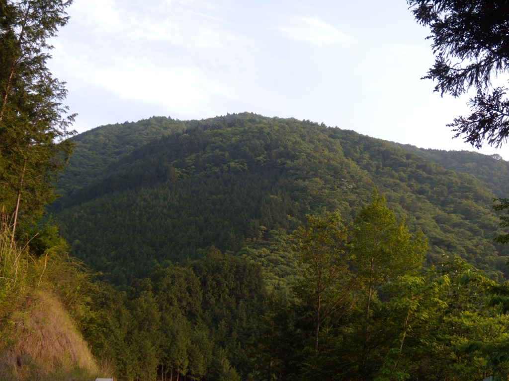


121 more on the map.
Museums and landmarks53

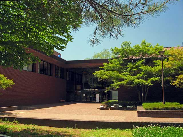
Chichibu Festival Hall
Museum · 1.1 km
冬期は10時開館。入館料 大人400円、小人200円。
8, 秩父市
09:00-17:30

Wadō Site
Monument and historic site · 7.0 km
Mining site, archaeological site in Saitama, Japan
やまとーあーとみゅーじあむ
Museum · 1.5 km
1, 秩父市
Tu off; Mo,We-Su,PH 10:00-16:00
秩父錦酒づくりの森酒蔵資料館
Museum · 1.9 km
酒造資料館入館料 200円
Mo 09:00-16:00; We-Su 09:00-16:30
Mt. buko Museum
Museum · 1.4 km
Tu off; Mo,We-Su,PH 10:00-16:00


41 more on the map.
Parks, trails and playgrounds32


Tsukinoishi Momiji Park (Lunar Stone Maple Park)
Park · 11.5 km
Mo-Su 05:00-21:00


20 more on the map.
Restaurants and cafes117



Chichibu Ganesha
Restaurant · Indian · 0.7 km
Mo-Tu 11:00-15:00,17:00-21:00; Th-Su 11:00-15:00,17:00-21:00

BOOK CAFE GALLERY PNB-1253
Cafe · Cake, Coffee Shop · 10.6 km
1, 皆野町
Th-Tu 11:00-19:00

柳田総本店武甲酒造
Brewery and winery · 1.3 km
酒造見学は10名以上。営業時間内は内井戸を開放。容器持参で水を持ち帰ることが可能。
08:00-17:30
105 more on the map.
History
Japanese archaeologists identified the remains of what may be the world's oldest artificial structure located on a hillside in Chichibu. This discovery offers new perspectives on early architectural practices in Asia. The shelter is believed to have been constructed by Homo erectus, an early human ancestor known for the use of stone tools. According to a report published in New Scientist, the archaeological site has been dated to approximately 500,000 years ago. The structure consists of ten post holes forming two irregular pentagons, suggesting the former existence of two distinct huts. In addition to the ground markings, thirty stone tools were found scattered across the vicinity. Prior to this find, the oldest known remains of a human-made structure were those identified at Terra Amata in France. Those French archaeological remains date back to a period between 200,000 and 400,000 years ago, making the Chichibu discovery significantly older.
From the History section of Chichibu, Saitama on Wikipedia, under CC BY-SA 4.0.
Where to stay36
Churches and places of worship88
Shopping21
Gas and EV charging12
Schools, colleges and libraries50
Healthcare22
Map of Chichibu
250 places. The map loads OpenStreetMap tiles when you open it.
Getting there and nearby towns
Yokota Air Base (OKO) is the nearest airport with scheduled flights listed in OpenStreetMap, 36 km away.
- Ogano 7 km northwest, about 7 min by car
- Yorii 18 km northeast, about 18 min by car
- Ogawamachi 18 km east, about 18 min by car
- Ogose 20 km east, about 20 min by car
- Hannō 27 km southeast, about 27 min by car
- Ōme 27 km southeast, about 27 min by car
- Fujioka 28 km north, about 28 min by car
- Yoshii 30 km north, about 30 min by car
- Kumagaya 32 km northeast, about 32 min by car
- Iruma 33 km southeast, about 33 min by car
Drive times are estimates from straight-line distance, not routes.
Local news
Headlines from INDB.
Reviews, tips and questions
Loading what members have shared...
Sources and licences
- GeoNames (CC BY 4.0): population, coordinates, regions and time zone
- OpenStreetMap contributors (ODbL 1.0): places, airports, map data
- Wikidata (CC0 1.0): elevation, founding date, time zone, website, landmarks and historic places
- Wikimedia Commons (see each image): photos
- Wikipedia (CC BY-SA 4.0): overview and history text
Photo credits
- Central Chichibu view from Hitsujiyama Park, Abasaa, Public domain
- Jigen-ji (Chichibu, Saitama) 09, Higa4, CC0
- Yao departmentstore, Chichibu, Saitama-20240331, 山田晴通, CC0
- Imamiya-bō (Chichibu, Saitama) 05, Higa4, CC0
- Imamiya-bō (Chichibu, Saitama) 01, Higa4, CC0
- Imamiya-bō (Chichibu, Saitama) 04, Higa4, CC0
- Chichibu 14 Imamiya-bo 202610b, tak1701d, CC BY-SA 3.0
- Imamiya-bō (Chichibu, Saitama) 02, Higa4, CC0
- Imamiya-bō (Chichibu, Saitama) 03, Higa4, CC0
- Imamiya-bō (Chichibu, Saitama) 06, Higa4, CC0
- Chichibu 14 Imamiya-bo 202411a, tak1701d, CC BY-SA 3.0
- Chichibu 14 Imamiya-bo 01, tak1701d, CC BY-SA 3.0
- Chichibu 14 Imamiya-bo 202610a, tak1701d, CC BY-SA 3.0
- Imamiya-bō (Chichibu, Saitama) 07, Higa4, CC0
- Imamiya-bō (Chichibu, Saitama) 09, Higa4, CC0
- Jigen-ji (Chichibu, Saitama) 01, Higa4, CC0
- Imamiya-bō (Chichibu, Saitama) 08, Higa4, CC0
- Chichibu Jigen-ji Yakushi-do 202309, tak1701d, CC BY-SA 3.0
- Jigen-ji (Chichibu, Saitama) 02, Higa4, CC0
- Jigen-ji (Chichibu, Saitama) 03, Higa4, CC0
- Jigen-ji (Chichibu, Saitama) 11, Higa4, CC0
- Jigen-ji (Chichibu, Saitama) 04, Higa4, CC0
- Jigen-ji (Chichibu, Saitama) 05, Higa4, CC0
- Jigen-ji (Chichibu, Saitama) 08, Higa4, CC0
- Jigen-ji (Chichibu, Saitama) 10, Higa4, CC0
- Jigen-ji (Chichibu, Saitama) 07, Higa4, CC0
- Jigen-ji (Chichibu, Saitama) 06, Higa4, CC0
- Chichibu Jigen-ji Yakushi-do 202610, tak1701d, CC BY-SA 3.0
- Chichibu Jigen-ji Yakushi-do 201404, tak1701d, CC BY-SA 3.0
- Chichibu 13 Jigen-ji, Ultrasleeper, CC BY-SA 3.0
- Futase Dam, photo: Qurren ( talk ) Taken with Canon IXY 10S (Digital IXUS 210), CC BY-SA 3.0
- Chichibu Wado Ruins Open-pit Mining 1, 京浜にけ, CC BY-SA 3.0
- Chichibu-Shrine, NY066, CC BY-SA 3.0
- Mount Buko 20140517 - Flickr, elminium, CC BY 2.0
- UNICUS Chichibu, Abasaa, Public domain
- 伊豆ヶ岳の男坂, Koda6029, CC BY-SA 4.0
- Saitama Prefectural Minano High School, M yanagisawa, CC BY 3.0
- Chichibu agricultural science High school, Ebiebi2, CC BY-SA 3.0
- Saitama Prefectural Chichibu High School, M yanagisawa, CC BY 3.0
- Ngatoro Saitamakenritu sizennohakubutukan 1, 京浜にけ, CC BY-SA 3.0
- Douhirayama, Andshin, CC BY-SA 3.0
- 大平山, lizhijp, Public domain
- 武甲山から見た大持山と小持山, Koda6029, CC BY-SA 4.0
- 寶登山神社・鳥居 - panoramio, Adachi Masayuki, CC BY-SA 3.0
- Kumakurayama, lizhijp, CC BY-SA 3.0
- Chichibu Muse-Park1, Ebiebi2, CC BY-SA 3.0
- Kagemori Junior high school in Chichibu, Saitama, Ebiebi2, CC BY-SA 3.0
- Chichibu Municipal Hospital, Ebiebi2, Public domain
- Tetudoshiyariyo park2, Ebiebi2, Public domain
- 羊山公園の芝桜の丘 (Phlox subulata in Chichibu) 02 May, 2010 - panoramio, Hiroaki Kaneko, CC BY-SA 3.0
- Nagatoro Town Museum, Abasaa, Public domain
- Chichibu 34 Suisen-ji 201903a, tak1701d, CC BY-SA 3.0
- Chichibu 08 Saizen-ji 201911a, tak1701d, CC BY-SA 3.0
- 1番 誦経山 四萬部寺 - panoramio, fum3670045, CC BY 3.0
- Chichibu 30 Houn-ji 201907b, tak1701d, CC BY-SA 3.0
- Hocho-ji (Yokoze, Saitama) 02, Higa4, CC0
- Chichibu 33 Kikusui-ji 01, tak1701d, CC BY-SA 3.0
- 2021年春の慈眼寺観音堂, Alujiotto, CC BY-SA 4.0
- Chichibu 32 Hosho-ji 202603a, tak1701d, CC BY-SA 3.0
- Chichibu 31 Kannon-in 03, tak1701d, CC BY-SA 3.0
- Chichibu 29 Chosen-in 202604b, tak1701d, CC BY-SA 3.0
- Chichibu 15 Shorin-ji 01, tak1701d, CC BY-SA 3.0
- Hatago Ichiban (Chichibu Saitama) 01, Higa4, CC0
- Kannon chaya (Ogano, Saitama) 04, Higa4, CC0
- 月の石もみじ公園 ライトアップ(撮影日:2008年11月) - panoramio, mocchan1982, CC BY 3.0
- 四阿屋山, Koda6029, CC BY-SA 4.0
- 落合方面から見た秩父御岳山, Koda6029, CC BY-SA 4.0
- 蔦岩山からの武川岳, Koda6029, CC BY-SA 4.0
- Kuna Elementary School, M yanagisawa, CC BY 4.0
- Chichibu-seikyo Hosiptal, 運動会プロテインパワー, CC BY-SA 4.0


Page built November 5, 2026. Spotted a mistake? Tell us or suggest a place.