


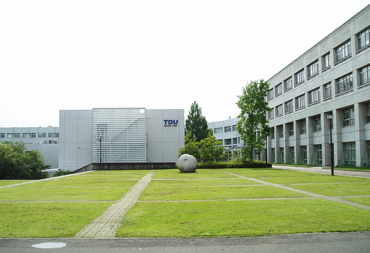


Hatoyama, Japan
鳩山町
Hatoyama is a town of 13,560 people in Saitama, Japan, founded in April 15, 1955.
Why visit Hatoyama
Townapedia lists 34 museums and landmarks, 86 parks and trails, 91 places to eat, 1 place to stay and 16 attractions in and around town.
Highlights include Saitama Children's Zoo, Kamikumi Nousan butsu Chokubai Jo "Chokkuma", Peace Museum of Saitama and Beatrix Potter Reference Library.
Weather in Hatoyama
Forecast from MET Norway (CC BY 4.0). Full forecast
About Hatoyama
Hatoyama (鳩山町, Hatoyama-machi) is a town located in Saitama Prefecture, in the central Kantō region of Japan. As of 1 March 2021, the town had an estimated population of 13,414 in 6006 households and a population density of 520 persons per km2. The total area of the town is 25.73 square kilometres (9.93 sq mi). The JAXA Earth Observation Center is located in Hatoyama.
From the Wikipedia article Hatoyama, Saitama (this version), under CC BY-SA 4.0.
Things to do16


Kamikumi Nousan butsu Chokubai Jo "Chokkuma"
Farm and orchard · 2.2 km
イートインコーナーあり
Mo off; Tu-Su 09:00-17:00; Jan 01-04,Dec 31 off

Kagawa Nutrition University
School · 7.6 km
Private university in Japan with campuses in Saitama Prefecture and Tokyo

Nihon Institute of Medical Science
School · 5.6 km
Higher education institution in Saitama Prefecture, Japan

Saitama Medical University
School · 5.3 km
Higher education institution in Saitama Prefecture, Japan

Saitama Medical University College
School · 5.5 km
Higher education institution in Saitama Prefecture, Japan


4 more on the map.
Museums and landmarks34



Minimamihiki Kiln Site
Monument and historic site · 2.1 km
Archaeological site in Japan
22 more on the map.
Parks, trails and playgrounds86




74 more on the map.
Restaurants and cafes91

La Casserole
Restaurant · French · 4.2 km
休業曜日が祝日の場合、その後最初の平日が休業
Mo,Tu[1,3] off; Tu-Su,PH 11:00-15:00,18:00-22:00
Narikoma
Restaurant · Seafood, Japanese · 4.2 km
送迎バス応相談
Mo off; Tu-Sa 11:30-14:30,17:00-22:00; Su,PH 11:30-14:30,17:00-21:30

79 more on the map.
History
The village of Hatoyama was created on April 15, 1955, by the merger of the villages of Kamei and Imajuku. It was raised to town status on April 1, 1982.
From the History section of Hatoyama, Saitama on Wikipedia, under CC BY-SA 4.0.
Where to stay1
Churches and places of worship47
Shopping22
Gas and EV charging6
Schools, colleges and libraries26
Healthcare16
Map of Hatoyama
250 places. The map loads OpenStreetMap tiles when you open it.
Getting there and nearby towns
Yokota Air Base (OKO) is the nearest airport with scheduled flights listed in OpenStreetMap, 26 km away.
- Ogose 5 km southwest, about 5 min by car
- Tsurugashima 7 km east, about 7 min by car
- Takasaka 6 km east, about 6 min by car
- Hidaka 8 km south, about 8 min by car
- Ranzan 8 km north, about 8 min by car
- Higashi-Matsuyama 9 km northeast, about 9 min by car
- Ogawamachi 10 km northwest, about 10 min by car
- Igusa 12 km east, about 12 min by car
- Hannō 14 km south, about 14 min by car
- Kawagoe 16 km southeast, about 16 min by car
Drive times are estimates from straight-line distance, not routes.
Local news
Headlines from INDB.
Reviews, tips and questions
Loading what members have shared...
Sources and licences
- GeoNames (CC BY 4.0): population, coordinates, regions and time zone
- OpenStreetMap contributors (ODbL 1.0): places, airports, map data
- Wikidata (CC0 1.0): elevation, founding date, time zone, website, landmarks and historic places
- Wikimedia Commons (see each image): photos
- Wikipedia (CC BY-SA 4.0): overview and history text
Photo credits
- Hatoyama Town Hall 1, Ebiebi2, CC BY-SA 3.0
- Hatoyama Junior High School, M yanagisawa, CC0
- TDU-Saitama-Hatoyama-2012061704, Hasec, CC0
- TDU-Saitama-Hatoyama-2012061703, Hasec, CC0
- TDU-Saitama-Hatoyama-2012061702, Hasec, CC0
- TDU-Saitama-Hatoyama-2012061701, Hasec, CC0
- Kagawa Nutrition University (Joshi Eiyō Daigaku), Mj-bird, CC BY-SA 4.0
- Nihon Institute of Medical Science, Nyao148, CC BY-SA 4.0
- Higashimatsuyama Peace Museum Of Saitama 1, 京浜にけ, CC BY-SA 3.0
- Capybaras in Saitama Children's Zoo, Doricono, CC BY-SA 3.0
- Saitama Prefectural Ogose High School, M yanagisawa, CC BY 3.0
- Beatrix Potter Reference Library, Daito Bunka University - Apr 29, 2023, Nori Norisa, CC BY 2.0
- Yamamura Gakuen College, Nyao148, CC BY-SA 3.0
- MusashiOgoseHighschool, Asasa198, CC BY-SA 3.0
- Higashimatsuyama Mount Monomi Summit 1, 京浜にけ, CC BY-SA 3.0
- Kodomo-shizen-zoo, Miyarin, CC BY-SA 3.0
- Yamanobe-bashi, User:うさもも (Usamomo), CC BY-SA 3.0
- Saitama-medical-center 1, Ebiebi2, CC0
- Iwadonosan Shobo-ji 05, tak1701d, CC BY-SA 3.0
- 鳩山町, EastPineHill, CC BY-SA 4.0
- 鳩山町2, EastPineHill, CC BY-SA 4.0
- 東京電機大学鳩山キャンパス裏 - panoramio, ahash, CC BY-SA 3.0
- 東京電機大, EastPineHill, CC BY-SA 4.0
- 濁った池 - panoramio, ahash, CC BY-SA 3.0
- Iwadono, Higashimatsuyama, Saitama Prefecture 355-0065, Japan - panoramio, 赤カメラ, CC BY 3.0
- Iwadonosan Shobo-ji 03, tak1701d, CC BY-SA 3.0
- Iwadonosan Shobo-ji 03a, tak1701d, CC BY-SA 3.0
- Iwadonosan Shobo-ji 01, Miyarin at Japanese Wikipedia, CC BY-SA 3.0
- 岩殿観音のイチョウ - panoramio, 高橋文武, CC BY 3.0
- Iwadono, Higashimatsuyama, Saitama Prefecture 355-0065, Japan - panoramio (2), 赤カメラ, CC BY 3.0
- Iwadono, Higashimatsuyama, Saitama Prefecture 355-0065, Japan - panoramio (1), 赤カメラ, CC BY 3.0
- 岩殿観音 - panoramio, fum3670045, CC BY 3.0
- Iwadonosan Shobo-ji 07, tak1701d, CC BY-SA 3.0
- Iwadonosan Shobo-ji 02, 立志堂 at Japanese Wikipedia, CC BY-SA 3.0
- Iwadonosan Shobo-ji 02b, tak1701d, CC BY-SA 3.0
- Iwadonosan Shobo-ji 04, tak1701d, CC BY-SA 3.0
- Iwadonosan Shobo-ji 04b, tak1701d, CC BY-SA 3.0
- Nishiokubo, Moroyama, Iruma District, Saitama Prefecture 350-0433, Japan - panoramio, 赤カメラ, CC BY 3.0
- Higashimatsuyama Hatago Chōji-ya 202008, tak1701d, CC BY-SA 3.0
- Iwadonosan Shobo-ji Rokumendo 01, tak1701d, CC BY-SA 3.0


Page built November 5, 2026. Spotted a mistake? Tell us or suggest a place.