


Annaka, Japan
安中市
Annaka is a town of 57,013 people in Gunma, Japan, founded in April 1, 1889.
Why visit Annaka
Townapedia lists 79 museums and landmarks, 99 parks and trails, 121 places to eat, 8 places to stay and 11 attractions in and around town.
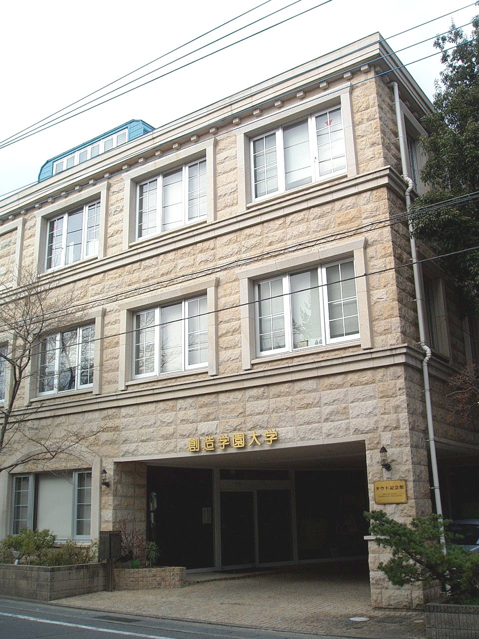
Highlights include Gumma Paz University, Gunma University of Social Welfare, Tomioka Silk Mill and Hidaka site.
Weather in Annaka
Forecast from MET Norway (CC BY 4.0). Full forecast
About Annaka
Annaka (安中市, Annaka-shi; Japanese pronunciation: [ä̀ń.nä́.kä́(.ɕì), ä́ń-]) is a city located in Gunma Prefecture, Japan. As of 31 July 2020, the city had an estimated population of 47,911 in 24,749 households, and a population density of 210 persons per square kilometre. The total area of the city is 276.31 km2 (106.68 sq mi).
From the Wikipedia article Annaka, Gunma (this version), under CC BY-SA 4.0.
Things to do11

Gumma Paz University
School · 10.3 km
Higher education institution in Gunma Prefecture, Japan

Gunma University of Social Welfare
School · 13.9 km
Higher education institution in Gunma Prefecture, Japan




Museums and landmarks79

Tomioka Silk Mill
Monument and historic site · 8.3 km
Silk reeling factory in Tomioka, Gunma prefecture, Japan

Hidaka site
Monument and historic site · 12.9 km
Ruins of a Yayoi period settlement in Takasaki, Japan

Kanaizawa Stele
Monument and historic site · 11.9 km
8th century Japanese stele

Kayano Site
Monument and historic site · 15.7 km
Archaeological site in Shintō, Gunma, Japan
Kitayatsu Site
Monument and historic site · 12.7 km
Ruins of a Kofun period residence in Takasaki, Japan
Tago District Shōsō ruins
Monument and historic site · 11.8 km
Archaeological site in Japan

Tago Stele
Monument and historic site · 11.6 km
Stone memorial in Japan
Takasaki Byakue Daikannon
Monument and historic site · 7.9 km
Large statue in Takasaki, Japan

Yamanoue Stele
Monument and historic site · 13.2 km
Stele, kofun in Gunma, Japan


67 more on the map.
Parks, trails and playgrounds99




87 more on the map.
Restaurants and cafes121

白雲亭
Restaurant · Barbecue, Korean · 8.9 km
Mo off; Tu-Fr 11:00-14:00,15:30-21:00; Sa-Su 11:00-14:00,16:30-21:00

109 more on the map.
History
Annaka is located within traditional Kōzuke Province. During the Edo period, central Annaka was the jōkamachi of Annaka Domain, a feudal domain held by the Itakura clan under the Tokugawa shogunate. The area also prospered from its location on the Nakasendō highway connecting Edo with Kyoto. Post stations located within the borders of modern Annaka were: Itahana-shuku, Annaka-shuku, Matsuida-shuku, and Sakamoto-shuku.
Annaka Town was created within Usui District, Gunma Prefecture on April 1, 1889, with the creation of the modern municipalities system after the Meiji Restoration. On March 1, 1955, Annaka merged with neighboring Haraichi, Isobe and Itahana towns, and Higashiyokono, Iwanoya, Akima and Gokan villages. It was raised to city status on November 1, 1958. On March 18, 2006, the town of Matsuida, merged with Annaka. Usui District was dissolved as a result of this merger.
From the History section of Annaka, Gunma on Wikipedia, under CC BY-SA 4.0.
Where to stay8
Churches and places of worship81
Shopping38
Gas and EV charging20
Schools, colleges and libraries65
Healthcare40
Map of Annaka
250 places. The map loads OpenStreetMap tiles when you open it.
Getting there and nearby towns
Yokota Air Base (OKO) is the nearest airport with scheduled flights listed in OpenStreetMap, 76 km away.
- Tomioka 8 km south, about 8 min by car
- Takasaki 11 km east, about 11 min by car
- Yoshii 12 km southeast, about 12 min by car
- Kanekomachi 13 km northeast, about 13 min by car
- Fujioka 18 km southeast, about 18 min by car
- Higashiagatsuma 28 km north, about 28 min by car
- Nakanojō 29 km north, about 29 min by car
- Ōmamachō-ōmama 36 km east, about 36 min by car
- Numata 36 km north, about 36 min by car
- Kiryū 40 km east, about 40 min by car
Drive times are estimates from straight-line distance, not routes.
Local news
Headlines from INDB.
Reviews, tips and questions
Loading what members have shared...
Sources and licences
- GeoNames (CC BY 4.0): population, coordinates, regions and time zone
- OpenStreetMap contributors (ODbL 1.0): places, airports, map data
- Wikidata (CC0 1.0): elevation, founding date, time zone, website, landmarks and historic places
- Wikimedia Commons (see each image): photos
- Wikipedia (CC BY-SA 4.0): overview and history text
Photo credits
- Annaka City Hall, 禁樹なずな, CC BY-SA 3.0
- Annaka Church, photo: Qurren ( talk ) Taken with Canon IXY 430F (Digital IXUS 245 HS), CC BY-SA 3.0
- UCCJ Annaka Church Onkotei, Suikotei, CC BY 4.0
- The remains of the Annaka-han Koribugyo Residence, Suikotei, CC BY 4.0
- The remains of the Annaka-han Koribugyo Residence 1, photo: Qurren ( talk ) Taken with Canon IXY 430F (Digital IXUS 245 HS), CC BY-SA 3.0
- The remains of the Annaka-han Koribugyo Residence 3, photo: Qurren ( talk ) Taken with Canon IXY 430F (Digital IXUS 245 HS), CC BY-SA 3.0
- UCCJ Annaka Church Senkyoshikan, Suikotei, CC BY 4.0
- The remains of the Annaka-han Koribugyo Residence 2, photo: Qurren ( talk ) Taken with Canon IXY 430F (Digital IXUS 245 HS), CC BY-SA 3.0
- The old Annaka-han Buke Nagaya 1, photo: Qurren ( talk ) Taken with Canon IXY 430F (Digital IXUS 245 HS), CC BY-SA 3.0
- The old Annaka-han Buke Nagaya 2, photo: Qurren ( talk ) Taken with Canon IXY 430F (Digital IXUS 245 HS), CC BY-SA 3.0
- The old Annaka-han Buke Nagaya 3, photo: Qurren ( talk ) Taken with Canon IXY 430F (Digital IXUS 245 HS), CC BY-SA 3.0
- Annaka city Yatsu branch office 2, photo: Qurren ( talk ) Taken with Canon IXY 430F (Digital IXUS 245 HS), CC BY-SA 3.0
- Annaka city Yatsu branch office 1, photo: Qurren ( talk ) Taken with Canon IXY 430F (Digital IXUS 245 HS), CC BY-SA 3.0
- Annaka city office, photo: Qurren ( talk ) Taken with Canon IXY 430F (Digital IXUS 245 HS), CC BY-SA 3.0
- Takasaki District Fire Bureau Annaka Fire station, Suikotei, CC BY 4.0
- Annaka No. 6 kofun Neesima monument, photo: Qurren ( talk ) Taken with Canon IXY 430F (Digital IXUS 245 HS), CC BY-SA 3.0
- Annaka No. 6 kofun, photo: Qurren ( talk ) Taken with Canon IXY 430F (Digital IXUS 245 HS), CC BY-SA 3.0
- Takasaki Public Employment Security Office Annaka Branch, Suikotei, CC BY 4.0
- Annaka Station building 01, Rory trains, CC BY-SA 4.0
- Toho Zinc Annaka , Gunma - panoramio (1), Kaz Ish, CC BY-SA 3.0
- Toho Zinc Annaka , Gunma - panoramio (2), Kaz Ish, CC BY-SA 3.0
- Toho Zinc Annaka , Gunma - panoramio, Kaz Ish, CC BY-SA 3.0
- Toho Zinc Annaka , Gunma - panoramio (3), Kaz Ish, CC BY-SA 3.0
- Annaka-SL 01, Rory trains, CC BY-SA 4.0
- Bic Clean Energy Annaka, photo: Qurren ( talk ) Taken with Canon IXY 430F (Digital IXUS 245 HS), CC BY-SA 3.0
- Annaka Haraichi Post office, Suikotei, CC BY 4.0
- Gunma University of Health and Welfare, Abasaa, Public domain
- Takasaki University of Commerce, WAKA77, CC0
- SouzouGakuen-Univ-Yachiyo01, Hasec, CC0
- Tomioka Silk Mill East Cocoon Warehouse05, Hasec, Public domain
- Monument of Kanaizawa, 文屋将監, CC BY 3.0
- Monument of Tago (Tagohi), 文屋将監, CC BY 3.0
- Yamanouehi, 文屋将監, CC BY 3.0
- TCUE-Bldg5, Hasec, CC0
- Fudouji (Annakashi) Nioumon, こやまひろ, CC BY-SA 4.0
- Daisho Gokoku-ji, Abasaa, Public domain
- Niijima Gakuen Junior and Senior High School, 禁樹なずな, CC BY-SA 3.0
- 少林山達磨寺霊符堂, 小池 隆, CC BY 3.0
- Chōkoku-ji, Gunma, M yanagisawa, CC0
- Tomioka city auditorium, photo: Qurren ( talk ) Taken with Samsung Galaxy J (NTT docomo SC-02F), CC BY-SA 3.0
- Takasaki City Kannonduka Museum of Archaeololgy, Abasaa, Public domain
- Kenzaki Nagatoronishi Kofun, funkyu, Saigen Jiro, CC0
- Takasaki University of Health and Welfare, Abasaa, Public domain
- Yanase Futagozuka Kofun, funkyu-4, Saigen Jiro, CC0


Page built November 4, 2026. Spotted a mistake? Tell us or suggest a place.