


Nantan, Japan
南丹市
Nantan is a town of 31,629 people in Kyoto, Japan, founded in January 1, 2006.
Why visit Nantan
Townapedia lists 145 museums and landmarks, 33 parks and trails, 99 places to eat, 43 places to stay and 61 attractions in and around town.
Highlights include Meiji University of Integrative Medicine, Mt. Chozuka, Natural Whetstone and Hone Museum and Shuzan Castle Ruins.
Weather in Nantan
Forecast from MET Norway (CC BY 4.0). Full forecast
About Nantan
Nantan (南丹市, Nantan-shi) is a city located in Kyoto Prefecture, Japan. As of 1 May 2022, the city had an estimated population of 30,744 in 14406 households and a population density of 50 persons per km2 (130 per sq. mi.). The total area of the city is 616.40 square kilometres (237.99 sq mi).
From the Wikipedia article Nantan, Kyoto (this version), under CC BY-SA 4.0.
Things to do61

Meiji University of Integrative Medicine
School · 8.0 km
Higher education institution in Kyoto Prefecture, Japan


49 more on the map.
Museums and landmarks145



133 more on the map.
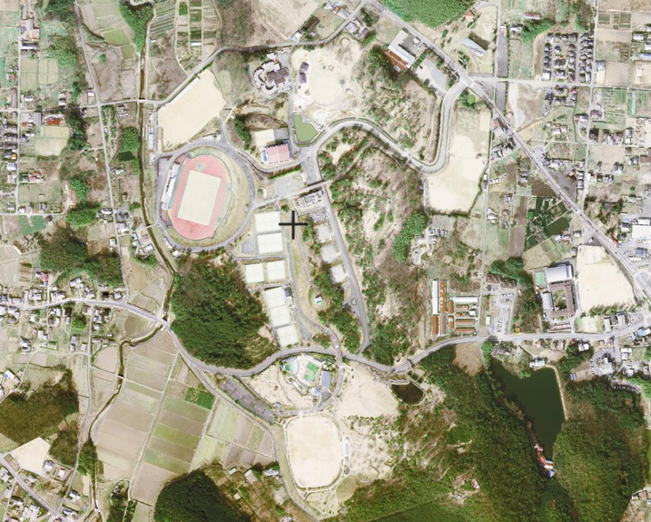
Parks, trails and playgrounds33




21 more on the map.
Restaurants and cafes99



curran coron
Cafe · 13.0 km
09:00+; We off
Open in Google Maps · https://www.instagram.com/curran_colon/

いちご農家のジェラートGoccia(ゴッチャ)
Restaurant · Ice Cream, ジェラート, Italian, カフェ · 12.1 km
87 more on the map.
History
The area of the modern town of Nantan was within ancient Tanba Province, and may have been the site of the provincial capital in the Nara period. During the Edo Period, Sonobe Domain was located within its borders. The town of Sonobe was established with the creation of the modern municipalities system on April 1, 1889. Sonobe merged with the neighboring towns of Hiyoshi, and Yagi (all from Funai District), and the town of Miyama (from Kitakuwada District) to form the city of Nantan on January 1, 2006.
From the History section of Nantan, Kyoto on Wikipedia, under CC BY-SA 4.0.
Where to stay43
Churches and places of worship69
Shopping19
Gas and EV charging24
Schools, colleges and libraries53
Healthcare14
Map of Nantan
250 places. The map loads OpenStreetMap tiles when you open it.
Getting there and nearby towns
Osaka Itami Airport (ITM) is the nearest airport with scheduled flights listed in OpenStreetMap, 37 km away.
- Arashiyama 20 km southeast, about 20 min by car
- Kyoto 26 km east, about 26 min by car
- Mukō 25 km southeast, about 25 min by car
- Tamba-Sasayama 25 km west, about 25 min by car
- Sasayama 25 km west, about 25 min by car
- Takatsuki 31 km south, about 31 min by car
- Ayabe 30 km northwest, about 30 min by car
- Minoh 32 km south, about 32 min by car
- Ibaraki 33 km south, about 33 min by car
- Kawanishi 33 km south, about 33 min by car
Drive times are estimates from straight-line distance, not routes.
Local news
Headlines from INDB.
Reviews, tips and questions
Loading what members have shared...
Sources and licences
- GeoNames (CC BY 4.0): population, coordinates, regions and time zone
- OpenStreetMap contributors (ODbL 1.0): places, airports, map data
- Wikidata (CC0 1.0): elevation, founding date, time zone, website, landmarks and historic places
- Wikimedia Commons (see each image): photos
- Wikipedia (CC BY-SA 4.0): overview and history text
Photo credits
- Nantan city hall, アラツク, CC BY-SA 4.0
- Nantan PA, アラツク, CC BY-SA 4.0
- Anaoji02s3872, 663highland, CC BY 2.5
- Kameoka Athletic Stadium, 国土地理院, CC BY 4.0
- Nantan General Hospital, アラツク, CC BY-SA 4.0
- Taji-jinja (Nantan) keidai, Saigen Jiro, CC0
- Atago-jinja (Kameoka city) honden, Saigen Jiro, CC0
- Makejinjya9004r, ja:User:Nnn, CC BY-SA 3.0
- Rakurakuso02s3200, 663highland, CC BY 2.5
- Ikimitenmangū keidai, Saigen Jiro, CC0
- 九手神社, といとい, CC BY-SA 4.0
- Gokurakuji temple, Tama-cyan, CC BY-SA 4.0
- Syuzan-jo 03, 京都新観光提言懇談会メンバー, CC BY-SA 4.0
- Onisaburo Deguchi Cave - overview, Kuroshiononeko, CC0
- Kameoka athletic park gymnasium, 運動会プロテインパワー, CC BY-SA 4.0
- Tanba Sports Park, 国土地理院, CC BY 4.0
- Sonobe 20220730105422 (52656375008), inunami, CC BY 2.0
- Sonobe 20220730105412 (52655886076), inunami, CC BY 2.0
- Sonobe 20220730105621 (52655885736), inunami, CC BY 2.0
- Sonobe 20220730104943 (52655886281), inunami, CC BY 2.0
- Sonobe 20220730110641 (52656165559), inunami, CC BY 2.0
- JRW 223-6000 Mori no Kyoto wrapping 20220730112614, inunami, CC BY 2.0
- Sonobe 20220730110327 (52655885601), inunami, CC BY 2.0
- Sonobe-exit, Takuwanbento1098, CC BY-SA 4.0
- Ikimi-Tenman-gû Shrine - Kôtai-Jingû, Yanajin33, CC BY-SA 3.0
- Ikimi-Tenman-gû Shrine - Komainu, Yanajin33, CC BY-SA 3.0
- Ikimi-Tenman-gû Shrine - Tomb of Shikibe Genzô, Yanajin33, CC BY-SA 3.0
- Ikimi-Tenman-gû Shrine - Sessha, Yanajin33, CC BY-SA 3.0
- Ikimi-Tenman-gû Shrine - Stone statue of a cattle, Yanajin33, CC BY-SA 3.0
- School face, Tacky2k, CC BY-SA 4.0
- 京都聖カタリナ写真, 矢野裕之, CC BY-SA 4.0
- Ikimi-Tenman-gû Shrine - Dai-Jôya-tô Tower, Yanajin33, CC BY-SA 3.0
- 「道の駅京都新光悦村」とは, 松田丹後, CC BY-SA 4.0
- Ikimi-Tenman-gû Shrine - Stone torii in front of the Haiden, Yanajin33, CC BY-SA 3.0
- Ikimi-Tenman-gû Shrine - Itsukushima-jinja Shintô Shrine, Yanajin33, CC BY-SA 3.0
- Le Temple Bouddhiste Kyôto-Taishakuten - Le mur de pierre, Yanajin33, CC BY-SA 3.0
- Le Temple Bouddhiste Kyôto-Taishakuten - Le beffroi "Shôrô", Yanajin33, CC BY-SA 3.0
- Le Temple Bouddhiste Kyôto-Taishakuten - Les pierres "Koishi-musubi", Yanajin33, CC BY-SA 3.0
- Le Temple Bouddhiste Kyôto-Taishakuten - Les empreintes de pied du Bouddha, Yanajin33, CC BY-SA 3.0
- Le Temple Bouddhiste Kyôto-Taishakuten - Le bâtiment principal "Hon-dô", Yanajin33, CC BY-SA 3.0


Page built November 5, 2026. Spotted a mistake? Tell us or suggest a place.