


Nisshin, Japan
日進市
Nisshin is a town of 91,795 people in Aichi, Japan, founded in October 1, 1994.
Why visit Nisshin
Townapedia lists 40 museums and landmarks, 172 parks and trails, 180 places to eat, 1 place to stay and 17 attractions in and around town.
Highlights include Aichi Gakuin University, Aichi Institute of Technology, Toyota Automobile Museum and Araki Syuseikan Museum.
Weather in Nisshin
Forecast from MET Norway (CC BY 4.0). Full forecast
About Nisshin
Nisshin (日進市, Nisshin-shi) is a city in Aichi Prefecture, Japan. As of 1 October 2019, the city had an estimated population of 91,795 in 37,398 households, and a population density of 2,629 persons per km2. The total area of the city was 34.91 square kilometres (13.48 sq mi).
From the Wikipedia article Nisshin, Aichi (this version), under CC BY-SA 4.0.
Things to do17

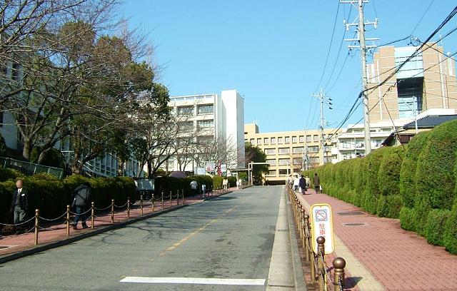
Aichi Gakuin University
School · 2.8 km
Higher education institution in Aichi Prefecture, Japan

Aichi Institute of Technology
School · 7.5 km
Higher education institution in Aichi Prefecture, Japan

Aichi Medical University
School · 6.3 km
Higher education institution in Aichi Prefecture, Japan

Aichi Prefectural University
School · 5.9 km
Higher education institution in Aichi Prefecture, Japan

Aichi Prefectural University of Fine Arts and Music
School · 4.0 km
Higher education institution in Aichi Prefecture, Japan


Higashiyama Sky Tower
Monument and historic site · 7.0 km
Building in Nagoya, Aichi Prefecture, Japan

Japanese Red Cross Toyota College of Nursing
School · 7.2 km
Higher education institution in Aichi Prefecture, Japan
Meijo University
School · 6.9 km
Higher education institution in Gifu Prefecture, Japan


Nagoya University of Commerce & Business
School · 5.5 km
Japanese business school
5 more on the map.
Museums and landmarks40





28 more on the map.
Parks, trails and playgrounds172


Higashiyama Zoo and Botanical Gardens
Park · 7.2 km
Municipal zoo and botanical garden in Chikusa-ku, Nagoya





160 more on the map.
Restaurants and cafes180


MOUNT EVEREST
Restaurant · Curry · 2.9 km
瀬戸大府東海線, 東郷町
11:00-15:00 "Lunch"; 17:00-22:00 "Dinner"
168 more on the map.
Where to stay1
Churches and places of worship19
Shopping40
Gas and EV charging9
Schools, colleges and libraries51
Healthcare54
Map of Nisshin
250 places. The map loads OpenStreetMap tiles when you open it.
Getting there and nearby towns
Nagoya Airfield (NKM) is the nearest airport with scheduled flights listed in OpenStreetMap, 18 km away.
- Owariasahi 8 km north, about 8 min by car
- Toyota 11 km southeast, about 11 min by car
- Seto 12 km north, about 12 min by car
- Nagoya 14 km west, about 14 min by car
- Chiryū 15 km south, about 15 min by car
- Ōbu 16 km southwest, about 16 min by car
- Kariya 18 km south, about 18 min by car
- Anjō 20 km south, about 20 min by car
- Kitanagoya 20 km northwest, about 20 min by car
- Komaki 20 km northwest, about 20 min by car
Drive times are estimates from straight-line distance, not routes.
Local news
Headlines from INDB.
Reviews, tips and questions
Loading what members have shared...
Sources and licences
- GeoNames (CC BY 4.0): population, coordinates, regions and time zone
- OpenStreetMap contributors (ODbL 1.0): places, airports, map data
- Wikidata (CC0 1.0): elevation, founding date, time zone, website, landmarks and historic places
- Wikimedia Commons (see each image): photos
- Wikipedia (CC BY-SA 4.0): overview and history text
Photo credits
- Hataori-ike Pond (2), Nagatsuka Fujishima-cho Nisshin City 2024, Tomio344456, CC0
- Hataori-ike Pond (1), Nagatsuka Fujishima-cho Nisshin City 2024, Tomio344456, CC0
- Nisshin Ontake-san, Hosousu, CC BY 4.0
- Nisshin city office, アラツク, CC BY-SA 4.0
- Aichi Institute of Technology - panoramio (4), K.Masa, CC BY-SA 3.0
- Aichi Medical University - 深志, The original uploader was 深志 at Japanese Wikipedia ., CC BY-SA 3.0
- Aichi Toho University L building ac (2), Asturio Cantabrio, CC BY-SA 4.0
- Chukyo University 4057498467 f2a1041450, Emran Kassim from Nagoya, Aichi, Japan, CC BY 2.0
- Higashiyama Sky Tower - 01, JKT-c, CC BY 3.0
- Meijou daigaku Tempaku campus, The original uploader was Gnsin at Japanese Wikipedia ., CC BY-SA 3.0
- Nagoya University dk4591, DrKssn, CC BY-SA 3.0
- Araki Shuseikan 20151107, 円周率3パーセント, CC BY-SA 4.0
- Heiwakouen, Bariston, CC BY-SA 3.0
- Higashiyama Zoo and Botanical Gardens Aerial, outside, CC BY-SA 3.0
- Nagoya Agricultural Center05, KAMUI, CC BY-SA 3.0
- Nagoya University of Foreign Studies, Keroobean, CC0
- AICHIGAKUIN Univ.MEIJO-KOEN, Sanoth24, CC BY-SA 4.0
- Aichi Prefectural University of Fine Arts and Music 150713, Umako, CC0
- Iwasaki Castle01, Captain76, Public domain
- Aichi Shukutoku University, AS-terrace, CC BY-SA 4.0
- Toyota Automobile Museum entrance 2013 September, Morio, CC BY-SA 3.0
- Miyoshi City Kurozasa Elementary School (2016.11.23), Edotih Yno, CC BY-SA 4.0
- Maspro Art Museum (Nissin city. 2016.02.21), Edotih Yno, CC BY-SA 4.0
- Nagoya Memorial Hospital, アラツク, CC BY-SA 4.0
- 名都美術館, 深志, CC BY-SA 3.0
- 杁ヶ池, Akusiroyo, CC BY-SA 4.0
- National Hospital Organization Higashi Nagoya National Hospital, Waka77, Public domain
- Shiratori Shrine, Togo, 運動会プロテインパワー, CC BY-SA 4.0
- Nagakute Historical Museum-01, KAMUI, CC BY-SA 3.0
- Renkyoji3, Bariston, CC BY-SA 4.0
- Old Ichikawa House ac (3), Asturio Cantabrio, CC BY-SA 4.0
- Hakusangu, 良人, CC BY-SA 4.0
- 名古屋市名東区 20241229 1108-2, 円周率3パーセント, CC BY-SA 4.0
- Iwasakijou3, Bariston, CC BY-SA 4.0
- 名古屋商科大学, Yamada takuo, CC BY 4.0
- Distant View of Japanese Red Cross Toyota College of Nursing, Hakusan-cho Toyota 2019, Tomio344456, CC BY-SA 4.0
- Aichi Kourogi Sports Park, 運動会プロテインパワー, CC BY-SA 4.0
- 愛知淑徳大学, Aichi Shukutoku University, CC BY-SA 3.0
- Toyota Automobile Museum 2013 September, Morio, CC BY-SA 3.0
- Nagoya gakugei daigaku, The original uploader was 深志 at Japanese Wikipedia ., CC BY-SA 3.0
- Nagoya City Meito High School 20151012, 円周率3パーセント, CC BY-SA 4.0
- Chinoike Park, 立花左近, CC BY-SA 3.0
- Makinogaike Ryokuchi Entrance, Umemorizaka Takabari Itaka-cho Meito Ward Nagoya 2021, Tomio344456, CC BY-SA 4.0
- PRIMETREE AKAIKE, Minote Akaike-cho Nisshin City 2023, Tomio344456, CC BY-SA 4.0
- Itaka forest sekobou, リニモ1号, CC BY-SA 4.0
- Orido Hachiman Sha 20171209-24, 円周率3パーセント, CC BY-SA 4.0


Page built November 4, 2026. Spotted a mistake? Tell us or suggest a place.