
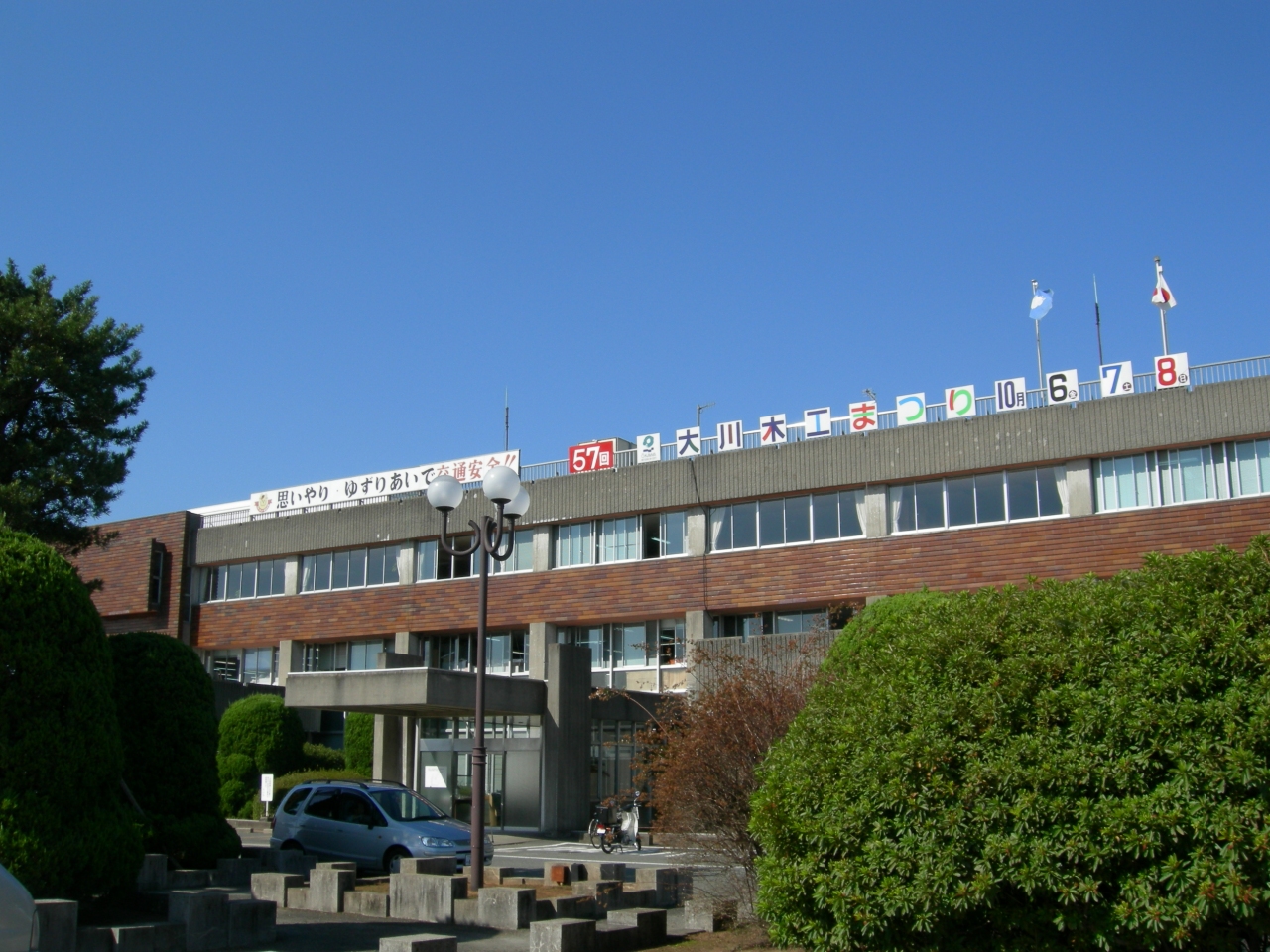


Ōkawa, Japan
大川市
Ōkawa is a town of 39,223 people in Fukuoka, Japan, founded in April 1, 1954.
Why visit Ōkawa
Townapedia lists 58 museums and landmarks, 16 parks and trails, 70 places to eat and 5 attractions in and around town.
Highlights include Chikugo River Lift Bridge, Former Mietsu Naval Dock, Sano Tsunetami and the Mietsu Naval Dock History Museum and Yuyunomori Park.
Weather in Ōkawa
Forecast from MET Norway (CC BY 4.0). Full forecast
About Ōkawa
Ōkawa (大川市, Ōkawa-shi; Japanese pronunciation: [ó̞ò̞.kä̀.β̞ä̀, ò̞ó̞.kä́.β̞ä́.ɕì, ó̞ó̞.kä́.β̞ä́-]) is a city located in Fukuoka Prefecture, Japan. As of 1 February 2024, the city had an estimated population of 31,605 in 13984 households, and a population density of 940 persons per km². The total area of the city is 33.62 km2 (12.98 sq mi).
From the Wikipedia article Ōkawa, Fukuoka (this version), under CC BY-SA 4.0.
Things to do5


Museums and landmarks58



Chinese Poem Monument of Army General Maresuke Nogi
Monument and historic site · 5.1 km
46 more on the map.
Parks, trails and playgrounds16



4 more on the map.
Restaurants and cafes70




58 more on the map.
History
The area of Ōkawa was part of ancient Chikugo Province. During the Edo Period the area was divided between of Kurume Domain and Yanagawa Domain. After the Meiji restoration, the town of Ōkawa was established on May 1, 1889 with the creation of the modern municipalities system. It was the location of a dike constructed by Dutch engineer Johannis de Rijke in 1890. It annexed the neighboring villages of Kawaguchi, Onojima, Taguchi, Mimata, and Kimuro on April 1, 1955 and was raised to city status.
From the History section of Ōkawa, Fukuoka on Wikipedia, under CC BY-SA 4.0.
Churches and places of worship81
Shopping18
Gas and EV charging5
Schools, colleges and libraries37
Municipal Fuyo Combined Elementary and Junior High School
School · 5.0 km
Healthcare25
Map of Ōkawa
250 places. The map loads OpenStreetMap tiles when you open it.
Getting there and nearby towns
Saga Airport (Kyushu Saga International Airport) (HSG) is the nearest airport with scheduled flights listed in OpenStreetMap, 9 km away.
- Yanagawa 5 km southeast, about 5 min by car
- Setakamachi-takayanagi 11 km southeast, about 11 min by car
- Kurume 18 km northeast, about 18 min by car
- Ōmuta 20 km south, about 20 min by car
- Tachiarai 31 km northeast, about 31 min by car
- Chikushino-shi 35 km north, about 35 min by car
- Kasuga 36 km north, about 36 min by car
- Ōnojō 38 km north, about 38 min by car
- Umi 42 km north, about 42 min by car
- Fukuoka 44 km north, about 44 min by car
Drive times are estimates from straight-line distance, not routes.
Local news
Headlines from INDB.
Reviews, tips and questions
Loading what members have shared...
Sources and licences
- GeoNames (CC BY 4.0): population, coordinates, regions and time zone
- OpenStreetMap contributors (ODbL 1.0): places, airports, map data
- Wikidata (CC0 1.0): elevation, founding date, time zone, website, landmarks and historic places
- Wikimedia Commons (see each image): photos
- Wikipedia (CC BY-SA 4.0): overview and history text
Photo credits
- Okawa-cityoffice, みんと at Japanese Wikipedia, Public domain
- Chikugo River Lift Bridge UP 20110914, Rsa, CC BY-SA 3.0
- Mietsu Naval Dock view south, Pekachu, CC BY-SA 4.0
- Ryōsei-ji, Gpwitteveen, CC BY-SA 3.0
- Morodomicho Community Center, Peka, CC BY-SA 4.0
- Sano Tsunetami Memorial Museum, STA3816, CC BY-SA 4.0
- Saga line tikugoyanagawa station, Own work, CC BY-SA 3.0
- Yamaguchi Family's House Saga roof close up, Pekachu, CC BY-SA 4.0
- Ryosei-ji Yanagawa ac (1), Asturio Cantabrio, CC BY-SA 4.0
- Fukuoka Okawa Junior High School, hyolee2, CC BY-SA 4.0
- Okawa Elementary School and Okawatoei Junior High School, hyolee2, CC BY-SA 4.0
- Fuyo combined elementary and junior high school in Saga 2018, Peka, CC BY-SA 4.0
- Saga Nakakawasoe Elementary School, hyolee2, CC BY-SA 4.0
- Saga Odakuma Elementary School, hyolee2, CC BY-SA 4.0
- Saga Morodomikita Elementary School, hyolee2, CC BY-SA 4.0
- Saga Morodomiminami Elementary School, hyolee2, CC BY-SA 4.0
- Saga Morodomi Junior High School, hyolee2, CC BY-SA 4.0
- Woodworks and street of Enokizu, Okawa, Peka, CC BY-SA 4.0
- Kobo Hachiman Shrine, Peka, CC BY-SA 4.0
- Takahashi Family's Residence 01, Peka, CC BY-SA 4.0
- Yoshihara Yoshiro Family's Residence, Peka, CC BY-SA 4.0
- Takahashi Family's Residence 02, Peka, CC BY-SA 4.0
- Headquarters and store of Shikikamaboko, Peka, CC BY-SA 4.0
- 旧吉原家住宅その3 - panoramio, sk01, CC BY-SA 3.0
- 旧吉原家住宅その2 - panoramio, sk01, CC BY-SA 3.0
- 旧吉原家住宅その1 - panoramio, sk01, CC BY-SA 3.0
- KAGUHAUS in Okawa, Fukuoka, Peka, CC BY-SA 4.0
- 筑後大川駅跡地 - panoramio, Yobito KAYANUMA, CC BY-SA 3.0
- Okawa-chuo Interchange entrance, Peka, CC BY-SA 4.0
- 佐賀線跡 - panoramio, Yobito KAYANUMA, CC BY-SA 3.0
- Fukuoka Prefectural Road 767 in Mukaijima, Peka, CC BY-SA 4.0
- Pond of Okawa Park in Okawa, Fukuoka, Peka, CC BY-SA 4.0
- Hanamune River, Hanamune-Ohashi in Okawa, Peka, CC BY-SA 4.0
- Furogu Shirasaginokusu 02, Peka, CC BY-SA 4.0
- Furogu Shirasaginokusu 01, Peka, CC BY-SA 4.0
- Furogu five-storied stone pagoda, Peka, CC BY-SA 4.0
- Furogu Honden, Peka, CC BY-SA 4.0
- Chikugo Wakatsu Station Ruins, Rsa, CC BY-SA 3.0
- Ariake-Engan Okawa Overpass Bridge in Hataho, Peka, CC BY-SA 4.0
- Chikugo-Wakatsu Station Monumente 20110914, Rsa, CC BY-SA 3.0


Page built November 4, 2026. Spotted a mistake? Tell us or suggest a place.