


Sekimachi-minami, Japan
関町南
Sekimachi-minami is a town of 16,504 people in Tokyo, Japan.
Why visit Sekimachi-minami
Townapedia lists 22 museums and landmarks, 116 parks and trails, 222 places to eat, 2 places to stay and 7 attractions in and around town.
Highlights include Seikei University, Tokyo Woman's Christian University, Ghibli Museum and NTT History Center of Technologies.
Weather in Sekimachi-minami
Forecast from MET Norway (CC BY 4.0). Full forecast
About Sekimachi-minami
Sekimachi-Minami (関町南) is a neighborhood of Nerima Ward in Tokyo, Japan. The residential address system has been implemented since June 1, 1984, and the current administrative names go from Sekmachi-Minami 1st Street to 4th Street (丁目, chōme).
From the Wikipedia article Sekimachi-Minami (this version), under CC BY-SA 4.0.
Things to do7

Seikei University
School · 1.3 km
Private university centered in Tokyo, Japan


Japan Women's College of Physical Education
School · 5.0 km
Organization

Kichijoji Plaza
Cinema and theater · 1.6 km
19, 武蔵野市

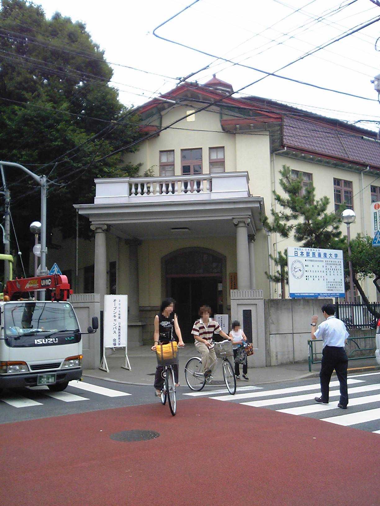
Nippon Veterinary and Life Science University
School · 3.8 km
Private university in Tokyo
Museums and landmarks22




Shitanoya Site
Monument and historic site · 1.8 km
Archaeological site in Tokyo, Japan


Japanese-style gate of Koyata Iwasaki's Kamakura villa
Monument and historic site · 1.0 km
10 more on the map.
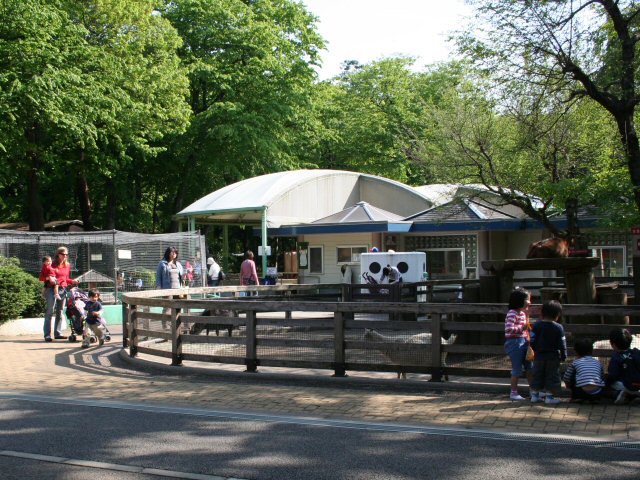
Parks, trails and playgrounds116


DyDo Drinco Ice Arena
Sports field and stadium · 1.6 km
25, 西東京市





104 more on the map.
Restaurants and cafes222



Crayon House
Restaurant · Japanese, Asian · 1.7 km
有機食材を95%以上使用した和食中心のオーガニック・ビュッフェ。ヴィーガンやベジタリアン対応メニューが毎日あり、毎月10日・20日・30日はグルテンフリーデーです。
6, 武蔵野市
Mo-Su 11:00-21:00


Yakiniku King
Restaurant · Barbecue · 1.2 km
3, 練馬区
Mo-Fr 11:00-15:00, 17:00-23:00; Sa,Su,PH 11:00-23:00
210 more on the map.
Where to stay2
Churches and places of worship31
Shopping67
Gas and EV charging6
Schools, colleges and libraries52
Healthcare56
Map of Sekimachi-minami
250 places. The map loads OpenStreetMap tiles when you open it.
Getting there and nearby towns
Yokota Air Base (OKO) is the nearest airport with scheduled flights listed in OpenStreetMap, 21 km away.
- Kichijōji-honchō 2 km south, about 2 min by car
- Musashino 3 km southwest, about 3 min by car
- Nishi-Tokyo-shi 4 km west, about 4 min by car
- Ōizumimachi 5 km north, about 5 min by car
- Asagaya-minami 6 km southeast, about 6 min by car
- Koganei 7 km west, about 7 min by car
- Higashikurume 7 km northwest, about 7 min by car
- Nakano 8 km east, about 8 min by car
- Kodaira 9 km west, about 9 min by car
- Tokyo 11 km east, about 11 min by car
Drive times are estimates from straight-line distance, not routes.
Local news
Headlines from INDB.
Reviews, tips and questions
Loading what members have shared...
Sources and licences
- GeoNames (CC BY 4.0): population, coordinates, regions and time zone
- OpenStreetMap contributors (ODbL 1.0): places, airports, map data
- Wikidata (CC0 1.0): elevation, founding date, time zone, website, landmarks and historic places
- Wikimedia Commons (see each image): photos
- Wikipedia (CC BY-SA 4.0): overview and history text
Photo credits
- Seikei Gakuen Main Building, Kakidai, CC BY-SA 4.0
- TWCU Main Building2023, Charlie fong, CC BY-SA 4.0
- Asia-University-Japan, The original uploader was Itasan at Japanese Wikipedia ., CC BY-SA 3.0
- Nihonjyoshitaiikuuniv, Original uploader was Hykw-a4 at ja.wikipedia, CC BY-SA 3.0
- Ariake Campus, Musashino University, Kakidai, CC BY-SA 4.0
- Jyuuitikusanuniv, The original uploader was Hykw-a4 at Japanese Wikipedia ., CC BY-SA 3.0
- Suginami kaikan suginami animation museum 2009, Kamemaru2000, CC BY-SA 3.0
- Zenpukuji-ike -5月 a, koji_h, CC BY-SA 3.0
- Cherry blossoms at Inokashira Park, Fizzerfung, CC BY-SA 4.0
- Inokasira-sizen-bunkaen, No machine-readable author provided. Kazubon~commonswiki assumed (based on copyright claims)., Public domain
- Makino Memorial Garden entrance 2013-11-24, Asanagi, CC0
- 武蔵関公園「富士見池」(中之橋から北東ボート乗り場方面)練馬区, Guy-aan, CC BY-SA 4.0
- 2019 Otaguro garden in autumn 4, Kakidai, CC BY-SA 4.0
- Nerima Syakujii park sampoji pond, Ribbon, CC BY-SA 3.0
- Takaido Park Fujimigaoka Entrance, Mzaki, CC BY-SA 4.0
- Tekigaisou̠2016, N1229, CC BY-SA 4.0
- Shimonoya iseki park, 妖精書士, CC0
- DydoDrinkCoIceArena, Rsa, CC BY-SA 3.0
- Igusa hachimangu entrance, Kamemaru2000, CC BY-SA 3.0
- Ichikishima Shrine - Zenpukuji Park - Suginami, Tokyo - DSC01791, Daderot, CC0
- Igusa High School, Abasaa, Public domain
- Shakujii High School, Abasaa, Public domain
- Tokyu Kichijoji 201410, ITA-ATU, CC BY-SA 4.0
- NTT History Center of Technologies, ITA-ATU, CC BY-SA 4.0
- Honryuji sekimachikita nerima 2014, Kentin, CC BY-SA 4.0
- Renjo-ji (Musashino), Abasaa, Public domain
- Zenpukuji temple suginami tokyo 2009, User:Kentin, CC BY-SA 3.0
- Chifuku-ji (Nerima), Abasaa, Public domain
- Hoyu-ji (Nerima), Abasaa, Public domain
- Musashino Hachiman-gū (Musashino) 01, Higa4, CC0
- Gessō-ji (Musashino) 01, Higa4, CC0
- Kōsen-ji (Musashino) 01, Higa4, CC0
- An'yō-ji (Musashino) 02, Higa4, CC0
- CREATE SDS Nerima-sekimachi-minami, ITA-ATU, CC BY-SA 3.0
- 東急百貨店 吉祥寺店 - panoramio, 運転太郎, CC BY 3.0
- Igusa Hachiman-gu north torii gate (2) 2026-05-10, Asanagi, CC0
- Tokyo Metropolitan Institute Suginami Technical High School, Abasaa, Public domain
- Globeat Japan headquarters 2024-04-14, Asanagi, CC0
- 吉祥寺プラザ, Bject, CC BY-SA 4.0
- 下野谷遺跡, 下里の王子さま, CC BY-SA 4.0
- Ghibli Museum, Mitaka - panoramio, Tomi Mäkitalo, CC BY-SA 3.0


Page built November 5, 2026. Spotted a mistake? Tell us or suggest a place.