


Kodaira, Japan
小平市
Kodaira is a town of 198,739 people in Tokyo, Japan, founded in April 1, 1889.
Why visit Kodaira
Townapedia lists 40 museums and landmarks, 141 parks and trails, 174 places to eat, 1 place to stay and 22 attractions in and around town.
Highlights include ルネこだいら, Asia University, 鈴木遺跡 and Edo-Tokyo Open Air Architectural Museum.
Weather in Kodaira
Forecast from MET Norway (CC BY 4.0). Full forecast
About Kodaira
Kodaira (小平市, Kodaira-shi) is a city located in the western portion of the Tokyo Metropolis, Japan. As of 1 April 2021, the city had an estimated population of 195,207 in 93,654 households, and a population density of 9500 persons per km2. The total area of the city was 20.51 square kilometres (7.92 sq mi).
From the Wikipedia article Kodaira, Tokyo (this version), under CC BY-SA 4.0.
Travel tips from other travellers: Kodaira on Wikivoyage (CC BY-SA 4.0).
Things to do22


Hitotsubashi University
School · 5.1 km
National university in Kunitachi, Tokyo, Japan

International Christian University
School · 5.9 km
University in Tokyo
Japan College of Social Work
School · 4.9 km
Private university in Tokyo, Japan

Japan Lutheran College
School · 6.2 km
Private university in Tokyo, Japan

Kunitachi College of Music
School · 6.7 km
Private University in Tokyo

Meiji Pharmaceutical University
School · 6.5 km
Private university in Kiyose, Tokyo, Japan

Musashino Art University
School · 3.4 km
University in Kodaira, western Tokyo

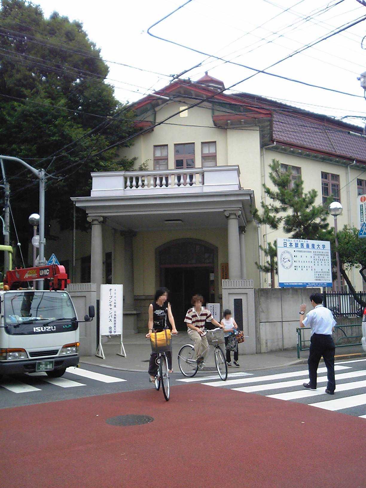
Nippon Veterinary and Life Science University
School · 6.2 km
Private university in Tokyo

Seibu-en
Monument and historic site · 6.1 km
Amusement park in Tokorozawa, Japan
10 more on the map.
Museums and landmarks40


Kodaira Hirakushi Denchu Art Museum
Museum · 1.2 km
Art museum in Tokyo, Japan

National Institute of Polar Research
Museum · 7.0 km
Japanese research institute for Antarctica

Shitanoya Site
Monument and historic site · 6.9 km
Archaeological site in Tokyo, Japan
Suzuki Site
Monument and historic site · 1.3 km
Archaeological site in Kodaira, Japan


28 more on the map.
Parks, trails and playgrounds141


Higashikurumeshi Chikurin Park
Park · 5.4 km
Park in Higashikurume, Japan





129 more on the map.
Restaurants and cafes174




一龍 小平新館
Restaurant · Japanese · 0.6 km
39, 小平市
Tu-Sa 11:30-14:00,17:00-21:30; Su,PH 11:30-14:00,17:00-21:00; Mo off
みんなの酒場 らんらん
Restaurant · Oriental · 2.6 km
栄町1-11-60
We-Su 17:00-22:00
162 more on the map.
History
The area of present-day Kodaira was part of ancient Musashi Province, but was a largely unpopulated area under the opening of the Tamagawa Aqueduct in the Edo period made agriculture possible. In the post-Meiji Restoration cadastral reform of July 22, 1878, the area became part of Kitatama District in Kanagawa Prefecture. The village of Kodaira was created on April 1, 1889, with the establishment of the modern municipalities system. Kitatama District was transferred to the administrative control of Tokyo Metropolis on April 1, 1893. The population of the area expanded after the 1923 Great Kantō earthquake with the relocation of universities and housing areas from central Tokyo. Kodaira was elevated to town status in 1944 and to city status on October 1, 1962.
From the History section of Kodaira, Tokyo on Wikipedia, under CC BY-SA 4.0.
Where to stay1
Churches and places of worship31
Shopping54
Gas and EV charging8
Schools, colleges and libraries68
Healthcare59
Map of Kodaira
250 places. The map loads OpenStreetMap tiles when you open it.
Getting there and nearby towns
Yokota Air Base (OKO) is the nearest airport with scheduled flights listed in OpenStreetMap, 12 km away.
- Kokubunji 3 km south, about 3 min by car
- Higashimurayama 4 km northwest, about 4 min by car
- Higashikurume 4 km northeast, about 4 min by car
- Nishi-Tokyo-shi 5 km east, about 5 min by car
- Fuchū 6 km south, about 6 min by car
- Tachikawa 6 km west, about 6 min by car
- Musashino 7 km east, about 7 min by car
- Tokorozawa 8 km north, about 8 min by car
- Akishima 10 km west, about 10 min by car
- Niiza 12 km northeast, about 12 min by car
Drive times are estimates from straight-line distance, not routes.
Local news
Headlines from INDB.
Reviews, tips and questions
Loading what members have shared...
Sources and licences
- GeoNames (CC BY 4.0): population, coordinates, regions and time zone
- OpenStreetMap contributors (ODbL 1.0): places, airports, map data
- Wikidata (CC0 1.0): elevation, founding date, time zone, website, landmarks and historic places
- Wikimedia Commons (see each image): photos
- Wikipedia (CC BY-SA 4.0): overview and history text
Photo credits
- Kodaira City Hall, ja:user:Hykw-a4, CC BY-SA 3.0
- Runekodaira, Hiroaki Arai, CC BY-SA 4.0
- L Minimart, Kodaira-Nakamachi, 2026-05-30, 山田晴通, CC BY-SA 4.0
- JREast-Musashino-line-JM32-Shin-kodaira-station-platform-20240113-104944, LERK, CC BY-SA 4.0
- JREast-Musashino-line-Shin-kodaira-station-platform, LERK, CC BY 3.0
- Plaque at the Aiki-koen park, Kodaira, Tokyo, Japan, commemorating Yukiyoshi Sagawa 2025-04-18, 山田晴通, CC0
- Asia-University-Japan, The original uploader was Itasan at Japanese Wikipedia ., CC BY-SA 3.0
- Kanematsu auditorium, Wiiii, CC BY-SA 3.0
- ルーテル学院チャペル外観, ルーテル学院大学, CC BY-SA 3.0
- Kunitachiondai2, The original uploader was Hykw-a4 at Japanese Wikipedia ., CC BY-SA 3.0
- Meiji Pharmaceutical University, Nyao148, CC BY-SA 3.0
- Musashino Art University, The original uploader was Hykw-a4 at Japanese Wikipedia ., CC BY-SA 3.0
- Ariake Campus, Musashino University, Kakidai, CC BY-SA 4.0
- Jyuuitikusanuniv, The original uploader was Hykw-a4 at Japanese Wikipedia ., CC BY-SA 3.0
- Seibuen Amusement Park (11152952796), Tomohiro Ohtake from Kawasaki, Japan, CC BY 2.0
- Entrance of the Edo-Tokyo Open Air Architectural Museum, Fumiya Fujihara, CC BY 2.0
- National Institute of Japanese Literature, Tamago915 ( talk ), CC BY-SA 3.0
- Shimonoya iseki park, 妖精書士, CC0
- Fuchunomorikoen, っ, CC BY-SA 3.0
- Chikurin Park in Higashikurume-shi (50547377101), Mikhail Kotykhov from Tokyo, Japan, CC BY 2.0
- Koganei-Park, Itasan, CC BY 3.0
- Musashinonomori Park 2, っ, CC BY-SA 3.0
- Tonogayato1, Irina Gelbukh, CC BY-SA 3.0
- Kodaira Hirakushi Denchu Art Museum front, Calton, CC BY-SA 4.0
- Suzuki Remains Museum, Nyao148, CC BY-SA 3.0
- GAS MUSEUM (Kodaira) 02, Suikotei, CC BY-SA 4.0
- De Lalande's Residence, 立花左近, CC BY-SA 3.0
- Showa General Hospital, Abasaa, Public domain
- Shou-hondo, S.adnoH, CC BY-SA 4.0
- House-Kunio-Maekawa-03, Rs1421, CC BY-SA 3.0
- Inari Jinja (Onumacho, Kodaira), Abasaa, Public domain
- Inari Jinja (Josuihoncho, Kodaira), Abasaa, Public domain
- Musashino Jinja, Abasaa, Public domain
- House-of-Koide, Rs1421, CC BY-SA 3.0
- Daisen-ji (Kodaira), Abasaa, Public domain
- Heian-in, Kodaira 202409-1, 運動会プロテインパワー, CC BY-SA 4.0
- Emmei-ji (Kodaira), Abasaa, Public domain
- Enjo-in (Kodaira), Abasaa, Public domain
- Hoju-in (Kodaira), Abasaa, Public domain
- Itoen Kagurazaka building, Mochizuki1018, CC BY 4.0
- Kodaira first jr.high, 路側帯, Public domain
- Fureai Sewerage Museum, photo: Qurren ( talk ) Taken with Canon PowerShot G9 X, CC BY-SA 4.0
- Hachikokuyama Taiken no Sato 2023-09-10, Asanagi, CC0


Page built November 4, 2026. Spotted a mistake? Tell us or suggest a place.