
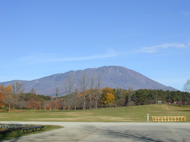


Shizukuishi, Japan
雫石町
Shizukuishi is a town of 16,263 people in Iwate, Japan, founded in April 1, 1889.
Why visit Shizukuishi
Townapedia lists 24 museums and landmarks, 156 parks and trails, 164 places to eat, 23 places to stay and 51 attractions in and around town.
Highlights include Iwate Medical University, Iwate Prefectural University, Iwate Museum of Art and Yubunezawa Stone Circle.
Weather in Shizukuishi
Forecast from MET Norway (CC BY 4.0). Full forecast
About Shizukuishi
Shizukuishi (雫石町, Shizukuishi-chō) is a town located in Iwate Prefecture, Japan. As of 31 March 2020, the town had an estimated population of 16,263 in 6354 households, and a population density of 27 persons per km2. The total area of the town is 608.82 square kilometres (235.07 sq mi).
From the Wikipedia article Shizukuishi (this version), under CC BY-SA 4.0.
Things to do51

Iwate Medical University
School · 14.3 km
Higher education institution in Iwate Prefecture, Japan

Iwate Prefectural University
School · 17.7 km
Higher education institution in Iwate Prefecture, Japan






39 more on the map.
Museums and landmarks24


Yubunezawa Stone Circle
Monument and historic site · 13.7 km
Archaeological site in Takizawa, Iwate, Japan






12 more on the map.
Parks, trails and playgrounds156
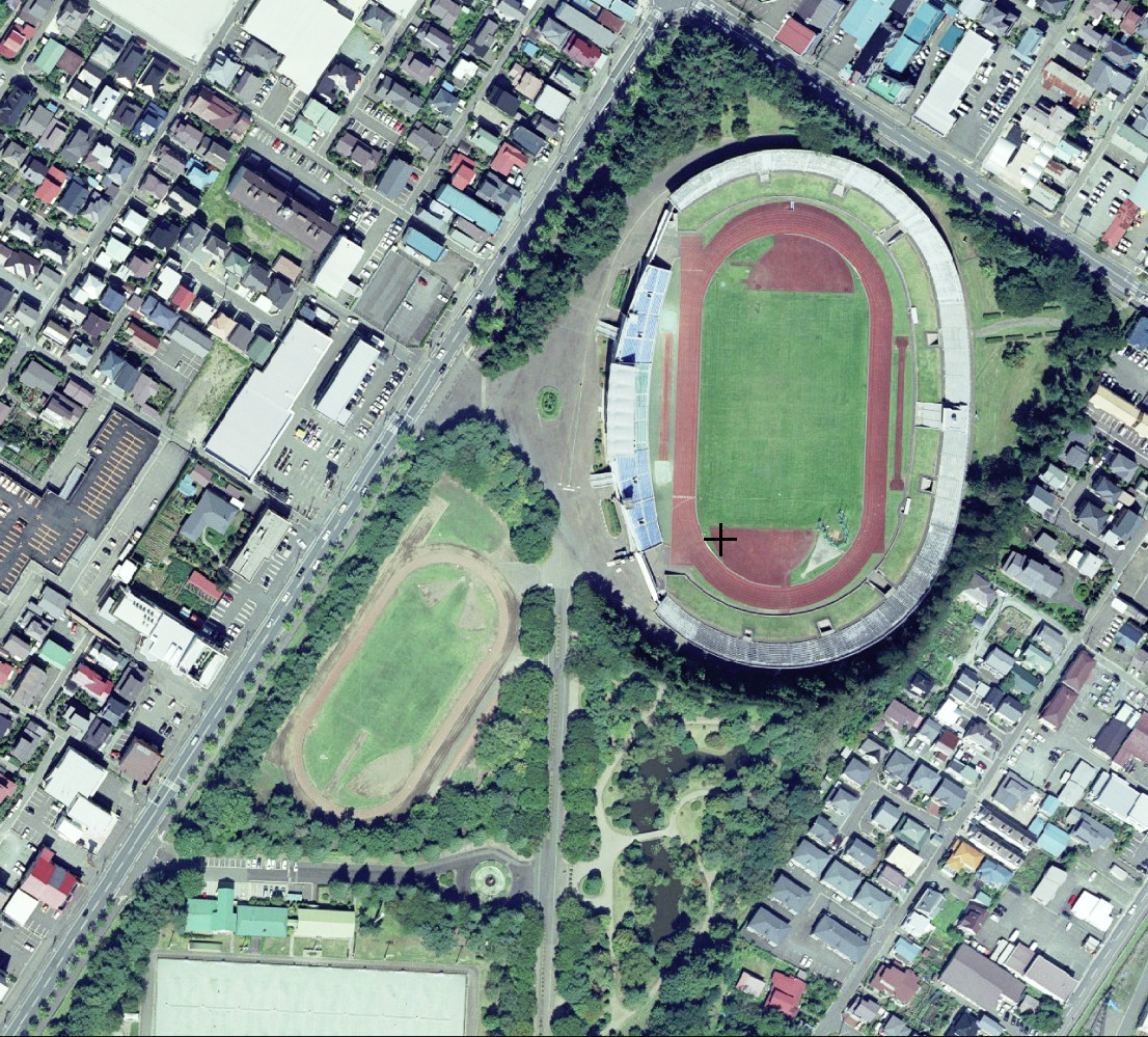
Iwate Morioka Stadium
Park · 12.7 km
Multi-use stadium in Morioka, Iwate, Japan





青山児童公園
Park · 11.8 km
参考URL http://www.city.morioka.iwate.jp/_res/projects/default_project/_page_/001/010/489/gaiku_zidou.pdf
4-1
世界アルペン記念公園
Park · 0.7 km
1993年、雫石町で開催された世界アルペンを記念して作られた公園です。 雫石町のイベントなどもここで開催されます。
144 more on the map.
Restaurants and cafes164



Restaurant Alyeska
Restaurant · Japanese · 10.8 km
Mo-Su 10:30-14:30
炭火焼BBQレストラン
Restaurant · 6.9 km
屋外でバーベキューをしたい人向けのレストラン。
11:00-15:00 open "季節により変動"
152 more on the map.
History
The area of present-day Shizukuishi has been inhabited since the earliest times. Archaeologists have found remains dating to the Japanese Paleolithic period. The area come under the control of the imperial dynasty during the early Heian period under the campaigns of Sakanoue no Tamuramaro, and was part of ancient Mutsu Province. The area was a battlefield during the Former Nine Years War and the Gosannen War. It eventually came under the control of the Nambu clan, who ruled from Morioka Domain under the Edo period Tokugawa shogunate.
In the Meiji period, the villages of Shizukuishi, Gosho, Nishiyama and Omyojin within Minami-Iwate District were created on April 1, 1889, with the establishment of the modern municipalities system. Kita-Iwate District and Minami-Iwate Districts merged to form Iwate District on March 29, 1896. Shizukuishi was raised to town status on December 23, 1940. On April 1, 1955, Shizukuishi merged with Gosho, Nishiyama and Omyojin, but lost a portion of its territory in a border adjustment with Morioka City on October 1 of the same year. The All Nippon Airways Flight 58 accident occurred over Shizukuishi on July 30, 1971.
From the History section of Shizukuishi on Wikipedia, under CC BY-SA 4.0.
Where to stay23
Churches and places of worship17
Shopping42
Gas and EV charging11
Schools, colleges and libraries49
Healthcare22
Map of Shizukuishi
250 places. The map loads OpenStreetMap tiles when you open it.
Getting there and nearby towns
Hanamaki Airport (HNA) is the nearest airport with scheduled flights listed in OpenStreetMap, 32 km away.
- Morioka 14 km east, about 14 min by car
- Semboku 20 km west, about 20 min by car
- Kakunodatemachi 38 km west, about 38 min by car
- Rokugō 48 km southwest, about 48 min by car
- Daisen 51 km southwest, about 51 min by car
- Ōmagari 51 km southwest, about 51 min by car
- Hanawa 57 km north, about 57 min by car
- Tōno 63 km southeast, about 1 h by car
- Ōshū 64 km south, about 1 h by car
- Yuzawa 72 km southwest, about 1 h 15 min by car
Drive times are estimates from straight-line distance, not routes.
Local news
Headlines from INDB.
Reviews, tips and questions
Loading what members have shared...
Sources and licences
- GeoNames (CC BY 4.0): population, coordinates, regions and time zone
- OpenStreetMap contributors (ODbL 1.0): places, airports, map data
- Wikidata (CC0 1.0): elevation, founding date, time zone, website, landmarks and historic places
- Wikimedia Commons (see each image): photos
- Wikipedia (CC BY-SA 4.0): overview and history text
Photo credits
- Iwate-san, Ans, CC BY-SA 3.0
- Shizukuishi municipal museum of history and folklore, 掬茶, CC BY-SA 4.0
- Shizukuishi 20220813175138 (52656223288), inunami, CC BY 2.0
- Shizukuishi 20220813174802 (52656223468), inunami, CC BY 2.0
- Shizukuishi 20220813172942 (52655244512), inunami, CC BY 2.0
- Shizukuishi 20220813173245 (52656223943), inunami, CC BY 2.0
- Ticket gate of Shizukuishi Station, 掬茶, CC BY-SA 4.0
- Platforms of Shizukuishi Station (1), 掬茶, CC BY-SA 4.0
- Shizukuishi 20220813173534 (52656174970), inunami, CC BY 2.0
- South exit of Shizukuishi Station (1), 掬茶, CC BY-SA 4.0
- South exit of Shizukuishi Station (2), 掬茶, CC BY-SA 4.0
- Platforms of Shizukuishi Station (2), 掬茶, CC BY-SA 4.0
- Iwate Prefectural Shizukuishi High School, Yasu ( talk ), CC BY-SA 3.0
- Magariya (Shizukuishi municipal museum of history and folklore), 掬茶, CC BY-SA 4.0
- Nishiyama Elementary School Shizukuishi 221009-2, Yauchi, CC0
- Nishiyama Elementary School Shizukuishi 221009, Yauchi, CC0
- Iwate-Medical-Univ-yahaba-20140426, Yskika, CC BY-SA 3.0
- Campus scenery of Iwate Prefectural University 20220525a, 掬茶, CC BY-SA 4.0
- Iwate Museum of Art, yisris / Yuichi, CC BY-SA 2.0
- 湯舟沢環状列石全景, 小池 隆, CC BY 3.0
- 171103 Iwate University Morioka Iwate pref Japan19s3, 663highland, CC BY-SA 4.0
- Iwate Prefectural Athletic Stadium, 国土地理院, CC BY 4.0
- AEON Mall Morioka 20230610b, 掬茶, CC BY-SA 4.0
- 南昌山 IMG 9394, フルスイング, CC BY-SA 4.0
- Iwate junior high school & iwate high school, 7t5w93tr, CC BY-SA 4.0
- Iwate Prefectural Library ac (2), Asturio Cantabrio, CC BY-SA 4.0
- 志波城古代公園, 小池 隆, CC BY 3.0
- Shizukuishi Prince Hotel, 掬茶, CC BY-SA 4.0
- 盛岡市アイスリンク, Onini, CC BY-SA 4.0
- Iwate University of Health and Medical Sciences, 掬茶, CC BY-SA 4.0
- Morioka City Children's Science Museum 1, Ebiebi2, CC BY-SA 4.0
- Onikoshi-Sozen-jinja, 掬茶, CC BY-SA 4.0
- Kippushi Riverside Park, 掬茶, CC BY-SA 4.0
- Hotel Metropolitan Morioka 2012, GENMEI Japan, CC BY-SA 3.0
- Iwate Prefectural Morioka Technical High School 1, Ebiebi2, CC BY-SA 4.0
- Morioka-Minami Saty, AXT, CC BY-SA 3.0
- Iwate Prefectural Morioka Commercial High School1, Ebiebi2, CC BY-SA 4.0
- Mount Iwate and Mount Kurakake from Shizukuishi Ski Area, Yasu ( talk ), CC BY-SA 3.0
- Iwatepref-AthleticStadium20170423, Hyperbrain-OK, CC BY-SA 4.0
- Iwate College of Nursing, 掬茶, CC BY-SA 3.0
- Busugamori, Js56hdvnju, CC BY-SA 3.0
- Hara-Kei Memorial Museum, 掬茶, CC BY-SA 4.0


Page built November 4, 2026. Spotted a mistake? Tell us or suggest a place.