



Why visit Taku
Townapedia lists 15 museums and landmarks, 19 parks and trails, 8 places to eat, 4 places to stay and 18 attractions in and around town.
Highlights include Mount Oninohana, Mt. Futago, Habu Site and 多久市郷土資料館.
Weather in Taku
Forecast from MET Norway (CC BY 4.0). Full forecast
About Taku
Taku (多久市, Taku-shi) is a city located in Saga Prefecture on the island of Kyushu, Japan. As of 1 May 2024, the city had an estimated population of 17,807 in 7,912 households, and a population density of 180 persons per km2. The total area of the city is 125.13 km2 (48.31 sq mi). Taku joined the UNESCO Global Network of Learning Cities in 2017.
From the Wikipedia article Taku, Saga (this version), under CC BY-SA 4.0.
Travel tips from other travellers: Taku on Wikivoyage (CC BY-SA 4.0).
Things to do18




6 more on the map.
Museums and landmarks15

Habu Site
Monument and historic site · 8.5 km
Archeological site in Ogi, Saga, Japan




3 more on the map.
Parks, trails and playgrounds19





7 more on the map.
Restaurants and cafes8

Sobahana
Restaurant · Regional · 7.4 km
Traditional soba restaurant
1, 多久市
We-Su 11:00-14:00,16:00-19:00


History
The area of Taku was part of ancient Hizen Province. During the Edo period it was mostly was part of Saga Domain. Following the Meiji restoration, the villages of Kita-Taku, Taku, Nishi-Taku, Higashi-Taku, and Minami-Taku were established with the creation of the modern municipalities system. Kita-Taku was raised to town status on April 1, 1949. These municipalities merged on May 1, 1954 to form the city of Taku.
From the History section of Taku, Saga on Wikipedia, under CC BY-SA 4.0.
Where to stay4
Churches and places of worship4
Shopping4
Gas and EV charging1
Schools, colleges and libraries20
Healthcare13
Map of Taku
106 places. The map loads OpenStreetMap tiles when you open it.
Getting there and nearby towns
Saga Airport (Kyushu Saga International Airport) (HSG) is the nearest airport with scheduled flights listed in OpenStreetMap, 23 km away.
- Ogi 8 km east, about 8 min by car
- Takeo 13 km southwest, about 13 min by car
- Kashima 19 km south, about 19 min by car
- Ureshinomachi-shimojuku 21 km southwest, about 21 min by car
- Karatsu 23 km northwest, about 23 min by car
- Arita 22 km southwest, about 22 min by car
- Kanzakimachi-kanzaki 25 km east, about 25 min by car
- Ōkawa 26 km east, about 26 min by car
- Yanagawa 30 km southeast, about 30 min by car
- Itoshima 30 km north, about 30 min by car
Drive times are estimates from straight-line distance, not routes.
Local news
Headlines from INDB.
Reviews, tips and questions
Loading what members have shared...
Sources and licences
- GeoNames (CC BY 4.0): population, coordinates, regions and time zone
- OpenStreetMap contributors (ODbL 1.0): places, airports, map data
- Wikidata (CC0 1.0): elevation, founding date, time zone, website, landmarks and historic places
- Wikimedia Commons (see each image): photos
- Wikipedia (CC BY-SA 4.0): overview and history text
Photo credits
- Taku City Hall, Waka77, CC0
- Taku City Central Community Center, Peka, CC BY-SA 4.0
- Taku Municipal Togenshosha Chuo School, Peka, CC BY-SA 4.0
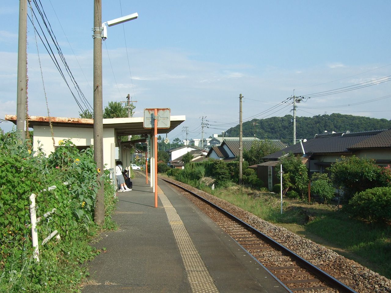
- JRKyushu Nakataku Station01, Muyo, CC BY-SA 3.0
- JRKyushu Nakataku Station02, Muyo, CC BY-SA 3.0
- Residential building and water tower of Municipal Nakataku Ekimae Housing, Peka, CC BY-SA 4.0
- Yoshinotani Subgroup coal seams in Sunahara, Taku 03, Pekachu, CC BY-SA 4.0
- Yoshinotani Subgroup coal seams in Sunahara, Taku 02, Pekachu, CC BY-SA 4.0
- Yoshinotani Subgroup coal seams in Sunahara, Taku 01, Pekachu, CC BY-SA 4.0
- Mitsubishi Kogayama Coal Mine monument in Taku, Pekachu, CC BY-SA 4.0
- Taku City Children's Center Ajisai, Peka, CC BY-SA 4.0
- TakuChurch, THE-ICER, CC0
- Taku Catholic Church, Peka, CC BY-SA 4.0
- Memorial of Taku Hokubu Elementary School, Peka, CC BY-SA 4.0
- Taku Inspector Koban, Peka, CC BY-SA 4.0
- Concrete coal loading hopper at east of Taku Station, Pekachu, CC BY-SA 4.0
- Takano Shrine in Minamitaku, Pekachu, CC BY-SA 4.0
- Climbing walls of Taku High School, Peka, CC BY-SA 4.0
- Taku Fire Station, Peka, CC BY-SA 4.0
- Mature "Sagabiyori" rice plants on field in Minamitaku, Pekachu, CC BY-SA 4.0
- Old houses and a leaning tree along the street in Takubaru, Peka, CC BY-SA 4.0
- Nakao Shrine in Takubaru, Peka, CC BY-SA 4.0
- Mount Tenzan from Minamitaku, Pekachu, CC BY-SA 4.0
- Takubaru Interchange entrance, Peka, CC BY-SA 4.0
- Taku Station north entrance 2016-10-14, Pekachu, CC BY-SA 4.0
- A street of Maple Town in Taku, Peka, CC BY-SA 4.0
- Chuo Park Taku, Pekachu, CC BY-SA 4.0
- Higashitaku Bypass near Takubaru IC, Peka, CC BY-SA 4.0
- Taku City Midorigaoka Japanese Archery Court, Peka, CC BY-SA 4.0
- Ameyama peak from Takubaru October 2018, Peka, CC BY-SA 4.0
- Graveyard of Shoni at Senshoji in Taku, Peka, CC BY-SA 4.0
- Main hall of Senshoji in Taku, Peka, CC BY-SA 4.0
- Saneware no Ume at Senshoji in Taku, Peka, CC BY-SA 4.0
- Work of rice straw baling in Minamitaku, Pekachu, CC BY-SA 4.0
- Habu Ancient Ruin restored houses and a warehouse, Pekachu, CC BY-SA 4.0
- Mount Hachiman from Nishitaku, Peka, CC BY-SA 4.0
- Mount Tenzan from Kiyomizu Ogi, Pekachu, CC BY-SA 4.0
- 小城公園1 - panoramio, sk01, CC BY-SA 3.0
- Urata Pond and Park in Omachi, Peka, CC BY-SA 4.0
- Navel in Kohoku, Saga, Peka, CC BY-SA 4.0
- Karatsu Kyuragi Elementary School, Peka, CC BY-SA 4.0
- Kyuragi High School, Nagasakifan, CC BY-SA 4.0
- Shishiga-jo Castle third section's south tower stone wall, Pekachu, CC BY-SA 4.0
- Karatsu City Kyuragi Elementary School and Junior High School, Ackeyyama, CC0
- Autumn garden and statue at Seikei Park 2016-10-14, Pekachu, CC BY-SA 4.0
- Takeo Kitagata Elementary School, hyolee2, CC BY-SA 4.0
- Takeo Kitagata Junior High School, hyolee2, CC BY-SA 4.0
- Taku Togenshosha Tobu School, hyolee2, CC BY-SA 4.0
- Taku Togenshosha Seikei School, hyolee2, CC BY-SA 4.0
- Omachi Rengakan south and west side, Pekachu, CC BY-SA 4.0
- Homanzan Park in Itaya, Taku, Peka, CC BY-SA 4.0


Page built November 5, 2026. Spotted a mistake? Tell us or suggest a place.