


Why visit Tamana
Townapedia lists 2 museums and landmarks, 2 parks and trails, 20 places to eat, 12 places to stay and 2 attractions in and around town.
Highlights include Kyushu University of Nursing and Social Welfare and Tonkararin Tunnel Structure.
Weather in Tamana
Forecast from MET Norway (CC BY 4.0). Full forecast
Things to do2


Kyushu University of Nursing and Social Welfare
School · 2.0 km
Higher education institution in Kumamoto Prefecture, Japan

Museums and landmarks2
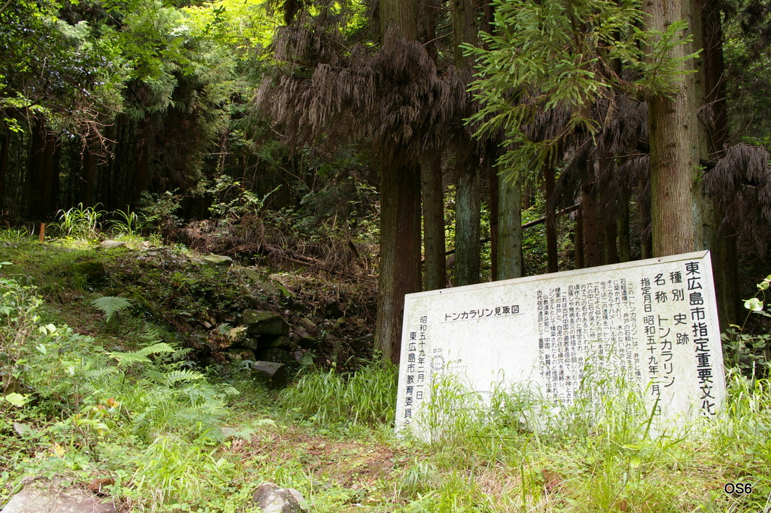
Tonkararin Tunnel Structure
Monument and historic site · 3.6 km
Archaeological site in Japan

Parks, trails and playgrounds2


Restaurants and cafes20


8 more on the map.
Where to stay12
Churches and places of worship2
Schools, colleges and libraries5
Healthcare2
Map of Tamana
47 places. The map loads OpenStreetMap tiles when you open it.
Getting there and nearby towns
Kumamoto Airport (KMJ) is the nearest airport with scheduled flights listed in OpenStreetMap, 29 km away.
- Uekimachi-mōno 12 km southeast, about 12 min by car
- Yamaga 13 km northeast, about 13 min by car
- Ōmuta 15 km northwest, about 15 min by car
- Kumamoto 19 km southeast, about 19 min by car
- Miyama 21 km north, about 21 min by car
- Setakamachi-takayanagi 25 km northwest, about 25 min by car
- Yanagawa 29 km northwest, about 29 min by car
- Chikugo 30 km north, about 30 min by car
- Uto 31 km south, about 31 min by car
- Yame 32 km north, about 32 min by car
Drive times are estimates from straight-line distance, not routes.
Local news
Headlines from INDB.
Reviews, tips and questions
Loading what members have shared...
Sources and licences
- GeoNames (CC BY 4.0): population, coordinates, regions and time zone
- OpenStreetMap contributors (ODbL 1.0): places, airports, map data
- Wikidata (CC0 1.0): elevation, founding date, time zone, website, landmarks and historic places
- Wikimedia Commons (see each image): photos
Photo credits
- 東広島トンカラリン, OS6, CC BY-SA 3.0
- Tamana girls' high school, hyolee2, CC BY-SA 3.0
- Kumamoto Kenhoku Hospital, hyolee2, CC BY-SA 4.0
- 九州看護福祉大学外観, Knhhm92, CC BY-SA 4.0
- Tamanacho Elementary school, hyolee2, CC BY-SA 3.0
- Tamana Gyokuryo Elementary School and Tamana Gyokuryo Junior High School, hyolee2, CC BY-SA 4.0
- NishigoushiHigashiEschool, Motoki-jj, CC BY-SA 3.0
- NishigoushiMinamiEschool, Motoki-jj, CC BY-SA 3.0
- Chiharadai High school, Motoki-jj, CC BY-SA 3.0
- NishigoushiMinamiJrHighschool, Motoki-jj, CC BY-SA 3.0
- 柳風公園 Yanagikaze Park - panoramio (1), Yuji Sakamoto, CC BY-SA 3.0
- YANAGIKAZE Park - panoramio, Yuji Sakamoto, CC BY-SA 3.0
- 柳風公園 Yanagikaze Park - panoramio, Yuji Sakamoto, CC BY-SA 3.0
- 秋の蛇ヶ谷公園 Jagatani park in autumn - panoramio, Yuji Sakamoto, CC BY-SA 3.0
- Jagatani park - panoramio, Yuji Sakamoto, CC BY-SA 3.0
- 秋の蛇ヶ谷公園 Jagatani park in autumn - panoramio (1), Yuji Sakamoto, CC BY-SA 3.0


Page built November 5, 2026. Spotted a mistake? Tell us or suggest a place.