


Yamaga, Japan
山鹿市
Yamaga is a town of 49,082 people in Kumamoto, Japan, founded in January 15, 2005.
Why visit Yamaga
Townapedia lists 39 museums and landmarks, 27 parks and trails, 49 places to eat, 22 places to stay and 13 attractions in and around town.
Highlights include Yachiyo-za theater, Kyushu University of Nursing and Social Welfare, Futagoyama Stone Tool Production Site and Katōda Higashibaru Site.
Weather in Yamaga
Forecast from MET Norway (CC BY 4.0). Full forecast
About Yamaga
Yamaga (山鹿市, Yamaga-shi) is a city in Kumamoto Prefecture, Japan. As of 31 July 2024, the city had an estimated population of 48,181 in 21,996 households, and a population density of 160 persons per km2. The total area of the city is 299.69 km2 (115.71 sq mi).
From the Wikipedia article Yamaga, Kumamoto (this version), under CC BY-SA 4.0.
Travel tips from other travellers: Yamaga on Wikivoyage (CC BY-SA 4.0).
Things to do13


Kyushu University of Nursing and Social Welfare
School · 14.9 km
Higher education institution in Kumamoto Prefecture, Japan



1 more on the map.
Museums and landmarks39

Futagoyama Stone Tool Production Site
Monument and historic site · 13.2 km
Archaeological site in Japan
Katōda Higashibaru Site
Monument and historic site · 3.4 km
Yayoi period settlement trace in Yamaga, Kumamoto, Japan

Kumamoto Prefectural Ancient Burial Mound Museum
Museum · 3.1 km
Museum in Yamaga, Kumamoto, Japan

Nabeta Cave Tombs
Monument and historic site · 1.7 km
Archaeological site in Japan
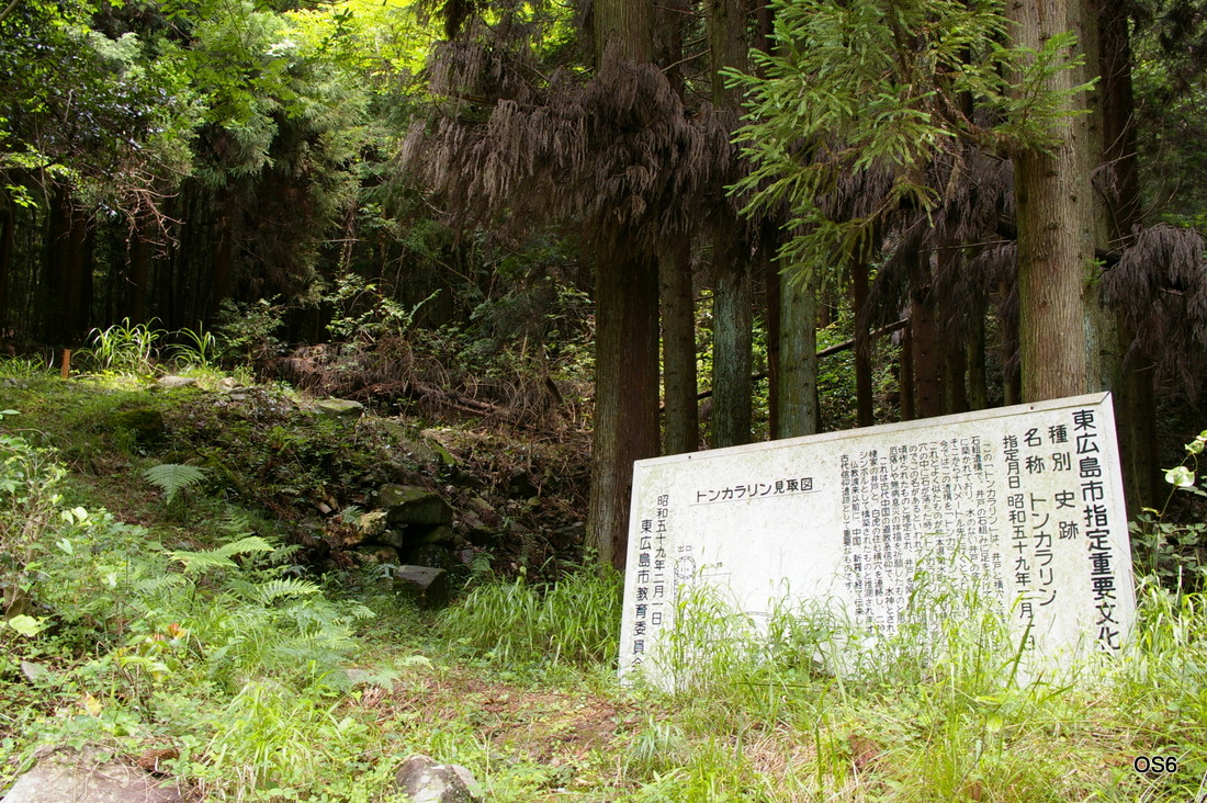
Tonkararin Tunnel Structure
Monument and historic site · 9.6 km
Archaeological site in Japan





27 more on the map.
Parks, trails and playgrounds27



15 more on the map.
Restaurants and cafes49


37 more on the map.
History
The area of Yamaga was part of ancient Higo Province. There are many burial mounds dating from the Kofun period within the city limitsm and the name "Yamaga" appears in early 8th century records. During the Kamakura period, the area developed as a hot spring town and in the Muromachi period it developed into a commercial settlement and a post town on the Buzen Kaido highway, and was noted for its production of umbrellas. During the Edo Period it was part of the holdings of Kumamoto Domain. It was the site of a battle during the 1877 Satsuma rebellion. After the Meiji restoration, the town of Yamaga was established with the creation of the modern municipalities system on April 1, 1889. On January 15, 2005, Yamaga absorbed the towns of Kahoku, Kamoto, Kaō and Kikuka (all from Kamoto District) to create the new and expanded city of Yamaga.
From the History section of Yamaga, Kumamoto on Wikipedia, under CC BY-SA 4.0.
Where to stay22
Churches and places of worship18
Shopping14
Gas and EV charging12
Schools, colleges and libraries80
Healthcare37
Map of Yamaga
250 places. The map loads OpenStreetMap tiles when you open it.
Getting there and nearby towns
Kumamoto Airport (KMJ) is the nearest airport with scheduled flights listed in OpenStreetMap, 25 km away.
- Miyama 21 km northwest, about 21 min by car
- Ōmuta 22 km west, about 22 min by car
- Kumamoto 23 km south, about 23 min by car
- Yame 24 km north, about 24 min by car
- Setakamachi-takayanagi 25 km northwest, about 25 min by car
- Chikugo 28 km northwest, about 28 min by car
- Hirokawa 28 km northwest, about 28 min by car
- Yanagawa 32 km northwest, about 32 min by car
- Ōkawa 36 km northwest, about 36 min by car
- Kurume 37 km northwest, about 37 min by car
Drive times are estimates from straight-line distance, not routes.
Local news
Headlines from INDB.
Reviews, tips and questions
Loading what members have shared...
Sources and licences
- GeoNames (CC BY 4.0): population, coordinates, regions and time zone
- OpenStreetMap contributors (ODbL 1.0): places, airports, map data
- Wikidata (CC0 1.0): elevation, founding date, time zone, website, landmarks and historic places
- Wikimedia Commons (see each image): photos
- Wikipedia (CC BY-SA 4.0): overview and history text
Photo credits
- Yamaga City Hall 2018, hyolee2, CC BY-SA 4.0
- Japanese umbrellas displayed at night, festival of Yamaga, Kumamoto (2015-02-14 by Kohji Asakawa @Pixabay 636870), Kohji Asakawa from Kumamoto, Japan, CC0
- Yamaga yachiyoza, Myaataro at Japanese Wikipedia, CC BY-SA 3.0
- 20250308-yamaga-buzen-09, UedaKenji31415926535, CC BY 4.0
- 20250308-yamaga-buzen-08, UedaKenji31415926535, CC BY 4.0
- 20250308-yamaga-buzen-13, UedaKenji31415926535, CC BY 4.0
- 20250308-yamaga-buzen-01, UedaKenji31415926535, CC BY 4.0
- 20250308-yamaga-buzen-02, UedaKenji31415926535, CC BY 4.0
- 20250308-yamaga-buzen-03, UedaKenji31415926535, CC BY 4.0
- 20250308-yamaga-buzen-10, UedaKenji31415926535, CC BY 4.0
- 20250308-yamaga-kongou-sekimon, UedaKenji31415926535, CC BY 4.0
- Yamaga-kongoujyouji-sekibutu, UedaKenji31415926535, CC BY 4.0
- 20250308-yamaga-buzen-04, UedaKenji31415926535, CC BY 4.0
- 20250308-yamaga-buzen-05, UedaKenji31415926535, CC BY 4.0
- 20250308-yamaga-buzen-11, UedaKenji31415926535, CC BY 4.0
- 20250308-yamaga-buzen-07, UedaKenji31415926535, CC BY 4.0
- Yamaga-mingeikan-tenjyou, UedaKenji31415926535, CC BY 4.0
- 20250308-yamaga-buzen-06, UedaKenji31415926535, CC BY 4.0
- 山鹿市役所 Yamaga city hall - panoramio, OS6, CC BY-SA 3.0
- 20250308-yamaga-buzen-12, UedaKenji31415926535, CC BY 4.0
- Nabeta Kofun, STA3816, CC BY-SA 3.0
- Kumamoto Prefectural Ancient Burial Mound Museum 02, STA3816, CC BY-SA 3.0
- 東広島トンカラリン, OS6, CC BY-SA 3.0
- Kikushi-shrine, Siwamura, CC BY-SA 3.0
- Chibusan Kofun, STA3816, CC BY-SA 3.0
- Yamaga Medical Center, hyolee2, CC BY-SA 3.0
- Ueki Hospital, hyolee2, CC BY-SA 3.0
- 鞠智城鼓楼, 小池 隆, CC BY 3.0
- Yachiyoza ac (2), Asturio Cantabrio, CC BY-SA 4.0
- Yamaga Daido Elementary school, hyolee2, CC BY-SA 4.0
- Kumamoto City Seinan Civil War Museum, STA3816, CC BY-SA 4.0
- Kumamoto Kenhoku Hospital, hyolee2, CC BY-SA 4.0
- Tonkararin (Nagomi), gaikan, Saigen Jiro, CC0
- Marushoku Imajuku 20190122, 新幹線, CC BY-SA 4.0
- Kikuchi-jyou, YAPON at Japanese Wikipedia, Public domain
- Kikuchi Girls High School, hyolee2, CC BY-SA 3.0
- Kumamoto Tabaru Elementary school, hyolee2, CC BY-SA 3.0
- Kumamoto Municipal Ueki Hospital, KUPS39M, CC BY-SA 4.0
- Yamaga City Medical Center, KUPS39M, CC BY-SA 4.0
- Koshi Nishigoshichuo Elementary school, hyolee2, CC BY-SA 3.0
- Koshi Nishigoshi Daiichi Elementary school, hyolee2, CC BY-SA 3.0
- Kikuchi Shichijo Elementary School, hyolee2, CC BY-SA 4.0
- 菊池市立七城中学校, Harap19670117, CC BY-SA 3.0
- Tsukabouzu, Mercury 4035, CC BY-SA 4.0
- Yamaga Nakatomi Elementary school, hyolee2, CC BY-SA 4.0
- Yamaga Yahata Elementary school, hyolee2, CC BY-SA 4.0
- Yamaga Mitama Elementary school, hyolee2, CC BY-SA 4.0
- 九州看護福祉大学外観, Knhhm92, CC BY-SA 4.0


Page built November 5, 2026. Spotted a mistake? Tell us or suggest a place.