


Tokorozawa, Japan
所沢市
Tokorozawa is a town of 344,194 people in Saitama, Japan, founded in November 3, 1950.
Why visit Tokorozawa
Townapedia lists 23 museums and landmarks, 59 parks and trails, 300 places to eat, 5 places to stay and 8 attractions in and around town.
Highlights include Japan College of Social Work, Jumonji University, Edo-Tokyo Open Air Architectural Museum and Kodaira Hirakushi Denchu Art Museum.
Weather in Tokorozawa
Forecast from MET Norway (CC BY 4.0). Full forecast
About Tokorozawa
Tokorozawa (所沢市, Tokorozawa-shi) is a city located in Saitama Prefecture, Japan. As of 1 February 2024, the city had an estimated population of 343,298 in 168,939 households and a population density of 4761 persons per km2. The total area of the city is 72.11 square kilometres (27.84 sq mi).
From the Wikipedia article Tokorozawa, Saitama (this version), under CC BY-SA 4.0.
Travel tips from other travellers: Tokorozawa on Wikivoyage (CC BY-SA 4.0).
Things to do8

Japan College of Social Work
School · 5.0 km
Private university in Tokyo, Japan

Jumonji University
School · 7.3 km
Higher education institution in Saitama Prefecture, Japan

Kunitachi College of Music
School · 9.1 km
Private University in Tokyo

Meiji Pharmaceutical University
School · 3.8 km
Private university in Kiyose, Tokyo, Japan

Musashino Art University
School · 8.4 km
University in Kodaira, western Tokyo

Seibu-en
Monument and historic site · 4.2 km
Amusement park in Tokorozawa, Japan

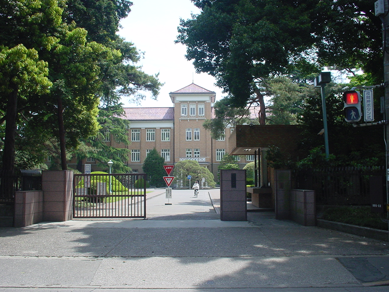
Museums and landmarks23


Kodaira Hirakushi Denchu Art Museum
Museum · 9.0 km
Art museum in Tokyo, Japan

Mizuko Shell Mound
Monument and historic site · 9.8 km
Shell midden, settlement in Saitama, Japan

Suzuki Site
Monument and historic site · 9.3 km
Archaeological site in Kodaira, Japan




11 more on the map.
Parks, trails and playgrounds59


Higashikurumeshi Chikurin Park
Park · 7.7 km
Park in Higashikurume, Japan


Taki-no Castle
Park · 5.7 km
Building in Tokorozawa, Saitama Prefecture, Japan


47 more on the map.
Restaurants and cafes300

Tokorozawa Blueberry Farm Cafe
Cafe · Ice Cream, Coffee Shop, Smoothie, Juice, Waffle · 1.6 km
1, 所沢市
We-Su,PH 11:00-15:30; Mo,Tu off



288 more on the map.
History
Archaeological research has shown that the vicinity of Tokorozawa was settled from about 20,000 years ago. Tokorozawa Shinmei Shrine has a traditional establishment of 110 AD. Hatogamine Hachiman Shrine is believed to date from 921 AD. During the Kamakura period, the Kamakura Kaidō ran through the area and the area was host to a series of battles fought in May 1333 that were part of the Genko War that ultimately ended the Kamakura Shogunate. These include the 1333 Battle of Kotesashi and the Battle of Kumegawa. Kotesashi was again the site of another battle nineteen years later. During the Edo period (1603–1867) the area's major industry was sericulture. It was also an important trading center, being located at the intersection of roads connecting Edo with the towns of Hachioji, Chichibu, Kawagoe and Fuchu.
The town of Tokorozawa was created within Iruma District, Saitama with the establishment of the modern municipalities system on April 1, 1889.
From the History section of Tokorozawa, Saitama on Wikipedia, under CC BY-SA 4.0.
Where to stay5
Churches and places of worship43
Shopping52
Gas and EV charging5
Schools, colleges and libraries32
Healthcare70
Hospital, National Rehabilitation Center for Persons with Disabilities
Hospital · 0.8 km
Map of Tokorozawa
250 places. The map loads OpenStreetMap tiles when you open it.
Getting there and nearby towns
Yokota Air Base (OKO) is the nearest airport with scheduled flights listed in OpenStreetMap, 12 km away.
- Nishi-Tokyo-shi 10 km southeast, about 10 min by car
- Tokyo 24 km southeast, about 24 min by car
- Aihara 26 km southwest, about 26 min by car
- Sagamihara 33 km southwest, about 33 min by car
- Zama 35 km south, about 35 min by car
- Yamato 36 km south, about 36 min by car
- Kawasaki 38 km southeast, about 38 min by car
- Matsudo 39 km east, about 39 min by car
- Nagareyama 40 km east, about 40 min by car
- Yokohama 44 km south, about 44 min by car
Drive times are estimates from straight-line distance, not routes.
Local news
Headlines from INDB.
Reviews, tips and questions
Loading what members have shared...
Sources and licences
- GeoNames (CC BY 4.0): population, coordinates, regions and time zone
- OpenStreetMap contributors (ODbL 1.0): places, airports, map data
- Wikidata (CC0 1.0): elevation, founding date, time zone, website, landmarks and historic places
- Wikimedia Commons (see each image): photos
- Wikipedia (CC BY-SA 4.0): overview and history text
Photo credits
- View of Tokorozawa from Hachikokuyama, Bryan MacKinnon ( Bryanmackinnon at en.wikipedia ), Public domain
- Mobile Recycle Box Tokorozawa, tokorokoko, Public domain
- Tokorozawa City Library entrance, tokoro koko, CC BY-SA 3.0
- Tokorozawa City Library 20090722, Tokorokoko, Public domain
- 1 Chome Namiki, Tokorozawa-shi, Saitama-ken 359-0042, Japan - panoramio, Hiroyuki Sato, CC BY-SA 3.0
- YS-11 at Tokorozawa 20260711, Suikotei, CC BY 4.0
- Tokorozawa Aviation Commemorative Park, Abasaa, Public domain
- Kunitachiondai2, The original uploader was Hykw-a4 at Japanese Wikipedia ., CC BY-SA 3.0
- Meiji Pharmaceutical University, Nyao148, CC BY-SA 3.0
- Musashino Art University, The original uploader was Hykw-a4 at Japanese Wikipedia ., CC BY-SA 3.0
- Seibuen Amusement Park (11152952796), Tomohiro Ohtake from Kawasaki, Japan, CC BY 2.0
- Tsudajukuuniv, The original uploader was Hykw-a4 at Japanese Wikipedia ., CC BY-SA 3.0
- Entrance of the Edo-Tokyo Open Air Architectural Museum, Fumiya Fujihara, CC BY 2.0
- Kodaira Hirakushi Denchu Art Museum front, Calton, CC BY-SA 4.0
- Fujimi Mizukokaiduka Park 3, 京浜にけ (Keihin-Nike), CC BY-SA 3.0
- Suzuki Remains Museum, Nyao148, CC BY-SA 3.0
- Chikurin Park in Higashikurume-shi (50547377101), Mikhail Kotykhov from Tokyo, Japan, CC BY 2.0
- Koganei-Park, Itasan, CC BY 3.0
- Satoyamaminkah, four horsemen, CC BY-SA 3.0
- Waterfall Castle Moat, Bryanmackinnon, Public domain
- Tokorosawa Shinmei-sha 100117, tokoro koko, Public domain
- Tokorozawa Aviation Museum in Koku-koen park 060910, Tokoroten, Public domain
- Hatogamine-Hachiman-Shrine-Main-Hall, User:Bryan MacKinnon, CC BY-SA 4.0
- Hospital, National Rehabilitation Center for Persons with Disabilities 1, Ebiebi2, CC0
- Tokorozawa-Kita High School 20090707, Tokorokoko, Public domain
- Tokorozawa City Mihara Junior High School, Suikotei, CC BY-SA 4.0
- Tokorozawa Proctogic Hospital, あばさー, Public domain
- Citizens Medical Center in Tokorozawa 1, Ebiebi2, CC BY-SA 4.0
- Shinkoji-Gate, Bryanmackinnon, CC BY-SA 4.0
- Saitama Nishi Kyodo Hospital, Yasu ( talk ), CC BY-SA 3.0
- Siraumegakuen, The original uploader was Hykw-a4 at Japanese Wikipedia ., CC BY-SA 3.0
- Jumonji Univ, 杉山真大, CC BY-SA 3.0
- Tokorozawa Aviation Museum, Abasaa, Public domain
- Hatomine-Hachiman-jinja entrance 2024-07-28, Asanagi, CC0
- Tokorozawa elementary school, 麒麟檸檬, CC BY-SA 4.0
- TOCOTOCO SQUARE, Nagachan77, CC BY-SA 4.0
- 所沢市役所裏 南西向き - panoramio, panotest001, CC BY-SA 3.0
- 所沢 歩道橋上 北西向き - panoramio, panotest001, CC BY-SA 3.0
- 所沢 歩道橋上 南東向き - panoramio, panotest001, CC BY-SA 3.0
- JA8732 (30055220342), Alec Wilson from Khon Kaen, Thailand, CC BY-SA 2.0
- Jizō Tokorozawa-shinmachi, Tokorokoko, Public domain
- Hachikokuyama Taiken no Sato 2023-09-10, Asanagi, CC0


Page built November 4, 2026. Spotted a mistake? Tell us or suggest a place.