


Tosa, Japan
土佐市
Tosa is a town of 25,732 people in Kochi, Japan, founded in April 1, 1889.
Why visit Tosa
Townapedia lists 20 museums and landmarks, 129 parks and trails, 49 places to eat, 8 places to stay and 27 attractions in and around town.
Highlights include Kōchi University, Kōchi Castle Museum of History, Tosa Ino Line and 新居緑地公園.
Weather in Tosa
Forecast from MET Norway (CC BY 4.0). Full forecast
About Tosa
Tosa (土佐市, Tosa-shi; Japanese pronunciation: [tó̞.sä̀, tò̞.sä́(.ɕì)]) is a city located in Kōchi Prefecture, Japan. As of 1 August 2022, the city had an estimated population of 26,427 in 12,671 households and a population density of 290 persons per km2. The total area of the city is 91.50 square kilometres (35.33 sq mi). The city of Tosa should not be confused with the historical Tosa Province, which covered all of modern-day Kōchi Prefecture.
From the Wikipedia article Tosa, Kōchi (this version), under CC BY-SA 4.0.
Things to do27
Kōchi University
School · 6.3 km
Higher education institution in Kōchi Prefecture, Japan

15 more on the map.
Museums and landmarks20

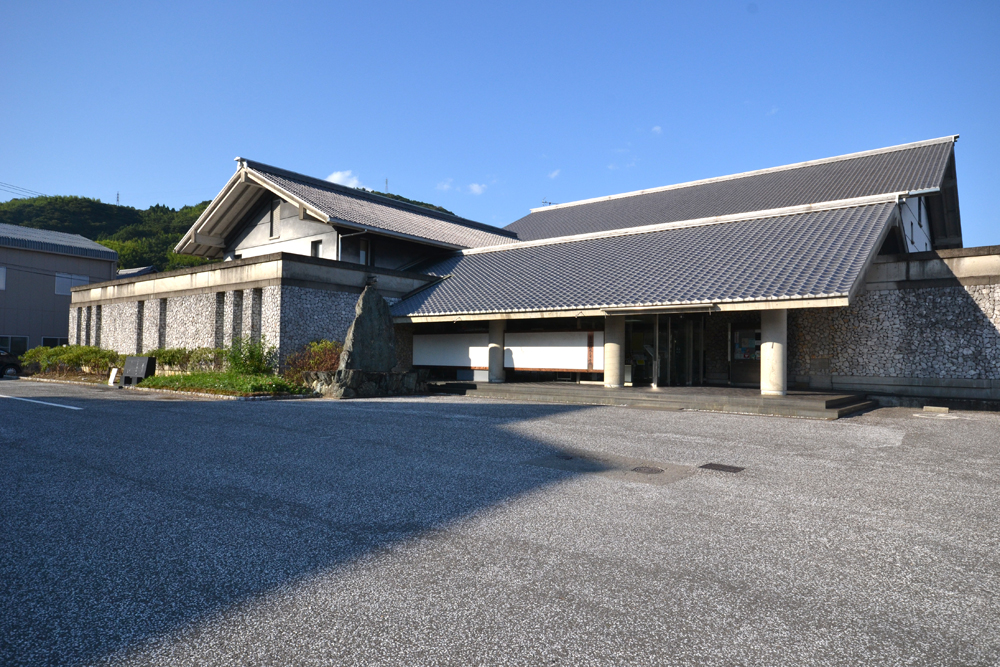
Kōchi Castle Museum of History
Museum · 10.3 km
Museum in Kōchi, Kōchi, Japan



8 more on the map.
Parks, trails and playgrounds129




117 more on the map.
Restaurants and cafes49



37 more on the map.
History
As with all of Kōchi Prefecture, the area of Tosa was part of ancient Tosa Province. Remains from the Jōmon period dated to 4000 years ago have been found within the city limits. During the Edo period, the area was part of the holdings of Tosa Domain ruled by the Yamauchi clan from their seat at Kōchi Castle. Following the Meiji restoration, the village of Takaoka (高岡村) was established within Takaoka District, Kōchi with the creation of the modern municipalities system on October 1, 1889. Takaoka was elevated to town status on March 1, 1899. Takaoka was elevated to city status on January 1, 1959, and renamed Tosa.
From the History section of Tosa, Kōchi on Wikipedia, under CC BY-SA 4.0.
Where to stay8
Churches and places of worship93
Shopping18
Gas and EV charging6
Schools, colleges and libraries52
Healthcare18
Map of Tosa
250 places. The map loads OpenStreetMap tiles when you open it.
Getting there and nearby towns
Kochi Ryoma Airport (KCZ) is the nearest airport with scheduled flights listed in OpenStreetMap, 21 km away.
- Ino 5 km north, about 5 min by car
- Sakawa 15 km west, about 15 min by car
- Aki 42 km east, about 42 min by car
- Niihama 52 km north, about 52 min by car
- Kawanoechō 58 km north, about 58 min by car
- Haramachi 67 km northwest, about 1 h by car
- Matsuyama 73 km northwest, about 1 h 15 min by car
- Kan’onjichō 72 km north, about 1 h 15 min by car
- Iyo 74 km west, about 1 h 15 min by car
- Imabari 75 km northwest, about 1 h 15 min by car
Drive times are estimates from straight-line distance, not routes.
Local news
Headlines from INDB.
Reviews, tips and questions
Loading what members have shared...
Sources and licences
- GeoNames (CC BY 4.0): population, coordinates, regions and time zone
- OpenStreetMap contributors (ODbL 1.0): places, airports, map data
- Wikidata (CC0 1.0): elevation, founding date, time zone, website, landmarks and historic places
- Wikimedia Commons (see each image): photos
- Wikipedia (CC BY-SA 4.0): overview and history text
Photo credits
- Iozan Kiyotakiji 07, Reggaeman, CC BY-SA 3.0
- Tosa municipal hospital, Kaityu20, CC BY-SA 4.0
- Tosa City Hall Kōchi Prefecture 202405261557, 0211 SKDGAKUCHO, CC0
- Headquarters of Tosa credit union, アラツク, CC BY-SA 4.0
- Tosa-exit, Takuwanbento1098, CC BY-SA 4.0
- Kochi University, Bakkai at Japanese Wikipedia, CC BY-SA 3.0
- Kochi catsle museum - 高知城歴史博物館 - panoramio, z tanuki, CC BY 3.0
- Kyu-Yamanouchike shimoyashiki nagaya01s3200, 663highland, CC BY 2.5
- Iozan Kiyotakiji 03, Reggaeman, CC BY-SA 3.0
- 独立行政法人国立病院機構高知病院 2014-02-18 19-43, User:Kaityu20, CC BY-SA 3.0
- Haruno Sports Park, 国土地理院, CC BY 4.0
- Korizu-jinja haiden, Saigen Jiro, CC0
- Ino Business high school, Bakkai, CC BY-SA 3.0
- Kiyotakiji 01, Dokudami, CC BY-SA 4.0
- Tanemaji 20230411 1, Araiyasushige, CC BY-SA 4.0
- 土佐市立新居小学校, 谷本 一郎, CC BY-SA 4.0
- Korizu-jinja haiden-2, Saigen Jiro, CC0
- Tanemaji 02, Reggaeman, CC BY-SA 3.0
- いの町紙の博物館, Oyazo, CC BY-SA 3.0
- Neope goschkevitschii 560366082, 林正文, CC BY 4.0
- Mecopoda niponensis from iNaturalist 555102532, 林正文(lin-chen-wen), CC BY 4.0
- 仁淀川堤防 - panoramio (1), r18 INO (PACHIMO), CC BY 3.0
- Iozan Kiyotakiji 02, Reggaeman, CC BY-SA 3.0
- 高知22き260, 由紀奈, CC BY-SA 4.0
- ISS042-E-175864 - View of Earth, Earth Science and Remote Sensing Unit , Lyndon B. Johnson Space Center, Public domain
- ISS042-E-175863 - View of Earth, Earth Science and Remote Sensing Unit , Lyndon B. Johnson Space Center, Public domain
- ISS049-E-31558 - View of Earth, Earth Science and Remote Sensing Unit , Lyndon B. Johnson Space Center, Public domain
- 仁淀川堤防 - panoramio, r18 INO (PACHIMO), CC BY 3.0
- 学校法人光の村学園, 谷本 一郎, CC BY-SA 4.0
- 土佐市宇佐町の空撮写真, 谷本 一郎, CC BY-SA 4.0
- 仁淀病院, Kaityu20, CC BY-SA 3.0
- 20210808 Ino Station station-wicket, Rsa, CC BY-SA 3.0
- JR Ino station2, tosimisi, CC BY-SA 2.0
- JR Ino Station, tosimisi, CC BY-SA 2.0
- Bank of Kōchi Ino Branch, ラハール, CC BY-SA 4.0
- 国道33号線・伊野駅前バス停 - panoramio, minamikaze, CC BY 3.0
- 20210808 LAWSON and Idemitsu in front of Ino Station, Rsa, CC BY-SA 3.0
- 関西砕石(株) - panoramio, r18 INO (PACHIMO), CC BY 3.0
- いの町新町付近 - panoramio, minamikaze, CC BY 3.0
- Hyakujūshi Bank Ino Branch, ラハール, CC BY-SA 4.0


Page built November 5, 2026. Spotted a mistake? Tell us or suggest a place.