
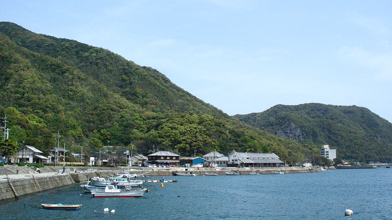


Uki, Japan
宇城市
Uki is a town of 59,928 people in Kumamoto, Japan, founded in January 15, 2005.
Why visit Uki
Townapedia lists 68 museums and landmarks, 106 parks and trails, 94 places to eat, 13 places to stay and 27 attractions in and around town.
Highlights include Mt. Nozoe, Mt. Nukatsuka, Adaka-Kurobashi Shell Mounds and 向野田古墳.
Weather in Uki
Forecast from MET Norway (CC BY 4.0). Full forecast
About Uki
Uki (宇城市, Uki-shi; Japanese pronunciation: [ɯ̈́.k̟ʲì, ɯ̈̀.k̟ʲi̥.ɕì]) is a city in Kumamoto Prefecture, Japan. As of 1 September 2024, the city had an estimated population of 56,491 in 25302 households, and a population density of 300 persons per km2. The total area of the city is 188.67 km2 (72.85 sq mi).
From the Wikipedia article Uki, Kumamoto (this version), under CC BY-SA 4.0.
Travel tips from other travellers: Uki on Wikivoyage (CC BY-SA 4.0).
Things to do27


15 more on the map.
Museums and landmarks68
Adaka-Kurobashi Shell Mounds
Monument and historic site · 10.4 km
Archaeological site(s) in Kumamoto, Kumamoto, Japan




56 more on the map.
Parks, trails and playgrounds106



Kumamoto Prefectural Museum Network Center Multipurpose Plaza
Playground · 4.2 km
94 more on the map.
Restaurants and cafes94

82 more on the map.
History
The area of Uki was part of ancient Higo Province, During the Edo Period it was part of the holdings of Kumamoto Domain. After the Meiji restoration, the town of Matsubase was established with the creation of the modern municipalities system on April 1, 1889.
The city of Uki was established on January 15, 2005, as a result of the merger between the towns of Misumi and Shiranuhi (both from Uto District), and the towns of Matsubase, Ogawa and Toyono (all from Shimomashiki District).
From the History section of Uki, Kumamoto on Wikipedia, under CC BY-SA 4.0.
Where to stay13
Churches and places of worship104
Shopping26
Gas and EV charging12
Schools, colleges and libraries62
Healthcare35
Map of Uki
250 places. The map loads OpenStreetMap tiles when you open it.
Getting there and nearby towns
Kumamoto Airport (KMJ) is the nearest airport with scheduled flights listed in OpenStreetMap, 30 km away.
- Matsubase 3 km north, about 3 min by car
- Uto 7 km north, about 7 min by car
- Mifune 18 km northeast, about 18 min by car
- Kumamoto 21 km north, about 21 min by car
- Uekimachi-mōno 31 km north, about 31 min by car
- Shimabara 33 km northwest, about 33 min by car
- Ōzu 35 km northeast, about 35 min by car
- Nagasu 40 km northwest, about 40 min by car
- Kikuchi 43 km north, about 43 min by car
- Yamaga 44 km north, about 44 min by car
Drive times are estimates from straight-line distance, not routes.
Local news
Headlines from INDB.
Reviews, tips and questions
Loading what members have shared...
Sources and licences
- GeoNames (CC BY 4.0): population, coordinates, regions and time zone
- OpenStreetMap contributors (ODbL 1.0): places, airports, map data
- Wikidata (CC0 1.0): elevation, founding date, time zone, website, landmarks and historic places
- Wikimedia Commons (see each image): photos
- Wikipedia (CC BY-SA 4.0): overview and history text
Photo credits
- Misumi-west port 1, MK Products, CC BY-SA 3.0
- Michinoeki Uki, アラツク, CC BY-SA 4.0
- JA Kumamoto Uki Uto Branch, Suikotei, CC BY 4.0
- Jomon Kaimen, Nanj2783, CC BY-SA 4.0
- Innyaku-jinjya, Siwamura, CC BY-SA 3.0
- Matsubase-shrine, Siwamura, CC BY-SA 3.0
- Einoo-jinja Torii gate in the sea 001, Naokijp, CC BY-SA 4.0
- Kumamoto Minami National Hospital, Waka77, CC0
- Kumamoto City Tsukawara Historical Museum, hyolee2, CC BY-SA 3.0
- Uto Elementary School, Kenta Mabuchi, CC BY-SA 2.0
- Uto Kakujo Junior High School, hyolee2, CC BY-SA 4.0
- Yatsushiro Sencho Junior High School, hyolee2, CC BY-SA 4.0
- Uki Matsubase Elementary School, hyolee2, CC BY-SA 4.0
- Uki Toyokawa Elementary School, Hyolee2, CC BY-SA 4.0
- Uki Tonoo Elementary School, hyolee2, CC BY-SA 4.0
- Matsubase Junior high school 01, hyolee2, CC BY-SA 3.0
- Uki Shiranui Elementary School, hyolee2, CC BY-SA 4.0
- Uki Ogawa Elementary School, hyolee2, CC BY-SA 4.0
- Uki Gonoe Elementary School, hyolee2, CC BY-SA 4.0
- UKi Ogawa Junior High School, hyolee2, CC BY-SA 4.0
- Einoo-jinja Worship Hall, Naokijp, CC BY-SA 4.0
- Ono Iwaya Kofun, funkyu, Saigen Jiro, CC0
- Mukonoda Kofun, funcho, Saigen Jiro, CC0
- 宇城市立中央図書館美術館 02, しょう大, CC0
- 宇城市立中央図書館美術館 05, しょう大, CC0
- 宇城市立中央図書館美術館 01, しょう大, CC0
- 宇城市立中央図書館美術館 06, しょう大, CC0
- 宇城市立中央図書館美術館 03, しょう大, CC0
- 宇城市立中央図書館美術館 04, しょう大, CC0
- 宇賀岳の桜 - panoramio, 浅川浩二, CC BY 3.0
- 宇賀岳からの夕焼け - panoramio, 浅川浩二, CC BY 3.0
- ISS032-E-22089 - View of Earth, Earth Science and Remote Sensing Unit , Lyndon B. Johnson Space Center, Public domain
- ISS067-E-182381 - View of Earth, Earth Science and Remote Sensing Unit , Lyndon B. Johnson Space Center, Public domain
- ISS034-E-40716 - View of Earth, Earth Science and Remote Sensing Unit , Lyndon B. Johnson Space Center, Public domain
- ISS067-E-182382 - View of Earth, Earth Science and Remote Sensing Unit , Lyndon B. Johnson Space Center, Public domain
- ISS045-E-11812 - View of Earth, Earth Science and Remote Sensing Unit , Lyndon B. Johnson Space Center, Public domain
- 泉胃腸科外科 - panoramio, 浅川浩二, CC BY 3.0
- Hinoyutaka Japanese citrus fruit, Mizushimasea, CC BY-SA 4.0
- 宇城総合病院の全景, ノート258, CC BY-SA 4.0
- Michinoeki Ryuhoku, アラツク, CC BY-SA 4.0


Page built November 5, 2026. Spotted a mistake? Tell us or suggest a place.