

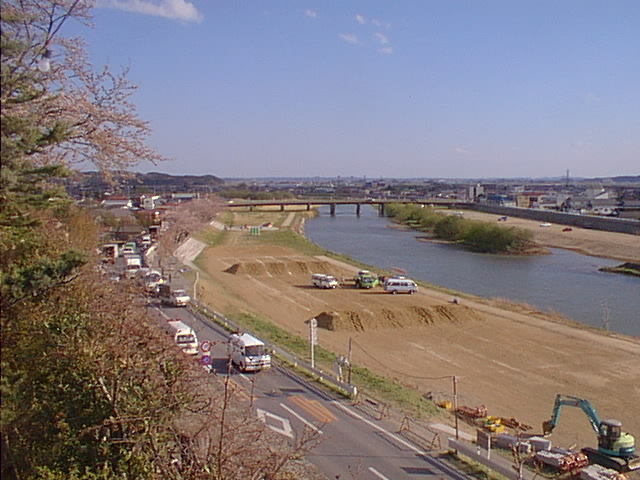


Wakuya, Japan
涌谷町
Wakuya is a town of 15,763 people in Miyagi, Japan, founded in April 1, 1889.
Why visit Wakuya
Townapedia lists 15 museums and landmarks, 34 parks and trails, 142 places to eat, 5 places to stay and 12 attractions in and around town.
Highlights include 加護坊山, 崑岳山, Nagane Shell Mound and Nakazawame Shell Mound.
Weather in Wakuya
Forecast from MET Norway (CC BY 4.0). Full forecast
About Wakuya
Wakuya (涌谷町, Wakuya-chō) is a town located in Miyagi Prefecture, Japan. As of 30 April 2020, the town had an estimated population of 15,763 in 6028 households, and a population density of 190 persons per km2. The total area of the town is 82.16 square kilometres (31.72 sq mi). The area is noted for its rice production.
From the Wikipedia article Wakuya (this version), under CC BY-SA 4.0.
Things to do12


Museums and landmarks15

Nagane Shell Mound
Monument and historic site · 6.4 km
Archaeological site in Japan
Nakazawame Shell Mound
Monument and historic site · 9.0 km
Archaeological site in Japan


Yamamae Site
Monument and historic site · 7.5 km
Archaeological site in Misato, Miyagi, Japan.

3 more on the map.
Parks, trails and playgrounds34


22 more on the map.
Restaurants and cafes142



ボスコロ
Restaurant · 0.9 km
We-Sa 11:00-21:30; Su 11:00-21:00; Mo-Tu 11:00-16:00
130 more on the map.
History
The area of present-day Wakuya was part of ancient Mutsu Province, and has been settled since at least the Jōmon period by the Emishi people. During the Nara period, gold was discovered in the area, and 13 kilograms of gold from Wakuya were used in the construction of the Nara Daibutsu. During later portion of the Heian period, the area was ruled by the Northern Fujiwara. During the Sengoku period, the area was contested by various samurai clans before the area came under the control of the Date clan of Sendai Domain during the Edo period, under the Tokugawa shogunate.
The town of Wakuya was established on June 1, 1889, with the establishment of the modern municipalities system. The town annexed the neighboring village of Moto-Wakuya on December 1, 1948, and the village of Nonodake on July 15, 1955. The 2011 Tōhoku earthquake and tsunami destroyed numerous buildings in the town, and resulted in one fatality.
From the History section of Wakuya on Wikipedia, under CC BY-SA 4.0.
Where to stay5
Churches and places of worship63
Shopping44
Gas and EV charging11
Schools, colleges and libraries38
Healthcare41
Map of Wakuya
250 places. The map loads OpenStreetMap tiles when you open it.
Getting there and nearby towns
Sendai Airport (SDJ) is the nearest airport with scheduled flights listed in OpenStreetMap, 49 km away.
- Ōsaki 15 km west, about 15 min by car
- Yamoto 15 km southeast, about 15 min by car
- Ishinomaki 20 km southeast, about 20 min by car
- Tomiya 27 km southwest, about 27 min by car
- Sendai 39 km southwest, about 39 min by car
- Ichinoseki 41 km north, about 41 min by car
- Ōshū 66 km north, about 1 h by car
- Rikuzen-Takata 69 km northeast, about 1 h 15 min by car
- Kanegasaki 73 km north, about 1 h 15 min by car
- Ōfunato 77 km northeast, about 1 h 15 min by car
Drive times are estimates from straight-line distance, not routes.
Local news
Headlines from INDB.
Reviews, tips and questions
Loading what members have shared...
Sources and licences
- GeoNames (CC BY 4.0): population, coordinates, regions and time zone
- OpenStreetMap contributors (ODbL 1.0): places, airports, map data
- Wikidata (CC0 1.0): elevation, founding date, time zone, website, landmarks and historic places
- Wikimedia Commons (see each image): photos
- Wikipedia (CC BY-SA 4.0): overview and history text
Photo credits
- WakuyaCastle, Kumamushi, CC BY 3.0
- Wakuya Miyagi - panoramio, cora_cola 茶々丸, CC BY-SA 3.0
- Wakuya Miyagi Japan - panoramio, cora_cola 茶々丸, CC BY-SA 3.0
- Yamamae ruins, MChew, CC BY-SA 4.0
- Kagobo, ToshiJapon, CC BY-SA 4.0
- Miyagi Prefecture Nango High School, Ebiebi2, CC BY-SA 4.0
- Miyagi Prefecture Kogota Agriculture and Forestry High School 1, Ebiebi2, CC BY-SA 4.0
- Miyagi Prefectural support school Kogota High School&Miyagi Prefectural hearing aid school Kogota schools, Ebiebi2, CC BY-SA 4.0
- Haiden of Kogota Yamanokamisha shrine 5, Bachstelze, CC BY-SA 3.0
- Koganeyama-jinja Haiden, ChiefHira, CC BY-SA 3.0
- Cherry blossoms in Shiroyama Park, Gifu Prefecture; April 2013 (03), Yuichiro Haga, CC BY 2.0
- Cherry blossoms in Shiroyama Park, Gifu Prefecture; April 2013 (12), Yuichiro Haga, CC BY 2.0
- Cherry blossoms in Shiroyama Park, Gifu Prefecture; April 2013 (11), Yuichiro Haga, CC BY 2.0
- Cherry blossoms in Shiroyama Park, Gifu Prefecture; April 2013 (01), Yuichiro Haga, CC BY 2.0
- Cherry blossoms in Shiroyama Park, Gifu Prefecture; April 2013 (04), Yuichiro Haga, CC BY 2.0
- Cherry blossoms in Shiroyama Park, Gifu Prefecture; April 2013 (02), Yuichiro Haga, CC BY 2.0
- Cherry blossoms in Shiroyama Park, Gifu Prefecture; April 2013 (10), Yuichiro Haga, CC BY 2.0
- Cherry blossoms in Shiroyama Park, Gifu Prefecture; April 2013 (05), Yuichiro Haga, CC BY 2.0
- Cherry blossoms in Shiroyama Park, Gifu Prefecture; April 2013 (07), Yuichiro Haga, CC BY 2.0
- Cherry blossoms in Shiroyama Park, Gifu Prefecture; April 2013 (13), Yuichiro Haga, CC BY 2.0
- Cherry blossoms in Shiroyama Park, Gifu Prefecture; April 2013 (08), Yuichiro Haga, CC BY 2.0
- Cherry blossoms in Shiroyama Park, Gifu Prefecture; April 2013 (06), Yuichiro Haga, CC BY 2.0
- Cherry blossoms in Shiroyama Park, Gifu Prefecture; April 2013 (09), Yuichiro Haga, CC BY 2.0
- 三叉路 - panoramio, cora_cola 茶々丸, CC BY-SA 3.0
- 涌谷高校 - panoramio, cora_cola 茶々丸, CC BY-SA 3.0
- 天平ろまん館 - panoramio, cora_cola 茶々丸, CC BY-SA 3.0
- Koganeyama jinja Gate, ChiefHira, CC BY-SA 3.0
- 涌谷町 天平の湯 - panoramio, cora_cola 茶々丸, CC BY-SA 3.0
- 江合川の橋 - panoramio, cora_cola 茶々丸, CC BY-SA 3.0
- Koganeyama jinja Honden, ChiefHira, CC BY-SA 3.0
- Flickr - DVIDSHUB - Sailors deliver supplies to tsunami victims (Image 3 of 4), DVIDSHUB, CC BY 2.0
- Flickr - DVIDSHUB - Sailors deliver supplies to tsunami victims (Image 1 of 4), DVIDSHUB, CC BY 2.0
- 箟岳山のトンネル - panoramio, cora_cola 茶々丸, CC BY-SA 3.0
- 仲良しの樹 - panoramio, cora_cola 茶々丸, CC BY-SA 3.0
- Kompo-ji Nishi-daimon, Zhaitengli, CC0
- Kagobou Mountain 1000's Cherryblossom, Miyagi Prefecture; April 2013 (02), Yuichiro Haga, CC BY 2.0
- Kagobou Mountain 1000's Cherryblossom, Miyagi Prefecture; April 2013 (09), Yuichiro Haga, CC BY 2.0
- Kagobou Mountain 1000's Cherryblossom, Miyagi Prefecture; April 2013 (01), Yuichiro Haga, CC BY 2.0
- Kagobou Mountain 1000's Cherryblossom, Miyagi Prefecture; April 2013 (11), Yuichiro Haga, CC BY 2.0
- Kagobou Mountain 1000's Cherryblossom, Miyagi Prefecture; April 2013 (10), Yuichiro Haga, CC BY 2.0


Page built November 5, 2026. Spotted a mistake? Tell us or suggest a place.