


Yahaba, Japan
矢巾町
Yahaba is a town of 28,056 people in Iwate, Japan, founded in March 1, 1955.
Why visit Yahaba
Townapedia lists 8 museums and landmarks, 92 parks and trails, 63 places to eat, 7 places to stay and 12 attractions in and around town.
Highlights include Iwate Museum of Art, 矢巾町歴史民俗資料館, Morioka Minami Park and 盛岡南公園球技場(いわぎんスタジアム).
Weather in Yahaba
Forecast from MET Norway (CC BY 4.0). Full forecast
About Yahaba
Yahaba (矢巾町, Yahaba-chō) is a town in Iwate Prefecture, Japan. As of 1 April 2020, the town had an estimated population of 27,227, and a population density of 400 persons per km2 in 10,131 households. The total area of the town is 67.32 square kilometres (25.99 sq mi).
From the Wikipedia article Yahaba, Iwate (this version), under CC BY-SA 4.0.
Things to do12


Museums and landmarks8

Iwate Museum of Art
Museum · 9.4 km
Art museum in Morioka, Iwate, Japan

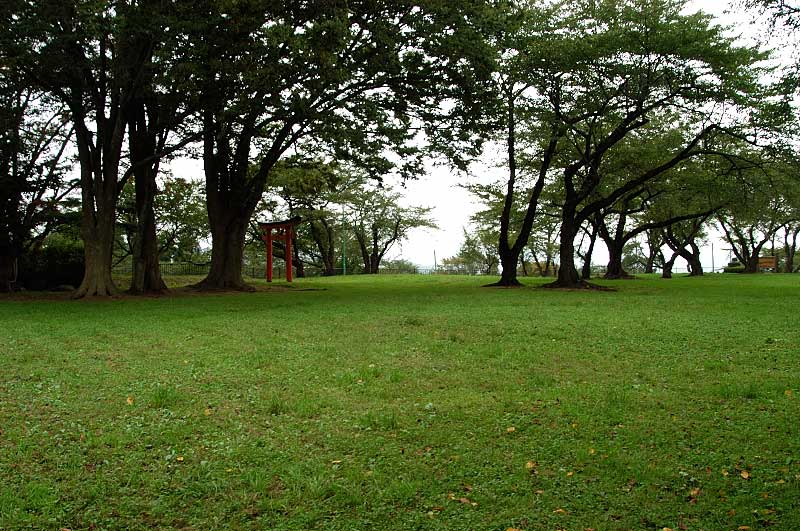


Parks, trails and playgrounds92




80 more on the map.
Restaurants and cafes63


トレンタ矢巾店
Restaurant · Pasta · 1.6 km
69, 矢巾町
Mo-Su 11:00-15:30,17:00-21:00

Tully's Coffee
Cafe · Coffee Shop · 1.4 km
1, 矢巾町
Mo-Fr 07:30-19:00; Sa 07:30-17:00; Su 09:00-17:00

51 more on the map.
History
The area of present-day Yahaba was part of ancient Mutsu Province, and has been settled since at least the Jōmon period. The area was inhabited by the Emishi people, and came under the control of the imperial dynasty during the early Heian period with the construction Tokutan Castle (徳丹城) a fortified settlement, by Sakanoue no Tamuramaro in 813 AD. During the Sengoku period, the area was dominated by various samurai clans before coming under the control of the Nambu clan during the late Sengoku period, who ruled Morioka Domain under the Edo period Tokugawa shogunate.
After the start of the Meiji period, the villages of Kemuyama, Tokuda and Fudo were established within Shiwa District by the establishment of the modern municipalities system on April 1, 1889. The three villages merged on March 1, 1955 to form Yahaba village, which was raised to town status on May 1, 1966.
From the History section of Yahaba, Iwate on Wikipedia, under CC BY-SA 4.0.
Where to stay7
Churches and places of worship8
Shopping23
Gas and EV charging3
Schools, colleges and libraries29
Healthcare23
Map of Yahaba
250 places. The map loads OpenStreetMap tiles when you open it.
Getting there and nearby towns
Hanamaki Airport (HNA) is the nearest airport with scheduled flights listed in OpenStreetMap, 20 km away.
- Morioka 10 km north, about 10 min by car
- Shizukuishi 17 km northwest, about 17 min by car
- Hachimantai 32 km north, about 32 min by car
- Semboku 36 km west, about 36 min by car
- Kanegasaki 46 km south, about 46 min by car
- Tōno 47 km southeast, about 47 min by car
- Kakunodatemachi 50 km west, about 50 min by car
- Ōshū 53 km south, about 53 min by car
- Rokugō 56 km southwest, about 56 min by car
- Daisen 60 km west, about 1 h by car
Drive times are estimates from straight-line distance, not routes.
Local news
Headlines from INDB.
Reviews, tips and questions
Loading what members have shared...
Sources and licences
- GeoNames (CC BY 4.0): population, coordinates, regions and time zone
- OpenStreetMap contributors (ODbL 1.0): places, airports, map data
- Wikidata (CC0 1.0): elevation, founding date, time zone, website, landmarks and historic places
- Wikimedia Commons (see each image): photos
- Wikipedia (CC BY-SA 4.0): overview and history text
Photo credits
- Yahaba Station west exit, Likebreak at Japanese Wikipedia, CC BY-SA 3.0
- Yahaba-cho Folk Historical Material Hall, 妖精書士, CC0
- Bank of Iwate 119-Yahaba branch, Suikotei, CC BY 4.0
- IBC Yahaba Radio Station4, カスタヌー, CC BY-SA 3.0
- Yahaba PA, アラツク, CC BY-SA 4.0
- IBC Yahaba Radio Station3, カスタヌー, CC BY-SA 3.0
- Yahaba SIC for Aomori 221008, Yauchi, CC0
- Iwate Prefectural Road Route 207 (Yahaba Station Line) at Nishitokuta, Yahaba Town, 小石川人晃, CC BY-SA 4.0
- Tohoku Expressway Yahaba Smart Interchange, Yasu ( talk ), CC BY-SA 3.0
- Iwate Prefectural Road Route 208 (Ogayu Tokuta Line) at Nishitokuta, Yahaba Town, 小石川人晃, CC BY-SA 4.0
- Iwate Museum of Art, yisris / Yuichi, CC BY-SA 2.0
- Moriokaminami, Tankobodg This photo was taken with iPhone 5S, CC BY-SA 3.0
- Morioka Red Cross Hospital, アラツク, CC BY-SA 4.0
- Kousuijijou001, Satoshin, CC BY-SA 3.0
- Iwate Prefectural Morioka Daishi High School 1, Ebiebi2, CC BY-SA 4.0
- Iwate Prefectural Morioka Technical High School 1, Ebiebi2, CC BY-SA 4.0
- Kawakubo hospital, Morioka, 運動会プロテインパワー, CC BY-SA 4.0
- Iwate Prefectural Kozukata Senior High School 1, Ebiebi2, CC BY-SA 4.0
- 岩手県立産業技術短期大学校 矢巾キャンパス, Qthr, CC BY-SA 4.0
- 県道207号線 - panoramio (1), Yobito KAYANUMA, CC BY-SA 3.0
- Sasaki Family Magariya House, 妖精書士, CC0
- 県道205号線 - panoramio, Yobito KAYANUMA, CC BY-SA 3.0
- 県道285号線 - panoramio (1), Yobito KAYANUMA, CC BY-SA 3.0
- 徳田橋 - panoramio, Yobito KAYANUMA, CC BY-SA 3.0
- Partial Solar Eclipse at Morioka, Japan (Composition), yisris from Morioka, Japan, CC BY 2.0
- Partial Solar Eclipse at Morioka, Japan (7241208924), yisris, CC BY 2.0
- 南昌山 IMG 9394, フルスイング, CC BY-SA 4.0
- 盛岡矢巾自転車道 - panoramio (2), Yobito KAYANUMA, CC BY-SA 3.0
- 8 Chiwari Higashimirumae, Morioka-shi, Iwate-ken 020-0832, Japan - panoramio (3), kiwa dokokano, CC BY-SA 3.0
- 8 Chiwari Higashimirumae, Morioka-shi, Iwate-ken 020-0832, Japan - panoramio, kiwa dokokano, CC BY-SA 3.0
- 8 Chiwari Higashimirumae, Morioka-shi, Iwate-ken 020-0832, Japan - panoramio (1), kiwa dokokano, CC BY-SA 3.0
- ISS045-E-81595 - View of Earth, Earth Science and Remote Sensing Unit , Lyndon B. Johnson Space Center, Public domain
- ISS045-E-81593 - View of Earth, Earth Science and Remote Sensing Unit , Lyndon B. Johnson Space Center, Public domain
- ISS045-E-81590 - View of Earth, Earth Science and Remote Sensing Unit , Lyndon B. Johnson Space Center, Public domain
- ISS045-E-81592 - View of Earth, Earth Science and Remote Sensing Unit , Lyndon B. Johnson Space Center, Public domain
- ISS045-E-81594 - View of Earth, Earth Science and Remote Sensing Unit , Lyndon B. Johnson Space Center, Public domain
- ISS045-E-81591 - View of Earth, Earth Science and Remote Sensing Unit , Lyndon B. Johnson Space Center, Public domain
- Iwagin Stadium 20250516, 掬茶, CC BY-SA 4.0
- 8 Chiwari Higashimirumae, Morioka-shi, Iwate-ken 020-0832, Japan - panoramio (2), kiwa dokokano, CC BY-SA 3.0
- Indoor facility of Iwate Morioka Ballpark 20250516b, 掬茶, CC BY-SA 4.0


Page built November 5, 2026. Spotted a mistake? Tell us or suggest a place.