


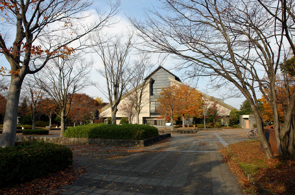


Yamanobe, Japan
山辺町
Yamanobe is a town of 13,725 people in Yamagata, Japan, founded in April 1, 1889.
Why visit Yamanobe
Townapedia lists 12 museums and landmarks, 22 parks and trails, 194 places to eat, 2 places to stay and 7 attractions in and around town.
Highlights include Yamagata Prefectural University of Health Sciences, Yamagata University, Shima ruins and Yamagata Museum of Art.
Weather in Yamanobe
Forecast from MET Norway (CC BY 4.0). Full forecast
About Yamanobe
Yamanobe (山辺町, Yamanobe-machi) is a town located in Yamagata Prefecture, Japan. As of 1 March 2020, the town had an estimated population of 14,174 in 4839 households, and a population density of 230 persons per km2. The total area of the town is 61.36 square kilometres (24 sq mi).
From the Wikipedia article Yamanobe, Yamagata (this version), under CC BY-SA 4.0.
Things to do7
Yamagata Prefectural University of Health Sciences
School · 7.0 km
Higher education institution in Yamagata Prefecture, Japan

Yamagata University
School · 8.8 km
Higher education institution in Yamagata Prefecture, Japan


Museums and landmarks12

Shima ruins
Monument and historic site · 4.6 km
Japanese archaeological site
Yamagata Museum of Art
Museum · 6.9 km
Art museum in Yamagata, Yamagata, Japan




Parks, trails and playgrounds22



10 more on the map.
Restaurants and cafes194


182 more on the map.
History
The area of present-day Yamanobe was part of ancient Dewa Province. After the start of the Meiji period, the area became part of Higashimurayama District, Yamagata Prefecture. The village of Yamanobe was established on April 1, 1889, with the creation of the modern municipalities system. It was elevated to town status in 1896.
From the History section of Yamanobe, Yamagata on Wikipedia, under CC BY-SA 4.0.
Where to stay2
Churches and places of worship42
Shopping55
Gas and EV charging13
Schools, colleges and libraries25
Healthcare68
Map of Yamanobe
250 places. The map loads OpenStreetMap tiles when you open it.
Getting there and nearby towns
Yamagata Airport (GAJ) is the nearest airport with scheduled flights listed in OpenStreetMap, 16 km away.
- Tendō 11 km northeast, about 11 min by car
- Nagai 29 km southwest, about 29 min by car
- Takahata 33 km south, about 33 min by car
- Obanazawa 37 km north, about 37 min by car
- Murata 44 km southeast, about 44 min by car
- Shiroishi 44 km southeast, about 44 min by car
- Ōkawara 49 km southeast, about 49 min by car
- Shinjō 52 km north, about 52 min by car
- Sendai 52 km east, about 52 min by car
- Natori-shi 56 km east, about 56 min by car
Drive times are estimates from straight-line distance, not routes.
Local news
Headlines from INDB.
Reviews, tips and questions
Loading what members have shared...
Sources and licences
- GeoNames (CC BY 4.0): population, coordinates, regions and time zone
- OpenStreetMap contributors (ODbL 1.0): places, airports, map data
- Wikidata (CC0 1.0): elevation, founding date, time zone, website, landmarks and historic places
- Wikimedia Commons (see each image): photos
- Wikipedia (CC BY-SA 4.0): overview and history text
Photo credits
- Yamanobe town office, アラツク, CC BY-SA 4.0
- Yamagata Pref. Univ. of Health Sciences, Suz-b, CC BY-SA 3.0
- Yamagata Museum of Art 2007, No machine-readable author provided. Crown of Lenten rose assumed (based on copyright claims)., Public domain
- Mogami Yoshiaki Historical Museum, Mogami Yoshiaki Historical Museum, CC BY-SA 3.0
- Yamagata-Saisei-Byoin, Suz-b, CC BY-SA 3.0
- Yamagata Pref. Yamanobe High School, Suz-b, CC BY-SA 3.0
- National Hospital Organization Yamagata National Hospital, Waka77, Public domain
- 220430 Yamagata Castle Yamagata Yamagata pref Japan01s3, 663highland, CC BY-SA 4.0
- Chōkai Gassan Ryōshonomiya torii - 2012, Suz-b, CC BY-SA 3.0
- Yamagata-jo ninomaru higashi-otemon, kamoseiro, CC BY-SA 2.5
- AEON Yamagata kita Shopping Center 02, Suz-b, CC BY-SA 4.0
- Shima iseki park 02, Yamagata, Suz-b, CC BY-SA 4.0
- 220430 Yamagata Castle Yamagata Yamagata pref Japan21s3, 663highland, CC BY-SA 4.0
- Yamagata Tokushukai Hospital, Yamagata, Suz-b, CC BY-SA 4.0
- Yabuki hospital in Shima, Yamagata, Suz-b, CC BY-SA 4.0
- Shima iseki park 01, Yamagata, Suz-b, CC BY-SA 4.0
- 山辺の夕日 - panoramio, himucl, CC BY-SA 3.0
- ISS043-E-245265 - View of Earth, Earth Science and Remote Sensing Unit , Lyndon B. Johnson Space Center, Public domain
- ISS043-E-245264 - View of Earth, Earth Science and Remote Sensing Unit , Lyndon B. Johnson Space Center, Public domain
- ISS022-E-63105 - View of Earth, Earth Science and Remote Sensing Unit , Lyndon B. Johnson Space Center, Public domain
- Yamagata-Chuo IC 7000km 120630, Yauchi, CC BY-SA 3.0
- Yamagata-Chuo IC 120630, Yauchi, CC BY-SA 3.0
- Yamagata Prefectural Road Route 49 (Yamagata Yamabe Line) at Nishita, Yamagata City, 小石川人晃, CC BY-SA 4.0
- 紅白 ひよ子 吉野堂 (27154787020), 克年 三沢, CC BY 2.0
- ThinkPad X230 keyboard 20150925, 三沢克年, CC BY 2.0
- Nakayama town oiffice, アラツク, CC BY-SA 4.0
- 焼肉専科プルコギ - panoramio, himucl, CC BY-SA 3.0
- Yamagata Parking Area 20250712, 掬茶, CC BY-SA 4.0
- ISS019-E-11167 - View of Earth, Earth Science and Remote Sensing Unit , Lyndon B. Johnson Space Center, Public domain
- ISS022-E-57075 - View of Earth, Earth Science and Remote Sensing Unit , Lyndon B. Johnson Space Center, Public domain
- ISS022-E-61949 - View of Earth, Earth Science and Remote Sensing Unit , Lyndon B. Johnson Space Center, Public domain
- 山形営業所で待機する路線車, Kumoya743, CC BY-SA 4.0
- 山形営業所, Kumoya743, CC BY-SA 4.0
- Akanegaoka Park in Yamagata, Yamagata 001, contri from Yonezawa-Shi, Yamagata, Japan, CC BY-SA 2.0
- Akanegaoka Park in Yamagata, Yamagata 002, contri from Yonezawa-Shi, Yamagata, Japan, CC BY-SA 2.0
- Griver SAGAE 2013, Tourisu-garin, Public domain
- 虎真ラーメン - panoramio, himucl, CC BY-SA 3.0
- 大朝日岳 Mt. O-asahi-dake - panoramio (1), Tomofumi Sato, CC BY-SA 3.0
- 月山 Mt. Gassan - panoramio (1), Tomofumi Sato, CC BY-SA 3.0
- 瀧山と山形新幹線つばさ Mt. Ryu-zan ^ Yamagata Shinkansen "Tsubasa" - panoramio, Tomofumi Sato, CC BY-SA 3.0


Page built November 5, 2026. Spotted a mistake? Tell us or suggest a place.