


Why visit Lauderdale
Townapedia lists 57 museums and landmarks, 24 parks and trails, 40 places to eat, 1 place to stay and 20 attractions in and around town.
Highlights include 10th Avenue Bridge, Augsburg University, Bell Museum and Luther Seminary.
July is the warmest month, with average highs of 81°F; January lows average 6°F, and about 40 inches of snow fall in a normal year.
Weather in Lauderdale
Forecast from the National Weather Service. Full forecast
About Lauderdale
Lauderdale is a city in Ramsey County, Minnesota, United States. The population was 2,271 at the 2020 census. Lauderdale is part of the Minneapolis–St. Paul metropolitan area and is bordered by Minneapolis, St. Paul, Roseville, and Falcon Heights. Along with Roseville, it is one of two cities to be bordered directly by Minneapolis and St.
From the Wikipedia article Lauderdale, Minnesota (this version), under CC BY-SA 4.0.
Things to do20

10th Avenue Bridge
Bridge · National Register of Historic Places · 2.3 mi
Bridge in Minneapolis, Minnesota

Hamline University
School · 2.7 mi
Private liberal arts college in Saint Paul, Minnesota
Hennepin Avenue Bridge
Bridge · 3.0 mi
Bridge in Minneapolis, Minnesota
I-35W Mississippi River bridge
Bridge · 2.3 mi
Destroyed bridge in Minneapolis, Minnesota
I-35W Saint Anthony Falls Bridge
Bridge · 2.3 mi
Bridge in Minneapolis, Minnesota
Lake Street-Marshall Bridge
Bridge · 3.2 mi
Bridge connecting Minneapolis and Saint Paul, Minnesota

Mixed Blood Theatre Company
Cinema and theater · 2.8 mi
Theater company in Minneapolis, Minnesota, United States, using the Alan Page Auditorium in a historic fire station
Northern Pacific Bridge Number 9
Bridge · 2.2 mi
Bridge in Minneapolis, Minnesota
Pence Opera House
Cinema and theater · 3.3 mi
Former theatre in Minneapolis, Minnesota, United States
8 more on the map.
Museums and landmarks57


Luther Seminary
Monument and historic site · National Register of Historic Places · 0.7 mi
Lutheran seminary in Saint Paul, Minnesota, US

Advance Thresher/Emerson-Newton Implement Company
Monument and historic site · National Register of Historic Places · 3.0 mi
Historic buildings in Minneapolis, Minnesota, USA

Andrew R. McGill House
Monument and historic site · National Register of Historic Places · 1.3 mi
Historic house in Minnesota, United States

B. O. Cutter House
Monument and historic site · National Register of Historic Places · 2.0 mi
Historic house in Minnesota, United States

Bandana Square
Monument and historic site · National Register of Historic Places · 2.9 mi
Historic district in Saint Paul, Minnesota
Bridges No. L-5853 and 92247
Monument and historic site · National Register of Historic Places · 3.0 mi
Bridges in Saint Paul, Minnesota, United States

Chicago, Milwaukee, St. Paul and Pacific Depot Freight House and Train Shed
Monument and historic site · National Register of Historic Places · 3.1 mi
Former train station in Minneapolis, Minnesota, since renovated for other uses

Como Park Zoo and Conservatory
Monument and historic site · National Register of Historic Places · 2.7 mi
Zoo and conservatory in Saint Paul, Minnesota, United States

East Lake Library
Monument and historic site · National Register of Historic Places · 3.4 mi
Public library in Minneapolis, Minnesota, USA
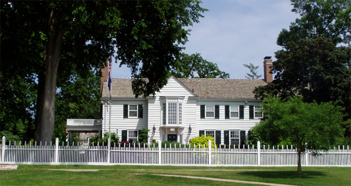
Eastcliff
Monument and historic site · National Register of Historic Places · 3.3 mi
Historic house in St. Paul, Minnesota


Farmers and Mechanics Savings Bank
Monument and historic site · National Register of Historic Places · 3.3 mi
Building in Minneapolis, Minnesota
45 more on the map.
Parks, trails and playgrounds24

Mill Ruins Park
Park · 2.8 mi
Park in Minneapolis, Minnesota, United States
12 more on the map.
Restaurants and cafes40

Vitality Roasting
Cafe · Coffee Shop · 1.4 mi
Vitality Roasting offers hand crafted beverages from it's local, craft roasted beans.
1500 SE Como Ave, Minneapolis
Mo-Su 08:00-17:00

Boludo
Restaurant · Argentinian, Pizza, Empanada · 1.4 mi
1519 Southeast Como Avenue
Mo 17:00-21:00; Tu-Th 11:00-21:00; Fr-Sa 11:00-00:00; Su 11:00-21:00
Chin Dian Kitchen
Restaurant · Chinese, Indian, Asian · 1.4 mi
1500 East Hennepin Avenue, Minneapolis
Mo-Th 11:00-14:00,16:30-20:30; Fr 11:00-13:00,16:30-21:00; Sa 17:00-21:00
Honour Coffee
Cafe · Coffee Shop, Juice, Breakfast · 1.1 mi
451 Northeast Stinson Boulevard, Minneapolis
Mo-Fr 06:30-18:00, Sa-Su 07:00-18:00
Lanna Thai
Restaurant · Thai · 0.9 mi
2295 Como Avenue, Saint Paul
Mo-Th 11:00-21:00, Fr-Sa 11:00-22:00, Su 11:00-20:00
Manning's
Restaurant · American, Burger, Grill · 1.0 mi
2200 Southeast Como Avenue
Mo-Th,Su 08:00-24:00; Fr,Sa 08:00-02:00
Phở 79
Restaurant · Vietnamese · 1.4 mi
2233 Energy Park Drive, Saint Paul
Mo-Fr 11:00-20:00; Sa 12:00-20:00
Zakia Deli
Restaurant · Lebanese · 1.1 mi
2412 Northeast Kennedy Street, Minneapolis
Mo-Fr 10:00-19:00; Sa 11:00-16:00

Como Tap
Restaurant · 1.0 mi
2124 Southeast Como Avenue, Minneapolis
Mo-Th 16:00-01:00; Fr-Sa 11:00-02:00; Su 11:00-01:00
28 more on the map.
History
Originally named Rose Hill, Lauderdale was part of the larger Rose Township, named after trader Isaac Rose. Rose Township included parts of what are now Roseville, Falcon Heights, Minneapolis, Saint Paul, Saint Anthony Village and Lauderdale. In 1871, Rose Hill's first school opened when Heman Gibbs of Gibbs Farm Museum fame donated the land for the school.
The Village of Lauderdale was incorporated on January 21, 1949. It was named after William Henry Lauderdale, a prominent Twin Cities businessman who donated land to Rose Hill Township for a school and park.
From the History section of Lauderdale, Minnesota on Wikipedia, under CC BY-SA 4.0.
Where to stay1
Churches and places of worship13
Saint Anthony Park United Church of Christ
Church · United Church Of Christ · 1.1 mi
2129 Commonwealth Avenue, Saint Paul
Centennial United Methodist Church
Church · United Methodist · 1.1 mi
2200 West Hillside Avenue, Saint Paul
Dar Al-Farooq
Place of worship · Sunni · 1.4 mi
983 Southeast 17th Avenue, Minneapolis
Shopping8
Gas and EV charging10
Koch Trucking Fuel Island
Gas station · 0.9 mi
430 Northeast Harding Street, Minneapolis
Schools, colleges and libraries47
Healthcare3
Map of Lauderdale
223 places. The map loads OpenStreetMap tiles when you open it.
Climate by month
Monthly table
| Month | High | Low | Rain | Snow |
|---|---|---|---|---|
| Jan | 21°F | 6°F | 0.7 in | 8.3 in |
| Feb | 26°F | 9°F | 0.8 in | 12.3 in |
| Mar | 39°F | 22°F | 1.6 in | 4.0 in |
| Apr | 55°F | 36°F | 3.0 in | 2.1 in |
| May | 67°F | 48°F | 4.2 in | 0.0 in |
| Jun | 77°F | 58°F | 4.6 in | 0.0 in |
| Jul | 81°F | 63°F | 4.5 in | 0.0 in |
| Aug | 79°F | 60°F | 4.5 in | 0.0 in |
| Sep | 71°F | 52°F | 3.3 in | 0.0 in |
| Oct | 57°F | 39°F | 2.9 in | 0.5 in |
| Nov | 40°F | 25°F | 1.5 in | 3.0 in |
| Dec | 26°F | 12°F | 1.1 in | 10.2 in |
U.S. Climate Normals 1991-2020 for U Of Mn St Paul (1 mi away), NOAA NCEI.
People and cost of living
American Community Survey 5-year estimates, 2020-2024, U.S. Census Bureau. Estimates have margins of error, larger for small towns.
Disaster history
Ramsey County has had 10 federal disaster declarations since 2000, most often for floods.
- 2020-04-07: Covid-19 Pandemic (Biological)
- 2020-03-13: Covid-19 (Biological)
- 2019-06-12: Severe Winter Storm, Straight-Line Winds, And Flooding (Flood)
- 2014-07-21: Severe Storms, Straight-Line Winds, Flooding, Landslides, And Mudslides (Flood)
- 2011-05-10: Severe Storms And Flooding (Flood)
- 2010-04-19: Flooding (Flood)
OpenFEMA disaster declarations summaries.
Getting there and nearby towns
Minneapolis-Saint Paul International Airport (MSP) is the nearest airport with scheduled flights listed in OpenStreetMap, 8 miles away.
- Falcon Heights 1 mi east, about 2 min by car
- Roseville 3 mi northeast, about 5 min by car
- Minneapolis 4 mi southwest, about 6 min by car
- Columbia Heights 4 mi northwest, about 7 min by car
- New Brighton 5 mi north, about 9 min by car
- Hilltop 5 mi northwest, about 8 min by car
- St. Paul 6 mi southeast, about 9 min by car
- Arden Hills 6 mi north, about 9 min by car
- Little Canada 6 mi east, about 10 min by car
- Fridley 7 mi northwest, about 11 min by car
Drive times are estimates from straight-line distance, not routes.
Local news
Headlines from INDB, the NEMICO news database.
Reviews, tips and questions
Loading what members have shared...
Sources and licences
- NCES EDGE (Public domain): public schools
- NOAA NCEI U.S. Climate Normals 1991-2020 (Public domain): climate by month
- OpenFEMA (Public domain): disaster declarations
- OpenStreetMap contributors (ODbL 1.0): places, airports, map data
- U.S. Census Bureau (Public domain): population, income, housing, education, commute
- Wikidata (CC0 1.0): elevation, founding date, time zone, website, landmarks and historic places
- Wikimedia Commons (see each image): photos
- Wikipedia (CC BY-SA 4.0): overview and history text
Photo credits
- Minneapolis, MN - panoramio (118), Gabriel Vanslette, CC BY 3.0
- Bockman Hall, McGhiever, CC BY-SA 3.0
- Flour Exchange Building, McGhiever, CC BY-SA 4.0
- B. O. Cutter House, McGhiever, CC BY-SA 4.0
- St. Anthony Park Branch Library, McGhiever, CC BY 4.0
- 2023-0929 Malcolm Willey House, Bobak Ha'Eri, CC BY 3.0
- Woodbury Fisk House, McGhiever, CC BY-SA 4.0
- Northrop Mall - panoramio, Jon Platek, CC BY-SA 3.0
- Hollywood Theater Mpls, McGhiever, CC BY-SA 4.0
- Minneapolis Fire Department Repair Shop, McGhiever, CC BY-SA 4.0
- 1stcongchurch, Appraiser, CC BY-SA 4.0
- 1891 Farmers and Mechanics Savings Bank, McGhiever, CC BY-SA 3.0
- Southeast Steam Plant-2006-07-22, Michael Hicks, CC BY 2.0
- Triune Masonic Temple 2013, McGhiever, CC BY-SA 3.0
- Minneapolis Armory, Tim Kiser ( w:User:Malepheasant ), CC BY-SA 2.5
- Horatio P. Van Cleve House, McGhiever, CC BY-SA 3.0
- Meeker Island Lock and Dam, Unknown author, Public domain
- Riverside Plaza and Mixed Blood Theatre at sunset 2014-08-09, August Schwerdfeger, CC BY 4.0
- Franklin Avenue Bridge Minneapolis, Mulad, Public domain
- Minneapolis Grain Exchange, Unknown author, Public domain
- Pillsbury Hall, Unknown author, Public domain
- Grace University Lutheran Church Minneapolis 20, AlexiusHoratius, CC BY-SA 3.0
- Muskego3, Appraiser, CC BY-SA 4.0
- Krank Manufacturing Company Building 2, McGhiever, CC BY-SA 3.0
- Mill City Museum-20070704, quaziefoto from Ann Arbor, CC BY 2.0
- Eastcliff, RxS at English Wikipedia, Public domain
- Franklin Branch Library 2, Elkman, CC BY-SA 4.0
- Old Federal Building Minneapolis east, McGhiever, CC BY-SA 4.0
- BandanaSq, RxS at English Wikipedia, Public domain
- Fire Station No. 19, McGhiever, CC BY-SA 4.0
- North East NHood House 1, Elkman, CC BY-SA 4.0
- Advance Thresher–Emerson-Newton Implement Company, McGhiever, CC BY-SA 4.0
- Como Park Zoo and Conservatory-2006, RxS at English Wikipedia, Public domain
- Salvation Army Women's Home & Hospital, McGhiever, CC BY-SA 3.0
- Minneapolis Brewing Company, McGhiever, CC BY-SA 3.0
- Milwaukee Ave Minneapolis 2, McGhiever, CC BY-SA 4.0
- Minneapolis City Hall 2012, Jason Riedy from East Point, GA, USA, CC BY 2.0
- Old East Lake Branch Library, McGhiever, CC BY-SA 4.0
- 051907-020-TheDepot, Bobak Ha'Eri, CC BY 3.0


Page built October 30, 2026. Spotted a mistake? Tell us or suggest a place.