


Why visit Hilltop
Townapedia lists 8 museums and landmarks, 34 parks and trails, 45 places to eat, 2 places to stay and 5 attractions in and around town.
Highlights include Camden Bridge, Canadian Pacific Camden Place Rail Bridge, Banfill Tavern and Foss House.
July is the warmest month, with average highs of 83°F; January lows average 7°F.
Weather in Hilltop
Forecast from the National Weather Service. Full forecast
About Hilltop
Hilltop is a city in Anoka County, Minnesota, United States. The population was 958 at the 2020 census.
From the Wikipedia article Hilltop, Minnesota (this version), under CC BY-SA 4.0.
Things to do5

Camden Bridge
Bridge · 2.2 mi
Bridge in Minneapolis, Minnesota, United States
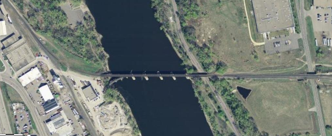
Canadian Pacific Camden Place Rail Bridge
Bridge · 2.3 mi
Bridge in Minneapolis, Minnesota


Lowry Avenue Bridge
Bridge · 3.0 mi
Tied-arch bridge that crosses the Mississippi River in Minneapolis, Minnesota, United States

Museums and landmarks8
Banfill Tavern
Monument and historic site · National Register of Historic Places · 2.8 mi
Building in Fridley, Minnesota, United States

Foss House
Monument and historic site · National Register of Historic Places · 1.7 mi
Home in New Brighton, Minnesota, United States

Hollywood Theater
Monument and historic site · National Register of Historic Places · 2.5 mi
Former movie theater in Minneapolis, Minnesota, United States


North East Neighborhood House
Monument and historic site · National Register of Historic Places · 3.2 mi
Building in Minneapolis, Minnesota, United States

Parks, trails and playgrounds34

Bohanon Park
Park · 2.2 mi
City park in Minneapolis, Minnesota, United States
North Mississippi Regional Park
Park · 1.7 mi
Park in Hennepin County, Minnesota, United States of America

22 more on the map.
Restaurants and cafes45

Al Baraka Grill
Restaurant · Middle Eastern · 0.7 mi
4110 Central Avenue Northeast, Columbia Heights
Mo-Th 11:00-22:30; Fr 10:00-23:00; Sa,Su 11:00-23:45
Big Marina Buffet & Deli
Restaurant · Greek
4755 Central Avenue Northeast, Columbia Heights
Mo-Fr 10:00-21:00

Chimney Cake House
Cafe · Dessert, Coffee Shop · 0.7 mi
4110 Central Avenue Northeast, Columbia Heights
Mo-Th 11:00-22:00; Fr,Sa 11:00-00:00; Su 11:00-22:00
El Taco Loco
Restaurant · Mexican · 0.6 mi
4220 Central Avenue Northeast
Tu-Sa 10:00-21:00; Su,Mo 10:00-20:00
El Tequila Mexican Grill & Bar
Restaurant · Mexican, Ecuadorian · 0.9 mi
4005 Central Avenue Northeast, Columbia Heights
Su-Th 11:00-23:00; Fr, Sa 11:00-00:00
Filfillah Mediterranean Grill
Restaurant · Mediterranean · 0.5 mi
4301 Central Avenue Northeast, Columbia Heights
Su-Sa 11:00-23:45
Great Moon Buffet
Restaurant · Chinese · 0.8 mi
4029 Central Avenue Northeast, Columbia Heights
Su-Th 11:00-21:00; Fr, Sa 11:00-22:00
LaCasita Mexican Restaurant
Restaurant · Mexican · 0.6 mi
5085 Central Avenue Northeast
Su-Th 11:00-21:00; Fr,Sa 11:00-22:00
New York Gyro
Restaurant · Greek
4621 Central Avenue Northeast, Columbia Heights
Mo-Fr 11:00-00:00; Sa,Su 10:00-00:00
Pizza Man
Restaurant · Pizza · 0.8 mi
4045 Central Avenue Northeast, Columbia Heights
Su-Sa 10:30-22:00
33 more on the map.
History
The land where Hilltop sits was originally an unincorporated part of the former Fridley Township, a civil township next to the city of Fridley. The land had a dairy farm and was later the Oak Grove Riding Academy and Stables. The first trailer park, Trailer City, opened on the land in the 1940s; another park, Sunnyside, soon opened next door. Residents of two trailer parks became concerned that the township was planning to remove the mobile homes. In 1956, led by Trailer City Park owner Les Johnson, they approached Columbia Heights and requested to be annexed by the city. Columbia Heights turned down their request, so Johnson circulated a petition to have the residents vote on incorporation. The petition for incorporation passed, 137 to 34, and Hilltop was created. The city was named after a nearby drive-in cinema.
From the History section of Hilltop, Minnesota on Wikipedia, under CC BY-SA 4.0.
Where to stay2
Churches and places of worship5
The Church of Jesus Christ of Latter-day Saints
Church · Mormon · 1.5 mi
100 Silver Lake Road, New Brighton
Shopping10
Gas and EV charging7
Schools, colleges and libraries43
Legacy of Dr Josie R Johnson Montes
School · 4.3 mi
2201 Girard Ave N, Minneapolis
Healthcare2
Map of Hilltop
161 places. The map loads OpenStreetMap tiles when you open it.
Climate by month
Monthly table
| Month | High | Low | Rain |
|---|---|---|---|
| Jan | 24°F | 7°F | 0.6 in |
| Feb | 29°F | 11°F | 0.6 in |
| Mar | 42°F | 23°F | 1.4 in |
| Apr | 57°F | 35°F | 2.9 in |
| May | 70°F | 47°F | 4.3 in |
| Jun | 79°F | 58°F | 4.4 in |
| Jul | 83°F | 62°F | 4.2 in |
| Aug | 81°F | 60°F | 4.1 in |
| Sep | 73°F | 52°F | 3.2 in |
| Oct | 58°F | 38°F | 2.6 in |
| Nov | 42°F | 26°F | 1.5 in |
| Dec | 29°F | 13°F | 0.9 in |
U.S. Climate Normals 1991-2020 for Mpls Crystal Ap (5 mi away), NOAA NCEI.
People and cost of living
American Community Survey 5-year estimates, 2020-2024, U.S. Census Bureau. Estimates have margins of error, larger for small towns.
Disaster history
Anoka County has had 6 federal disaster declarations since 2000, most often for biologicals.
- 2020-04-07: Covid-19 Pandemic (Biological)
- 2020-03-13: Covid-19 (Biological)
- 2011-06-07: Severe Storms And Tornadoes (Severe Storm)
- 2005-09-13: Hurricane Katrina Evacuation (Hurricane)
- 2001-05-16: Severe Winter Storms, Flooding, And Tornadoes (Flood)
- 2000-10-20: Mn - Carlos Edge Fire Complex - 10/19/2000 (Fire)
OpenFEMA disaster declarations summaries.
Getting there and nearby towns
Crystal Airport (MIC) is the nearest airport with scheduled flights listed in OpenStreetMap, 5 miles away.
- Columbia Heights 0 mi southeast, about 1 min by car
- Fridley 2 mi north, about 3 min by car
- New Brighton 2 mi northeast, about 4 min by car
- Brooklyn Center 3 mi west, about 6 min by car
- Mounds View 4 mi northeast, about 7 min by car
- Arden Hills 4 mi east, about 7 min by car
- Robbinsdale 4 mi southwest, about 7 min by car
- Roseville 5 mi southeast, about 9 min by car
- Crystal 5 mi west, about 9 min by car
- Minneapolis 6 mi south, about 10 min by car
Drive times are estimates from straight-line distance, not routes.
Local news
Headlines from INDB, the NEMICO news database.
Reviews, tips and questions
Loading what members have shared...
Sources and licences
- NCES EDGE (Public domain): public schools
- NOAA NCEI U.S. Climate Normals 1991-2020 (Public domain): climate by month
- OpenFEMA (Public domain): disaster declarations
- OpenStreetMap contributors (ODbL 1.0): places, airports, map data
- U.S. Census Bureau (Public domain): population, income, housing, education, commute
- Wikidata (CC0 1.0): elevation, founding date, time zone, website, landmarks and historic places
- Wikimedia Commons (see each image): photos
- Wikipedia (CC BY-SA 4.0): overview and history text
Photo credits
- 2009-0610-004-Hilltop-CH, Bobak Ha'Eri, CC BY 3.0
- Hollywood Theater Mpls, McGhiever, CC BY-SA 4.0
- Foss House, McGhiever, CC BY-SA 3.0
- North East NHood House 1, Elkman, CC BY-SA 4.0
- Banfill Tavern, McGhiever, CC BY-SA 3.0
- Camden Bridge Mpls, McGhiever, CC BY-SA 4.0
- St Mary's Orthodox Cathedral Mpls, McGhiever, CC BY-SA 4.0
- New Lowry Avenue Bridge, Cadwaladr, CC BY-SA 3.0
- Canadian Pacific Camden Place Rail Bridge USGS, USGS, Public domain

Page built October 30, 2026. Spotted a mistake? Tell us or suggest a place.