




Cuauhtémoc, Mexico
Cuauhtémoc is a town of 531,831 people in Mexico City, Mexico, founded in December 29, 1970.
Why visit Cuauhtémoc
Townapedia lists 110 museums and landmarks, 28 parks and trails, 271 places to eat, 43 places to stay and 29 attractions in and around town.
Highlights include Teatro de la Ciudad Esperanza Iris, Teatro Fru Fru, Museo de Arte Popular and Museo Memoria y Tolerancia.
Weather in Cuauhtémoc
Forecast from MET Norway (CC BY 4.0). Full forecast
About Cuauhtémoc
Cuauhtémoc (Spanish pronunciation: [kwawˈtemok] ) is a borough of Mexico City. Named after the 16th-century Aztec ruler Cuauhtémoc, it contains the oldest parts of the city, extending over what was the entire urban core of Mexico City in the 1920s.
From the Wikipedia article Cuauhtémoc, Mexico City (this version), under CC BY-SA 4.0.
Things to do29


Teatro Fru Fru
Cinema and theater · 1.2 km
Theatre in Mexico City, Mexico
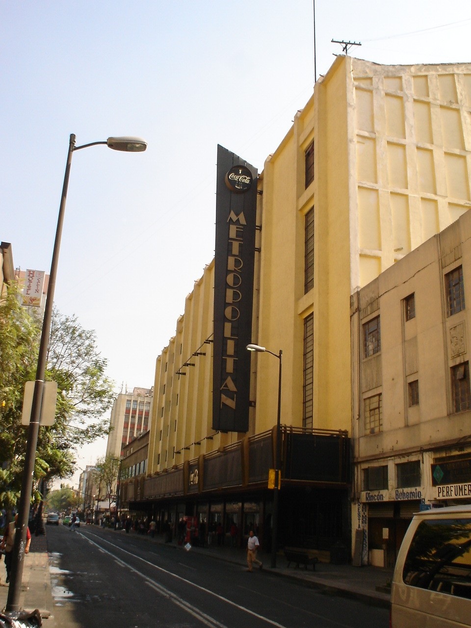
Teatro Metropólitan
Cinema and theater · 1.3 km
Music venue and theater in Mexico City, formerly a movie theater
90 Independencia, Ciudad de México


Aztlán Parque Urbano
Monument and historic site · 6.1 km
Amusement park in Mexico City
La Feria Chapultepec Mágico
Monument and historic site · 6.2 km
Former amusement park in Mexico City, Mexico

Palace of Fine arts
Cinema and theater · 1.2 km
Cultural centre in Mexico City

Polyforum Cultural Siqueiros
Cinema and theater · 6.4 km
Building in Mexico City, Mexico

Royal and Pontifical University of Mexico
School · 2.0 km
Historic university in Mexico City (1551–1865)
Teatro de la Ciudad
Cinema and theater · 1.3 km
Theatre in Mexico City

Universidad Autónoma de la Ciudad de México
School · 6.8 km
University in Mexico

17 more on the map.
Museums and landmarks110

Museo de Arte Popular
Museum · 1.2 km
11 Revillagigedo, Ciudad de México
Tu-Su 10:00-18:00; We 10:00-21:00

Museo Memoria y Tolerancia
Museum · 1.2 km
12 Calle Luis Moya, Ciudad de México
Tu-Fr 09:00-18:00; Sa,Su 10:00-19:00

Museo Nacional de San Carlos
Museum · 1.0 km
National Museum of Mexico
50 Avenida México-Tenochtitlan
Tu-Su 10:00-18:00


Museo Nacional de la Estampa
Museum · 1.0 km
Art museum in Mexico City, Mexico
39 Avenida Hidalgo, Ciudad de México
Tu-Su 10:00-18:00


Museo Franz Mayer
Museum · 0.9 km
45 Avenida Hidalgo, Ciudad de México
Mo off; Tu-Su 10:00-17:00

Museo Mural Diego Rivera
Museum · 1.0 km
Museum in Mexico City
Tu-Su 10:00-18:00


Museo Nacional de Arte
Museum · 1.2 km
Art museum in Mexico City, Mexico
10:00-18:00

Academy of San Carlos
Museum · 2.2 km
First major art academy and the first art museum in the Americas

Borda House
Monument and historic site · 1.6 km
Palace in Mexico City
98 more on the map.
Parks, trails and playgrounds28



16 more on the map.
Restaurants and cafes271

Xkina Reforma
Restaurant · Mexican · 1.0 km
24 Avenida Paseo de la Reforma, Ciudad de México
Mo-Su 07:00-23:00
Restaurante Gotan
Restaurant · Grill, Argentinian · 1.2 km
17 Calle Pedro Baranda
Mo-Th 14:00-22:00; Fr-Sa 14:00-22:00
Sonora Grill
Restaurant · Steak House · 1.2 km
1 Avenida Paseo de la Reforma
Su-We 12:00-24:00, Th-Sa 12:00-02:00
Terraza Cha Cha Chá
Restaurant · Mexican · 1.2 km
157 Avenida de la República
Mo-Sa 13:00-24:00, Su 10:00-19:00
Burger Bar Joint Forum Buenavista
Restaurant · Burger · 0.8 km
259 Eje 1 Norte, Ciudad de Mexico
Mo-Su 13:00-23:00

259 more on the map.
Where to stay43
City Express by Marriott Ciudad de México Alameda
Motel and hotel · 1.3 km
23 Calle Revillagigedo, Ciudad de México
Churches and places of worship41
Iglesia de San Hipólito
Church · Roman Catholic · 0.8 km
12 Francisco Zarco, Ciudad de México
Shopping44
Gas and EV charging6
Schools, colleges and libraries37
Centro Trilingue de Estudios Universitarios
School · 1.3 km
109 Manuel Carpio, Ciudad de México
Colegio Bilingüe Saint Mary
School · 1.3 km
72 Santa María Ribera, Ciudad de México
Colegio Nacional de Matemáticas
School · 1.0 km
21 Avenida Rosales, Ciudad de México
Escuela Primaria Dr Belisario Dominguez
School · 0.7 km
25 Heroes, Ciudad de México
Escuela Primaria Ignacio M. Altamirano
School · 0.6 km
27 Heroes, Ciudad de México
Escuela Primaria Pensador Mexicano
School · 1.3 km
132 Jaime Torres Bodet, Ciudad de México
Healthcare21
Farmacias del Ahorro
Clinic and pharmacy · 1.2 km
108 Avenida México-Tenochtitlan, Ciudad de México
Farmacia Guadalajara
Clinic and pharmacy · 1.3 km
73-81 Sor Juana Inés de la Cruz, Ciudad de México
Unidad de Medicina Familiar 16 Col. Guerrero
Clinic and pharmacy · 0.8 km
Calle Francisco González Bocanegra
Map of Cuauhtémoc
250 places. The map loads OpenStreetMap tiles when you open it.
Getting there and nearby towns
Mexico City International Airport (MEX) is the nearest airport with scheduled flights listed in OpenStreetMap, 8 km away.
- Mexico City 3 km southeast, about 3 min by car
- Benito Juarez 5 km south, about 5 min by car
- Azcapotzalco 6 km northwest, about 6 min by car
- Miguel Hidalgo 6 km west, about 6 min by car
- Gustavo Adolfo Madero 7 km northeast, about 7 min by car
- Iztacalco 8 km southeast, about 8 min by car
- Ciudad Nezahualcoyotl 15 km east, about 15 min by car
- Tlalpan 17 km south, about 17 min by car
- Ecatepec de Morelos 20 km northeast, about 20 min by car
- Xochimilco 22 km south, about 22 min by car
Drive times are estimates from straight-line distance, not routes.
Local news
Headlines from INDB.
Reviews, tips and questions
Loading what members have shared...
Sources and licences
- GeoNames (CC BY 4.0): population, coordinates, regions and time zone
- OpenStreetMap contributors (ODbL 1.0): places, airports, map data
- Wikidata (CC0 1.0): elevation, founding date, time zone, website, landmarks and historic places
- Wikimedia Commons (see each image): photos
- Wikipedia (CC BY-SA 4.0): overview and history text
Photo credits
- Calle Madero - Mexico City, Own work, CC BY-SA 4.0
- Frufru, Henryficar, CC BY-SA 4.0
- TEATRO METROPOLITAN EN EL D. F., No machine-readable author provided. JEDIKNIGHT1970 assumed (based on copyright claims)., CC BY-SA 2.5
- Acuario Inbursa entrance, Keizers, CC BY-SA 3.0
- La Feria Chapultepec Mágico, Dag Lindgren, Public domain
- Atardecer En Bellas Artes Vertical, Octavio Alonso Maya Castro, CC BY-SA 3.0
- PolyforumSiqueiros06, AlejandroLinaresGarcia, CC BY-SA 3.0
- Placa relativa a la Real y Pontificia Universidad de México, Patricia Alzuarte Díaz, CC BY-SA 3.0
- Murayl y tempusfugit, Tempusflow, CC BY 2.5
- MNSC, pátio oval, David Moran from Brooklyn, CC BY-SA 2.0
- Museo Nacional de Estampa - Mexico 2024 (2), José Luiz, CC BY-SA 4.0
- Museo Mural Diego Rivera, Kgv88, CC BY-SA 3.0
- Vista del MUNAL en la Ciudad de México, Luisalvaz, CC BY-SA 4.0
- SanCarlosAcademyDF, Thelmadatter, Public domain
- BordaHouseDF, Thelmadatter, CC BY-SA 3.0
- Dgzentradachapultepec, Nonbeach, CC BY-SA 3.0
- Monumento al Gral. Lázaro Cárdenas, Equipo 9mkt, CC BY-SA 3.0
- ClockTowerPolancoDF, Thelmadatter, Public domain
- Parque Lira - Arco de Entrada (Francesco Saverio Cavallari), Keizers, CC BY-SA 3.0
- FacadeSoledadDF3, Thelmadatter, CC BY-SA 3.0
- ValvaneraChurchDF, Thelmadatter, Public domain
- TEMPLO DE SAN BERNARDO 1, Tonatiuh101, CC BY-SA 3.0
- Convento de San Francisco - Ciudad de México - 1, ProtoplasmaKid, CC BY-SA 3.0
- Facade - Saint Ines Church - Mexico 2024, José Luiz, CC BY-SA 4.0
- CourtyardJLCMuseumDF, Thelmadatter, Public domain
- FacadeLaEnseñanza1DF, Thelmadatter, Public domain
- Santuario de Nuestra Señora del Carmen en Miguel Hidalgo (CDMX) 01, Luis Alvaz, CC BY-SA 4.0
- Templo de la Santísima Trinidad 2012-09-03 19-30-26, EdwinDlacruz, CC BY-SA 3.0
- Catedral Metropolitana de la Ciudad de México 1, ProtoplasmaKid, CC BY-SA 4.0
- Teatro de la Ciudad de Mexico, Arturo de Albornoz, CC BY-SA 2.0
- Alameda Central CDMX IMG 0731 (25892685445), Gobierno CDMX, CC0
- CourtyardFranzMayer, Thelmadatter, Public domain
- UpperStoriesMAPDF, AlejandroLinaresGarcia, CC BY-SA 4.0
- Museo Memoria y Tolerancia 2, Museo Memoria y Tolerancia, CC BY-SA 4.0
- Biblioteca Vasconcelos, Ciudad de México, México, 2015-07-20, DD 13-15 HDR, Diego Delso, CC BY-SA 4.0
- MuseumTequilaMezcalGaribaldi crop, AlejandroLinaresGarcia ; cropped by Beyond My Ken ( talk ) 04:02, 2 October 2012 (UTC), CC BY-SA 4.0
- Hilton Mexico City Reforma - 2, Jarek Tuszyński, CC BY-SA 4.0
- Templo de San Hipólito, ProtoplasmaKid, CC BY-SA 3.0
- Monumento a victimas terremoto de 1985 en México, Luis Elioth Aguilar Perez, CC BY-SA 4.0
- Ciudad de México - Hotel Fontán Reforma 0729, Ruben Poncia; Adry del Rocio; Carlosalberto CH, CC0
- Biblioteca-uacm, Soul landin, Public domain
- Mexico City (2018) - 431, Another Believer, CC BY-SA 4.0
- Vista aérea de la Ciudad de México desde el Parque Aztlán 02, ProtoplasmaKid, CC BY 4.0
- Museo del Palacio de Bellas Artes en CDMX, Mexico. Fachada principal, Gustavo lozano san juan, CC BY 4.0


Page built November 4, 2026. Spotted a mistake? Tell us or suggest a place.