


Guadalupe, Mexico
Guadalupe is a town of 673,616 people in Nuevo León, Mexico, founded in January 4, 1716.
Why visit Guadalupe
Townapedia lists 26 museums and landmarks, 82 parks and trails, 173 places to eat, 14 places to stay and 20 attractions in and around town.
Highlights include Auditorio Banamex, Mirador del Obispado, Museo Universitario de Ciencias UANL and Faro del Comercio.
Weather in Guadalupe
Forecast from MET Norway (CC BY 4.0). Full forecast
About Guadalupe
Guadalupe is a city and surrounding municipality located in the state of Nuevo León, which is located in northern Mexico. It is part of the Greater Monterrey Metropolitan area.
From the Wikipedia article Guadalupe, Nuevo León (this version), under CC BY-SA 4.0.
Travel tips from other travellers: Guadalupe on Wikivoyage (CC BY-SA 4.0).
Things to do20

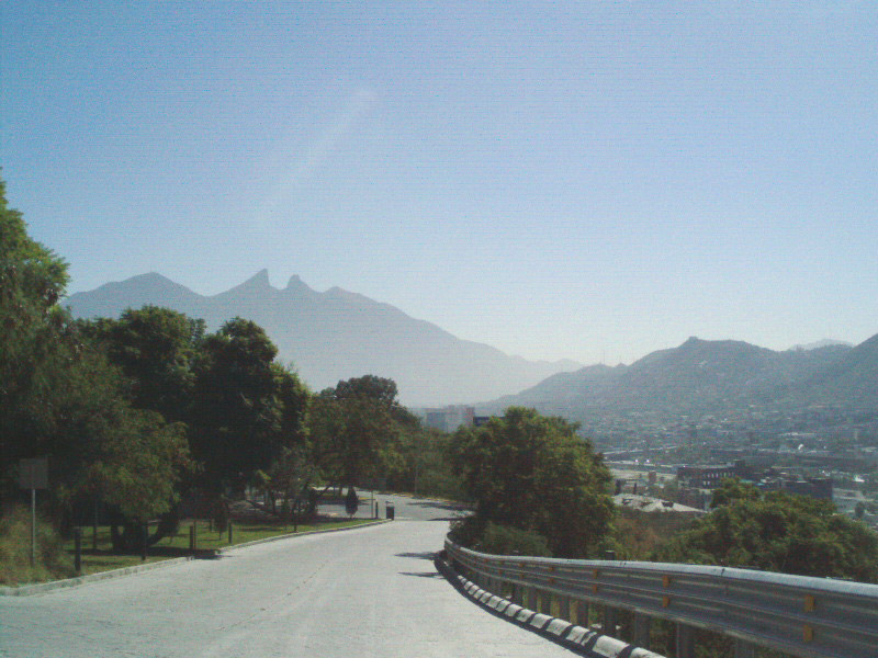
Mirador del Obispado
Monument and historic site · 8.7 km
Hill and lookout in Monterrey, Mexico

Monterrey Institute of Technology and Higher Education
School · 4.2 km
Private multi-campus university in Mexico

Monterrey Institute of Technology and Higher Education, Monterrey
School · 4.2 km
University campus


Universidad Autónoma Nuevo León
School · 7.6 km
Public university in the state Nuevo León in Mexico
Universidad de la vida, la casa de los famosos
School · 6.3 km
Institution of higher education in Monterrey, México
Universidad Metropolitana de Monterrey
School · 5.3 km
Mexican university

Zoológico la pastroa
Zoo and aquarium · 1.4 km
154 Avenida Pablo Livas, GUADALUPE
Mo-Fr 08:00-17:00

8 more on the map.
Museums and landmarks26

Museo Universitario de Ciencias UANL
Museum · 3.7 km
1060 Vicente Suárez
Tu-Fr 09:00-18:00; Sa-Su 10:00-17:00

Faro del Comercio
Monument and historic site · 5.2 km
Monument in Mexico

Government Palace Museum
Museum · 5.0 km
State government building in Monterrey, Mexico

Museo de Arte Contemporáneo de Monterrey
Museum · 5.2 km
Museum of Contemporary Art in Monterrey, Mexico

Museum of Steel
Museum · 2.4 km
Museum in Monterrey, Nuevo León, Mexico

Palacio del Obispado
Museum · 8.3 km
History Museum in Nuevo Leon, MX

14 more on the map.
Parks, trails and playgrounds82


Estadio BBVA
Sports field and stadium · 1.7 km
Avenida Pablo Livas, GUADALUPE

Parque Rincon del Contry
Park · 1.8 km
Parque con juegos, cancha de basketball y pista para caminar o trotar. Pet friendly.
Calle José Camilo Cela, Guadalupe

70 more on the map.
Restaurants and cafes173

Botanero Moritas
Restaurant · 3.1 km
Puntacero Av Fundidora 200, Obrera, 64800 Monterrey, N.L.
Mo-Th 01:00-01:00; Fr, Sa 01:00-02:00; Su 01:00-05:00
Los Tarascos
Restaurant · Tacos · 2.3 km
Mo 00:00-01:00; Mo-Th 13:00-24:00; Tu-Fr 00:00-01:00; Fr-Sa...

La Fogata
Restaurant · Mexican · 1.3 km
4108 Miguel Aleman
Tu-Su 11:00-00:00
Xilakil (Suc Tec)
Restaurant · Breakfast, Coffee Shop, Mexican · 4.1 km
3217A Avenida Junco de la Vega
We-Mo 08:30-22:00; Tu 08:30-16:00
Yama-To
Restaurant · Japanese · 3.8 km
Calle Dover, Monterrey
Mo-Su 12:00-23:00
Pholicioso
Restaurant · Vietnamese · 4.1 km
9 Calle Bogotá, Monterrey
Mo,Tu,Th,Fr 13:00-20:30; Sa 12:00-20:30; Su 11:00-19:30; We off
La Fonda de Chavela
Restaurant · Mexican · 4.1 km
660A Felipe B. Berriozábal, Monterrey
161 more on the map.
Where to stay14
Four Points by Sheraton Monterrey Linda Vista
Motel and hotel · 2.4 km
6064 Avenida Miguel Alemán, Guadalupe
Churches and places of worship20
Shopping43
Plaza Las Galias
Shopping center · 3.9 km
520 Avenida Rómulo Garza, SAN NICOLAS DE LOS GARZA
Gas and EV charging68
Schools, colleges and libraries55
Dr. Escuela Aguirre Pequeño
School · 2.7 km
2222 Lic. Antonio Flores Garza, Guadalupe
Preparatoria Álvaro Obregón #3
School · 3.8 km
SN Calz. Francisco I. Madero, Monterrey
Healthcare59
Farmacia Guadalajara
Clinic and pharmacy · 2.7 km
Avenida General Plutarco Elías Calles, GUADALUPE
Centro de Salud Municipal
Clinic and pharmacy · 2.6 km
Heliodoro Pérez, Monterrey
Map of Guadalupe
250 places. The map loads OpenStreetMap tiles when you open it.
Getting there and nearby towns
General Mariano Escobedo International Airport (MTY) is the nearest airport with scheduled flights listed in OpenStreetMap, 19 km away.
- Monterrey 6 km west, about 6 min by car
- San Nicolás de los Garza 8 km northwest, about 8 min by car
- Jardines de la Silla 9 km southeast, about 9 min by car
- Monte Kristal 12 km southeast, about 12 min by car
- Valle de Juárez 11 km southeast, about 11 min by car
- Ciudad Apodaca 14 km northeast, about 14 min by car
- Ciudad General Escobedo 15 km northwest, about 15 min by car
- San Pedro Garza García 15 km west, about 15 min by car
- Santa Catarina 20 km west, about 20 min by car
- Saltillo 77 km west, about 1 h 15 min by car
Drive times are estimates from straight-line distance, not routes.
Local news
Headlines from INDB.
Reviews, tips and questions
Loading what members have shared...
Sources and licences
- GeoNames (CC BY 4.0): population, coordinates, regions and time zone
- OpenStreetMap contributors (ODbL 1.0): places, airports, map data
- Wikidata (CC0 1.0): elevation, founding date, time zone, website, landmarks and historic places
- Wikimedia Commons (see each image): photos
- Wikipedia (CC BY-SA 4.0): overview and history text
Photo credits
- Mexico Monterrey Guadalupe, Arne Müseler, CC BY-SA 3.0 de
- Auditorio Banamex, Tavoman666, CC BY-SA 3.0
- ITESMMonterreyRectoria03, Thelmadatter, CC BY-SA 3.0
- Puente en Monterrey, Nuevo León, Rick González, CC BY 2.0
- Torre Rectoria UANL (2023), Davidmejoradas, CC BY-SA 4.0
- Farodelcomercio, Cvmontuy, CC BY-SA 3.0
- PALACIO DE GOB, LABNL Lab Cultural Ciudadano, CC BY-SA 2.0
- Fachada MARCO, Limbo@MX C, CC BY 2.5
- Antiguo Obispado o Museo Regional de Nuevo León, Brendablue77, CC BY-SA 3.0
- Parque Fundidora, Monterrey1, México en Fotos, CC BY-SA 2.0
- Basilica de Guadalupe Monterrey 17, Valdez Lopez, CC BY-SA 3.0
- Monterrey - Catedral de la Inmaculada Concepción - 4, This illustration was made by Peter Potrowl . Please credit this with : © Peter Potrowl in the immediate vicinity of the image. A link to my website sitemai.eu would be much appreciated but isn't..., CC BY-SA 4.0
- Monterrey - Antigua basilica de Guadalupe - 2, This illustration was made by Peter Potrowl . Please credit this with : © Peter Potrowl in the immediate vicinity of the image. A link to my website sitemai.eu would be much appreciated but isn't..., CC BY-SA 4.0
- Mexico Guadalupe Monterrey Estadio BBVA Bancomer fifa world cup 2026 6, Arne Müseler, CC BY-SA 3.0 de
- ITNL, Lolo, CC BY-SA 4.0
- Mirador Obispado 3, Unknown author, CC BY-SA 2.5
- Pabellón Sopladores del Museo del Acero en el Parque Fundidora, Rick González, CC BY 2.0
- Pilo's Bar 08, Wotancito, CC BY-SA 4.0
- Pilo's Bar 02, Wotancito, CC BY-SA 4.0
- Isidro Elizondo, Wotancito, CC BY-SA 4.0
- Pilo's Bar 03, Wotancito, CC BY-SA 4.0
- Pilo's Bar 01, Wotancito, CC BY-SA 4.0
- Pilo's Bar 04, Wotancito, CC BY-SA 4.0
- Pilo's Bar 07, Wotancito, CC BY-SA 4.0
- Pilo's Bar, Wotancito, CC BY-SA 4.0
- Pilo's Bar 05, Wotancito, CC BY-SA 4.0
- Pilo's Bar 06, Wotancito, CC BY-SA 4.0
- Grupo de Poecilla mexicana en tramo del Río Santa Catarina .en Nuevo León, México, Pouchita, CC BY 4.0
- Grupo de Poecilla mexicana en tramo urbano del Río Santa Catarina, Nuevo León, Pouchita, CC BY 4.0
- MSG Holiday Toy Drive - U.S. Embassy Monterrey 2017 (46398034411), Diplomatic Security Service from Washington, D.C., United States of America, Public domain
- MSG Holiday Toy Drive - U.S. Embassy Monterrey 2017 (44580939440), Diplomatic Security Service from Washington, D.C., United States of America, Public domain
- MSG Holiday Toy Drive - U.S. Embassy Monterrey 2017 (45485388245), Diplomatic Security Service from Washington, D.C., United States of America, Public domain
- MSG Holiday Toy Drive - U.S. Embassy Monterrey 2017 (44580933000), Diplomatic Security Service from Washington, D.C., United States of America, Public domain
- MSG Holiday Toy Drive - U.S. Embassy Monterrey 2017 (45485386255), Diplomatic Security Service from Washington, D.C., United States of America, Public domain
- MSG Holiday Toy Drive - U.S. Embassy Monterrey 2017 (46398035331), Diplomatic Security Service from Washington, D.C., United States of America, Public domain
- MSG Holiday Toy Drive - U.S. Embassy Monterrey 2017 (46398035851), Diplomatic Security Service from Washington, D.C., United States of America, Public domain
- MSG Holiday Toy Drive - U.S. Embassy Monterrey 2017 (44580935630), Diplomatic Security Service from Washington, D.C., United States of America, Public domain
- MSG Holiday Toy Drive - U.S. Embassy Monterrey 2017 (44580936330), Diplomatic Security Service from Washington, D.C., United States of America, Public domain
- MSG Holiday Toy Drive - U.S. Embassy Monterrey 2017 (46398036221), Diplomatic Security Service from Washington, D.C., United States of America, Public domain
- Sciurus alleni 114789074, Luc Wyn, CC BY 4.0


Page built November 4, 2026. Spotted a mistake? Tell us or suggest a place.