


Perryville, Maryland
Perryville is a town of 4,447 people in Cecil County, Maryland, founded in 1882.
Why visit Perryville
Townapedia lists 16 museums and landmarks, 9 parks and trails, 16 places to eat, 3 places to stay and 4 attractions in and around town.
Highlights include Susquehanna River bridge, CSX Susquehanna River Bridge, Concord Point Light and Edward W. Haviland House.
July is the warmest month, with average highs of 88°F; January lows average 25°F.
Weather in Perryville
Forecast from the National Weather Service. Full forecast
About Perryville
Perryville is a town in Cecil County, Maryland, United States. As of the 2020 census, Perryville had a population of 4,391. The town is located near an exit for Interstate 95, on the north side of the outlet of the Susquehanna River.
From the Wikipedia article Perryville, Maryland (this version), under CC BY-SA 4.0.
Things to do4

Susquehanna River bridge
Bridge · 1.6 mi
Former bridge in Maryland, US

CSX Susquehanna River Bridge
Bridge · 1.2 mi
Bridge in United States of America

Millard E. Tydings Memorial Bridge
Bridge · 2.2 mi
Bridge over the Susquehanna River

Thomas J. Hatem Memorial Bridge
Bridge · 1.6 mi
Bridge in Havre de Grace, Maryland
Museums and landmarks16

Concord Point Light
Lighthouse · National Register of Historic Places · 2.5 mi
Lighthouse in Maryland, United States

Edward W. Haviland House
Monument and historic site · National Register of Historic Places · 3.0 mi
Historic house in Maryland, United States

Havre de Grace Historic District
Monument and historic site · National Register of Historic Places · 2.3 mi
Historic district in Maryland, United States
Martha Lewis
Monument and historic site · National Register of Historic Places · 2.8 mi
Skipjack

Paw Paw Building
Monument and historic site · National Register of Historic Places · 3.7 mi
Building in Maryland, United States

Perry Point Mansion House and Mill
Monument and historic site · National Register of Historic Places · 1.7 mi
Historic house in Maryland, United States

Principio Furnace
Monument and historic site · National Register of Historic Places · 1.5 mi
Human settlement in United States of America
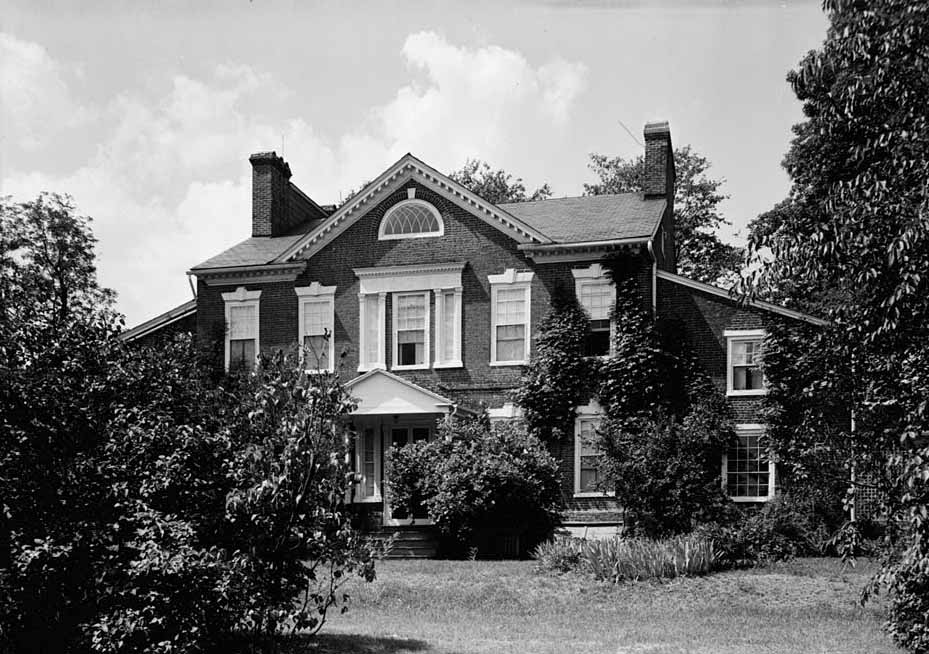
Sion Hill
Monument and historic site · National Register of Historic Places · 3.3 mi
Historic house in Maryland, United States

Southern Terminal, Susquehanna and Tidewater Canal
Monument and historic site · National Register of Historic Places · 2.0 mi
Historic district in Maryland, United States

Tome School
Monument and historic site · National Register of Historic Places · 3.1 mi
Private secondary school in Maryland, United States
Woodlands
Monument and historic site · National Register of Historic Places · 0.4 mi
Historic home in Perryville, Maryland, United States


Rodgers Tavern
Monument and historic site · National Register of Historic Places · 1.3 mi
4 more on the map.
Parks, trails and playgrounds9




Ice House Park
Park · 0.9 mi
Local Park and Free Fishing Area
411 Roundhouse Drive, Perryville

Restaurants and cafes16

Johnny's Sushi House
Restaurant · Sushi
5412 Pulaski Highway, Perryville
Mo off; Tu-Th 11:00-21:30; Fr 11:00-22:30; Sa 12:00-22:30; Su...
Pizza Tower
Restaurant · Pizza
Perryville Road, Perryville
Su 11:00-22:00; Mo 11:00-22:00; Tu 11:00-22:00; We 11:00-22:00; Th...

5th Company Brewing
Brewery and winery · 1.2 mi
325 Front Street, Perryville
Mo closed; Tu-Th 15:00-21:00; Fr-Sa 11:30-23:00; Su 12:00-18:00


Susky River Beverage Company
Bar and pub · 1.1 mi
80 Alstone Farm Lane, Perryville
Fr 15:00-21:00; Sa 12:00-21:00; Su 12:00-18:00

Ercole's Pizza, Pasta, & More
Restaurant · Pizza · 1.0 mi
631 Broad Street, Perryville
Perryville Sports Bar & Grill
Restaurant · 0.9 mi
628 Broad Street, Perryville


Domino's
Fast food · Pizza
5301 West Pulaski Highway, Perryville
Mo-Th 10:30-23:00; Fr-Sa 10:30-24:00; Su 10:30-23:00; PH off
4 more on the map.
History
Perryville was first settled by Europeans in 1622, when Edward Palmer was granted a patent for a settlement on what is now Garrett Island. During the 17th century, Lord Baltimore granted George Talbot 31,000 acres (130 km2) of land, which included the Perryville area. Before incorporation (1882), the settlement was known as Lower Ferry (circa 1695), Susquehanna (circa 18th century), and was finally named Perryville after Mary Perry, the wife of John Bateman.
During the Revolutionary War, Perryville served as a staging area for the Continental Army. Colonel John Rodgers (1728–1791), who operated the ferry and tavern in Perryville, raised the 5th Company of the Maryland Militia. This company became part of the famous Flying Camp and was instrumental during the early stages of the Revolutionary War. George Washington stopped frequently at Rodgers Tavern on his travels from Virginia to New York. Rodgers Tavern was listed on the National Register of Historic Places during 1972. Colonel Rodgers' son, John Rodgers, was instrumental in suppressing the Tripolitan pirates in the Mediterranean Sea and was subsequently promoted to Commodore of the Mediterranean Squadron. Commodore Rodgers served with distinction during the War of 1812 and is known as the "Father of the American Navy."
From the History section of Perryville, Maryland on Wikipedia, under CC BY-SA 4.0.
Where to stay3
Churches and places of worship8
First Baptist Church of Perryville
Church · Reformed, Baptist · 1.1 mi
4800 Pulaski Highway, Perryville
Perryville United Methodist Church
Church · Methodist · 1.1 mi
301 Susquehanna Avenue, Perryville
Blythedale Seventh Day Adventist Church
Church · Seventh Day Adventist · 1.1 mi
36 Blythedale Road, Perryville
Shopping1
Gas and EV charging6
Schools, colleges and libraries16
Healthcare1
Map of Perryville
80 places. The map loads OpenStreetMap tiles when you open it.
Climate by month
Monthly table
| Month | High | Low | Rain |
|---|---|---|---|
| Jan | 40°F | 25°F | 3.6 in |
| Feb | 43°F | 26°F | 2.6 in |
| Mar | 51°F | 34°F | 4.2 in |
| Apr | 64°F | 44°F | 3.4 in |
| May | 74°F | 54°F | 3.9 in |
| Jun | 83°F | 64°F | 4.5 in |
| Jul | 88°F | 68°F | 4.7 in |
| Aug | 85°F | 67°F | 4.5 in |
| Sep | 79°F | 60°F | 5.0 in |
| Oct | 67°F | 48°F | 4.5 in |
| Nov | 55°F | 37°F | 3.2 in |
| Dec | 45°F | 31°F | 4.0 in |
U.S. Climate Normals 1991-2020 for Conowingo Dam (8 mi away), NOAA NCEI.
People and cost of living
American Community Survey 5-year estimates, 2020-2024, U.S. Census Bureau. Estimates have margins of error, larger for small towns.
Disaster history
Cecil County has had 14 federal disaster declarations since 2000, most often for hurricanes.
- 2026-01-24: Severe Winter Storm (Winter Storm)
- 2020-03-26: Covid-19 Pandemic (Biological)
- 2020-03-13: Covid-19 (Biological)
- 2016-03-04: Severe Winter Storm And Snowstorm (Snowstorm)
- 2012-11-20: Hurricane Sandy (Hurricane)
- 2012-10-28: Hurricane Sandy (Hurricane)
OpenFEMA disaster declarations summaries.
Getting there and nearby towns
Phillips Army Air Field (APG) is the nearest airport with scheduled flights listed in OpenStreetMap, 9 miles away.
- Havre de Grace 3 mi southwest, about 5 min by car
- Charlestown 4 mi east, about 7 min by car
- Aberdeen 7 mi southwest, about 11 min by car
- North East 7 mi east, about 11 min by car
- Perryman 11 mi southwest, about 18 min by car
- Elkton 13 mi east, about 21 min by car
- Abingdon 13 mi southwest, about 22 min by car
- Bel Air South 14 mi west, about 22 min by car
- Bel Air 15 mi west, about 25 min by car
- Bel Air North 16 mi west, about 27 min by car
Drive times are estimates from straight-line distance, not routes.
Local news
Headlines from INDB, the NEMICO news database.
Reviews, tips and questions
Loading what members have shared...
Sources and licences
- NCES EDGE (Public domain): public schools
- NOAA NCEI U.S. Climate Normals 1991-2020 (Public domain): climate by month
- OpenFEMA (Public domain): disaster declarations
- OpenStreetMap contributors (ODbL 1.0): places, airports, map data
- U.S. Census Bureau (Public domain): population, income, housing, education, commute
- Wikidata (CC0 1.0): elevation, founding date, time zone, website, landmarks and historic places
- Wikimedia Commons (see each image): photos
- Wikipedia (CC BY-SA 4.0): overview and history text
Photo credits
- US Post Office Perryville MD Apr 10, Pubdog at en.wikipedia, Public domain
- 2021-08-16 18 10 32 View west along U.S. Route 40 (Pulaski Highway) just east of Maryland State Route 222 (Aiken Avenue-Perryville Road) in Perryville, Cecil County, Maryland, Famartin, CC BY-SA 4.0
- 2021-08-16 09 31 56 View north along Maryland State Route 222 (Perryville Road) at U.S. Route 40 (Pulaski Highway) in Perryville, Cecil County, Maryland, Famartin, CC BY-SA 4.0
- Woodlands Perryville, Arkaytee, CC BY-SA 3.0
- 2021-08-16 08 59 54 View east along U.S. Route 40 (Pulaski Highway) at Maryland State Route 222 (Aiken Avenue-Perryville Road) in Perryville, Cecil County, Maryland, Famartin, CC BY-SA 4.0
- 2021-08-16 09 23 29 View west along Maryland State Route 7 (Broad Street) at Coudon Boulevard in Perryville, Cecil County, Maryland, Famartin, CC BY-SA 4.0
- 2021-08-16 09 14 48 View east along Maryland State Route 7 (Broad Street) at Coudon Boulevard in Perryville, Cecil County, Maryland, Famartin, CC BY-SA 4.0
- 2021-08-16 09 24 19 View west along Maryland State Route 7 (Broad Street) at Maryland State Route 327 (Ikea Way) in Perryville, Cecil County, Maryland, Famartin, CC BY-SA 4.0
- 2021-08-16 09 09 17 View east along Maryland State Route 327 (Ikea Way) at Maryland State Route 7 (Broad Street) in Perryville, Cecil County, Maryland, Famartin, CC BY-SA 4.0
- St, Marks Perryville Nave, DreyHey, CC0
- NS Coal in Perryville, MD (6456919525), jpmueller99 from Shenandoah Valley of VA, USA, CC BY 2.0
- 2021-08-16 09 36 20 View north along Maryland State Route 222 (Perryville Road-Perrylawn Drive) at Maryland State Route 824 (Blythedale Road) in Blythedale, Cecil County, Maryland, Famartin, CC BY-SA 4.0
- 2016-06-11 08 58 06 View west along the Thomas J. Hatem Memorial Bridge (U.S. Route 40) crossing the Susquehanna River from Perryville, Cecil County, Maryland to Havre de Grace, Harford County..., Famartin, CC BY-SA 4.0
- 2021-08-16 09 11 12 View west along Maryland State Route 327 (Ikea Way) at Marion Tapp Parkway in Perryville, Cecil County, Maryland, Famartin, CC BY-SA 4.0
- 2017-08-12 14 36 34 View west along Maryland State Route 327 (Ikea Road) at Marion Tapp Parkway in Perryville, Cecil County, Maryland, Famartin, CC BY-SA 4.0
- 2021-08-16 09 37 41 View north along Maryland State Route 824 (Blythedale Road) just north of Maryland State Route 222 (Perryville Road-Perrylawn Drive) in Blythedale, Cecil County, Maryland, Famartin, CC BY-SA 4.0
- Perryville station 1908 postcard, Unknown author Unknown author, Public domain
- 2016-06-11 08 58 12 View west along the Thomas J. Hatem Memorial Bridge (U.S. Route 40) crossing the Susquehanna River from Perryville, Cecil County, Maryland to Havre de Grace, Harford County..., Famartin, CC BY-SA 4.0
- 2016-06-11 08 55 35 View east along the Thomas J. Hatem Memorial Bridge (U.S. Route 40) crossing the Susquehanna River from Havre de Grace, Harford County, Maryland to Perryville, Cecil County..., Famartin, CC BY-SA 4.0
- 2015-12-26 12 23 19 Signs at a private railroad level crossing in Perryville, Maryland, Famartin, CC BY-SA 4.0
- 2015-12-26 12 23 13 A private railroad level crossing in Perryville, Maryland, Famartin, CC BY-SA 4.0
- 2016-06-11 08 55 33 View east along the Thomas J. Hatem Memorial Bridge (U.S. Route 40) crossing the Susquehanna River from Havre de Grace, Harford County, Maryland to Perryville, Cecil County..., Famartin, CC BY-SA 4.0
- Acela Express Souththbound - Perryville, MD (6456917069), jpmueller99 from Shenandoah Valley of VA, USA, CC BY 2.0
- Acela Express - Perryville, MD (6456915881), jpmueller99 from Shenandoah Valley of VA, USA, CC BY 2.0
- 2016-06-11 08 55 31 View east along the Thomas J. Hatem Memorial Bridge (U.S. Route 40) crossing the Susquehanna River from Havre de Grace, Harford County, Maryland to Perryville, Cecil County..., Famartin, CC BY-SA 4.0
- Perryville, MD MARC Station (6468559959), jpmueller99 from Shenandoah Valley of VA, USA, CC BY 2.0
- Perryville Tower, DanTD, CC BY-SA 3.0
- 2016-06-11 08 55 29 View east along the Thomas J. Hatem Memorial Bridge (U.S. Route 40) crossing the Susquehanna River from Havre de Grace, Harford County, Maryland to Perryville, Cecil County..., Famartin, CC BY-SA 4.0
- 2016-06-11 08 55 27 View east along the Thomas J. Hatem Memorial Bridge (U.S. Route 40) crossing the Susquehanna River from Havre de Grace, Harford County, Maryland to Perryville, Cecil County..., Famartin, CC BY-SA 4.0
- Principio Furnace Office Apr 10, Pubdog ( talk ), Public domain
- Jacob Tome Institute, Memorial Hall, Tome Road, Port Deposit, Cecil County, MD HABS MD,8-PODEP cropped, HABS photographer, Public domain
- Haviland House CecilCo MD, Smallbones, CC0
- Susquehanna and Tidewater Canal S end MD1, Acroterion, CC BY-SA 4.0
- Sion Hill, E.H. Pickering, photographer for HABS, Public domain
- Paw Paw Port Deposit MD 2, Smallbones, CC0
- Perry Point Mansion House Apr 10, Pubdog ( talk ), Public domain
- Rodgers Tavern Apr 10, Pubdog ( talk ) (Transferred by rohith_goura /Originally uploaded by Pubdog ), Public domain
- 2015-12-26 11 56 38 View southwest towards the Millard E. Tydings Memorial Bridge (Interstate 95) connecting Harford and Cecil Counties, Maryland from the east bank of the Susquehanna River, Famartin, CC BY-SA 4.0
- Hatem Bridge, Bill Lawson, CC BY-SA 3.0
- Perryville Railroad Bridge LOC 082060pu, Jack Boucher, Public domain


Page built October 30, 2026. Spotted a mistake? Tell us or suggest a place.