


Why visit Adlaon
Townapedia lists 43 museums and landmarks, 12 parks and trails, 198 places to eat, 102 places to stay and 5 attractions in and around town.
Highlights include Cebu–Cordova Link Expressway, Muelle Osmeña Lighthouse, Casa Gorordo Museum and Museo Sugbo.
Weather in Adlaon
Forecast from MET Norway (CC BY 4.0). Full forecast
Things to do5

Cebu–Cordova Link Expressway
Bridge · 2.1 km
Longest bridge in the Philippines
Muelle Osmeña Lighthouse
Lighthouse · 5.5 km
Lighthouse in Poblacion, Lapu Lapu, Philippines

Museums and landmarks43

Casa Gorordo Museum
Museum
Built in the 1850s, this former residence of Juan Gorordo offers guided tours, a cafe & a gift shop.
35 Eduardo Aboitiz Street
Mo-Sa 09:00-17:00
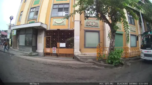
University of San Carlos Museum
Museum
History museum in Cebu City, Philippines
Mo-Fr 09:00-12:00,13:00-17:00; Sa 09:00-12:00; Su off

Cathedral Museum of Cebu
Museum · 0.6 km
Catholic museum in Cebu City, Philippines

Fort San Pedro
Monument and historic site · 1.0 km
A. Pigafetta Street, Cebu

Andres Bonifacio (30 Nobyembre 1863 – 10 Mayo 1897)
Monument and historic site · 1.0 km
A. Pigafetta Street, Cebu City

Bank of the Philippine Islands (BPI)
Monument and historic site · 0.8 km
Magallanes Street, Cebu City

Birthplace of Sergio Osmeña, Sr.
Monument and historic site · 0.8 km
Osmeña Boulevard, Cebu City


The Cross of Magellan
Monument and historic site · 0.8 km
Magallanes Street, Cebu
31 more on the map.
Parks, trails and playgrounds12

Plaza Independencia
Park · 0.9 km
Public park in Cebu City, Philippines
Legaspi Extension, Cebu

Cebu Business Park
Park · 2.2 km
Central business district in Central Visayas, Philippines




Restaurants and cafes198


de los Reyes Foods
Restaurant · Filipino, Asian, Chinese · 0.8 km
18 Dimasalang Street, Cebu City
Mo-Sa 08:00-19:00
Burakku Bowl Ramen
Restaurant · Japanese · 1.2 km
F. Ramos Street, Cebu
13:00-01:00
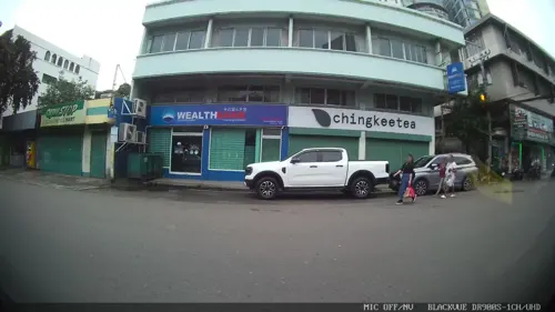
301 Ramos Street Sportsbar and Grill
Bar and pub · 1.0 km
301 F. Ramos Street
Mo-Su 10:00-03:00
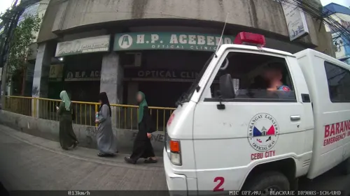


Kuyang Coffee Shop
Cafe · Coffee Shop, Cake, Donut, Deli, Filipino, Pasta, Sandwich, Tea · 1.2 km
Mo-Su 10:00-10:00
Muelle Uno Resto Cafe
Restaurant · Regional · 1.0 km
Stall 4 Madrigal Compound Legaspi Extension, Cebu
05:30 - 22:00

Quady’s
Bar and pub · Filipino · 0.8 km
32C General Echavez Street
Mo-Sa 16:00-02:00
Quarter Café
Cafe
Junquera Street
Mo-Fr 10:00-19:00; Sa-Su 11:00-20:00
186 more on the map.
Where to stay102
Churches and places of worship26
Cebu Metropolitan Cathedral
Church · Roman Catholic
P. Gomez Street, Cebu
Basilica Minore del Santo Niño de Cebu Pilgrim Center
Church · Roman Catholic · 0.7 km
Osmeña Boulevard, Cebu City
Bradford Uniqted Church of Christ in the Philippines
Church · Protestant · 0.9 km
#85 Osmeña Boulevard, Cebu
Archdiocesan Shrine of San Nicolas de Tolentino
Church · Roman Catholic · 1.2 km
Tupas Street, Cebu
Kingdom Hall of Jehovah's Witnesses
Church · Jehovahs Witness · 0.7 km
258-C Uytengsu Street
Mother of Perpetual Help Chapel
Church · Roman Catholic · 1.1 km
F. Rallos Street, Cebu City
Shopping51
Gas and EV charging13
Schools, colleges and libraries53
College of Technological Sciences–Cebu
School · 1.1 km
Natalio Bacalso Avenue, Cebu City
Healthcare42
Map of Adlaon
250 places. The map loads OpenStreetMap tiles when you open it.
Getting there and nearby towns
Mactan–Cebu International Airport (CEB) is the nearest airport with scheduled flights listed in OpenStreetMap, 9 km away.
- Cebu City 2 km northwest, about 2 min by car
- Mandaue City 4 km northeast, about 4 min by car
- Lapu-Lapu City 6 km east, about 6 min by car
- Talisay 8 km southwest, about 8 min by car
- Consolacion 11 km northeast, about 11 min by car
- Minglanilla 13 km southwest, about 13 min by car
- Liloan 15 km northeast, about 15 min by car
- Naga 19 km southwest, about 19 min by car
- Compostela 21 km northeast, about 21 min by car
- San Fernando 26 km southwest, about 26 min by car
Drive times are estimates from straight-line distance, not routes.
Local news
Headlines from INDB.
Reviews, tips and questions
Loading what members have shared...
Sources and licences
- GeoNames (CC BY 4.0): population, coordinates, regions and time zone
- Mapillary (see each image): photos
- OpenStreetMap contributors (ODbL 1.0): places, airports, map data
- Wikidata (CC0 1.0): elevation, founding date, time zone, website, landmarks and historic places
- Wikimedia Commons (see each image): photos
Photo credits
- Cebu Downtown CCLEX top view (Cebu City; 09-07-2022), Patrickroque01, CC BY-SA 4.0
- Muelle Osmeña, Tribu akru, Public domain
- Museo Sugbu, Aries Eroles, CC BY-SA 3.0
- Bahay Na Bato Cebu, Markytour777, CC BY-SA 4.0
- Cebu Business Park skyscrapers view from Luz (Cebu City; 01-16-2024), Patrickroque01, CC BY-SA 4.0
- Cebu Metropolitan Cathedral (P. Burgos, Cebu City; 01-10-2024), Patrickroque01, CC BY-SA 4.0
- University of San Carlos Cebu, Badz Patanag, CC BY-SA 3.0
- Matilda Bradford Memorial Church, Jonathan Blaza, CC BY-SA 4.0
- Basilica Minore del Santo Niño de Cebu (Osmeña Boulevard, Cebu City; 09-05-2022), Patrickroque01, CC BY-SA 4.0
- Fort of San Pedro historical marker (perspective corrected), Eugene Alvin Villar ( seav ), CC0
- Andres Bonifacio NHCP historical marker (Cebu City), Photo: Ralff Nestor Nacor ; perspective correction: Eugene Alvin Villar ( seav ), CC BY-SA 4.0
- Bank of the Philippine Islands (BPI) Cebu NHCP Historical Marker, Kej Andres (Ryomaandres), CC BY 4.0
- 20170812160609!Magellan's Cross historical marker, Photo: Josh Lim ( Sky Harbor ); perspective correction and retouching: Eugene Alvin Villar ( seav ), CC BY-SA 3.0 ph
- Casa Gorordo Cebu, CharMel Creations, CC BY-SA 4.0
- Cebu Ruta ng Espedisyong Magallanes - Elcano sa Pilipinas NHCP Historical Marker, Ryomaandres, CC BY 4.0
- Humabon NHCP marker, Photo: Carlo Joseph Moskito ; perspective correction: Eugene Alvin Villar ( seav ), CC BY-SA 4.0
- Humabon Monument in Cebu City, Carlojoseph14, CC BY-SA 4.0
- Birthplace of Sergio Osmeña, Sr. NHCP Historical Marker, Kej Andres (Ryomaandres), CC BY 4.0
- Fort San Pedro, Cebu-City (49063919082), xiquinhosilva, CC BY 2.0
- Cebu City after dark, Ubo Pakes from Cebu City, Philippines, CC BY 2.0
- Basilica del Santo Niño 2024-07-05, LMP 2001, CC BY-SA 4.0
- Fort San Pedro, Plaza Independencia, Cebu Port Pier 1 drone (MJ Cuenco Avenue, Cebu City; 01-16-2026), Patrickroque01, CC BY-SA 4.0
- ISS049-E-48501 - View of Earth, Earth Science and Remote Sensing Unit , Lyndon B. Johnson Space Center, Public domain
- San Jose Recoletos, QueenCityCebu, CC BY-SA 4.0
- University of San Jose Recoletos, QueenCityCebu, CC BY-SA 4.0
- Liberation of Cebu Monument, QueenCityCebu, CC BY-SA 4.0
- PHIL0445a, Yves Picq, CC BY-SA 4.0
- University of San Carlos Cebu NHCP Marker, StephenPamorada, CC BY 3.0
- University of San Carlos historical marker 2, Carlo Joseph Moskito, CC BY-SA 4.0
- University of San Carlos historical marker, Carlo Joseph Moskito, CC BY-SA 4.0
- University of the Visayas, Mareeiyyyyy, CC BY-SA 4.0
- Statues of Thérèse de Lisieux in the Philippines, Deepak-nsk, CC0
- PHIL0921a, Yves Picq, CC BY-SA 4.0
- PHIL0912a, Yves Picq, CC BY-SA 4.0
- Iconique Center parking lot (2023-07-16), PaulGorduiz106, CC BY-SA 4.0
- PHIL0509a, Yves Picq, CC BY-SA 4.0
- Beanleaf at the Iconique Center (2023-07-16), PaulGorduiz106, CC BY-SA 4.0
- UniversityOfTheVisayas, AxeEffect, CC BY 3.0
- Colon Street NHCP Historical Marker, StephenPamorada, CC BY 3.0
- Colon Street NHCP Historical Marker 2, StephenPamorada, CC BY 3.0
- New Freedom Park in Carbon Market, Filipinayzd, CC0
- Street-level photo, Kaart---RIGHT, CC BY-SA 4.0
- Street-level photo, Kaart---LEFT, CC BY-SA 4.0
- Street-level photo, Kaart---RIGHT, CC BY-SA 4.0
- Street-level photo, Kaart---FRONT, CC BY-SA 4.0
- Street-level photo, Kaart---RIGHT, CC BY-SA 4.0
- Street-level photo, Kaart---RIGHT, CC BY-SA 4.0
- Street-level photo, Kaart---RIGHT, CC BY-SA 4.0
- Street-level photo, Kaart---RIGHT, CC BY-SA 4.0
- Street-level photo, Kaart---RIGHT, CC BY-SA 4.0
- Street-level photo, Kaart---LEFT, CC BY-SA 4.0
- Street-level photo, Kaart---FRONT, CC BY-SA 4.0
- Street-level photo, Kaart---LEFT, CC BY-SA 4.0
- Street-level photo, Kaart---FRONT, CC BY-SA 4.0
- Street-level photo, Kaart---LEFT, CC BY-SA 4.0
- Street-level photo, Kaart---RIGHT, CC BY-SA 4.0
- Street-level photo, Kaart---RIGHT, CC BY-SA 4.0


Page built November 7, 2026. Spotted a mistake? Tell us or suggest a place.