

Dalwangan, Philippines
Dalwangan is a town of 4,906 people in Northern Mindanao, Philippines.
Weather in Dalwangan
Forecast from MET Norway (CC BY 4.0). Full forecast
About Dalwangan
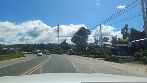
Dalwangan (Binukid: Báriyu Daluwangan) is a barangay west of Malaybalay City situated on the foothills of the Kitanglad Range, 12 kilometers west of the city proper. It is bounded to the north by Impalutao of the municipality of Impasugong, to the east by Patpat and Kalasungay, to the south by Capitan Angel and the Mount Kitanglad Range Natural Park, and to the west by Kibenton of Impasugong. According to the 2015 census, Dalwangan has a population of 7,004 people.
From the Wikipedia article Dalwangan (this version), under CC BY-SA 4.0.
Gas and EV charging1

Schools, colleges and libraries4

History
The name "Dalwangan" comes from Binukid which means "shed in a valley". The settlement of what is now Dalwangan was known as Sil-ipon, named after a creek less than a kilometer to the north of the village. The village was officially designated as a barrio in 1913 but was only organized by order of Bukidnon governor Manuel Fortich on March 26, 1915. Juanito Casinabe was appointed as its first teniente del barrio. Throughout the 20th century Dalwangan has been progressive as a result of its location along the Sayre Highway and the establishment of the Malaybalay Stock Farm and various government research institutions for agriculture.
From the History section of Dalwangan on Wikipedia, under CC BY-SA 4.0.
Map of Dalwangan
5 places. The map loads OpenStreetMap tiles when you open it.
Getting there and nearby towns
Maramag Airport (XMA) is the nearest airport with scheduled flights listed in OpenStreetMap, 50 km away.
- Sumpong 10 km southeast, about 10 min by car
- Malaybalay 11 km southeast, about 11 min by car
- Casisang 12 km southeast, about 12 min by car
- Manolo Fortich 27 km northwest, about 27 min by car
- Libona 37 km northwest, about 37 min by car
- Malitbog 41 km northwest, about 41 min by car
- Maramag 49 km south, about 49 min by car
- Tagoloan 49 km northwest, about 49 min by car
- Cagayan de Oro 53 km northwest, about 53 min by car
- Quezon 53 km south, about 53 min by car
Drive times are estimates from straight-line distance, not routes.
Local news
Headlines from INDB.
Reviews, tips and questions
Loading what members have shared...
Sources and licences
- GeoNames (CC BY 4.0): population, coordinates, regions and time zone
- Mapillary (see each image): photos
- OpenStreetMap contributors (ODbL 1.0): places, airports, map data
- Wikidata (CC0 1.0): elevation, founding date, time zone, website
- Wikimedia Commons (see each image): photos
- Wikipedia (CC BY-SA 4.0): overview and history text
Photo credits
- Homona salaconis, Image shared by iNaturalist user: leifgabrielsen, CC BY-SA 4.0
- Street-level photo, dp24ph, CC BY-SA 4.0
Page built November 7, 2026. Spotted a mistake? Tell us or suggest a place.