


Libona, Philippines
Libona is a town of 5,713 people in Northern Mindanao, Philippines, founded in October 4, 1957.
Why visit Libona
Townapedia lists 3 museums and landmarks, 5 parks and trails, 55 places to eat, 9 places to stay and 4 attractions in and around town.
Highlights include Thrill Playgrounds & Tipi Cafe.
Weather in Libona
Forecast from MET Norway (CC BY 4.0). Full forecast
About Libona
Libona, officially the Municipality of Libona (Bukid and Higaonon: Banuwa ta Libona; Cebuano: Lungsod sa Libona; Tagalog: Bayan ng Libona), is a municipality in the province of Bukidnon, Philippines. According to the 2024 census, it has a population of 51,555 people.
From the Wikipedia article Libona (this version), under CC BY-SA 4.0.
Things to do4


Museums and landmarks3

Parks, trails and playgrounds5



Restaurants and cafes55

TeaTiw Milk Tea
Cafe · Bubble Tea, Burger · 14.2 km
Block 7 Lot 25 Santan Street, Cagayan de Oro City
Mo-Su 08:00-21:00

Ernestos
Restaurant · Filipino · 11.2 km
Canyon Road, Libona
Mo-Th,Sa-Su 07:00-20:00; Fr off
Tipi cafe at Thrill playgrounds
Cafe · Burger, Indian, Chicken, Asian, American · 7.4 km
Mo-Su 09:00-21:00
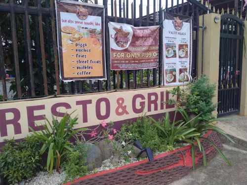
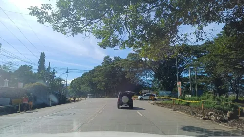
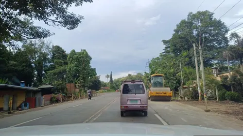



43 more on the map.
History
According to folk history, gold had flourished in the locality that prompted people from the neighboring towns flocked into this place in their quest for the golden fame and fortune. It was said that on January 17, 1817, A Spanish soldier who was on patrol was tasked to write down the names of the places he would come across within the course of his mission. He happened to pass by a group of men who were digging gold on one of the gold mines. Talking in Spanish, the soldier inquired about the name of the place. The natives, who did not understand the language, thought the soldier was asking them how many gold ores they have already gathered. In response, the natives answered "libo na", meaning a thousand already. The Spanish soldier jotted the word "Libona" in his logbook believing it was the name of the locality.
From the History section of Libona on Wikipedia, under CC BY-SA 4.0.
Where to stay9
Bhai Pahulayan Travellers Inn
Motel and hotel · 13.9 km
Dahilayan Road, Manolo Fortich
Churches and places of worship16
San Isidro Labrador Chapel
Church · Roman Catholic · 6.9 km
Libona-Indahag Road, Libona
Shopping13
Gas and EV charging12
Schools, colleges and libraries73
Alae Central Elementary School
School · 12.5 km
Camp Phillips Road, Manolo Fortich
Healthcare17
ABC Doctors Animal Bite Center
Clinic and pharmacy · 14.7 km
Sayre Highway, Manolo Fortich
San Isidro BHS
Clinic and pharmacy · 10.2 km
Sitio San Isidro, Brgy. San Jose, Libona
Map of Libona
207 places. The map loads OpenStreetMap tiles when you open it.
Getting there and nearby towns
Laguindingan Airport (CGY) is the nearest airport with scheduled flights listed in OpenStreetMap, 43 km away.
- Manolo Fortich 15 km east, about 15 min by car
- Cagayan de Oro 19 km northwest, about 19 min by car
- Tagoloan 22 km north, about 22 min by car
- Villanueva 28 km north, about 28 min by car
- Opol 27 km northwest, about 27 min by car
- Malitbog 27 km northeast, about 27 min by car
- Iligan City 38 km west, about 38 min by car
- Sumpong 46 km southeast, about 46 min by car
- Malaybalay 48 km southeast, about 48 min by car
- Iligan 55 km west, about 55 min by car
Drive times are estimates from straight-line distance, not routes.
Local news
Headlines from INDB.
Reviews, tips and questions
Loading what members have shared...
Sources and licences
- GeoNames (CC BY 4.0): population, coordinates, regions and time zone
- Mapillary (see each image): photos
- OpenStreetMap contributors (ODbL 1.0): places, airports, map data
- Wikidata (CC0 1.0): elevation, founding date, time zone, website
- Wikimedia Commons (see each image): photos
- Wikipedia (CC BY-SA 4.0): overview and history text
Photo credits
- Nangka Libona Bukidnon-Mayor Totom Calingasan, LIBONACEC, CC BY-SA 4.0
- ISS055-E-46118 - View of Earth, Earth Science and Remote Sensing Unit, NASA Johnson Space Center, Public domain
- ISS055-E-46119 - View of Earth, Earth Science and Remote Sensing Unit, NASA Johnson Space Center, Public domain
- ISS055-E-46122 - View of Earth, Earth Science and Remote Sensing Unit, NASA Johnson Space Center, Public domain
- ISS055-E-46123 - View of Earth, Earth Science and Remote Sensing Unit, NASA Johnson Space Center, Public domain
- ISS043-E-254526 - View of Earth, Earth Science and Remote Sensing Unit , Lyndon B. Johnson Space Center, Public domain
- ISS043-E-254525 - View of Earth, Earth Science and Remote Sensing Unit , Lyndon B. Johnson Space Center, Public domain
- ISS055-E-46120 - View of Earth, Earth Science and Remote Sensing Unit, NASA Johnson Space Center, Public domain
- ISS055-E-46121 - View of Earth, Earth Science and Remote Sensing Unit, NASA Johnson Space Center, Public domain
- ISS043-E-254527 - View of Earth, Earth Science and Remote Sensing Unit , Lyndon B. Johnson Space Center, Public domain
- ISS043-E-254528 - View of Earth, Earth Science and Remote Sensing Unit , Lyndon B. Johnson Space Center, Public domain
- ISS043-E-254531 - View of Earth, Earth Science and Remote Sensing Unit , Lyndon B. Johnson Space Center, Public domain
- ISS043-E-254532 - View of Earth, Earth Science and Remote Sensing Unit , Lyndon B. Johnson Space Center, Public domain
- ISS043-E-254530 - View of Earth, Earth Science and Remote Sensing Unit , Lyndon B. Johnson Space Center, Public domain
- ISS043-E-254529 - View of Earth, Earth Science and Remote Sensing Unit , Lyndon B. Johnson Space Center, Public domain
- Street-level photo, Parleman143, CC BY-SA 4.0
- Street-level photo, dp24ph, CC BY-SA 4.0
- Street-level photo, dp24ph, CC BY-SA 4.0
- Street-level photo, dp24ph, CC BY-SA 4.0
- Street-level photo, dp24ph, CC BY-SA 4.0
- Street-level photo, dp24ph, CC BY-SA 4.0
- Street-level photo, dp24ph, CC BY-SA 4.0
- Street-level photo, dp24ph, CC BY-SA 4.0
- Street-level photo, dp24ph, CC BY-SA 4.0
- Street-level photo, dp24ph, CC BY-SA 4.0
- Street-level photo, dp24ph, CC BY-SA 4.0
- Street-level photo, dp24ph, CC BY-SA 4.0
- Street-level photo, dp24ph, CC BY-SA 4.0
- Street-level photo, dp24ph, CC BY-SA 4.0
- Street-level photo, dp24ph, CC BY-SA 4.0
- Street-level photo, dp24ph, CC BY-SA 4.0


Page built November 7, 2026. Spotted a mistake? Tell us or suggest a place.