


San Vicente, Philippines
San Vicente is a town of 3,389 people in Bicol Region, Philippines.
Loading the weather...
Population3,389
GeoNames
RegionBicol Region
Elevation16 m
52 ft
Time zoneAsia/Manila
Nearest airportNaga Airport (WNP)
18 km
Why visit San Vicente
Townapedia lists 1 museum or landmark, 2 parks and trails, 15 places to eat and 2 places to stay in and around town.
Weather in San Vicente
Forecast from MET Norway (CC BY 4.0). Full forecast
Museums and landmarks1

Parks, trails and playgrounds2

Restaurants and cafes15






3 more on the map.
Advertisement
Where to stay2



Churches and places of worship7
Locale of Maharlika
Church · Iglesia Ni Cristo · 2.1 km
Baao-Iriga City-Nabua Road, Baao
Shopping4
Advertisement
Gas and EV charging7
Schools, colleges and libraries15
Healthcare7
Advertisement
Map of San Vicente
60 places. The map loads OpenStreetMap tiles when you open it.
Getting there and nearby towns
Naga Airport (WNP) is the nearest airport with scheduled flights listed in OpenStreetMap, 18 km away.
- Baao 1 km west, about 1 min by car
- Iriga City 5 km southeast, about 5 min by car
- Nabua 5 km south, about 5 min by car
- Bula 10 km west, about 10 min by car
- Bato 11 km south, about 11 min by car
- Buhi 16 km east, about 16 min by car
- Libon 18 km southeast, about 18 min by car
- Polangui 22 km southeast, about 22 min by car
- Oas 25 km southeast, about 25 min by car
- Naga 28 km northwest, about 28 min by car
Drive times are estimates from straight-line distance, not routes.
Local news
Headlines from INDB.
Reviews, tips and questions
Loading what members have shared...
Sources and licences
- GeoNames (CC BY 4.0): population, coordinates, regions and time zone
- Mapillary (see each image): photos
- OpenStreetMap contributors (ODbL 1.0): places, airports, map data
- Wikidata (CC0 1.0): elevation, founding date, time zone, website, landmarks and historic places
- Wikimedia Commons (see each image): photos
Photo credits
- Saint Anthony Padua Hall, Mark Balang, CC BY-SA 4.0
- View of Mt. Asog in Baao, Free2barredo, CC BY-SA 4.0
- La Consolacion College Baao, Cam Sur, Mar 2026 (2), Ralff Nestor Nacor, CC BY-SA 4.0
- Baao Church DOT Marker, Camarines Sur, Ralff Nestor Nacor, CC BY-SA 4.0
- BAAO CENTRAL SCHOOL, Free2barredo, CC BY-SA 4.0
- ROSARY SCHOOL INC, Free2barredo, CC BY-SA 4.0
- Ancestral House of Bishop Jorge I. Barlin, Free2barredo, CC BY-SA 4.0
- RECUDO BAR, Free2barredo, CC BY-SA 4.0
- BISHOP JORGE I. BARLIN, Free2barredo, CC BY-SA 4.0
- Bishop Jorge I. Barlin Birthplace, Baao, Camarines Sur, Mar 2026, Ralff Nestor Nacor, CC BY-SA 4.0
- Bishop Jorge I. Barlin Birthplace Marker, Baao, Camarines Sur, Ralff Nestor Nacor, CC BY-SA 4.0
- Iriga-Baao Road in Baao, Cam Sur, Mar 2026, Ralff Nestor Nacor, CC BY-SA 4.0
- Sta. Monica Academy Baao Camarines Sur, Raymark Guevara Barredo, CC BY-SA 3.0
- BELEN LYING IN IN BAAO, Free2barredo, CC BY-SA 4.0
- LUIS GUEVARA DATO, Raymark Guevara Barredo, Public domain
- La Consolacion College Baao, Cam Sur, Mar 2026 (1), Ralff Nestor Nacor, CC BY-SA 4.0
- Rizal Monument, Baao, Cam Sur, Mar 2026 (2), Ralff Nestor Nacor, CC BY-SA 4.0
- Rizal Monument, Baao, Cam Sur, Mar 2026 (1), Ralff Nestor Nacor, CC BY-SA 4.0
- Rizal Monument Dedication Marker, Baao, Camarines Sur, Ralff Nestor Nacor, CC BY-SA 4.0
- Rizal Monument, Baao, Cam Sur, Mar 2026 (3), Ralff Nestor Nacor, CC BY-SA 4.0
- St. Bartholomew Parish Baao Camarines, Jerickson D. Getizo, CC BY-SA 4.0
- Baao Municipal Hall, Cam Sur, Mar 2026, Ralff Nestor Nacor, CC BY-SA 4.0
- Padyak sa Baao, Free2barredo, CC BY-SA 4.0
- Luis Guevara Dato Marker, Baao, Cam Sur, Mar 2026, Ralff Nestor Nacor, CC BY-SA 4.0
- Jorge Barlin Historical Marker, Baao, Camarines Sur, Ralff Nestor Nacor, CC BY-SA 4.0
- Jorge Barlin Monument, Baao, Cam Sur, Mar 2026, Ralff Nestor Nacor, CC BY-SA 4.0
- Jorge Barlin Park, Baao, Cam Sur, Mar 2026, Ralff Nestor Nacor, CC BY-SA 4.0
- Church of Baao Historical Marker, Camarines Sur, Ralff Nestor Nacor, CC BY-SA 4.0
- Baao Church Interior, Camarines Sur, Mar 2026, Ralff Nestor Nacor, CC BY-SA 4.0
- Baao Church, Camarines Sur, Mar 2026 (1), Ralff Nestor Nacor, CC BY-SA 4.0
- Baao Church, Camarines Sur, Mar 2026 (2), Ralff Nestor Nacor, CC BY-SA 4.0
- BAAO MUNICIPAL, Free2barredo, CC BY-SA 4.0
- Baloy Carlota, Baao, Cam Sur, Mar 2026, Ralff Nestor Nacor, CC BY-SA 4.0
- Baao Public Market, Cam Sur, Mar 2026, Ralff Nestor Nacor, CC BY-SA 4.0
- Food Court Area in Baao Municipal Market, Free2barredo, CC BY-SA 4.0
- BidiBidi Cafe, Baao, Cam Sur, Mar 2026, Ralff Nestor Nacor, CC BY-SA 4.0
- Pansit na agko Inulas ag Itlog, Raymark Guevara Barredo, CC BY 3.0
- Vagetable Vendor at Baao Public Market, Raymark Guevara Barredo, CC BY 3.0
- Rizal St., Baao, Cam Sur, Mar 2026, Ralff Nestor Nacor, CC BY-SA 4.0
- Baao Crossing, Cam Sur, Mar 2026, Ralff Nestor Nacor, CC BY-SA 4.0
- ATLANTIC BAKERY BAAO BRANCH, Free2barredo, CC BY-SA 4.0
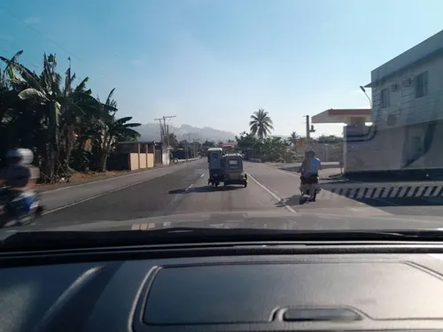
- Street-level photo, ericb1983, CC BY-SA 4.0
- Street-level photo, ericb1983, CC BY-SA 4.0
- Street-level photo, ericb1983, CC BY-SA 4.0
- Street-level photo, ericb1983, CC BY-SA 4.0
- Street-level photo, ericb1983, CC BY-SA 4.0


Page built November 7, 2026. Spotted a mistake? Tell us or suggest a place.