


Why visit Tangke
Townapedia lists 3 museums and landmarks, 6 parks and trails, 42 places to eat, 1 place to stay and 1 attraction in and around town.
Highlights include Cebu–Cordova Link Expressway and Crocolandia Foundation.
Weather in Tangke
Forecast from MET Norway (CC BY 4.0). Full forecast
Things to do1

Cebu–Cordova Link Expressway
Bridge · 5.2 km
Longest bridge in the Philippines
Museums and landmarks3


Parks, trails and playgrounds6


Restaurants and cafes42

Luminous Espresso Industry Ph (IL Corso)
Cafe · 1.9 km
7V8H+PF3 Cebu South Coastal Road
Mo-Fr 08:00-22:30; Sa-Su 07:00-23:30





30 more on the map.
Where to stay1
Churches and places of worship8
Our Lady of Consolation Parish -Recoletos de Laray
Church · Roman Catholic · 0.9 km
Vicente H. Garces Street
Santa Teresa de Avila Parish Church
Church · Roman Catholic · 2.2 km
Vicente H. Garces Street, Talisay
Shopping6
Gas and EV charging8
Schools, colleges and libraries17
Inayawan National Night High School Extension
School · 2.2 km
F. Jaca Street, Cebu
St. Ignatius de Loyola Preparatory School Inc.
School · 0.6 km
Vicente H. Garces Street
Healthcare6
Map of Tangke
98 places. The map loads OpenStreetMap tiles when you open it.
Getting there and nearby towns
Mactan–Cebu International Airport (CEB) is the nearest airport with scheduled flights listed in OpenStreetMap, 14 km away.
- Talisay 2 km southwest, about 2 min by car
- Cebu City 7 km north, about 7 min by car
- Minglanilla 8 km west, about 8 min by car
- Mandaue City 10 km northeast, about 10 min by car
- Lapu-Lapu City 11 km northeast, about 11 min by car
- Naga 13 km southwest, about 13 min by car
- Consolacion 17 km northeast, about 17 min by car
- San Fernando 20 km southwest, about 20 min by car
- Liloan 22 km northeast, about 22 min by car
- Toledo 28 km northwest, about 28 min by car
Drive times are estimates from straight-line distance, not routes.
Local news
Headlines from INDB.
Reviews, tips and questions
Loading what members have shared...
Sources and licences
- GeoNames (CC BY 4.0): population, coordinates, regions and time zone
- Mapillary (see each image): photos
- OpenStreetMap contributors (ODbL 1.0): places, airports, map data
- Wikidata (CC0 1.0): elevation, founding date, time zone, website, landmarks and historic places
- Wikimedia Commons (see each image): photos
Photo credits
- Cebu Downtown CCLEX top view (Cebu City; 09-07-2022), Patrickroque01, CC BY-SA 4.0
- Dd saint teresas church of talisay oldest church a, Øyvind Holmstad, CC BY-SA 4.0
- Philippines, Cebu (6886528196), M M from Switzerland, CC BY-SA 2.0
- Musdkipper03, Herbertkikoy, CC BY 4.0
- Musdkipper02, Herbertkikoy, CC BY 4.0
- IL Corso 2022 02 005, Martin Michlmayr, CC BY-SA 4.0
- IL Corso 2022 02 004, Martin Michlmayr, CC BY-SA 4.0
- IL Corso 2022 02 002, Martin Michlmayr, CC BY-SA 4.0
- IL Corso 2022 02 006, Martin Michlmayr, CC BY-SA 4.0
- IL Corso 2022 03 001, Martin Michlmayr, CC BY-SA 4.0
- IL Corso 2022 02 010, Martin Michlmayr, CC BY-SA 4.0
- IL Corso 2022 02 009, Martin Michlmayr, CC BY-SA 4.0
- IL Corso 2022 02 007, Martin Michlmayr, CC BY-SA 4.0
- IL Corso 2022 02 008, Martin Michlmayr, CC BY-SA 4.0
- Ayame at IL Corso (2023-05-04), PaulGorduiz106, CC BY-SA 4.0
- Luminous at IL Corso (2023-05-04), PaulGorduiz106, CC BY-SA 4.0
- Rico's Lechon at IL Corso (2023-05-04), PaulGorduiz106, CC BY-SA 4.0
- Dunkin' at IL Corso (2023-05-04), PaulGorduiz106, CC BY-SA 4.0
- IL Corso 2025 001, Martin Michlmayr, CC BY-SA 4.0
- Morning Catch, Akosimaxxx, CC BY 4.0
- Mangroves and Catch, Akosimaxxx, CC BY 4.0
- Mangroves and Stilts, Akosimaxxx, CC BY 4.0
- LantawSRP grass area spherical 360-degree shot, theinstantmatrix, CC0
- Nustar - SM Seaside in Cebu - phtoo Bart Sakwerda 2023-05, Barts83eu, CC BY-SA 4.0
- Talisay Landing Historical Marker, Pavl Anthøny, CC BY-SA 4.0
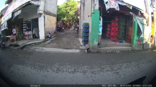
- Street-level photo, Kaart---FRONT, CC BY-SA 4.0
- Street-level photo, Kaart---LEFT, CC BY-SA 4.0
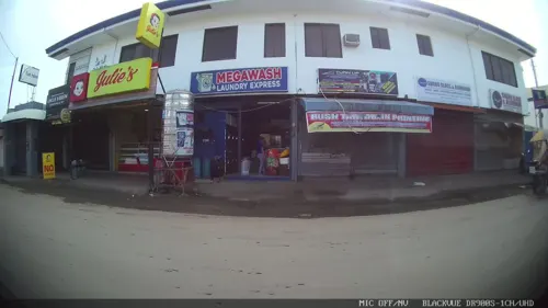
- Street-level photo, Kaart---LEFT, CC BY-SA 4.0
- Street-level photo, Kaart---RIGHT, CC BY-SA 4.0
- Street-level photo, Kaart---RIGHT, CC BY-SA 4.0
- Street-level photo, Kaart---FRONT, CC BY-SA 4.0
- Street-level photo, Kaart---LEFT, CC BY-SA 4.0
- Street-level photo, Kaart---FRONT, CC BY-SA 4.0
- Street-level photo, Kaart---FRONT, CC BY-SA 4.0
- Street-level photo, Kaart---LEFT, CC BY-SA 4.0
- Street-level photo, Kaart---FRONT, CC BY-SA 4.0
- Street-level photo, Kaart---LEFT, CC BY-SA 4.0
- Street-level photo, Kaart---FRONT, CC BY-SA 4.0
- Street-level photo, Kaart---FRONT, CC BY-SA 4.0
- Street-level photo, Kaart---LEFT, CC BY-SA 4.0


Page built November 7, 2026. Spotted a mistake? Tell us or suggest a place.