


Why visit Ungca
Townapedia lists 5 museums and landmarks, 8 parks and trails, 67 places to eat, 13 places to stay and 2 attractions in and around town.
Highlights include Iloilo Bridge, Brandy Museum, Iloilo Museum of Contemporary Art and WaterWorld Iloilo.
Weather in Ungca
Forecast from MET Norway (CC BY 4.0). Full forecast
Things to do2


Museums and landmarks5

Brandy Museum
Museum · 3.5 km
Brandy museum in Iloilo City, Philippines
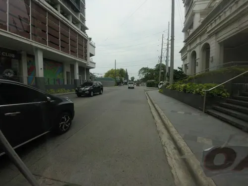
Iloilo Museum of Contemporary Art
Museum · 3.5 km
Art museum in Iloilo City, Philippines

Lizares Mansion
Monument and historic site · 2.2 km
MacArthur Drive, Iloilo
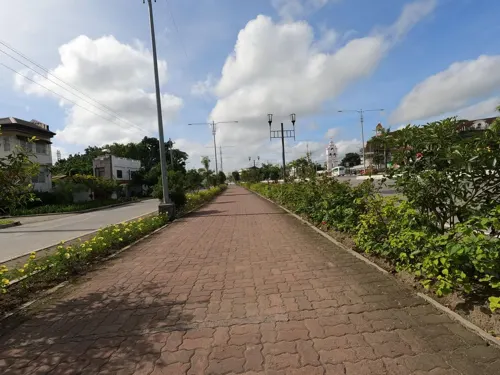
Musée d' Arsie
Museum · 1.8 km
Benigno S. Aquino, Jr. Avenue, Jaro
Monday-Sunday 9:00-18:00

Parks, trails and playgrounds8


Restaurants and cafes67

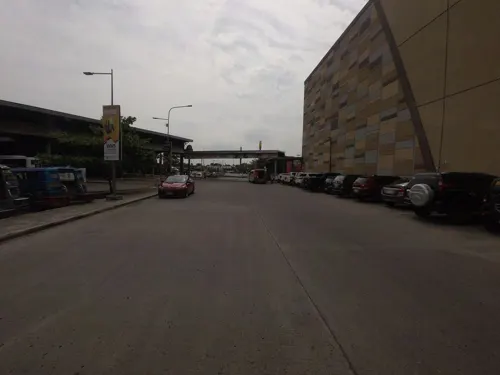
Lechon Haus
Restaurant · Chinese, Breakfast, Filipino, Diner, Chicken, Barbecue, Asian · 1.2 km
National Highway (R3)
Mo-Fr 09:00-21:00; Sa-Su 09:00-22:00

Ceylon Coffee Club
Cafe · 2.0 km
Lopez Jaena Street, Iloilo City
Mo-Su 08:00-22:00
Marlu's Filipino Asian Restaurant
Restaurant · Filipino · 1.5 km
Mo-Su 10:00-22:00



55 more on the map.
Where to stay13
Churches and places of worship17
Shopping18
Gas and EV charging22
Schools, colleges and libraries31
Judith Lazariaga Tiongco Elementary School
School · 1.9 km
Delfin Gonzales Avenue, Iloilo
Healthcare8
Map of Ungca
191 places. The map loads OpenStreetMap tiles when you open it.
Getting there and nearby towns
Iloilo International Airport (ILO) is the nearest airport with scheduled flights listed in OpenStreetMap, 11 km away.
- Pavia 3 km north, about 3 min by car
- Iloilo 6 km south, about 6 min by car
- Leganes 6 km northeast, about 6 min by car
- Santa Barbara 8 km north, about 8 min by car
- Zarraga 10 km northeast, about 10 min by car
- Oton 10 km southwest, about 10 min by car
- Alimodian 15 km northwest, about 15 min by car
- Cabatuan 16 km northwest, about 16 min by car
- Leon 18 km west, about 18 min by car
- Dumangas 20 km northeast, about 20 min by car
Drive times are estimates from straight-line distance, not routes.
Local news
Headlines from INDB.
Reviews, tips and questions
Loading what members have shared...
Sources and licences
- GeoNames (CC BY 4.0): population, coordinates, regions and time zone
- Mapillary (see each image): photos
- OpenStreetMap contributors (ODbL 1.0): places, airports, map data
- Wikidata (CC0 1.0): elevation, founding date, time zone, website, landmarks and historic places
- Wikimedia Commons (see each image): photos
Photo credits
- Jaro Cathedral, Kguirnela at English Wikipedia, CC BY 2.5
- Central Philippine University Church, Shewillshine22, CC BY-SA 4.0
- Angelicum School Iloilo Lizares Mansion (Radial Road 4, Jaro, Iloilo City; 01-26-2023), Patrickroque01, CC BY-SA 4.0
- CPU Church, Johngaje92, CC0
- Eugenio Lopez Hall at Central Philippine University, Americana22ount, CC BY-SA 4.0
- Angelicum School Iloilo Lizares Mansion field view (Radial Road 4, Jaro, Iloilo City; 01-26-2023) (cropped), Patrickroque01, CC BY-SA 4.0
- Iloilo Supermart – Atrium, BlockatePollop2, CC BY-SA 4.0
- Iloilo Bridge (View from Mandurriao side), Aug 2024, Ralff Nestor Nacor, CC BY-SA 4.0
- Casa De Emperador with monument (Megaworld Boulevard, Mandurriao, Iloilo City; 04-25-2024), Patrickroque01, CC BY-SA 4.0
- La Paz Church (Iglesia de La Paz) or Iglesia de Nuesta Señora de La Paz y Buen Viaje, Johngaje92, CC BY-SA 4.0
- 1983-NHI-Ang Bahay ni Hechanova-Surroundings, Andre Ryan Maceda, CC BY-SA 4.0
- 1998-NHI-Battle of Balantang, Andre Ryan Maceda, CC BY-SA 4.0
- Angelicum School, Jaro, Iloilo City, Sep 2026, Ralff Nestor Nacor, CC BY-SA 4.0
- Street-level photo, Kaart_Local, CC BY-SA 4.0
- Street-level photo, Kaart_Local, CC BY-SA 4.0
- Street-level photo, Kaart_Local, CC BY-SA 4.0
- Street-level photo, Kaart_Local, CC BY-SA 4.0
- Street-level photo, Kaart_Local, CC BY-SA 4.0
- Street-level photo, Kaart_Local, CC BY-SA 4.0
- Street-level photo, Kaart_Local, CC BY-SA 4.0
- Street-level photo, Kaart_Local, CC BY-SA 4.0
- Street-level photo, Kaart_Local, CC BY-SA 4.0
- Street-level photo, Kaart_Local, CC BY-SA 4.0
- Street-level photo, Kaart_Local, CC BY-SA 4.0
- Street-level photo, Kaart_Local, CC BY-SA 4.0
- Street-level photo, Kaart_Local, CC BY-SA 4.0
- Street-level photo, Kaart_Local, CC BY-SA 4.0
- Street-level photo, Kaart_Local, CC BY-SA 4.0
- Street-level photo, GOwin, CC BY-SA 4.0
- Street-level photo, Kaart_Local, CC BY-SA 4.0
- Street-level photo, Kaart_Local, CC BY-SA 4.0
- Street-level photo, Kaart_Local, CC BY-SA 4.0
- Street-level photo, Kaart_Local, CC BY-SA 4.0
- Street-level photo, GOwin, CC BY-SA 4.0
- Street-level photo, Kaart_Local, CC BY-SA 4.0
- Street-level photo, Kaart_Local, CC BY-SA 4.0
- Street-level photo, GOwin, CC BY-SA 4.0
- Street-level photo, Kaart_Local, CC BY-SA 4.0


Page built November 7, 2026. Spotted a mistake? Tell us or suggest a place.