


Riverton, New Jersey
Riverton is a borough of 2,770 people in Burlington County, New Jersey, founded in December 18, 1893.
Why visit Riverton
Townapedia lists 16 museums and landmarks, 6 parks and trails, 16 places to eat, 1 place to stay and 5 attractions in and around town.
Highlights include Holme Avenue Bridge, Tacony Music Hall, Burrough-Dover House and Ethan Allen School.
July is the warmest month, with average highs of 87°F; January lows average 25°F.
Weather in Riverton
Forecast from the National Weather Service. Full forecast
About Riverton
Riverton is a borough located in Burlington County, in the U.S. state of New Jersey. As of the 2020 United States census, the borough's population was 2,764, a decrease of 15 (−.5%) from the 2010 census count of 2,779, which in turn reflected an increase of 20 (+0.7%) from the 2,759 counted in the 2000 census. The borough, and all of Burlington County, is a part of the Philadelphia metropolitan area.
From the Wikipedia article Riverton, New Jersey (this version), under CC BY-SA 4.0.
Things to do5

Holme Avenue Bridge
Bridge · National Register of Historic Places · 3.2 mi
Bridge in United States of America

Tacony Music Hall
Cinema and theater · National Register of Historic Places · 1.8 mi
Historic building in the Tacony section of Philadelphia, Pennsylvania

Frankford Avenue Bridge
Bridge · National Register of Historic Places · 2.3 mi


Tacony–Palmyra Bridge
Bridge · 1.6 mi
Bridge that connects from Palmyra, New Jersey to Philadelphia (Tacony), Pennsylvania
Museums and landmarks16

Burrough-Dover House
Monument and historic site · National Register of Historic Places · 2.6 mi
Historic house in Camden County, New Jersey

Ethan Allen School
Monument and historic site · National Register of Historic Places · 2.8 mi
United States historic place
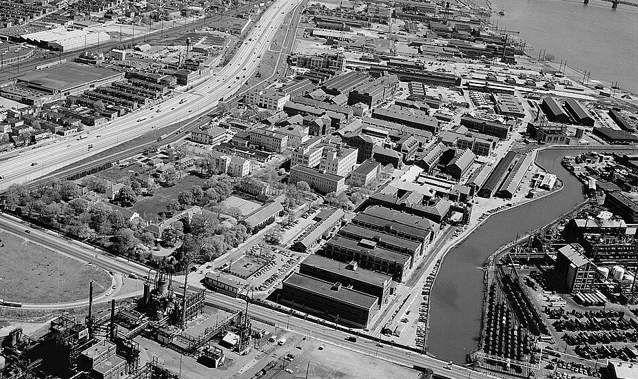
Frankford Arsenal
Monument and historic site · National Register of Historic Places · 2.9 mi
Former United States Army munitions plant

Glen Foerd at Torresdale
Monument and historic site · National Register of Historic Places · 2.8 mi
Building in Pennsylvania, United States

Greenbelt Knoll
Monument and historic site · National Register of Historic Places · 3.1 mi
Historic house in Pennsylvania, United States

Griffith Morgan House
Monument and historic site · National Register of Historic Places · 2.3 mi
Pennsauken Township, New Jersey, listed on the NRHP in Camden County

Henry Longfellow School
Monument and historic site · National Register of Historic Places · 3.0 mi
In northeast Philadelphia, Pennsylvania, NRHP-listed

Warren G. Harding Middle School
Monument and historic site · National Register of Historic Places · 3.2 mi
Middle school in Philadelphia, Pennsylvania

Bridesburg School
Monument and historic site · National Register of Historic Places · 2.9 mi

Edwin Forrest School
Monument and historic site · National Register of Historic Places · 2.0 mi

Hamilton Disston School
Monument and historic site · National Register of Historic Places · 2.1 mi

James J. Sullivan School
Monument and historic site · National Register of Historic Places · 2.8 mi
4 more on the map.
Parks, trails and playgrounds6


Pennypack Park
Park · 3.3 mi
Park in Pennsylvania, United States of America, United States of America



Restaurants and cafes16

Friendly's
Diner · American · 1.4 mi
505 Route 130, Cinnaminson
Mo-Th 11:00-22:00; Fr-Sa 08:00-23:00; Su 08:00-22:00

Kaffir Thai
Restaurant · Thai · 0.6 mi
16 East Broad Street, Palmyra
Tu-Fr 11:00-15:00,16:00-22:00; Sa 16:00-22:00; Su 16:00-21:00; Mo off

Palmyra Taco House
Restaurant · Mexican · 0.6 mi
537 Cinnaminson Avenue, Palmyra
Mo-Sa 11:00-22:00; Su off
Whistlers Inn
Restaurant · American, Burger · 1.4 mi
901 Burlington Pike, Cinnaminson
Mo-Tu 11:30-22:00; We-Sa 11:30-24:00; Su 12:00-22:00

5West Pub & Resturant
Bar and pub · 0.6 mi
5 West Broad Street, Palmyra
Su 11:00-24:00; Mo-We 15:00-21:00; Th 15:00-22:00; Fr-Sa 15:00-22:00

Domino's
Fast food · Pizza · 1.5 mi
1821 Cinnaminson Avenue, Cinnaminson
Mo-Th 10:30-24:00; Fr-Sa 10:30-01:00; Su 10:30-24:00
4 more on the map.
History
Riverton was established in 1851, along the Delaware River, having been laid out by Philadelphia architect Samuel Sloan. According to architectural historian Henry Russell Hitchcock, Riverton was one of the first totally planned residential subdivisions in the United States.
The Japanese beetle, now a widespread invasive insect pest in the United States, were first discovered in a nursery near Riverton in 1916.
From the History section of Riverton, New Jersey on Wikipedia, under CC BY-SA 4.0.
Where to stay1
Churches and places of worship4
Shopping4
Gas and EV charging4
Schools, colleges and libraries46
Camden County Technical School-Pennsauken
School · 5.7 mi
6008 Browning Road, Pennsauken
Healthcare2
Map of Riverton
104 places. The map loads OpenStreetMap tiles when you open it.
Climate by month
Monthly table
| Month | High | Low | Rain |
|---|---|---|---|
| Jan | 40°F | 25°F | 3.5 in |
| Feb | 43°F | 26°F | 2.6 in |
| Mar | 52°F | 33°F | 4.4 in |
| Apr | 64°F | 42°F | 3.9 in |
| May | 73°F | 52°F | 3.9 in |
| Jun | 82°F | 62°F | 4.6 in |
| Jul | 87°F | 68°F | 5.0 in |
| Aug | 85°F | 66°F | 4.1 in |
| Sep | 78°F | 59°F | 4.3 in |
| Oct | 66°F | 46°F | 4.1 in |
| Nov | 55°F | 36°F | 3.3 in |
| Dec | 45°F | 30°F | 4.5 in |
U.S. Climate Normals 1991-2020 for Pennsauken 1N (3 mi away), NOAA NCEI.
People and cost of living
American Community Survey 5-year estimates, 2020-2024, U.S. Census Bureau. Estimates have margins of error, larger for small towns.
Disaster history
Burlington County has had 23 federal disaster declarations since 2000, most often for hurricanes.
- 2021-09-05: Remnants Of Hurricane Ida (Hurricane)
- 2021-09-02: Remnants Of Hurricane Ida (Hurricane)
- 2020-12-11: Tropical Storm Isaias (Hurricane)
- 2020-03-25: Covid-19 Pandemic (Biological)
- 2020-03-13: Covid-19 (Biological)
- 2018-06-08: Severe Winter Storm And Snowstorm (Severe Storm)
OpenFEMA disaster declarations summaries.
Getting there and nearby towns
Northeast Philadelphia Airport (PNE) is the nearest airport with scheduled flights listed in OpenStreetMap, 5 miles away.
- Palmyra 1 mi southwest, about 2 min by car
- Moorestown-Lenola 4 mi southeast, about 7 min by car
- Merchantville 5 mi southwest, about 7 min by car
- Cherry Hill Mall 5 mi south, about 8 min by car
- Golden Triangle 5 mi south, about 9 min by car
- Philadelphia 6 mi west, about 10 min by car
- Ramblewood 6 mi southeast, about 10 min by car
- Ellisburg 6 mi south, about 10 min by car
- Beverly 6 mi northeast, about 10 min by car
- Camden 7 mi southwest, about 11 min by car
Drive times are estimates from straight-line distance, not routes.
Local news
Headlines from INDB, the NEMICO news database.
Reviews, tips and questions
Loading what members have shared...
Sources and licences
- NCES EDGE (Public domain): public schools
- NOAA NCEI U.S. Climate Normals 1991-2020 (Public domain): climate by month
- OpenFEMA (Public domain): disaster declarations
- OpenStreetMap contributors (ODbL 1.0): places, airports, map data
- U.S. Census Bureau (Public domain): population, income, housing, education, commute
- Wikidata (CC0 1.0): elevation, founding date, time zone, website, landmarks and historic places
- Wikimedia Commons (see each image): photos
- Wikipedia (CC BY-SA 4.0): overview and history text
Photo credits
- 20070421 RivertonNJ D80 NearHiway73, Sanoyes at English Wikipedia, Public domain
- Riverton, NJ fire department, Dec. 2024, Mr. Matté (if there is an issue with this image, contact me using this image's Commons talk page , my Commons user talk page , or my English Wikipedia user talk page ; I'll know about it a lot faster), CC BY-SA 4.0
- Riverton, NJ Free Library, Aug. 2025, Mr. Matté (if there is an issue with this image, contact me using this image's Commons talk page , my Commons user talk page , or my English Wikipedia user talk page ; I'll know about it a lot faster), CC BY-SA 4.0
- Riverton, NJ borough hall, Dec. 2024, Mr. Matté (if there is an issue with this image, contact me using this image's Commons talk page , my Commons user talk page , or my English Wikipedia user talk page ; I'll know about it a lot faster), CC BY-SA 4.0
- CR 543 sb at CR 603, Riverton, NJ, April 2026, Mr. Matté (if there is an issue with this image, contact me using this image's Commons talk page , my Commons user talk page , or my English Wikipedia user talk page ; I'll know about it a lot faster), CC BY-SA 4.0
- Burlington CR 603 nb at CR 543, Riverton, NJ, Dec. 2024, Mr. Matté (if there is an issue with this image, contact me using this image's Commons talk page , my Commons user talk page , or my English Wikipedia user talk page ; I'll know about it a lot faster), CC BY-SA 4.0
- Riverton Bicycle Track marker, Riverton, NJ, Dec. 2024, Mr. Matté (if there is an issue with this image, contact me using this image's Commons talk page , my Commons user talk page , or my English Wikipedia user talk page ; I'll know about it a lot faster), CC BY-SA 4.0
- Riverton, NJ post office, Dec. 2024, Mr. Matté (if there is an issue with this image, contact me using this image's Commons talk page , my Commons user talk page , or my English Wikipedia user talk page ; I'll know about it a lot faster), CC BY-SA 4.0
- 2018-05-23 17 05 21 View south along Burlington County Route 543 (Broad Street) between Martha's Lane and Cedar Street in Riverton, Burlington County, New Jersey, Famartin, CC BY-SA 4.0
- 2018-05-23 17 24 49 View north along Burlington County Route 543 (Broad Street) at Linden Avenue in Riverton, Burlington County, New Jersey, Famartin, CC BY-SA 4.0
- Frank Furness - Riverton, NJ - Alfred Earnshaw House (1), Unknown author Unknown author, Public domain
- CR 543 sb entering Riverton, NJ, April 2026, Mr. Matté (if there is an issue with this image, contact me using this image's Commons talk page , my Commons user talk page , or my English Wikipedia user talk page ; I'll know about it a lot faster), CC BY-SA 4.0
- Glen Foerd at T, Smallbones, Public domain
- Holme Ave Bridge Philly, Smallbones, Public domain
- Greenbelt Knoll, Smallbones, Public domain
- Tacony Music Hall HABS, HABS photographer, Public domain
- FrankfordArsenal, Joseph Elliott, photographer, Public domain
- E Allen School Philly, Smallbones, Public domain
- Longfellow School Philly, Smallbones, Public domain
- BURROUGH-DOVER HOUSE, PENNSAUKEN, CAMDEN COUNTY, Jerrye & Roy Klotz, MD, CC BY-SA 3.0
- Griffith Morgan House Interior, Paul Rudderow, CC BY-SA 3.0
- Harding Jr HS Philly, Smallbones, Public domain
- Ham Disston School Philly, Smallbones, Public domain
- Frankford-Avenue-Bridge, The original uploader was Coemgenus at English Wikipedia ., Public domain
- M Disston School Philly, Smallbones, Public domain
- Phila EdwinForrestSchool01, Davidt8, Public domain
- Phila JosephHBrownSchool02, Davidt8, Public domain
- Bridesburg School 1847 Philly, Smallbones, Public domain
- Sullivan School Philly A, Smallbones, Public domain
- Insectarium-Philadelphia, Jllm06, CC0
- Tacony Palmyra Bridge, Aerolin55, CC BY-SA 3.0
- Pennypack Creek from Pennypack Trail in Pennypack Park, Dough4872, CC BY-SA 4.0
- Betsy Ross Bridge from Pennsauken Township Boat Ramp, Dough4872, CC BY-SA 4.0
- Northern terminus of Burlington, NJ CR 603 looking south, Jan. 2024, Mr. Matté (if there is an issue with this image, contact me using this image's Commons talk page , my Commons user talk page , or my English Wikipedia user talk page ; I'll know about it a lot faster), CC BY-SA 4.0
- 2018-05-23 17 27 34 View north along Burlington County Route 543 (River Road) at Pompess Avenue in Cinnaminson Township, Burlington County, New Jersey, Famartin, CC BY-SA 4.0
- 2018-05-23 17 08 37 View south along Burlington County Route 543 (Broad Street) at Maple Avenue in Palmyra, Burlington County, New Jersey, Famartin, CC BY-SA 4.0
- CR 543 sb at Morgan Avenue, Palmyra, NJ, April 2026, Mr. Matté (if there is an issue with this image, contact me using this image's Commons talk page , my Commons user talk page , or my English Wikipedia user talk page ; I'll know about it a lot faster), CC BY-SA 4.0
- CR 543 sb at Garfield Avenue, Palmyra, NJ, April 2026, Mr. Matté (if there is an issue with this image, contact me using this image's Commons talk page , my Commons user talk page , or my English Wikipedia user talk page ; I'll know about it a lot faster), CC BY-SA 4.0
- Chief Payton Flournoy Memorial Park, Palmyra, NJ, Dec. 2024, Mr. Matté (if there is an issue with this image, contact me using this image's Commons talk page , my Commons user talk page , or my English Wikipedia user talk page ; I'll know about it a lot faster), CC BY-SA 4.0
- Palmyra, NJ borough hall (2), Dec. 2024, Mr. Matté (if there is an issue with this image, contact me using this image's Commons talk page , my Commons user talk page , or my English Wikipedia user talk page ; I'll know about it a lot faster), CC BY-SA 4.0


Page built October 30, 2026. Spotted a mistake? Tell us or suggest a place.