


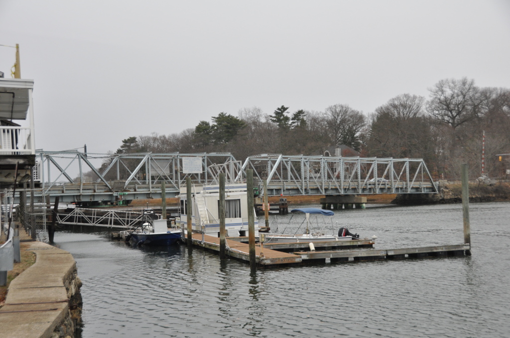


Why visit Saugatuck
Townapedia lists 35 museums and landmarks, 18 parks and trails, 16 places to eat, 3 places to stay and 11 attractions in and around town.
Highlights include AMC Royale 6, Peck Ledge Light, New Haven Line and Compo–Owenoke Historic District.
July is the warmest month, with average highs of 85°F; January lows average 22°F, and about 34 inches of snow fall in a normal year.
Weather in Saugatuck
Forecast from the National Weather Service. Full forecast
About Saugatuck
Saugatuck is a census-designated place (CDP) in the town of Westport, Connecticut, United States. It is in the southwest part of the town, on both sides of the Saugatuck River, extending south to where it enters Long Island Sound. North of Interstate 95, it occupies just the west side of the Saugatuck and continues north as far as U.S. Route 1 (Post Road). It is bordered to the north by Westport Village (the town center) and to the west by the city of Norwalk.
From the Wikipedia article Saugatuck, Connecticut (this version), under CC BY-SA 4.0.
Things to do11


Peck Ledge Light
Lighthouse · National Register of Historic Places · 2.3 mi
Lighthouse in Connecticut, United States

Saugatuck River Bridge
Bridge · National Register of Historic Places · 0.7 mi
Bridge in Westport, Connecticut

Maritime Aquarium at Norwalk
Zoo and aquarium · 2.6 mi
Zoo in Connecticut, CT

Westport Country Playhouse
Cinema and theater · 2.2 mi
Theater in Westport, Connecticut
White Barn Theatre
Cinema and theater · 2.9 mi
Theater in Norwalk, Connecticut
Yankee Doodle Bridge
Bridge · 2.2 mi
Bridge in United States of America

Museums and landmarks35


Compo–Owenoke Historic District
Monument and historic site · National Register of Historic Places · 0.8 mi
Human settlement in United States of America

Beth Israel Synagogue
Monument and historic site · National Register of Historic Places · 3.0 mi
Religious building in Norwalk, Connecticut, United States

Bradley-Wheeler House
Monument and historic site · National Register of Historic Places · 2.2 mi
Historic house in Connecticut, United States
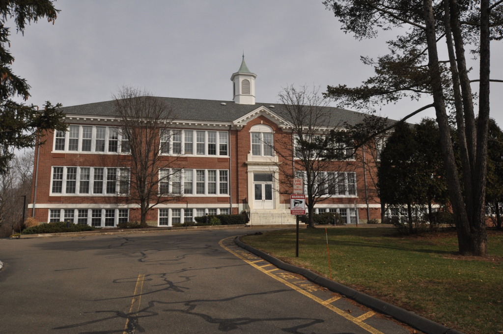
Bridge Street Historic District
Monument and historic site · National Register of Historic Places · 0.8 mi
Historic district in Connecticut, United States

Godillot Place
Monument and historic site · National Register of Historic Places · 2.0 mi
Building in Connecticut, United States
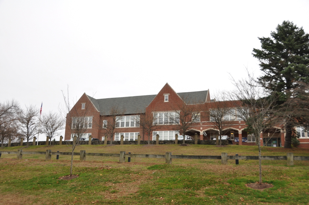
Greens Farms School
Monument and historic site · National Register of Historic Places · 2.8 mi
17 Morningside Dr. South, Westport
Haviland and Elizabeth Streets-Hanford Place Historic District
Monument and historic site · National Register of Historic Places · 2.8 mi
Historic district in Connecticut, United States

Joseph Loth Company Building
Monument and historic site · National Register of Historic Places · 3.0 mi
Building in Connecticut, United States

Kings Highway North Historic District
Monument and historic site · National Register of Historic Places · 2.0 mi
Historic district in Connecticut, United States


Lockwood-Mathews Mansion
Museum · National Register of Historic Places · 2.5 mi
Mansion and historic house museum in Norwalk, Connecticut, USA
Merritt Parkway
Monument and historic site · National Register of Historic Places · 3.4 mi
Highway in Connecticut
23 more on the map.
Parks, trails and playgrounds18



Saugatuck River Boat Launch
Park · 0.6 mi
Underhill Parkway/Saxon
Elaine Road, Westport
Sherwood Mill Pond Preserve
Park · 1.2 mi
Features: -Parking for patrons only, vehicles must be attended -Kayak and canoe access only, valid season launch permit required -No...
191 Hillspoint Road, Westport
Luciano Park
Park · 0.5 mi
Small Wood Playscape and Swing sets One (1) Baseball Field Tree Lined Borders Limited Parking

6 more on the map.
Restaurants and cafes16

Donut Crazy
Cafe · Donut, Coffee · 0.5 mi
1 Ferry Lane, Westport
Mo-Fr 05:30-20:00; Sa 07:00-20:00; Su 07:00-17:00

Rizzuto's Oyster Bar & Restaurant
Restaurant · 0.7 mi
540 Riverside Avenue
Mo-Th 16:00-21:00; Fr 16:00-21:30; Sa 11:30-21:30; Su 11:30-20:30
Tarantino Restaurant & Bar
Restaurant · Italian · 0.5 mi
30 Railroad Place, Westport

4 more on the map.
Where to stay3
Churches and places of worship7
Shopping5
Gas and EV charging3
Schools, colleges and libraries36
Healthcare1
Map of Saugatuck
135 places. The map loads OpenStreetMap tiles when you open it.
Climate by month
Monthly table
| Month | High | Low | Rain | Snow |
|---|---|---|---|---|
| Jan | 38°F | 22°F | 4.3 in | 9.1 in |
| Feb | 41°F | 23°F | 3.1 in | 11.9 in |
| Mar | 49°F | 30°F | 4.7 in | 5.9 in |
| Apr | 62°F | 40°F | 4.4 in | 0.5 in |
| May | 72°F | 50°F | 4.1 in | 0.0 in |
| Jun | 80°F | 58°F | 4.9 in | 0.0 in |
| Jul | 85°F | 64°F | 3.8 in | 0.0 in |
| Aug | 83°F | 63°F | 3.8 in | 0.0 in |
| Sep | 76°F | 56°F | 5.2 in | 0.0 in |
| Oct | 64°F | 45°F | 4.6 in | 0.0 in |
| Nov | 53°F | 35°F | 4.2 in | 0.8 in |
| Dec | 43°F | 27°F | 4.4 in | 5.8 in |
U.S. Climate Normals 1991-2020 for Stamford 5 N Hcn (9 mi away), NOAA NCEI.
People and cost of living
American Community Survey 5-year estimates, 2020-2024, U.S. Census Bureau. Estimates have margins of error, larger for small towns.
Disaster history
The county has had 25 federal disaster declarations since 2000, most often for hurricanes.
- 2024-09-20: Severe Storm, Flooding, Landslides, And Mudslides (Severe Storm)
- 2024-08-21: Severe Storms, Flooding, Landslides, And Mudslides (Severe Storm)
- 2021-10-30: Remnants Of Hurricane Ida (Hurricane)
- 2021-08-22: Hurricane Henri (Hurricane)
- 2021-01-12: Tropical Storm Isaias (Hurricane)
- 2020-08-06: Tropical Storm Isaias (Hurricane)
OpenFEMA disaster declarations summaries.
Getting there and nearby towns
Igor I. Sikorsky Memorial Airport (BDR) is the nearest airport with scheduled flights listed in OpenStreetMap, 13 miles away.
- Compo 1 mi northeast, about 2 min by car
- Westport Village 2 mi north, about 4 min by car
- Norwalk 3 mi southwest, about 5 min by car
- Greens Farms 3 mi east, about 4 min by car
- Old Hill 3 mi north, about 4 min by car
- Staples 4 mi northeast, about 6 min by car
- Poplar Plains 4 mi north, about 6 min by car
- Coleytown 5 mi north, about 8 min by car
- Southport 5 mi east, about 7 min by car
- South Wilton 5 mi northwest, about 7 min by car
Drive times are estimates from straight-line distance, not routes.
Local news
Headlines from INDB, the NEMICO news database.
Reviews, tips and questions
Loading what members have shared...
Sources and licences
- NCES EDGE (Public domain): public schools
- NOAA NCEI U.S. Climate Normals 1991-2020 (Public domain): climate by month
- OpenFEMA (Public domain): disaster declarations
- OpenStreetMap contributors (ODbL 1.0): places, airports, map data
- U.S. Census Bureau (Public domain): population, income, housing, education, commute
- Wikidata (CC0 1.0): elevation, founding date, time zone, website, landmarks and historic places
- Wikimedia Commons (see each image): photos
- Wikipedia (CC BY-SA 4.0): overview and history text
Photo credits
- Riverside Drive, Saugatuck, Connecticut, Packer1028, CC0
- Saugatuck station 1912 postcard, Unknown author Unknown author, Public domain
- WestportCT SaugatuckRiverBridgeUpstreamSide, Magicpiano, CC BY-SA 3.0
- WestportCT SaugatuckRiverBridgeDownstreamSide, Magicpiano, CC BY-SA 3.0
- Compo Owenoke Historical District, Westport, CT, 06880, USA - 2012, WestportWiki, CC BY-SA 3.0
- NorwalkCT HanfordPlace, Magicpiano, CC BY-SA 4.0
- Joseph Loth Company Building 005, Pedro Xing, CC0
- NorwalkCTLockwoodMansionSoSide09032007, Noroton at English Wikipedia, CC BY-SA 3.0
- NorwalkCTNorwalkMuseum80122007, Noroton at en.wikipedia, Public domain
- Old town hall, Westport, CT, Kohlnf, CC BY-SA 3.0
- Godillot place, Kohlnf, CC BY-SA 3.0
- Westport Bank and Trust Company, Westport, CT, USA 2012 C, WestportWiki, CC BY-SA 3.0
- Norwalk Green 012, Pedro Xing, CC0
- Bradley-Wheeler House, Westport, CT 01, WestportWiki, CC BY-SA 3.0
- WestportCT FormerPostOffice, Magicpiano, CC BY-SA 3.0
- National hall building circa 1966, Kohlnf, CC BY-SA 3.0
- South Norwalk Post Office 079, Pedro Xing, CC0
- SHAMBAUGH HOUSE, WESTPORT, FAIRFIELD COUNTY, CT, JERRYE & ROY KLOTZ, M.D., CC BY-SA 4.0
- Village Creek entrance 095, Pedro Xing, CC0
- WestportCT BridgeStreetHD 1, User:Magicpiano, CC BY-SA 4.0
- Old Burial Ground, Kings Highway, Compo Hills, Westport, CT, 06880, USA - Feb 2013 02, WestportWiki, CC BY-SA 3.0
- Canaan Institutional Baptist Church 002, Pedro Xing, CC0
- WestportCT GreenFarmsSchool, Magicpiano, CC BY-SA 3.0
- Saugatuck River Bridge, Saugatuck (Fairfield County, Connecticut), Jack Boucher, Public domain
- NorwalkCTNorwalkRivrRRBridgeCloseup08122007, Noroton at English Wikipedia, Public domain
- St mary norwalk ct, Unknown author, CC BY-SA 3.0
- Fitch law office, Gregbard, Public domain
- WestportCT Earthplace exterior, Jllm06, Public domain
- NorwalkCTMaritimeAquariumIMAXentrance08122007, Noroton at English Wikipedia, Public domain
- NorwalkCTSteppingStonesMuseum4Chldrn09052007, User:Noroton, Public domain
- Westport Country Playhouse, WestportWiki, CC BY-SA 3.0
- Our Lady of the Assumption Church, Westport, Connecticut, WestportWiki, CC BY-SA 3.0
- WestportCT AllenHouse, Magicpiano, CC BY-SA 3.0
- Longshore Club Park Panoramic, Westport, CT, WestportWiki, CC BY-SA 3.0
- Minuteman, Westport CT, WestportWiki, CC BY-SA 3.0
- WestportCT CompoOwenokeHD 3, Magicpiano, CC BY-SA 3.0
- WestportCT CompoOwenokeHD 1, Magicpiano, CC BY-SA 3.0
- WestportCT CompoOwenokeHD 2, Magicpiano, CC BY-SA 3.0
- WestportCT CompoOwenokeHD 4, Magicpiano, CC BY-SA 3.0
- Floating on the night, Jon Rosenoer, CC BY 4.0


Page built October 30, 2026. Spotted a mistake? Tell us or suggest a place.