


Why visit Staples
Townapedia lists 33 museums and landmarks, 26 parks and trails, 25 places to eat and 12 attractions in and around town.
Highlights include Saugatuck River Bridge, Fairfield University, Bronson Windmill and Bradley Edge Tool Company Historic District.
July is the warmest month, with average highs of 83°F; January lows average 24°F, and about 34 inches of snow fall in a normal year.
Weather in Staples
Forecast from the National Weather Service. Full forecast
About Staples
Westport is a town in Fairfield County, Connecticut, United States. Located in the Gold Coast along the Long Island Sound, it is 48 miles (77 km) northeast of New York City and is part of the Western Connecticut Planning Region.
From the Wikipedia article Westport, Connecticut (this version), under CC BY-SA 4.0.
Things to do12

Saugatuck River Bridge
Bridge · National Register of Historic Places · 3.2 mi
Bridge in Westport, Connecticut

Fairfield University
School · 2.6 mi
University located in Fairfield, Connecticut

Regina A. Quick Center for the Arts
Cinema and theater · 3.8 mi
University arts center in Fairfield, Connecticut

Westport Country Playhouse
Cinema and theater · 1.8 mi
Theater in Westport, Connecticut
White Barn Theatre
Cinema and theater · 3.4 mi
Theater in Norwalk, Connecticut

Museums and landmarks33
Bronson Windmill
Monument and historic site · National Register of Historic Places · 2.1 mi
Windmill in Connecticut, United States of America

Bradley Edge Tool Company Historic District
Monument and historic site · National Register of Historic Places · 3.3 mi
Historic district in Connecticut, United States

Bradley-Wheeler House
Monument and historic site · National Register of Historic Places · 2.0 mi
Historic house in Connecticut, United States
Bridge Street Historic District
Monument and historic site · National Register of Historic Places · 3.0 mi
Historic district in Connecticut, United States

Compo–Owenoke Historic District
Monument and historic site · National Register of Historic Places · 3.7 mi
Human settlement in United States of America

David Ogden House
Monument and historic site · National Register of Historic Places · 2.5 mi
Historic house in Connecticut, United States

Fairfield Historic District
Monument and historic site · National Register of Historic Places · 4.0 mi
Listed on the NRHP in Connecticut

Fairfield station
Monument and historic site · National Register of Historic Places · 3.6 mi
Railway station in Fairfield, Connecticut, United States

Godillot Place
Monument and historic site · National Register of Historic Places · 2.1 mi
Building in Connecticut, United States


Greenfield Hill Grange No. 133
Monument and historic site · National Register of Historic Places · 2.6 mi
Building in Connecticut, United States of America
Greenfield Hill Historic District
Monument and historic site · National Register of Historic Places · 2.2 mi
Historic district in Connecticut, United States
Greens Farms School
Monument and historic site · National Register of Historic Places · 1.3 mi
17 Morningside Dr. South, Westport
21 more on the map.
Parks, trails and playgrounds26


St. John Place/Myrtle Avenue Park
Park · 1.9 mi
Small Open Green Area Gardens with Benches Small Walkway
Town Farm Ball Complex
Park · 1.5 mi
3 Baseball Fields, Sofball Field, Batting Cages and Tennis Courts
14 more on the map.
Restaurants and cafes25


Hungry Pot
Restaurant · Chinese, Korean · 1.9 mi
1860 Post Road East
Mo,Su 12:00-22:30; Tu-Th off; Fr-Sa 12:00-23:00
Mama Chow
Restaurant · Noodles, Ramen, Asian Fusion · 2.1 mi
3381 Post Road, Fairfield
Tu-Th,Su 11:30-20:30, Fr-Sa 11:30-21:00, Mo closed

Fatto a Mano Bakery
Bakery · 1.8 mi
1835 Post Road East, Westport
We-Fr 08:00-15:00; Sa-Su 08:00-16:00

Wafu
Restaurant · Asian · 1.9 mi
Mo-Th 11:30-22:00; Fr-Sa 10:30-23:00; Su 12:00-22:00
Border Grill
Restaurant · Tex-Mex · 1.4 mi
1550 Post Road East, Westport
Toscano Pizzeria
Restaurant · Pizza · 2.1 mi
Mo-Th 10:00-23:00; Fr-Sa 10:00-24:00; Su 10:00-22:30
13 more on the map.
History
The earliest known inhabitants of the Westport area as identified through archaeological finds date back 7,500 years. Records from the first white settlers report the Pequot Indians living in the area which they called Machamux translated by the colonialists as beautiful land. Settlement by colonialists dates back to the five Bankside Farmers; whose families grew and prospered into a community that continued expanding. The settlers arrived in 1693, having followed cattle to the isolated area. The community had its own ecclesiastical society, supported by independent civil and religious elements, enabling it to be independent from the Town of Fairfield. As the settlement expanded its name changed: it was briefly known as "Bankside" in 1693, officially named Green's Farm in 1732 in honor of Bankside Farmer John Green and in 1835 incorporated as the Town of Westport.
From the History section of Westport, Connecticut on Wikipedia, under CC BY-SA 4.0.
Churches and places of worship12
Greens Farms Congregational Church
Church · United Church Of Christ · 1.4 mi
71 Hillandale Road, Westport
Saugatuck Congregational Church
Church · United Church Of Christ · 1.9 mi
245 Post Road East, Westport
Shopping8
Schools, colleges and libraries47
Healthcare4
Map of Staples
167 places. The map loads OpenStreetMap tiles when you open it.
Climate by month
Monthly table
| Month | High | Low | Rain | Snow |
|---|---|---|---|---|
| Jan | 38°F | 24°F | 3.2 in | 8.5 in |
| Feb | 40°F | 26°F | 3.1 in | 10.7 in |
| Mar | 47°F | 32°F | 4.1 in | 7.0 in |
| Apr | 58°F | 42°F | 4.2 in | 0.9 in |
| May | 68°F | 52°F | 3.6 in | 0.0 in |
| Jun | 78°F | 62°F | 3.8 in | 0.0 in |
| Jul | 83°F | 68°F | 3.3 in | 0.0 in |
| Aug | 82°F | 67°F | 4.0 in | 0.0 in |
| Sep | 75°F | 60°F | 4.0 in | 0.0 in |
| Oct | 64°F | 48°F | 3.8 in | 0.1 in |
| Nov | 54°F | 38°F | 3.1 in | 0.9 in |
| Dec | 44°F | 30°F | 4.0 in | 5.5 in |
U.S. Climate Normals 1991-2020 for Bridgeport Sikorsky Mem Ap 72504 (10 mi away), NOAA NCEI.
People and cost of living
American Community Survey 5-year estimates, 2020-2024, U.S. Census Bureau. Estimates have margins of error, larger for small towns.
Disaster history
The county has had 25 federal disaster declarations since 2000, most often for hurricanes.
- 2024-09-20: Severe Storm, Flooding, Landslides, And Mudslides (Severe Storm)
- 2024-08-21: Severe Storms, Flooding, Landslides, And Mudslides (Severe Storm)
- 2021-10-30: Remnants Of Hurricane Ida (Hurricane)
- 2021-08-22: Hurricane Henri (Hurricane)
- 2021-01-12: Tropical Storm Isaias (Hurricane)
- 2020-08-06: Tropical Storm Isaias (Hurricane)
OpenFEMA disaster declarations summaries.
Getting there and nearby towns
Igor I. Sikorsky Memorial Airport (BDR) is the nearest airport with scheduled flights listed in OpenStreetMap, 11 miles away.
- Coleytown 2 mi northwest, about 3 min by car
- Greens Farms 2 mi south, about 3 min by car
- Southport 2 mi southeast, about 4 min by car
- Compo 3 mi southwest, about 4 min by car
- Old Hill 3 mi west, about 5 min by car
- Mill Plain 3 mi east, about 5 min by car
- Poplar Plains 3 mi west, about 5 min by car
- Fairfield University 4 mi east, about 6 min by car
- Saugatuck 4 mi southwest, about 6 min by car
- South Wilton 5 mi west, about 8 min by car
Drive times are estimates from straight-line distance, not routes.
Local news
Headlines from INDB, the NEMICO news database.
Reviews, tips and questions
Loading what members have shared...
Sources and licences
- NCES EDGE (Public domain): public schools
- NOAA NCEI U.S. Climate Normals 1991-2020 (Public domain): climate by month
- OpenFEMA (Public domain): disaster declarations
- OpenStreetMap contributors (ODbL 1.0): places, airports, map data
- U.S. Census Bureau (Public domain): population, income, housing, education, commute
- Wikidata (CC0 1.0): elevation, founding date, time zone, website, landmarks and historic places
- Wikimedia Commons (see each image): photos
- Wikipedia (CC BY-SA 4.0): overview and history text
Photo credits
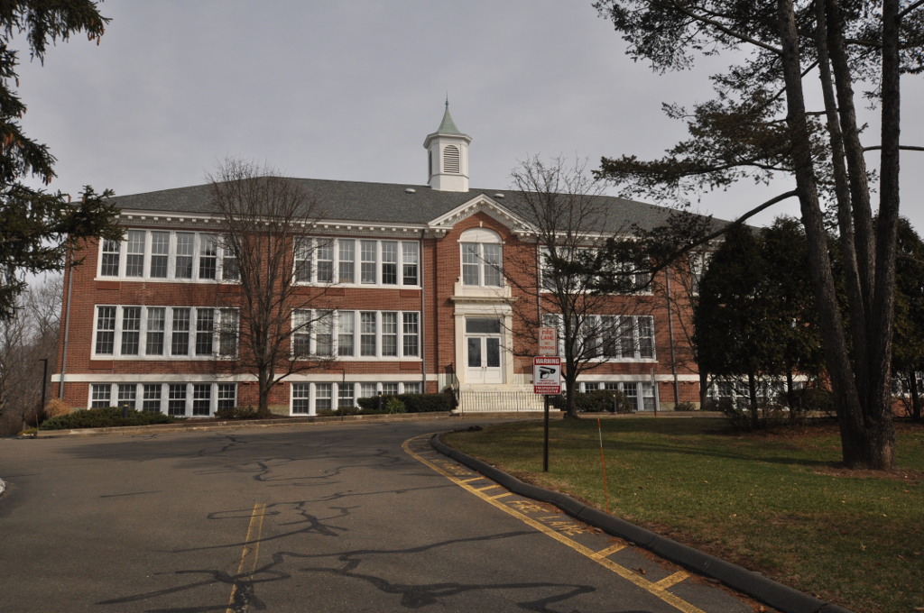
- Staples High School, Westport, CT, WestportWiki, CC BY-SA 3.0
- Frederic Bronson Windmill, 3015 Bronson Road, Fairfield (Fairfield County, Connecticut), Jack Boucher, Public domain
- Gershom W. Bradley House, Swroche, CC BY-SA 3.0
- Old town hall, Westport, CT, Kohlnf, CC BY-SA 3.0
- Godillot place, Kohlnf, CC BY-SA 3.0
- Westport Bank and Trust Company, Westport, CT, USA 2012 C, WestportWiki, CC BY-SA 3.0
- Pine creek park bridge, Wahrnehmer, CC BY-SA 4.0
- WestonCT KettleCreekHD 4, Magicpiano, CC BY-SA 3.0
- Jonathan Sturges House 074, Pedro Xing, CC0
- Southport Congregational Church, 1966, Jack Boucher, Public domain
- GREENFIELD HILL GRANGE NO. 133 FAIRFIELD COUNTY, JERRYE & ROY KLOTZ, M.D., CC BY-SA 4.0
- David Ogden House HABS 1938, Everett H. Keeler, Public domain
- Bradley-Wheeler House, Westport, CT 01, WestportWiki, CC BY-SA 3.0
- FairfieldCT WestboundSouthportRRStation2, Magicpiano, CC BY-SA 4.0
- Compo Owenoke Historical District, Westport, CT, 06880, USA - 2012, WestportWiki, CC BY-SA 3.0
- WestportCT FormerPostOffice, Magicpiano, CC BY-SA 3.0
- WestportCT SaugatuckRiverBridgeUpstreamSide, Magicpiano, CC BY-SA 3.0
- WestportCT AllenHouse, Magicpiano, CC BY-SA 3.0
- National hall building circa 1966, Kohlnf, CC BY-SA 3.0
- SHAMBAUGH HOUSE, WESTPORT, FAIRFIELD COUNTY, CT, JERRYE & ROY KLOTZ, M.D., CC BY-SA 4.0
- RESTMORE, FAIRFIELD COUNTY, CT, JERRYE & ROY KLOTZ, M.D., CC BY-SA 4.0
- Fairfield station from southbound train (2), July 2019, Pi.1415926535, CC BY-SA 3.0
- WestportCT MillCoveHD, Magicpiano, CC BY-SA 3.0
- JOHN OSBORNE HOUSE, FAIRFIELD COUNTY, CT, JERRYE & ROY KLOTZ, M.D., CC BY-SA 4.0
- WestportCT BridgeStreetHD 1, User:Magicpiano, CC BY-SA 4.0
- Old Burial Ground, Kings Highway, Compo Hills, Westport, CT, 06880, USA - Feb 2013 02, WestportWiki, CC BY-SA 3.0
- Saugatuck River Bridge, Saugatuck (Fairfield County, Connecticut), Jack Boucher, Public domain
- Connecticut Audubon Birdcraft Museum Exterior, Jllm06, Public domain
- First Unitarian Church in Westport 01 - soaring sanctuary on right, Jllm06, CC BY-SA 4.0
- WestportCT Earthplace exterior, Jllm06, Public domain
- Bellarmine Hall at Fairfield University, CT, Zeete, CC BY-SA 4.0
- Quick Center for the Arts, Stagophile, CC BY-SA 3.0
- Fairfield Entrance, Stagophile ( talk ), CC BY-SA 3.0
- Haze Mimi, Zorlack from Fairfield, CT, USA, CC BY 2.0
- CT Science Center 06, Jllm06, CC BY-SA 4.0
- CT Science Center 04 - Forces in Motion, Jllm06, CC BY-SA 4.0
- CT Science Center 07 - CT Geology, Jllm06, CC BY-SA 4.0
- CT Science Center 01 - Lobby, Jllm06, CC BY-SA 4.0
- CT Science Center 10 - Sports Lab, Jllm06, CC BY-SA 4.0
- CT Science Center 08 - View of CT River and Founders Bridge, Jllm06, CC BY-SA 4.0


Page built October 30, 2026. Spotted a mistake? Tell us or suggest a place.