


Why visit Greens Farms
Townapedia lists 35 museums and landmarks, 25 parks and trails, 19 places to eat and 6 attractions in and around town.
Highlights include Saugatuck River Bridge, Westport Country Playhouse, Bradley-Wheeler House and Bridge Street Historic District.
July is the warmest month, with average highs of 83°F; January lows average 24°F, and about 34 inches of snow fall in a normal year.
Weather in Greens Farms
Forecast from the National Weather Service. Full forecast
About Greens Farms
Green's Farms is the oldest neighborhood in the town of Westport in Fairfield County, Connecticut, United States. It was first listed as a census-designated place at the 2020 census. As of the 2020 census, Green's Farms had a population of 3,125.
From the Wikipedia article Greens Farms, Connecticut (this version), under CC BY-SA 4.0.
Things to do6

Saugatuck River Bridge
Bridge · National Register of Historic Places · 2.4 mi
Bridge in Westport, Connecticut

Westport Country Playhouse
Cinema and theater · 2.1 mi
Theater in Westport, Connecticut

Museums and landmarks35

Bradley-Wheeler House
Monument and historic site · National Register of Historic Places · 2.4 mi
Historic house in Connecticut, United States
Bridge Street Historic District
Monument and historic site · National Register of Historic Places · 2.2 mi
Historic district in Connecticut, United States

Bronson Windmill
Monument and historic site · National Register of Historic Places · 3.7 mi
Windmill in Connecticut, United States of America

Compo–Owenoke Historic District
Monument and historic site · National Register of Historic Places · 2.1 mi
Human settlement in United States of America

David Ogden House
Monument and historic site · National Register of Historic Places · 3.4 mi
Historic house in Connecticut, United States

Fairfield station
Monument and historic site · National Register of Historic Places · 3.6 mi
Railway station in Fairfield, Connecticut, United States

Godillot Place
Monument and historic site · National Register of Historic Places · 2.2 mi
Building in Connecticut, United States

Greenfield Hill Historic District
Monument and historic site · National Register of Historic Places · 3.9 mi
Historic district in Connecticut, United States
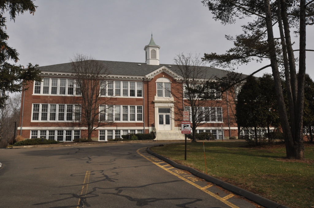
Greens Farms School
Monument and historic site · National Register of Historic Places · 0.9 mi
17 Morningside Dr. South, Westport

John Osborne House
Monument and historic site · National Register of Historic Places · 1.7 mi
Historic house in Connecticut, United States

Jonathan Sturges House
Monument and historic site · National Register of Historic Places · 3.3 mi
Historic house in Connecticut, United States


Kings Highway North Historic District
Monument and historic site · National Register of Historic Places · 2.6 mi
Historic district in Connecticut, United States
23 more on the map.
Parks, trails and playgrounds25


H. Smith Richardson Wildlife Preserve and Christmas Tree Farm
Hiking and trails · 0.9 mi
This sanctuary consists of three parcels: A 24-acre Christmas tree farm, a newly restored 14-acre field habitat, and a 36-acre evergreen...
Sasco Creek Road, Westport

H. Smith Richardson Wildlife Preserve
Hiking and trails · 0.9 mi
Green Farms Road
Sherwood Mill Pond Preserve
Park · 1.3 mi
Features: -Parking for patrons only, vehicles must be attended -Kayak and canoe access only, valid season launch permit required -No...
191 Hillspoint Road, Westport
13 more on the map.
Restaurants and cafes19


Hungry Pot
Restaurant · Chinese, Korean · 1.6 mi
1860 Post Road East
Mo,Su 12:00-22:30; Tu-Th off; Fr-Sa 12:00-23:00
Mama Chow
Restaurant · Noodles, Ramen, Asian Fusion · 1.9 mi
3381 Post Road, Fairfield
Tu-Th,Su 11:30-20:30, Fr-Sa 11:30-21:00, Mo closed

Fatto a Mano Bakery
Bakery · 1.6 mi
1835 Post Road East, Westport
We-Fr 08:00-15:00; Sa-Su 08:00-16:00

Wafu
Restaurant · Asian · 1.7 mi
Mo-Th 11:30-22:00; Fr-Sa 10:30-23:00; Su 12:00-22:00
Border Grill
Restaurant · Tex-Mex · 1.2 mi
1550 Post Road East, Westport
Toscano Pizzeria
Restaurant · Pizza · 1.9 mi
Mo-Th 10:00-23:00; Fr-Sa 10:00-24:00; Su 10:00-22:30
7 more on the map.
History
In 1648 the Town of Fairfield officially gave five farmers, collectively known as the Bankside Farmers, permission to settle the fertile land that the Pequot people were living in. The Bankside Farmers purchased the land from the Pequot who called it Machamux ("beautiful land"). The land that the Pequot sold, then within the original boundaries of the Town of Fairfield, stretched from "Frost Point an English mile along the seacoast toward Compaw, and six or seven miles inland." The Pequot moved to an area "elevated back east of this strip".
The first three settlers were Thomas Newton, Henry Gray and John Green. Daniel Frost and Francis Andrews later joined the Bankside Farmers making five in total.
They lived at the western end of what became Beachside Avenue.
On Green's Farms Road near Morningside Drive is the site of the first West Parish Common, the first schoolhouse, and the first meeting house. A small park there has a monument called Machamux Boulder.
Over the next 50 years, more land was bought from the Indians and the community grew. In 1711 the "West Parish of Fairfield" was established with church and civil functions. In 1732, the area was renamed "Green's Farms" in honor of John Green, one of the original five Bankside Farmers.
From the History section of Greens Farms, Connecticut on Wikipedia, under CC BY-SA 4.0.
Churches and places of worship5
Greens Farms Congregational Church
Church · United Church Of Christ · 0.9 mi
71 Hillandale Road, Westport
Shopping7
Gas and EV charging1
Schools, colleges and libraries41
Healthcare4
Map of Greens Farms
143 places. The map loads OpenStreetMap tiles when you open it.
Climate by month
Monthly table
| Month | High | Low | Rain | Snow |
|---|---|---|---|---|
| Jan | 38°F | 24°F | 3.2 in | 8.5 in |
| Feb | 40°F | 26°F | 3.1 in | 10.7 in |
| Mar | 47°F | 32°F | 4.1 in | 7.0 in |
| Apr | 58°F | 42°F | 4.2 in | 0.9 in |
| May | 68°F | 52°F | 3.6 in | 0.0 in |
| Jun | 78°F | 62°F | 3.8 in | 0.0 in |
| Jul | 83°F | 68°F | 3.3 in | 0.0 in |
| Aug | 82°F | 67°F | 4.0 in | 0.0 in |
| Sep | 75°F | 60°F | 4.0 in | 0.0 in |
| Oct | 64°F | 48°F | 3.8 in | 0.1 in |
| Nov | 54°F | 38°F | 3.1 in | 0.9 in |
| Dec | 44°F | 30°F | 4.0 in | 5.5 in |
U.S. Climate Normals 1991-2020 for Bridgeport Sikorsky Mem Ap 72504 (10 mi away), NOAA NCEI.
People and cost of living
American Community Survey 5-year estimates, 2020-2024, U.S. Census Bureau. Estimates have margins of error, larger for small towns.
Disaster history
The county has had 25 federal disaster declarations since 2000, most often for hurricanes.
- 2024-09-20: Severe Storm, Flooding, Landslides, And Mudslides (Severe Storm)
- 2024-08-21: Severe Storms, Flooding, Landslides, And Mudslides (Severe Storm)
- 2021-10-30: Remnants Of Hurricane Ida (Hurricane)
- 2021-08-22: Hurricane Henri (Hurricane)
- 2021-01-12: Tropical Storm Isaias (Hurricane)
- 2020-08-06: Tropical Storm Isaias (Hurricane)
OpenFEMA disaster declarations summaries.
Getting there and nearby towns
Igor I. Sikorsky Memorial Airport (BDR) is the nearest airport with scheduled flights listed in OpenStreetMap, 11 miles away.
- Compo 2 mi west, about 2 min by car
- Staples 2 mi north, about 3 min by car
- Southport 2 mi east, about 3 min by car
- Westport Village 2 mi northwest, about 4 min by car
- Saugatuck 3 mi west, about 4 min by car
- Old Hill 3 mi northwest, about 6 min by car
- Mill Plain 4 mi northeast, about 6 min by car
- Coleytown 4 mi north, about 6 min by car
- Fairfield University 4 mi northeast, about 7 min by car
- Norwalk 6 mi southwest, about 9 min by car
Drive times are estimates from straight-line distance, not routes.
Local news
Headlines from INDB, the NEMICO news database.
Reviews, tips and questions
Loading what members have shared...
Sources and licences
- NCES EDGE (Public domain): public schools
- NOAA NCEI U.S. Climate Normals 1991-2020 (Public domain): climate by month
- OpenFEMA (Public domain): disaster declarations
- OpenStreetMap contributors (ODbL 1.0): places, airports, map data
- U.S. Census Bureau (Public domain): population, income, housing, education, commute
- Wikidata (CC0 1.0): landmarks and historic places
- Wikimedia Commons (see each image): photos
- Wikipedia (CC BY-SA 4.0): overview and history text
Photo credits
- WestportGreensFarmsRRstationhouse11172007, Noroton at English Wikipedia, Public domain
- Greens Farms station from westbound train, July 2019, Pi.1415926535, CC BY-SA 4.0
- Shelter at Greens Farms station, September 2018, Pi.1415926535, CC BY-SA 3.0
- Old town hall, Westport, CT, Kohlnf, CC BY-SA 3.0
- Godillot place, Kohlnf, CC BY-SA 3.0
- Westport Bank and Trust Company, Westport, CT, USA 2012 C, WestportWiki, CC BY-SA 3.0
- Pine creek park bridge, Wahrnehmer, CC BY-SA 4.0
- Jonathan Sturges House 074, Pedro Xing, CC0
- Southport Congregational Church, 1966, Jack Boucher, Public domain
- David Ogden House HABS 1938, Everett H. Keeler, Public domain
- Bradley-Wheeler House, Westport, CT 01, WestportWiki, CC BY-SA 3.0
- FairfieldCT WestboundSouthportRRStation2, Magicpiano, CC BY-SA 4.0
- Compo Owenoke Historical District, Westport, CT, 06880, USA - 2012, WestportWiki, CC BY-SA 3.0
- WestportCT FormerPostOffice, Magicpiano, CC BY-SA 3.0
- WestportCT AllenHouse, Magicpiano, CC BY-SA 3.0
- WestportCT SaugatuckRiverBridgeUpstreamSide, Magicpiano, CC BY-SA 3.0
- National hall building circa 1966, Kohlnf, CC BY-SA 3.0
- SHAMBAUGH HOUSE, WESTPORT, FAIRFIELD COUNTY, CT, JERRYE & ROY KLOTZ, M.D., CC BY-SA 4.0
- RESTMORE, FAIRFIELD COUNTY, CT, JERRYE & ROY KLOTZ, M.D., CC BY-SA 4.0
- Fairfield station from southbound train (2), July 2019, Pi.1415926535, CC BY-SA 3.0
- WestportCT MillCoveHD, Magicpiano, CC BY-SA 3.0
- JOHN OSBORNE HOUSE, FAIRFIELD COUNTY, CT, JERRYE & ROY KLOTZ, M.D., CC BY-SA 4.0
- WestportCT BridgeStreetHD 1, User:Magicpiano, CC BY-SA 4.0
- Frederic Bronson Windmill, 3015 Bronson Road, Fairfield (Fairfield County, Connecticut), Jack Boucher, Public domain
- Old Burial Ground, Kings Highway, Compo Hills, Westport, CT, 06880, USA - Feb 2013 02, WestportWiki, CC BY-SA 3.0
- Saugatuck River Bridge, Saugatuck (Fairfield County, Connecticut), Jack Boucher, Public domain
- Connecticut Audubon Birdcraft Museum Exterior, Jllm06, Public domain
- WestportCT Earthplace exterior, Jllm06, Public domain
- Westport Country Playhouse, WestportWiki, CC BY-SA 3.0
- Our Lady of the Assumption Church, Westport, Connecticut, WestportWiki, CC BY-SA 3.0
- Westport Ct Sta from I-95 jeh, Jim.henderson, CC BY-SA 4.0
- Agalinis maritima iNat-25451539, Bill Keim, CC BY 4.0
- Agalinis maritima iNat-25451545, Bill Keim, CC BY 4.0
- Agalinis maritima iNat-25451547, Bill Keim, CC BY 4.0
- Symphyotrichum tenuifolium 25541161, Bill Keim, CC BY 4.0
- Sherwood Island State Park - panorama of east jetty and beach, Jllm06, CC BY-SA 4.0
- Sherwood Island State Park - east jetty, Jllm06, CC BY-SA 4.0
- Sherwood Island State Park Nature Center 03, Jllm06, CC BY-SA 4.0
- Sherwood Island State Park Nature Center 04, Jllm06, CC BY-SA 4.0
- Sherwood Island State Park Nature Center 02, Jllm06, CC BY-SA 4.0


Page built October 30, 2026. Spotted a mistake? Tell us or suggest a place.